Page Type: Our Work

  • Protecting Alpine Zones

    Protecting Alpine Zones

    What Are Alpine Zones?

    Alpine zones of the Northeast are biologically diverse, isolated, and rare ecozones found above treeline on some of the highest points of the regionโ€™s mountains. These zones are characterized by harsh winds and colder temperatures. Alpine areas provide us with a look back in time to what the landscape was like after the glaciers melted at the end of the last ice age 15,000 years ago.

    Here, youโ€™ll find tundra plants similar to those found in the Arctic Circle even though we are much farther south in latitude. Alpine zones provide important habitat for plants and wildlife that have adapted to survive in tough alpine zone conditions, several of which are considered endangered or threatened species.

    Although resilient to the harsh winds, cold temperatures, and acidic soil of their environment, alpine plants are vulnerable to other disturbances, including by human recreation. These plants can take a long time to grow in such an exposed environment but can some have long lifespans if protected from human activity (some individual plants and cushions are over 100 years old!). Aside from preserving them for their rarity, they are also important to the mountain ecosystem because their roots hold down soil and otherwise curb erosion at these altitudes.

    Mansfield alpine plants_August 2023_Jeffrey Zwicker

    Vermontโ€™s Alpine Zones

    Across New York, New Hampshire, Vermont, and Maine, there are about 13 square miles of alpine zone. In Vermont, less than 125 acres of alpine tundra remains. Within those acres, eight alpine species are classified as either endangered (4) or threatened (4) in Vermont.

    Three of the Green Mountainโ€™s tallest peaks are home to the stateโ€™s alpine areas. Approximately 110 acres are found on Mount Mansfield, about 10 acres on Camelโ€™s Hump, and less than 1 acre on Mt. Abraham. These three peaks are also some of the stateโ€™s most popular and well-hiked destinations and traversed by the Long Trail.

    Alpine zones are widely enjoyed for recreation, so as a hiker, itโ€™s crucial to educate yourself and others about the environmentโ€™s importance, fragility and vulnerability, and what you can do to help protect alpine zones.

    Alpine sandwort_alpine zone_Mount Mansfield chin_Sheri Larsen

    How Can You Protect Alpine Plants?

    Threats to alpine zones and plant life include climate change, development, invasive species, and the most immediate and preventable โ€“ human recreational impacts. Hiker footsteps pose the greatest danger to these plants, but the greatest protectors are hikers themselves.

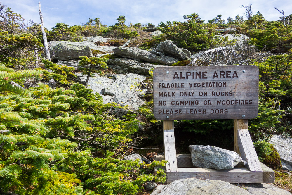
    You donโ€™t have to be botanist or other expert to know and help protect alpine zones. The most important thing to remember is to stay on trail, to protect alpine vegetation from the impact of human and canine footsteps. Here are a few simple but impactful ways every hiker can steward these special ecosystems:

    Mt Mansfield forehead_October2024_Gretchen Alexander
    • Do the โ€œrock walkโ€ by staying on marked trails or bare rock and off of vegetation
    • Stay within the areas marked by white string when hiking on alpine ridgelines and summits
    • Familiarize yourself with these alpine plants: Alpine ID: 15 Plants to Find Above Treeline (blog post to carry over: https://www.greenmountainclub.org/alpine-plants-id-find-above-treeline/)
    • Practice Leave No Trace in the alpine zone (blog post to carry over: https://www.greenmountainclub.org/leave-no-trace-alpine-zone/)
    • Contribute to alpine research as a citizen scientist (blog post to carry over: https://www.greenmountainclub.org/support-alpine-research-become-a-citizen-scientist/)
    • Leash dogs in alpine zones and ensure they do not step on plants either
    • Consider supporting GMCโ€™s work with a membership or donation
    wood grain texture

    GMC Caretakers as Alpine Stewards

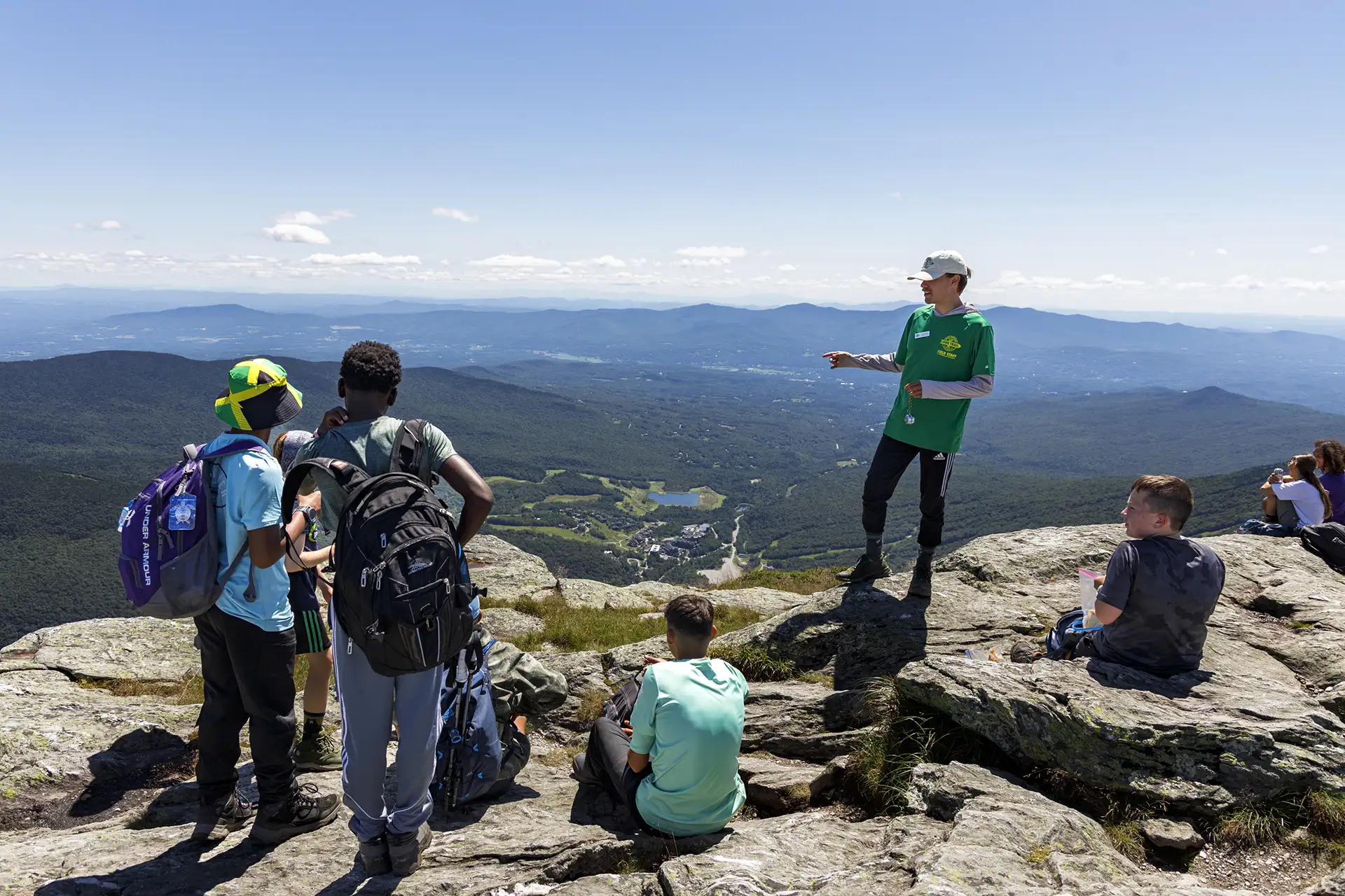
    A primary goal of GMCโ€™s backcountry caretaker program is to protect Vermontโ€™s alpine zones through face-to-face on-site education between caretakers and the hiking public. Caretakers and volunteer trail stewards are often onsite at popular alpine summits and can answer any questions you may have about your hike, the trails, shelters, and natural history of the area.

    Mt Mansfield_Alpine Zone_Caretaker_2022_Kate Songer
    wood grain texture

    Do Your Part in the Alpine Zone

    • Caretakers Teaching Hikers_Mansfield_Kate Songer 2022

      Be Prepared

      Leave No Trace

    • Mansfield Ridgeline

      Explore

      Mount Mansfield Area Trails

    • Camels Hump_2013_Mary Keenan

      Explore

      Camel’s Hump Area Trails

    • Shelter_Starks Nest sunrise_Sept2021_Erica Fuller

      Be Prepared

      Plan and Prepare

    Learn to Identify Alpine Plants

    Ready to take your alpine stewardship to the next level? Learn how to identify mountain sandwort, bearberry willow, Bigelowโ€™s sedge, and other plants found on Vermontโ€™s highest peaks.

  • Conservation & Stewardship

    Conservation & Stewardship

    wood grain texture
    • Long Trail_White Rocks Nat Rec Area_June 2020_Dan Lehmann

      Our Work

      Land Conservation

    • Blank S View_05-24-2017_Rob Rives

      Our Work

      Land Stewardship

  • Land Conservation

    Land Conservation

    Conserving the Long Trail Through the Years: One Foot at a Time 

    Since the 1980s, the Green Mountain Club has sought to secure a permanent route for the unprotected portions of the Long Trail. In the early decades of the Long Trail, the club could rely on simple handshake agreements with landowners to secure the trail’s route of passage. But by the 1980s, a few threats of trail closure and development near the trail inspired the club to conduct a concentrated conservation campaign.

    Between 1986 and 2025, volunteers and staff were able to conserve more than 25,000 acres of Vermont forest land through which the Long Trail and its side trails cross. The club has protected more than 80 miles of the Long Trail (much of the trail already existed on state and federal public land). 

    GMC is focused on conserving the remaining 4.5 miles of unprotected Long Trail and is using a strategic conservation plan to guide our work. By developing this plan, we were able to rank land parcels and better determine approach and tactic to conserving the remaining 16 parcels. We also secured a large three-year grant to double our land conservation capacity. We will continue this work until all miles of the Long Trail are conserved. 

    Long Trail near Johnson_July-2022_Tara Schatz

    GMCโ€™s Strategic Conservation Plan 

    Today, just 4.5 miles of the Long Trail remain unprotected. Securing permanent, legal protection for these final stretches is essential โ€” it guarantees public access, preserves the continuity of the Long Trail, and protects our investments in sustainable trail infrastructure. GMCโ€™s Strategic Conservation Plan, adopted in 2023, lays out a roadmap to prioritize and safeguard these last miles of the Long Trail for hikers in perpetuity. 

    The planning effort analyzed the quality and effectiveness of our protection campaign so far, and defined criteria for how tracts of land are prioritized. Now we can sharpen our focus on what body of conservation projects GMC should pursue in the future. 

    Fall foliage_Joseph Battell Wilderness_10-05-2022_Deborah Wilson

    Our conservation approach is organized into four tiers: 

    • Tier 1: Legal protection of Long Tail and Appalachian Trail treadway 
    • Tier 2: Legal protection of Side Trail treadway and trail infrastructure 
    • Tier 3: Conservation of priority parcels within the 1,000-foot Long Trail System corridor 
    • Tier 4: Enhanced protection for Long Trail System that crosses leased or licensed public lands 

    While all tiers are important for the realization of Long Trail System protection, Tier 1 is deemed the most critical, followed by Tier 2 through 4.  This system is meant to help with the allocation of resources.  Tiers are worked on concurrently to curate and develop project opportunities. 

    Be a Part of GMCโ€™s Land Conservation Work  

    Put GMCโ€™s land conservation principles into practice every day by joining the Corridor Monitor Volunteer Program.  

  • Land Stewardship

    Land Stewardship

    Our Stewardship Principles

    GMC is committed to responsibly managing GMC conservation lands and easements. Properties owned by the club are managed for high quality recreation, conservation of natural resources, and sustainable timber management. Timber harvests on GMC land have been used to enhance wildlife habitat, provide revenue for the Clubโ€™s work, and supply firewood for our visitor center, which used wood gasification boilers for heat and hot water until 2025.

    DLD blazes_2025_Rowan Kamman

    Corridor Monitoring_October 2023_Mollie Flanigan and Tori Dobbs

    Volunteer Corridor Monitoring Program

    More than 60 volunteers adopt conserved lands and monitor their assigned property each year. Volunteers maintain boundaries and keep watch over the trail corridor, ensuring that potential issues are documented and addressed by the land manager. This unique volunteer role involves bushwhacking, map and compass navigation, and immersion in Vermontโ€™s backcountry landscape. These volunteers help GMC achieve its goal of monitoring every mile of boundary, every year.


    A.T. Open Areas Initiative

    Vermontโ€™s rich agricultural history has left a unique mark on the Appalachian Trail through a series of open areas that enrich the trail experience and habitat diversity of the region. The Green Mountain Club, Appalachian Trail Conservancy, and U.S. Forest Service have partnered to maintain 19 โ€œopen areas,โ€ on the Appalachian Trail between Killington and Norwich, through mowing, grazing, and sometimes controlled burning, with the goal of keeping the views open for hikers, maintaining early successional habitat, and suppressing invasive plants.

    AT open area_Biggs Peters_05-10-2024_Mollie Flanigan

    View from Stanhope Ridge

    Future of Stewardship: GMCโ€™s Conservation Road Map

    Adopted in 2023, the Strategic Conservation Plan provides a plan to maintain the momentum of Long Trail Protection efforts, and to ensure stewardship of our existing properties is upheld amidst a complex and changing landscape.


    Get Involved in GMC Boundary Maintenance

    Joining GMCโ€™s corridor monitor volunteer program is an excellent way to directly contribute to the success of our stewardship goals, spend time outside, and learn more about the process of land conservation and use.

  • Our Work

    Our Work

    wood grain texture
    • Sunrise_Bolton_08-24-2024_William-Morris

      Our Work

      Conservation & Stewardship

    • Our Work

      Trail Work

    • Mansfield caretaker talking to kids 01_07-232025_Lily LaRegina

      Our Work

      Backcountry Caretakers

  • Backcountry Caretakers

    Backcountry Caretakers

    What do GMC Backcountry Caretakers Do?

    Caretakers are professional, paid seasonal staff employed by the Green Mountain Club. They may have backgrounds in trail work, environmental studies, or education, and are passionate about protecting Vermontโ€™s natural resources.

    Caretakers are stationed at the most high-use and vulnerable sites on the Long Trail, and spend 4-5 nights per week at their designated overnight site. They interact with hikers, passing along education about alpine stewardship, Leave No Trace principles, best practices, and trail information. They are a wealth of knowledge and will add to your experience of the Long Trail System.

    At Vermont’s busy alpine summits (Mount Mansfield, Camelโ€™s Hump, and Mount Abraham) caretakers ensure hikers are staying on the designated trail to protect the alpine vegetation. Caretakers also perform routine trail maintenance in a designated range, and are responsible for the composting process at GMCโ€™s backcountry privies (outhouses).

    Mansfield Caretakers talking to hikers_2022_by Kate Songer

    History of Modern GMC Caretakers

    In the late 1960s, scientists and advocates began to notice the impact that a huge backcountry recreation boom was having on Vermontโ€™s trails: trails and vegetation were eroding away, trash and human waste was rampant, and the rare alpine plants found on Mount Mansfield and Camelโ€™s Hump were threatened with extinction.

    GMC developed the caretakerโ€™s one-to-one education model, which focused on empowering hikers to become partners in protecting the natural resource, rather than shaming or policing behavior. The caretaker program began in 1969, and continues today, following roughly the same model of individualized education and stewardship.

    50 YearRanger naturalists on Mansfield Summit_Lou Borie
    Mansfield caretakers repainting blazes_2023_Adrienne Bartlett
    dirt and rocks

    Where Caretakers Live and Work

    Mahala and Gordon_Taft Lodge Caretakers

    For 2026, youโ€™ll find caretakers at the following locations:

    • Stratton Pond
    • Little Rock Pond
    • Griffith Lake/Bromley Mountain
    • Coolidge Range (including Killington and Pico)
    • Monroe Skyline (including Mount Abraham)
    • Camelโ€™s Hump
    • Mount Mansfield
    • Sterling Pond

    Caretakers survey the trails, shelters, and privies in these areas and are stationed at overnight sites including: Stratton Pond Shelter, Little Rock Pond Shelter, Butler Lodge, Taft Lodge, Hump Brook Tenting Area, Montclair Glen Lodge.

    Prior to 2023, caretaker staffed overnight sites had a $5 fee for camping overnight. The fees were eliminated in 2023 to increase access to and equity in backcountry recreation. Today, the caretaker program is primarily supported by donations, and is routinely one of the most underfunded programs that GMC operates.

    Did a caretaker improve your hiking experience? Consider a gift to support the program.

    wood grain texture

    More Backcountry Stewardship

    • Trail Steward

    • Scouting Belvidere 01_white blaze_05-02-2025_Lily LaRegina

      About GMC

      Job Opportunities

    • AlpineZoneSign

      Our Work

      Protecting Alpine Zones

    • Hell Brook Trail_Mansfield Area Hikes_Chris Catania

      Our Work

      Our Work

    Join us

    Interested in helping us achieve our backcountry education mission? Join GMC as a seasonal caretaker or as part of the volunteer trail steward program.

  • Trail Work

    Trail Work

    wood grain texture

    Learn More about GMCโ€™s Trail Work

    • Burrows Trail relo 07-09-2024 Lily LaRegina

      Our Work

      Sustainable Trails

    • Blaze and heart_Trail at Willard Gap 07-04-2021

      Explore

      The Long Trail

    • Trail tools_09-21-2023_Matt Vezina

      Our Work

      Project Archives

    • Burrows-Trail-Project-Check-Steps July 2022 Photo by Anna Gardner.

      Our Work

      Burrows Trail Project

  • Current & Past Projects

    Current & Past Projects

    Recent Work Highlights 

    Long Trail Relocation on Belvidere Mountain  

    In 2025, GMC trail crews began the first of two years of work relocating about three-quarters of a mile of Long Trail north of Route 118, near the climb to Belvidere Mountain. The relocation, for which planning began in 2022, has two goals: To move the trail out of a streambed and into a more sustainable grade and layout, and to move the trail from private land to the nearby Long Trail State Forest corridor, securing permanent protection for about one third of a mile of Long Trail. 

    In 2025, crews completed cutting new, sustainably laid out trail and installing trail hardening structure for about 0.3 miles relocation. We used a newly purchased mini-excavator to cut the new tread, following up with hand techniques. Using machinery on some portions of the Long Trail is a new construction technique designed to improve productivity and build skills in emerging trail-building technology.  

    The Belvidere project exemplifies many of the current strategies and challenges facing Long Trail management in the 21st century: It is a multi-year, full segment project that will result in reduced annual maintenance needs, increased longevity, and is less likely to fail from problems uphill or downhill. 

    It will be completed in 2026.

    Belvidere relocation_mini excavator_08-04-2025_Wesley Anderson

    Flood Recovery Projects 

    A significant portion of our work this year is flood recovery work from 2023 and 2024 floods. These projects received primary funding through two sources: the Emergency Relief for Federally Owned Roads (ERFO) funds for projects on the AT and Federal Emergency Management Agency (FEMA) funds directed through VT FPR for work on state lands. We are implementing sustainable practices into all flood recovery work; namely building back bigger and more durable bridges and trail structures that can withstand future extreme weather events. Flood recovery projects include:

    • Little Black Branch bridge repairs
    • Lye Brook Falls Spur Trail
    • Peru Peak bridge
    • Homer Stone Brook Trail
    • Homer Stone Brook bridge (on the Long Trail north of Little Rock Pond)
    • Long Trail in Nebraska Notch

    Battell Shelter Expansion  

    Senior Trail Technicians constructed a new, accessible shelter at the Battell overnight site in 2025. The new shelter sleeps up to 12 people and has a timber-framed, post-and-beam design. The old shelter, built in 1966, is a historical landmark and will remain on-site, increasing the capacity at this sensitive yet popular overnight camping destination. (tenting is not permitted here to protect the fragile subalpine environment). 

    New Battell Shelter_10-16-2025_Andrew Muller

    Southern Terminus Relocation 

    In 2025 GMC completed the Vermont portion of a long-planned relocation of the southern terminus of the Long Trail. Volunteer Long Trail Patrol crew members brushed the corridor, cut tread, and built stone infrastructure on the Vermont side of the state line (the Massachusetts portion is slated to be completed in 2027).  

    This work will replace the notoriously muddy southern terminus of the Long Trail โ€” a long-term goal of the club โ€” moving the trail up to drier soil on a sidehill with a more sustainable layout. It also inches us towards our land conservation goals as it moves approximately 1,000 feet of the LT/AT off of a private land parcel and onto the Green Mountain National Forest.   

    Mass line relocation_07-31-2025_Owen Maille

    Alpine Plant Protection and Research 

    Every five years, GMC conducts a photo monitoring research project to track the trajectory and growth of alpine plant vegetation coverage on Mount Mansfield. The findings help inform our management decisions along the Mansfield ridgeline. The latest installment will take place in 2026.

    Alpine Plants Mountain Sandwort_Mansfield_Sheri Larsen

    The Burrows Trail Project 

    From 2022-2024, GMC crews and partners completed the Burrows Trail rehabilitation project. Starting in Huntington, Vermont, the Burrows Trail runs 2.1 miles up the fall line of the mountain before intersecting with the Long Trail to reach the summit of Camelโ€™s Hump. 

    Burrows Trail Check Steps_July 2022_Anna Gardner (9)

    Sunrise Shelter Move and Reconstruction 

    In 2023, crews completed building the new Sunrise Shelter (relocated 1.2 miles south of the existing location due to road proximity and nuisance use). Site prep, foundation, piers, floor system, and privy were completed in 2022. . The 3-walled shelter was designed by Director of Field Programs Keegan Tierney and the GMC Special Projects Crew and volunteer Chip Swanson constructed the shelter over five working weeks in 2023. Sunrise was one of five shelter construction projects completed in 2023: the new Stratton View Shelter, new Seth Warner shelter, the Jean Haigh Cabin on Wheeler Pond, and repairs to Stratton Mountain Caretaker Cabin. 

    Finished Sunrise Shelter_Dylan Norris

    Be a Part of GMCโ€™s Work to Build and Protect Great Trail

    Members support the work of the Green Mountain Club with their annual dues. Join the Green Mountain Club hiking community today.

  • Sustainable Trails

    Sustainable Trails


    Good trail design, maintenance, and construction can be summed up with two main principles: keep water off the trail and keep hikers on it. 


    New Englandโ€™s Trails: Legacy and Challenge 

    Hikers often joke that switchbacks donโ€™t exist in New England, and itโ€™s kind of true! Many trails in Vermont, and New England as a whole, were built more than 100 years ago before sustainable design standards or other environmental impacts of human recreation were even considered. They tend to follow the โ€œfall-lineโ€ of a hill, or in other words, the steepest, straightest route from point A (the trailhead) to point B (a summit).  

    Fall-line trails pose challenges for two reasons. One, water also likes to take the fall-line path down a hill. When the trail is the same path as the route of least resistance for water, the water accumulates and accelerates, exacerbating erosion as it goes. 

    Second, fall-line trails are often very steep, with grades exceeding 15 to 20 percent, and pose challenges for many hikers, with big necessary steps and tiring climbs. Hikers are naturally prone to seek out the path of least resistance, so they might tend to go around difficult sections, widening and braiding the trail and causing additional erosion issues.  

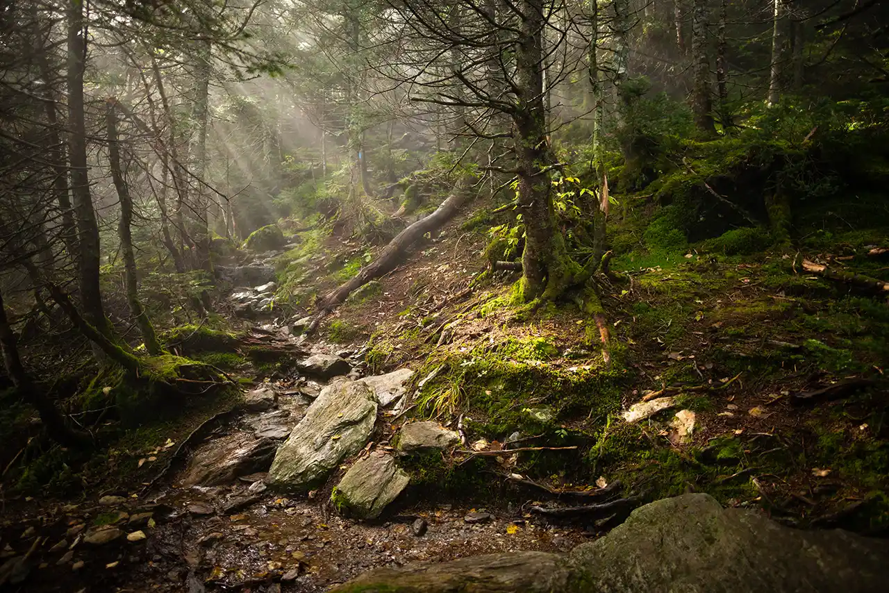
    steep rocky trail photo by Angela Gluck

    Sustainable Trails Assessment  

    In 2025, thanks to a generous grant from the Waterwheel Foundation, we undertook a trail assessment effort for the entire 272 miles of the Long Trail examining it through a sustainable trail design lens. We took a two-pronged approach of creating a desk assessment tool utilizing Geographic Information System (GIS) tools and analysis and field data collection of trail deficiencies. 

    The GIS assessment provided approaches to data analysis that allowed us to assign sustainability values to the trail while our field data collection was contrasted with the GIS model predictions.   The initial version of the model had a 80-85% accuracy rate for predicting trail deficiencies. As we refine the data analysis we will expand the assessment to the entire Long Trail System.   

    This will give us a georeferenced database for planning, reporting, and communication. It will guide prioritization of investments in the trail to help remedy those areas that are most at risk of failure from future intense weather events. It will improve our ability to respond rapidly and manage information after an event. And it will inform our work plan for the next 25 years as it is adopted by staff, volunteers and partners. 

    Trail assessment_Sterling Pond_08-03-2023_Lily LaRegina 001

    Rehabilitate or Relocate 

    There are two major approaches to upgradingย the sustainability of degraded, historic trails often found onย theย Long Trail System. We can do full-segment rehabilitationย following the existing route of the trail, employing crews to install hundreds of stone trail structures likeย checksteps, staircases, andย waterbars. Working on an entire segment of trail at once, like the 2.1-mileย Burrows Trailย restoration, ensures thatย severe weather or trail failures above a work zone do not negativelyย impactย or negate new work.ย 

    Full-scale rehab is effective, though costly and time-consuming. It makes the most sense in cases where relocation is not an option. Often, relocating a portion of trail and re-routing it to include sustainable grades, cross-slopes, and other sustainable trail design elements may have a similar cost and crew time associated with in-tread rehabilitation. That is another avenue we are exploring for major sustainable trails upgrade projects and the future of the Long Trail System.  

    By employing both of these techniques for major overhauls, we can learn about the most practical sustainable trails solutions for the nuanced needs of the legacy Long Trail System, and put them into practice statewide. 

    Sustainable Trail Construction Techniques 

    When permitting, land use regulations, or landscape realities dictate rehabilitation over relocation, our crews employ a variety of techniques to improve the durability and sustainability of existing trail corridors. 

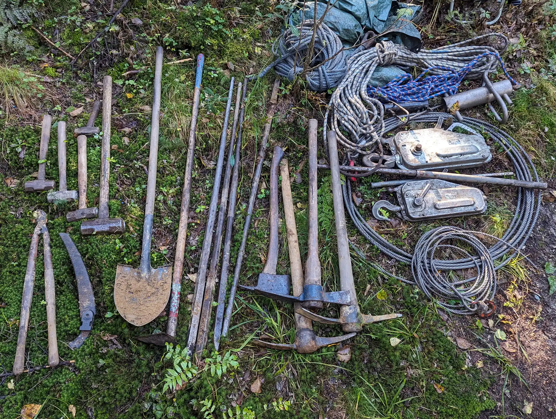
    Trail tools_09-21-2023_Matt Vezina

    Erosion Control

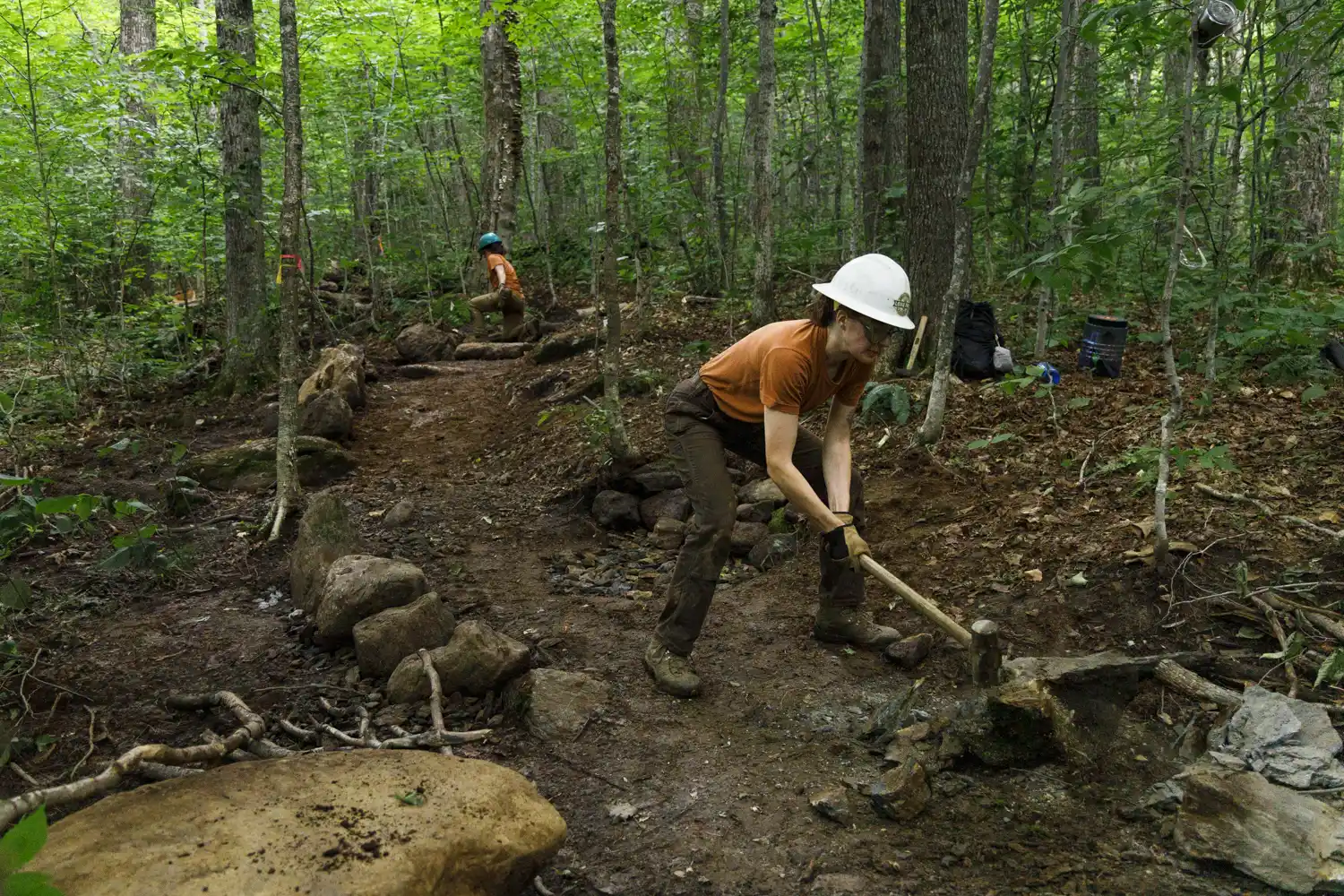
    Durable, high-quality rock structures like staircases and checksteps help mitigate erosion on steep and heavily used trails. They guide the hiker to stay on the designated path, provide a more durable trail surface, and help slow the flow of water down a trail.  

    Rock retaining walls also help prevent on-trail erosion. 

    Sucker Brook trail work_2024_Grace Law

    Tread Raising

    When the trail is too flat or low-lying, it is prone to major mud pits. These exacerbate over time, as hikers seek to walk around them, widening the trail. Crews build turnpikes, turnpikes, which are sections of trail bordered by rocks and filled with โ€œcrushโ€ โ€” crushed up stones โ€“ and topped with mineral soil to raise and dry the trail and create natural filter for water, instead of becoming a mud pit.

    Well-placed large, flat stepping stones also alleviate areas of trail prone to muddiness.

    Burrows Waterbar_July 2022_Anna Gardner (5)

    Drainage

    Waterbars (drains) are strategically placed on steep trail sections, to give water plenty of opportunities to drain off the trail and into the surrounding landscape. Waterbars must be large enough, frequent enough, and well-maintained to ensure they donโ€™t get overwhelmed during the big, intense rain storms we see more frequently now.  


    Forest City Bridge decking_2024_Dylan Norris

    Backcountry Infrastructure and Construction 

    As the world of trail construction and management continues to grow and professionalize, GMC is also exploring more efficient forms of trail construction, including the use of mechanized equipment to build trail in some locations along  the Long Trail System. Mechanized trail construction, followed by crews using hand tools and techniques, can make crews more efficient and reduce repetitive-use injury and burnout. 

    wood grain texture

    Learn More About GMCโ€™s Work on the Trails

    • Burrows-Trail-Project-Check-Steps July 2022 Photo by Anna Gardner.

      Our Work

      Burrows Trail Project

    • Our Work

      Current & Past Projects

    • Jay Peak

      Get Involved

      Join/Renew Membership

    Want to Support Sustainable Trail Work?

    Help ensure the trails are there for the next generation โ€” and the next. Support GMCโ€™s sustainable trails initiatives with a membership gift or donation today. 

  • Project Archives

    Project Archives

    Recent Season Reports

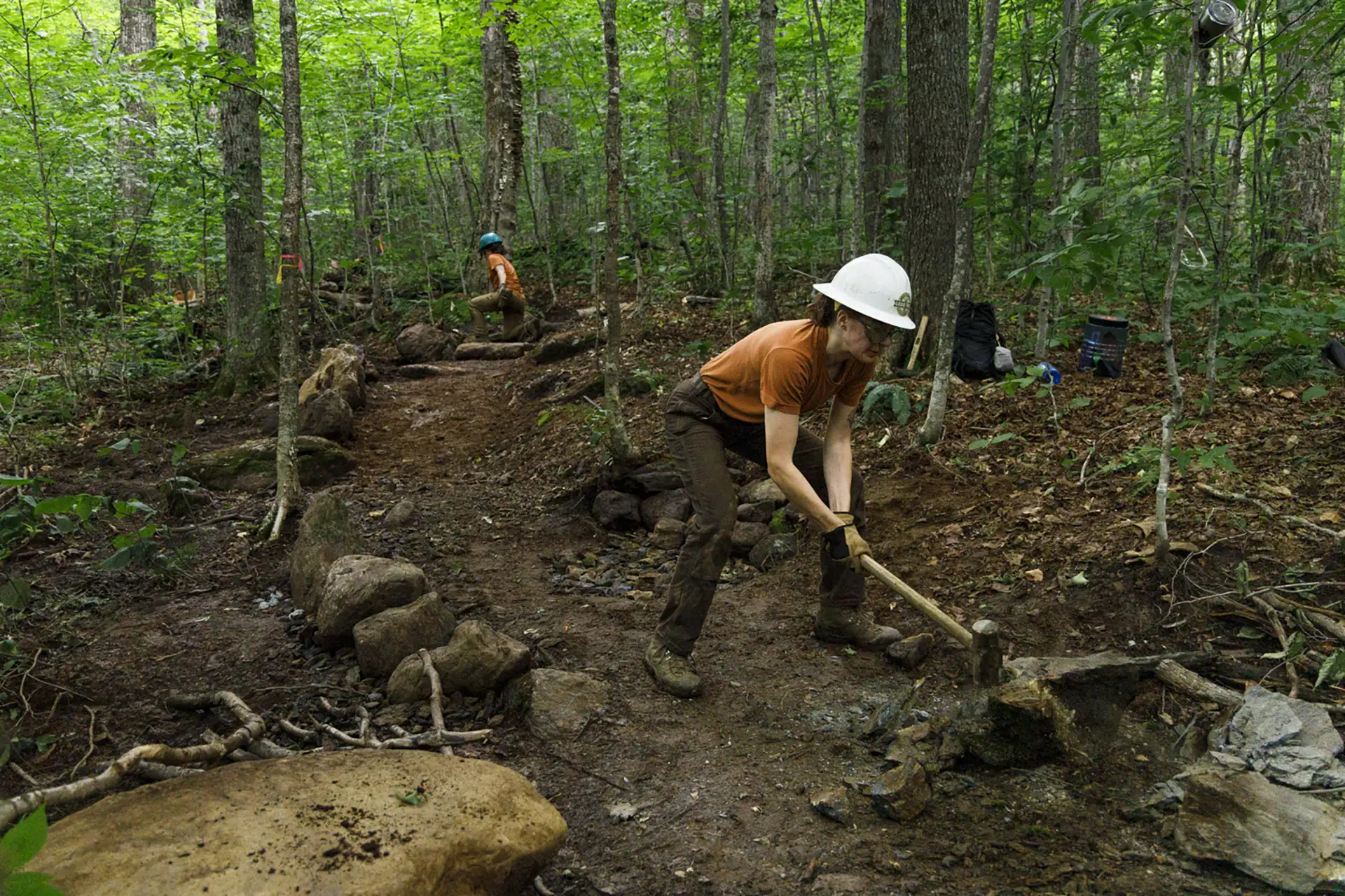
    Trail crews using rock bars_Belvidere_2025_Molly Belvo

    2025 Trail Projects

    wood grain texture

    Learn More about GMCโ€™s Trail Work

    • Burrows Trail relo 07-09-2024 Lily LaRegina

      Our Work

      Sustainable Trails

    • Blaze and heart_Trail at Willard Gap 07-04-2021

      Explore

      The Long Trail

    • Scouting Belvidere 01_white blaze_05-02-2025_Lily LaRegina

      About GMC

      Job Opportunities

    Support GMCโ€™s Work 

    Help ensure the trails are there for the next generation โ€” and the next. Support GMCโ€™s sustainable trails initiatives with a membership gift or donation today.