Submit your best Vermont hiking photos to the Green Mountain Club’s annual photo contest! Share how the trail has inspired, challenged, and awed you. Show us the people and pets you love to hike with, the details in the flora and fauna you’ve noticed as you connect with nature, the views that wow you, and the trails that have led you through Vermont.
Entering your photos is not only an artistic opportunity to share your trail experiences, but also a valuable way to give back to GMC. Sharing photos from your own trail experiences and adventures is important to the work we do: images are used in our annual calendar, in future editions of the Long Trail News, and on our social media channels as we share the work we do and connect with Vermont’s hiking community.
There are four categories for photo submissions: Trail Features; Hikers; Flora and Fauna; and Landscapes and Views. GMC staff will select one winner from each category and one overall contest winner. One Hiker’s Choice winner will be chosen, voted for by you. Contest prizes this year are:
Grand Prize: A Long Trail wall hanging by Grey Owl Design Long Trail graphic Nalgene water bottle, and large GMC maple syrup
Category Winners: One winner in each category will each receive a Long Trail graphic Nalgene water bottle, GMC store gift card, and small GMC maple syrup
Hiker’s Choice: GMC will select up to 15 honorable mention photos for Hiker’s Choice voting. The winning photographer will receive a Long Trail wall hanging by Grey Owl Design, Long Trail graphic Nalgene water bottle, and large GMC maple syrup
Contest submissions will remain open until Monday, August 31. The Hiker’s Choice voting selection will be announced on Friday, September 4 and voting will remain open until Friday, September 11. All winners will be announced on Monday, September 14.
Not sure which category your photo fits into? Read the descriptions below:
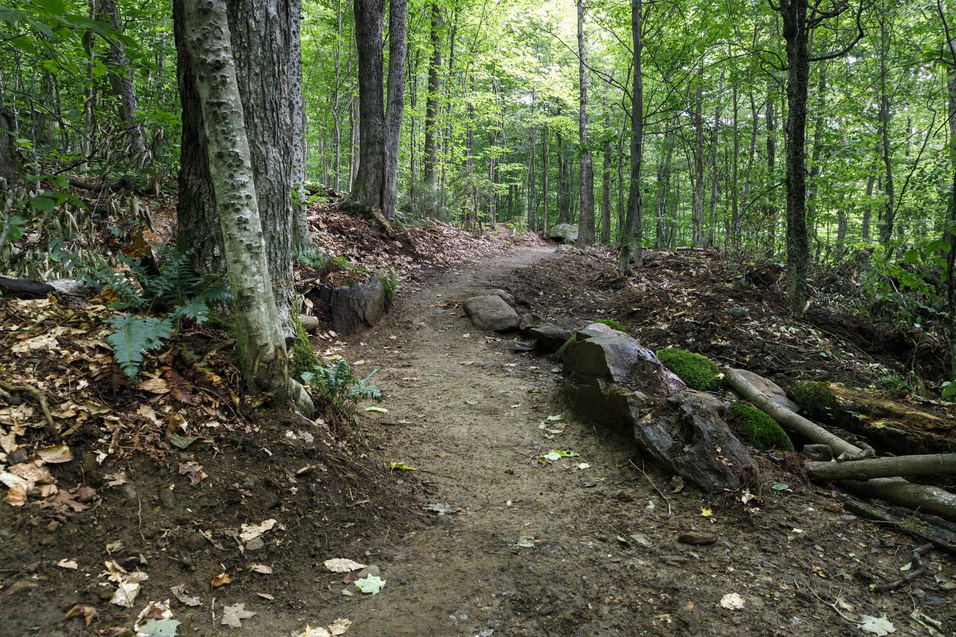
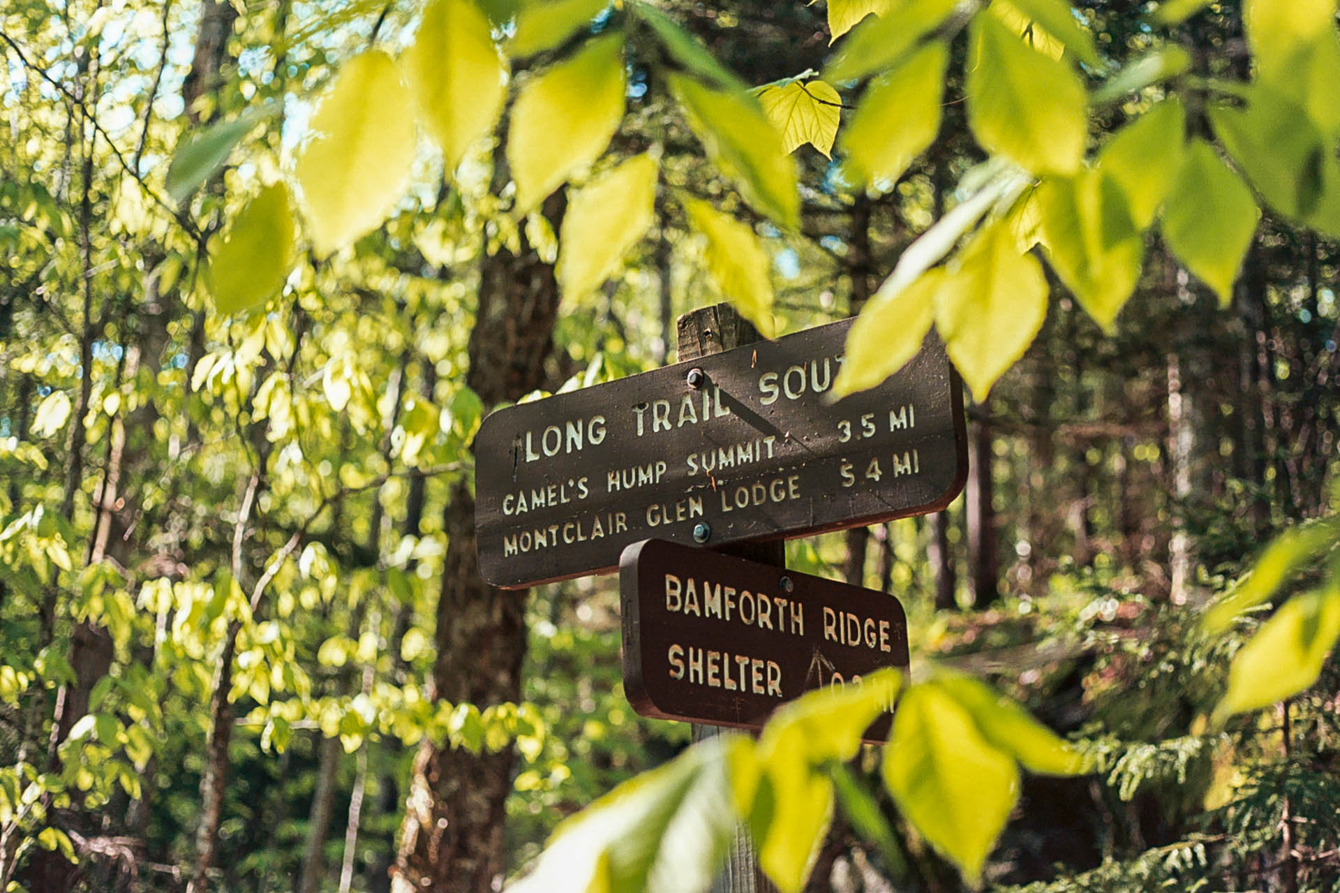
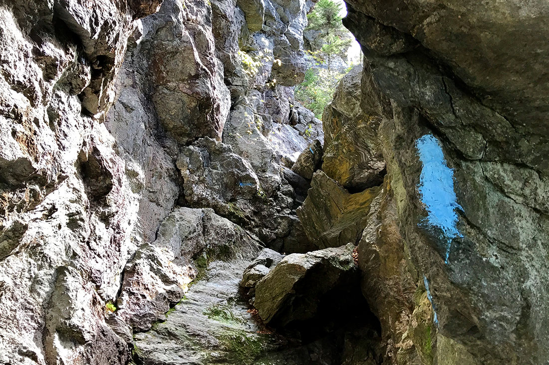
Trail Features: Trail structures like shelters and privies, staircases and ladders, trail signs, paths winding through the woods, and other iconic trail landmarks.
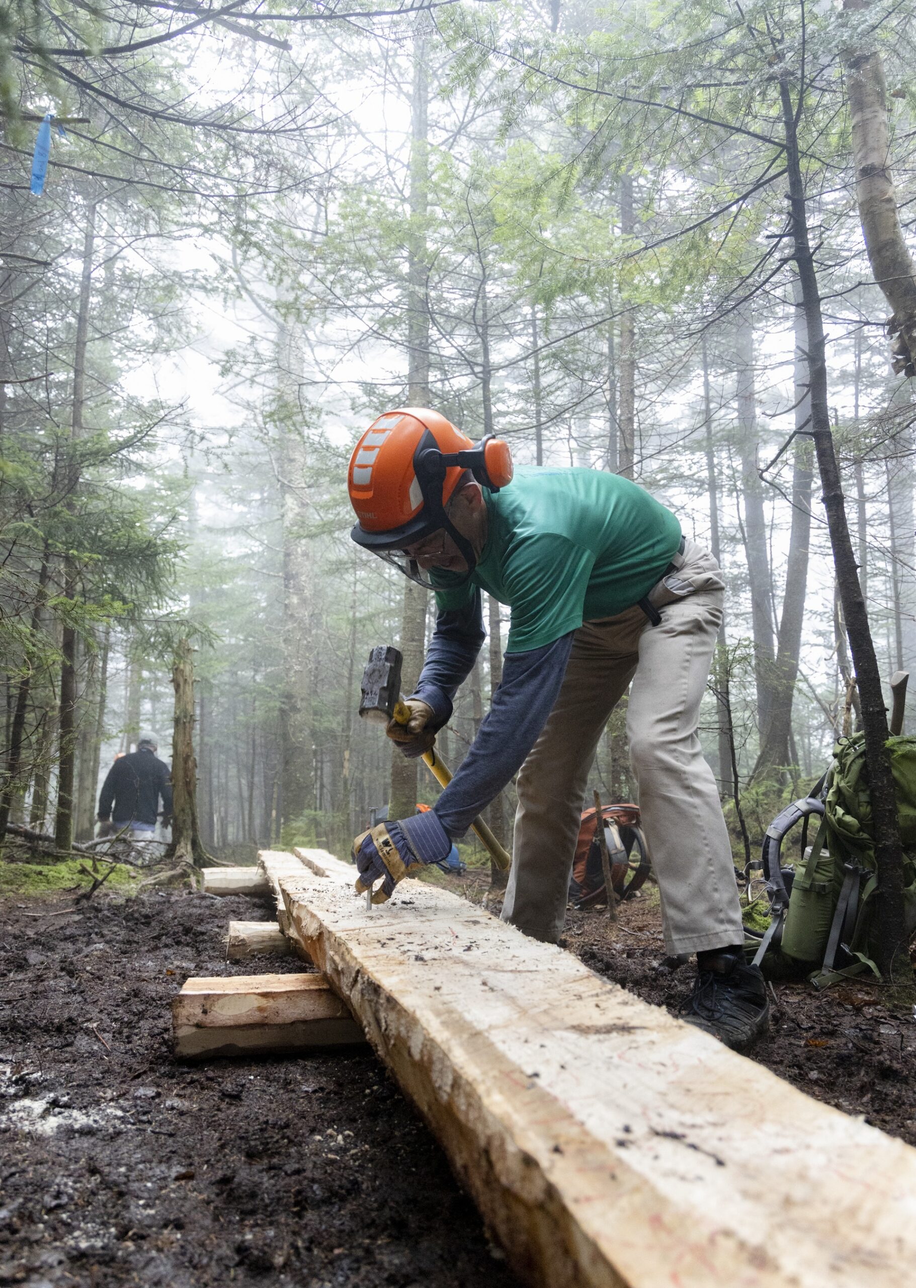
Hikers: You and/or your hiking partners, whether they’re two-legged or four-legged. Candid or posed. Any photos that speak to what it means to be a hiker.
Flora and Fauna: Wildlife and plant life spotted between the trees, by the ponds, and on ridge lines.
Landscapes and Views: Vista views, mountain layers, cloud formation-filled skies, horizons painted by sunrises and sunsets.
Entry Requirements and Guidelines
You must fill out the form fields with your first and last name and email.
You may submit up to 3 entries in each submission category.
Rename files using this naming format: Photographer Name_Date Taken_Location_Caption.jpg, for example JohnSmith_June2026_MountMansfieldSummit_StateHighPoint
Include a short caption for each photo entry identifying where and when the photo was taken, and what is depicted.
Photos can be from the past 3 years.
Photos must be from hikes in Vermont on the Long Trail and its side trails, the Vermont Appalachian Trail, or Northeast Kingdom trails.
Check that your files are not compressed, low resolution files. High-resolution digital photos, 300 dpi, in JPEG, PNG, or TIFF format are preferred.
FOR IMMEDIATE RELEASE: March 31, 2026 CONTACT: Chloe Miller, Communications Manager at Green Mountain Club cmiller@greenmountainclub.org, 802-241-8234
PROTECT THE TRAILS DURING VERMONT’S SPRING MUD SEASON
Waterbury Center, Vermont – As spring arrives and snow melts, Vermont’s mountains and trails are quickly transitioning to mud season.
The Green Mountain Club encourages trail users to avoid muddy trails, follow any seasonal trail or road closures, and help protect the treadway and vegetation during this sensitive season. As a reminder, the Vermont Department of Forests, Parks, and Recreation (VTFPR) issues trail closures on state land as conditions change, available on TrailFinder.
“During mud season, hikers can help us do the important work of protecting the trails and fragile mountain environments,” said Keegan Tierney, GMC’s Director of Field Programs. “This time of year, muddy trails are oversaturated with moisture and more vulnerable to erosion, while the rare and fragile vegetation in the mountain’s alpine zones lose their protective winter layers of snow and ice. We thank the Vermont hiking community for being good stewards of mountains and keeping the trails in good condition for hiking season by avoiding high elevation muddy trails and exploring low-elevation durable surface alternatives.”
Follow GMC and VTFPR to stay up to date on official mud season trail closures over the next several weeks until the end of mud season, which is typically Memorial Day weekend.
Make the most of mud season with these resources from GMC:
Find closures through TrailFinder and GMC’s Trail Updates. Stay up to date on trail access and closures. Not all active road or trail closures may be listed, so always follow posted road signs or signage at the trailhead, and evaluate conditions on the ground as well: if a trail or road is overly saturated, turn back and find a different place to hike.
Recommended Hikes:.While many high-elevation trails close during mud season, there are tons of mud season-friendly hikes. Check out mud season hike recommendations
About the Green Mountain Club: The Green Mountain Club was founded in 1910 with one goal: to build a long-distance hiking trail that spans the length of Vermont’s mountains. The Long Trail was completed in 1930. Today, Green Mountain Club staff and volunteers care for roughly 500 miles of trail in Vermont, and take a sustainable approach to trail building and maintenance in the face of climate change impacts and increased year-round use of the trails. We support the hiking community with education and access to enjoy Vermont’s beloved trails.
If you’ve hiked on the Long Trail (LT), you’re probably familiar with some of its notorious mud pits that require wide, precarious steps over a few random logs that dot the surface of the mud puddle or sacrificing your mostly dry socks to tread directly through the ankle-deep sludge.
Mud management is part of the Green Mountain Club’s (GMC) trail work, and while we’d love to eliminate all mud on the Long Trail System, that’s a Sisyphean goal. Instead, we improve drainage where we can, install bridging or tread-hardening measures on perpetual mud pits, and try to educate the hiking public on how their approach to mud impacts the overall trail and landscape health.
So this mud season, learn more about the mechanics of mud and mud-abating measures on the trail, and why those DIY logs aren’t the solution you might think they are.
Why is Vermont Muddy?
Vermont is sometimes called “Vermud” by Appalachian Trail hikers, and GMC’s familiar refrain to stay off fragile, high-elevation trails during the spring mud season is well known. With impacts from climate change, mud season conditions are now possible in any month of the year.
What causes Vermont’s notorious mud and mud season?
Vermont’s rocky soils have a higher percentage of clay minerals than surrounding states. Clay minerals absorb water and have very low permeability, preventing drainage.
Soil still frozen from winter does not allow snowmelt and spring rains to percolate deeper, creating the saturated, messy top layer known as mud. High snow and cold winters like this one often result in longer, later mud seasons and a muddier hiking season overall.
Soils at high elevations in Vermont are shallow and often on top of impermeable bedrock.
Last but not least, much of the Long Trail System was built over a century ago, without the impacts of climate change and a fraction of the hikers we see today. Those trails were built either too steep or too flat, traveling through susceptible soils with poor drainage.
How GMC Manages Mud
When assessing chronic mud pits, we look at where the water is coming from and any opportunity to exit the water . Preventing water from reaching the mud pit in the first place is the best option, and we can achieve this by installing drainage structures above it or relocating to a drier route.
Draining the mud pit, often through de-berming (removing the raised lip on the downslope side of the pit) or a drain, is the second-best option. If for some reason neither of those options are make sense, we consider a relocation or “harden” the trail, either via rock work or puncheon.
Relocation decisions are dependent on many factors, primarily length and severity of the mud pit and other trail layout issues, protected land corridors, and terrain options for a sustainable relocation. The recent southern terminus relocation is designed to move the trail up to a sidehill and alleviate some of the mud issues there.
Hardening the trail involves reconstructing the tread using features such as turnpikes or step stones, often combined with drainage improvements. These rockwork solutions are durable and effective, but they require significant time, cost, and skilled labor.
Puncheon: When it Works and When it Doesn’t
Puncheon is a common (and visible) solution to perpetually muddy areas, because compared to rockwork, it is quicker and easier to install. Puncheon in New England, sometimes referred to as bog bridging, typically adheres to this definition: “a single-or double-plank tread surface resting directly on mud sleepers, cribbing or piles.”
Most GMC puncheon is built out of Eastern Hemlock, which is fairly rot-resistant. We sometimes use more expensive, but more durable, black locust or cedar, or we fell trees f rom the surrounding area, usually red spruce or balsam fir, to create and install native puncheon.
GMC considers multiple factors when deciding if puncheon is the correct solution for a muddy piece of trail. Puncheon is fairly low-skill and fast to install, so GMC can work with volunteer service groups, section volunteers, or individual adopters to install puncheon. An efficient crew can build about 100 feet of puncheon in a day, and it starts working immediately.
But puncheon isn’t all sunshine and rainbows. The lumber is heavy and expensive, and packing it into the worksite is the biggest limiting factor. It also doesn’t last forever. Well-built puncheon ideally lasts 10-12 years, but that can vary, and the staff time and expenses add up over the decades.
Puncheon should only be installed in flat terrain, as sloped puncheon quickly becomes slippery and dangerous for the hiker. Trails that flood regularly are also not suitable candidates for puncheon as floodwaters can dislodge the boards. Ideally, puncheon begins and ends with durable tread, transporting the hiker across the muddy trail; placing 20 feet of puncheon in the center or at either end of a 100-foot mud pit doesn’t resolve the problem.
Good puncheon is sturdy with no bounce and no sag in the middle. GMC uses stringers that are 3”x8” and sills that are 6”x6”, so that puncheon is sturdy and settles in the ground. GMC uses a sledgehammer to drive galvanized 8” spikes through the stringers and into the sills. There should be a half-inch gap between stringers that allows water to drain but isn’t so large that a foot or trekking pole could get caught between them.
Why DIY Fixes Don’t Work
Hikers may see logs, bark, or brush added (usually by other hikers) to a mudpit to create a drier stepping surface. While it may be a very temporary fix, it can make the problem worse in the long run. Adding these items to the trail can dam up natural drainage in the pit, and that extra organic matter eventually decomposes and acts as a sponge, soaking up moisture and creating more mud in the long run. Rather than cobbling together a temporary fix, we kindly ask you to instead report the pit to GMC and walk right through the center of the pit to avoid widening it.
Despite GMC’s commitment to a durable and sustainable Long Trail System, it’s unlikely the club will resolve every mud pit on the 500-mile system — it’s just not practical or possible. So next time you come across a muddy stretch of trail, appreciate the heavy snowfalls, unique soils and ruggedness of the LT that created it in the first place. Look for a berm you can kick out to drain the pit, and traipse directly through the mud to avoid worsening the issue.
Help Us Manage Mud!
Vermont’s mud season generally runs from snowmelt to Memorial Day Weekend. High-elevation trails on state land are closed, and we ask for your cooperation in giving the saturated soils time to dry out by avoiding all high-elevation trails. Lower elevations, durable-surface trails, and dirt roads make great alternatives this time of year.
If you’re looking for some new-to-you trails and to discover little-visited corners of Vermont, the Long Trail (LT) Side-to-Side challenge might be perfect for you. A cousin of the End-to-End hiking challenge, the Side-to-Side Challenge was born in 2006 after years of hikers informally taking it on. Hiking the Vermont Side-to-Side challenge is a great way to mix up your standard hiking routes.
It consists of 88 side trails — 84 that the Green Mountain Club (GMC) manages, and a few we don’t, like the Wanderer Trail at Stratton Mountain Ski Resort — and covers 166.1 miles. These trails are mostly blue-blazed and generally extend from a trailhead to the LT itself.
There have been just 71 Side-to-Siders to date. Each year, we recognize about one percent of the total number of End-to-Enders, so joining the ranks of the Side-to-Siders places you in elite company.
Many of you are probably well on your way to completing the challenge and may not even know it. Certification is simple – we just ask for the approximate date hiked for each of the 88 side trails, conveniently organized in a digital tracker that includes the divisions used on the Long Trail Map. So grab our latest map and a Long Trail Guide for directions and trail descriptions and start plotting some routes to explore side trails that are new to you!
Hiking expert Philip Werner moved to Vermont in a few years ago and began working on his Side-to-Side certification as a way to explore his new home. He completed the challenge in September 2025 and documented his approach to itinerary planning and exploring on his website, sectionhiker.com.
Philip first heard about the Side-to-Side Challenge from a friend who had previously worked on a GMC trail crew and had completed it. He recommends using a Side-to-Side list to eliminate some of the endless browsing and choice.
“I’m a list hiker, I love having a list to take some of the guesswork out of where to hike each week,” he explains.
Side trails vary widely, from treacherous crawls through caves on Mount Mansfield’s rugged ridgeline, to gentle strolls to ponds in southern Vermont. Philip says it’s a great way to explore the variety of terrain that hiking in Vermont has to offer and keep your hiking experience fresh.
There’s no one way to approach the Side-to-Side Challenge. You could do 88 separate day hikes or try to combine multiple trails in a vicinity into one long day’s hike or a multi-day backpacking trip. No matter what, you’ll be hiking more than the designated 166.1 miles, since there are a few loop options and most trails will be hiked in some sort of out-and-back manner.
“Generally you will find fewer hikers which, for me, is a delight. Also, there’s a better chance of seeing Vermont’s wildlife because it’s quieter with the decrease in foot traffic. — Ira Sollace, Side-to-Side 2020
“You will drive yourself crazy trying to figure out the optimal route to get as many trail miles as possible,” admits Philip.
One strategy is to start with the trails nearest your home, to keep the activation energy low, and build up to trail areas that will require longer drives or nights away from home.
Jake Perkins, who completed the challenge in 2024 offers this approach: “Treat it as a long-term commitment and incorporate the hikes into other experiences in the surrounding woods and towns.”
Philip created backpacking routes using GMC’s hiking maps for networks of trails on Killington, Camel’s Hump, and Mount Mansfield. “They’re not traditional backpacking trips, because you’re doing a lot of in-and-out, back-and-forth to get to all the trails.” For example, over two days in the Killington Area, Philip hiked the following route:
Day One: Shrewsbury Peak Trail (3.8 mi.) to LT North (1.8 mi.), then down and back up the Bucklin Trail (3.5 mi. Each way, 7.0 mi. Total) before tenting overnight at Cooper Lodge.
Day Two: Killington Spur out-and-back to the summit, LT South (1.8 mi.) to Shrewsbury Peak Trail (again) to the Black Swamp Trail (2.1 mi.), and a 1.5 mi. road walk back to his car.
That’s a total of 19.5 miles of hiking for three side trails totaling 9.8 miles.
For Philip, planning is part of the fun of the challenge. A longtime New Hampshire resident, Philip was contemplating a move to Vermont a few years ago and used the Side-to-Side Challenge to explore the numerous back roads leading to some of the lesser-used trailheads. “Exploring Vermont this way has been thrilling, rekindling the joy I feel when driving down unmarked dirt roads in the middle of nowhere to hike on new trails to new destinations,” he says.
“I loved the logistics puzzle as a solo hiker and sometimes self-shuttled between trailheads with a bicycle and car.” — Liz Ford
Philip had trail highlights from the entire length of the system but he can’t name a single favorite.
Trails to ponds and streams, like Little Rock Pond and Griffith Lake, were memorable for their peaceful destinations. The twisty, scrambly Canyon and Cliff Trails on Mansfield are perennial favorites among Side-to-Siders.
George Grzyb, who completed their Side-to-Side in year, recommends the Frank Post and Forester’s Trails because “they provided for a scenic loop to visit both Tillotson Peak and Belvidere Mountain in a quieter part of the Long Trail System,” says George. “There are many opportunities to combine a few side trails and revisit your favorite Long Trail destinations.”
In addition to GMC’s hiking maps, including the online Avenza versions, Philip swears by a road atlas. “You can’t rely on Google or Apple Maps for this challenge,” he says. Having a hiking buddy and dropping a second car somewhere can eliminate the number of out-and-back hikes necessary.
“I think more people should pursue the Side-to-Side list. It’s an on-ramp to the Long Trail itself; it’s a great way to stay connected to the trails after an End-to-End, and it can be very family-friendly and flexible since it doesn’t follow a traditional through-hike structure,” Philip concludes.
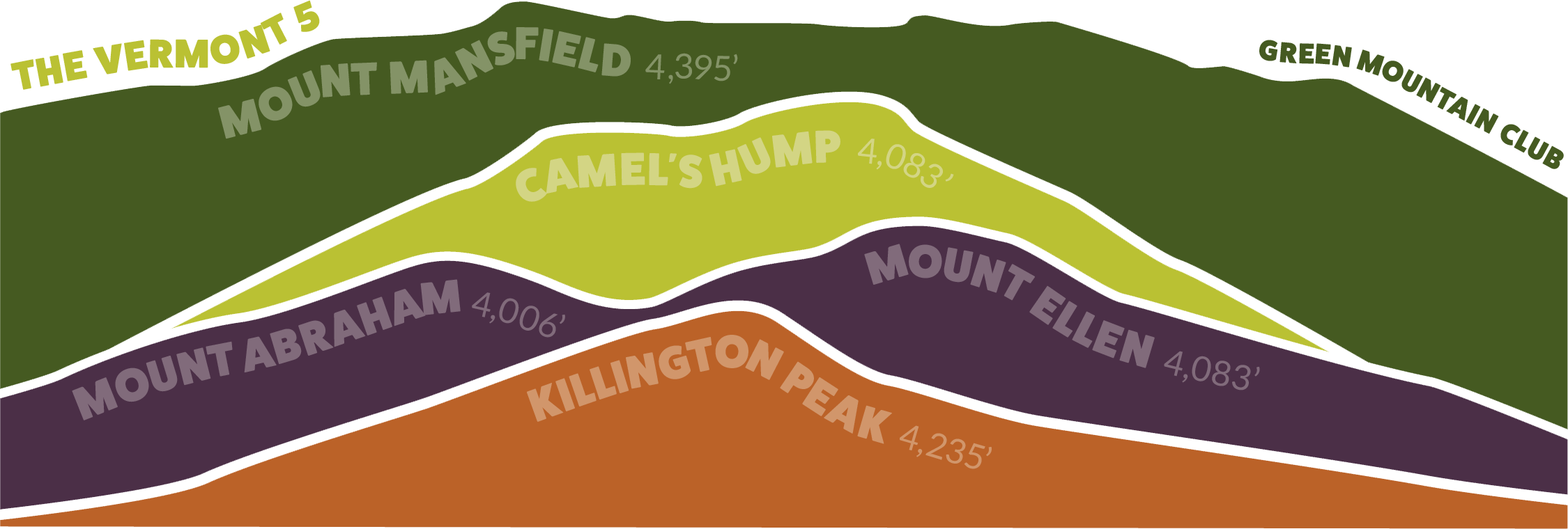
The new year is the perfect time to set goals for the year ahead, and one of our favorite is hiking goals! If you’re looking for a challenge to get you outside and up in the mountains, the Vermont 5 is a great new year goal. It involves summiting all five of Vermont’s 4,000-foot peaks. GMC’s Visitor Information Specialists put together some of their favorite routes up and down Vermont’s iconic peaks, so you can learn how to hike the VT5. Be sure to check trail conditions and refresh on seasonal guidance before tackling these challenging peaks.
If you’ve never hiked a 4,000-footer, they can be challening. Consider working your way up with a few weeks of training and leveling up your hikes. Use the suggestions in this “Couch to Camel’s Hump” post from a few years back!
Already hiked these peaks? Consider trying a new-to-you route or completing them all again in a given month in 2026. Some folks even try to hike them all in a day or weekend!
Proper preparation and weather research is critical, as is carrying the Ten Essentials. Check the latest mountain weather forecasts on mountain-forecast.com and National Weather Service. In general, we recommend waiting until summer to tackle these peaks!
New: GMC’s Vermont Five sticker, designed by Montpelier designer Dana-Dwinell Yardley, is the perfect way to commemorate the VT5 challenge.
Jump To:
Killington Peak is Vermont’s southernmost four-thousand-footer, and is the second-highest peak in Vermont. Its slopes are home to Killington Ski Area, nicknamed “Beast of the East.” The Long Trail doesn’t pass directly over Killington’s summit, but can be accessed by a challenging 0.25 mile spur trail from Cooper Lodge.
Long Trail South >> Killington Summit >> Sherburne Pass Loop
15 miles round trip; 3,860 feet of elevation gain
For a long, challenging hike, take the Long Trail South from Route 4 to Cooper Lodge, then take the spur trail to the summit. Head back the way you came to the Long Trail, then pick up Sherburne Pass Trail (tackle Pico Peak via a spur trail, 3,957 ft), continue to Deer Leap Trail (across Route 4), then pick up the Appalachian Trail South back to the Long Trail South to finish the loop.
Bucklin Trail >> Killington Peak
7.4 miles, 2,480 feet elevation gainFor a shorter hike on one of the Long Trail’s side trails, park at the Bucklin Trailhead on Wheelerville Rd, and hike up the moderate Bucklin Trail to the Long Trail/Appalachian Trail South. At Cooper Lodge, take the spur trail to Killington Peak. Enjoy the views from the top of Killington, then return the same way.
How to Hike the VT5: Mount Abraham, 4,006 ft
Mount Abraham is Vermont’s shortest four-thousand-footer, but is by no means the least! It offers great panoramic views of New Hampshire, the Adirondacks and Lake Champlain, and the Green Mountains north and south. It is also home to a small area of rare alpine vegetation, so take care to walk only on the rocks at the summit. Please note: Lincoln Gap Road, a popular access point for Mount Abraham, is closed from October 15 to May 1 each year.
Long Trail North from Lincoln Gap
5.2 mi rt, 1,640 ft elevation gain
This moderate to challenging hike takes you directly to the summit of Mount Abraham. Start at the Long Trail parking lots at the top of Lincoln Gap Road. (the road is closed in winter). Hike moderately uphill past Battell Shelter. The last mile to the summit is the most strenuous, with rock scrambles and steeper terrain, but you are rewarded with 360-degree views, including Mt. Ellen and Camel’s Hump to the north, the White Mountains to the east, the Adirondacks to the west, and the southern Green Mountains to the south.
Battell Trail >> Long Trail North to summit
5.8 miles round trip; 2,600 feet of elevation gainParking at Elder Hill Road, this moderate to strenuous side trail takes you to the summit of Mount Abraham. Take the blue-blazed Battell Trail 2 miles to its intersection with the white-blazed Long Trail, just south of Battell Shelter. Continue on the Long Trail North to the summit. The last mile of the trail on the Long Trail North section will include rocky scrambles and steeper terrain.
How to Hike the VT5: Mt. Ellen, 4,083′
Tied with Camel’s Hump as the third-highest peak in Vermont, Mount Ellen is a viewless summit just south of the Sugarbush Mount Ellen ski area. Be sure to take in the views from the top of the ski hill on your way to the summit! You get beautiful views looking east toward the Adirondacks and the Green Mountains to the north.
Jerusalem Trail >> Long Trail South >> Battell Trail
10.5 miles; 3,230 ft. Elevation gainTackle both Mount Ellen and Mount Abraham on this moderate to challenging hike. You will need to drop a car at one end or arrange for a shuttle. Drop your car at Battell Trail parking lot on Elder Hill Rd, and park your 2nd car at Jerusalem Trail parking area on Jim Dwire Rd. Hike up the Jerusalem Trail to the Long Trail South, passing some lookouts and the Sugarbush Mount Ellen Ski Area before summitting Mt. Ellen. Continue on the Monroe Skyline ridgeline to Mount Abraham, passing Cutts Peak, Nancy Hanks Peak, and Lincoln Peak (with views!). Descend down Mt. Abraham on the Long Trail South to Battell Trail, returning to your car. Note: the descent off Mt. Abraham will be steep and rocky, and the most challenging part of the hike.
Jerusalem Trail >> Long Trail South to Mount Ellen
8.4 miles round trip, 2,483 feet of elevation gain
If you’re looking for an out-and-back on Mount Ellen, the Jerusalem Trail is perfect. Park at the pulloff on Jim Dwire Rd, and take the blue-blazed Jerusalem Trail up to the Long Trail. Catch the Long Trail South to summit Mount Ellen, then return the way you came. Mount Ellen is viewless, but there are great views from the top of the Sugarbush Ski Area just before the summit!
How to Hike the VT5: Camel’s Hump, 4,083 ft
Once called Couching Lion, Moziozagan, and Tawapodiiwajo, Camel’s Hump is an iconic peak along the spine of the Green Mountains. Camel’s Hump is home to rare alpine vegetation, so please follow white blazes and stay on the rocks, especially on the summit. If hiking up the Burrows/Forest City Trails, please note the town of Huntington is enforcing parking regulations on Camels Hump Road, including ticketing and towing of cars parked outside of the designated parking area. Please respect posted signage and if parking lots are full please find another hike or try again at another time.
Monroe Trail >> Long Trail South to Summit >> Alpine Trail >> Monroe Trail
6.6 miles round trip, 2,583 feet elevation gain
This challenging hike takes you up one of Vermont’s most recognizable peaks of the Green Mountains, with 360-degree views of the White Mountains, the Adirondacks and Lake Champlain, and the Green Mountains extending north and south. Take the blue-blazed Monroe Trail to the hut clearing, then Long Trail South to the summit. Catch the Alpine trail and visit the site of an airplane crash before connecting back with the Monroe Trail to return to your car.
Forest City Trail >> LT North >> Burrows Trail
5.5 miles round trip, 2,446 ft elevation gain
This challenging hike takes you up the western side of Camels Hump, and gives great 360-degree views from the summit. From the Burrows parking lot, take Forest City Connector to the Forest City Trail to Long Trail North, summit the mountain, then continue on Long Trail North to the Burrows Trail to return to your car. The trail will include rocky scrambles up and down, some ledges, and beautiful views of the area.
Burrows Trail >> LT South >> Burrows Trail
4.8 miles round trip, 2,183 feet elevation gain
Try this moderate hike for a shorter (yet still steep!) adventure up Camels Hump! Take the blue-blazed Burrows Trail to the hut clearing (2.1 mi), then take the Long Trail South to the summit. The Long Trail section will have some rocky scrambling and larger boulders to navigate, but it is only a short distance.
How to Hike the VT5: Mount Mansfield, 4,395 ft
Mount Mansfield is Vermont’s northernmost four-thousand-footer and the tallest peak in the state, standing at 4,395 feet. Its distinctive ridgeline resembles a face, with the “Chin” being the highest point. Mount Mansfield is home to Vermont’s largest area of alpine vegetation, so please remain on the rocks and avoid stepping on vegetation.
Underhill State Park >> Maple Ridge Trail >> Long Trail North >> Summit >> Long Trail South >>Sunset Ridge Trail
8.8 miles, 2,700 feet elevation gain
This challenging loop trail will take you all along Mount Mansfield’s iconic ridgeline, from the Forehead to the Chin, with 360-degree views of Canada to the North, the White Mountains to the East, the Green Mountains to the South, and the Adirondack Mountains to the west. Take theEaglethe Eagle Pass trail to the CCC road in Underhill State Park, to Maple Ridge Trail. From Maple Ridge, connect with the Long Trail North at the Forehead, and continue on Long Trail North to the Chin. After summiting, backtrack to the Sunset Ridge Trail, enjoying unobstructed views of Lake Champlain and the Adirondacks on your hike down to Underhill State Park.
Long Trail South >> Chin
5.6 miles, 2850 feet elevation gain
For a more direct hike to the summit, the Long Trail South from Route 108 is one of GMC’s more popular routes. It can be done as an out-and-back, or you can create a loop with the Profanity Trail or Haselton Trail. From Route 108/Barnes Camp, take the Long Trail South over the boardwalk (take in stunning views of Smugglers Notch!), then cross Route 108 to being your ascent. Take a break at Taft Lodge before your last ascent to the Chin (expect some scrambling), where you will have 360-degree views of the Greens, Whites, and Adirondacks. Return the way you came, or continue on the ridgeline to either the Profanity Trail to Long Trail South or Haselton Trail (0.5 miles down the toll road).
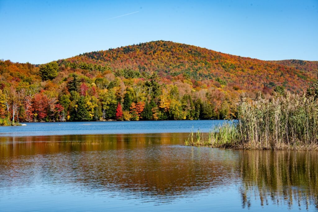
“Fall Foliage on the Long Trail,” by Tara Schatz
Whenever entering the backcountry, safety is paramount. Before setting out, let someone know where you’re going, what trails you are hiking, and when you’ll return. Get started with our HikeSafe information.
Weather: Be sure to check the weather and daylight hours ahead of your trip. In most circumstances, higher elevations mean cooler temperatures, and alpine zones offer little wind cover. Summit forecasts can be found on Mountain Forecast and the National Weather Service’s Enhanced Mountain Point Forecast. Most importantly, be aware that mountain conditions can change quickly; know your limitations, accept when it’s time to turn back, and postpone your hike if necessary.
Emergencies: Your first-aid kit should include hand and toe warmers, a headlamp, waterproof matches and a whistle, an emergency blanket, duct tape, alcohol wipes, moleskin and adhesive bandages, safety pins, ibuprofen, a sewing needle and thread, and any personal medications you may need, just in case. Pro tip: don’t expect to be rescued. Know how to rescue yourself.
Leave No Trace: Despite slowed traffic, it’s still essential to leave nothing but footprints… or snowshoe prints. Learn how to minimize your impact on the environment so the trails, campsites, and waterways look just as beautiful come Spring.
Parking: Some popular trailheads aren’t accessible in winter. If you cannot park fully outside the travel lane, use an alternative parking area or choose a different trailhead. Additionally, respect winter parking signage. Visit newengland511 for information on road closures, road work, and incidents.
Please plan ahead and prepare when going for any hike. We strongly suggest that hikers carry a map and guidebook when heading out to the trails. Guidebooks and maps are available for purchase at GMC’s Visitor Center, GMC’s online store, and in most Vermont bookstores and outdoor gear retailers.
Would you like to join a group hike? GMC’s fourteen sections lead outings every week all over Vermont. Check out our calendar to join them.
In the Long Trail Guide, you will find detailed maps and descriptions of the Long Trail System and the Appalachian Trail in Vermont, suggested day hikes, shelter descriptions, and public campgrounds near the trail. The Walker’s Guide to Vermont includes shorter walks and leisurely rambles around the state. We also now have a list of more accessible trails in Vermont.
Northern VT Fall Foliage Hikes:
Belvidere Mountain, Lowell
Approximately 5.5 hours, 7.9 mile loop – challenging, 1,980ft elevation gain
Belvidere Mountain is a gorgeous summit with a fire tower that offers 360-degree views on a clear day. From the tower, the Green Mountains are visible south to Camel’s Hump. Big Jay and Jay Peak are prominent to the north; to their right stands Owl’s Head and other mountains in Quebec near Lake Memphremagog. On a clear day, the White Mountains are visible to the east. Hike this loop to the summit via the Frank Post Trail to the Long Trail to Forester’s Trail or in the reverse direction. For a shorter hike, park at Long Trail State Forest parking lot on Route 118 in Eden and hike Long Trail North for 2.6 miles, then take the 0.1-mile spur trail to the east to the fire tower (5.4 miles round trip). This is a small parking lot. If the lot is full when you arrive, an alternative route up starts on Route 118 where the long trail crosses the road. Pick up the Long Trail going north for a 4.8 mile out and back up to Belvidere Mountain Fire Tower.
Laraway Lookout, Waterville
Approximately 2.5 hours, 3.6 miles out and back, moderate, 1,390ft elevation gain
This moderately challenging 3.6-mile out and back on the Long Trail is spectacular in the fall. Not only do hikers get views of Mansfield and the Sterling Range, but hikers can admire overhanging rock ledges that the trail passes by. From Codding Hollow Rd, take the Long Trail North for 1.8 miles.
Smugglers’ Notch Boardwalk and Barnes Camp Loop, Barnes Camp, Stowe
Boardwalk: Approximately 20 minutes out and back
Barnes Camp Loop: Approximately 1 hour, 1.4 mile loop, easy/moderate, 350ft elevation gain
Explore wetlands, see a beaver dam, and admire the notch from this 660-foot accessible boardwalk on the Long Trail. If you choose to extend your hike, complete the 1.4 mile Barnes Camp loop. On the Barnes Camp Loop, there will be a stream crossing. Rocks are in place to hop across. We recommend starting at the boardwalk to get amazing views of the Notch! If doing Barnes Camp Loop, please park in the Stowe hiker lot at the Stowe Mountain Resort across the road from Barnes Camp. If just hiking the boardwalk, please park at Barnes Camp.
Mt. Elmore, Morrisville
Approximately 3 hours, 4.2 mile loop, moderate, 1,470ft elevation gain
As one of the smaller peaks in the Worcester Range, Mt. Elmore is a great beginner hike. The fire tower at the top provides the perfect place to view the fall foliage found within the Worcester Range and offers stunning views of the Green Mountains. Located in Mt. Elmore State Park
Harrington’s View, Bolton
Approximately 2.5 hours, Approximately 4.2 mile loop, moderate/challenging, 600ft elevation gain
Harrington View offers a view of Mt. Mansfield to the north and Bolton Valley Ski Area to the south. Starting from Bolton Valley Resort, hike up the backcountry ski trails to Harrington’s View. There are multiple trails to take to reach Harrington’s View and loop back down. One possible route option, starting from the Bolton Valley Ski Area parking lot, take the Broadway trail to Telemark. Stay on the Telemark trail until it intersects with Eagle’s Nest which you will follow until it meets with the North Ridge Trail. When the North Ridge Trail meets the Long Trail, take the Long Trail south to Harrington’s View. To return, continue south on the Long Trail until you reach the intersection with the Goat Path. Take the Goat Path all the way to its intersection with the Maple Loop. Turn onto the Maple Loop and follow it until it intersects back to the Broadway trail which will lead you back to the parking area.
The Short Trail, Waterbury Center – field view of Worcester Range
Approximately 30 minutes, 0.7 miles, easy, 100ft elevation gain
The Short Trail is a lovely trail through the woods and fields with a view of the Worcester Mountain Range. The Green Mountain Club offers weekly guided hikes that explore the 0.5 mile loop on the Short Trail at GMC’s headquarters building in Waterbury Center. On this hike participants will learn more about hiking in Vermont, the Long Trail and the Green Mountain Club, and tips to have a successful hike. These hikes are open to hikers of all ages, from beginner day hikers to seasoned backpackers. Hikes take place on the 2nd and 4th Tuesdays at 10am, and on the 1st and 3rd Wednesdays at 2pm, through October 14. The hike will take about an hour to allow time to ask questions and to stop and explore. Folks are welcome to explore the trail on their own at any time.
Central VT Fall Foliage Hikes:
The Green Mountain Audubon Center, Huntington
Approximately 30 minutes to 3+ hours, 1 to 5 miles, easy, Approximately 300ft elevation gain
Nestled in the foothills of the Green Mountains, the 250-acre Green Mountain Audubon Center offers outstanding opportunities for exploration and discovery of the natural world of Vermont. Five miles of trails wind their way through a variety of natural communities including, northern hardwood forest, hemlock swamp, and the Huntington River. Their Visitor Center is open Monday-Friday 8 AM-4 PM. Stop by for a trail recommendation, information about Audubon Vermont’s education and conservation programs! Be sure to check out their gear loan library! Visitors can check out binoculars, field guides, or snowshoes to use on their trails.
Jerusalem Trail to Stark’s Nest, Lincoln
Approximately 4 hours, 6.2 miles, challenging, 2,180ft elevation gain
This route takes hikers across a section of the Monroe Skyline, passing Orvis’s Lookout that offers views to the west. From Stark’s Nest, there are stellar views to the north and east. The Jerusalem Trail climbs up hill and joins the Long Trail just before Stark Mountain. Once you join the LT, begin hiking north. You will walk past some ski runs at Mad River Glen and arrive at Stark’s Nest. This building is left unlocked during the summer for Long Trail hikers to relax and stay in overnight.
Stark Mountain Trail to Stark’s Nest
Approximately 4 hours, 5 miles, moderate/challenging, XX feet elevation gain
Park at Mad River Glen Ski Area on Route 17, and hike the Stark Mountain Trail to the Long Trail (2.4 miles) then take the Long Trail North to Stark’s Nest (0.1 miles). Return the way you came, or continue on Long Trail north past Theron Dean shelter to Sunnyside Trail (0.7 miles) and connect back with Stark Mountain trail (0.4 miles) to head back to your car.
Sunset Ledge, Breadloaf Wilderness
Approximately 1.5 hour, 2.2 miles, moderate, 380ft elevation gain
Hike out to Sunset Ledge to see views to the west and a lovely sunset over the Adirondack Mountains. Explore this 1.4-mile out-and-back trail near Lincoln, Vermont. This is a popular trail for hiking and walking, but you can still enjoy some solitude during quieter times of day. From Lincoln Gap, head South on the Long Trail. Please note: Lincoln Gap closes on October 15. If hiking after October 15, you will need to hike a mile up from the gate on the road.
Great Cliff of Mount Horrid, Rochester
Approximately 1.5 hours, 1.4 miles, moderate, 650ft elevation gain
With the cliff closed March 15 – August 1 due to Peregrine nesting, fall is a great time to hike to the Great Cliff of Mount Horrid. Although it is a short climb, the trail is steep and demanding, but hikers are rewarded with amazing views from the top to the south and east. From Brandon Gap, hike the Long Trail North for 0.7 miles, then take a 0.1-mile spur trail at the top of a rock staircase.
Southern VT Fall Foliage Hikes:
Kent Pond, Killington
Approximately 40 minutes, 1.4 miles, easy/moderate, 220ft elevation gain
Gifford Woods State Park is known for its beautiful fall foliage. It is located near the base of Killington and Pico Peaks with easy access to hiking in the park and on the nearby Long and Appalachian Trails, and a growing mountain bike trail network on adjacent national forest. Gifford Woods State Park contains one of the only easily accessible old-growth hardwood forests in Vermont. The forest is both a State Natural Area and National Natural Landmark. The Old Growth Interpretive Trail leads hikers through the forest with stops at interpretive panels containing information about forest ecology and natural history. The Kent Brook Trail loops through the park from the park office to the campground. Hikers can also cross the street and follow the Appalachian Trail for 0.7 miles to see breathtaking fall views of South Kent Pond as you hike, encircled by massive trees. There are beautiful views of the neighboring waterfalls from this trail.
Thundering Brook Falls, Killington
Approximately 30 minutes, 0.6 miles, easy, 30ft elevation gain
Hike along this accessible boardwalk to the sixth highest waterfall in Vermont. Starting from the River Road parking area, this trail along a portion of the Appalachian Trail (AT) travels to Thundering Falls along a 900 foot, approximately 3.5 foot wide, boardwalk built by the Green Mountain Club. The boardwalk crosses over the Ottauquechee River and through the open Ottauquechee River floodplain. The trail then ascends to a viewing platform overlooking the Falls via an accessible switchback and spur trail built by the Vermont Youth Conservation Corps.
Airport Lookout, Clarendon
Approximately 1 hour, 1.6 miles, moderate, 540ft elevation gain
Hike south on the Long Trail, over Clarendon Gorge and up to Airport Lookout and enjoy views to the west.
Bromley Mountain, Peru
Approximately 3 hours, 6 miles, moderate, 1,420ft elevation gain
From the Route 11/30 Parking Lot, take the Long Trail North to gradually ascend Bromley Mountain, crossing Bromley Brook and passing Bromley Shelter, to the summit where there are sweeping views in most directions from the fire tower. At the summit, the Bromley Ski Patrol Hut is open for hiker use in summer and fall and a moldering privy is provided and maintained by the Manchester Section of the Green Mountain Club.
Stratton Mountain, Stratton
Approximately 4 hours, 7.6 miles, moderate/challenging, 1,735ft elevation gain
Begin from a large dirt lot along Stratton-Arlington Road. Take the Long Trail North, climbing at a gradual grade before getting progressively steeper after about the 1.5 mile mark. The climb is mostly wooded but there are a few small viewpoints along the way. At the summit there is a fire tower you can climb that rewards you will incredible 360-degree views.
Porcupine Lookout, Woodford
Approximately 5 hours, 8.8 miles, moderate, 1,830ft elevation gain
This cliff-top forest opening on the Long Trail provides extensive views of the rugged Woodford Plateau to the east. Follow the Long Trail north for 4.4 miles that gradually climb past Melville Nauheim Shelter, cross a power line that affords views from Maple Hill which then crosses Hell Hollow Brook, and finally climb steadily to a nearly level ridge leading to the lookout.
Harmon Hill, Woodford
Approximately 2 hours, 3.6 miles, hard, 1,040ft elevation gain
Begin from a large trailhead along Vermont Route 9. You will cross the road and begin hiking south on the Long Trail/Appalachian Trail. You will begin with a very steep section of trail; trekking poles are very helpful here and will also be handy on the return trek. At the top of Harmon Hill there is an open meadow with a nice view looking out towards Bennington. The meadow vegetation offers beautiful fall colors.
Western VT Fall Foliage Hikes:
Mount Philo, North Ferrisburgh
Approximately 1.5 hours, 2 miles, moderate, 600ft elevation gain
This short trail takes you steeply up the side of Mount Philo State Park. The trail is short, but it goes up the entire way on a well-marked trail. You are rewarded with fantastic views of the surrounding area, including Lake Champlain.
Snake Mountain Loop, Addison
Approximately 2.5 hours, 5.4 miles, moderate, 1,060ft elevation gain
Snake Mountain is one of the most prominent peaks in the area. Once at the top, hikers are rewarded with sweeping views of the surrounding landscape, including the nearby Champlain Valley, the Adirondack Mountains to the west, and the Green Mountains to the east.
Rattlesnake Point, Salisbury
Approximately 2.5 hours, 3.9 miles, moderate, 1,160ft elevation gain
This loop begins by passing the Falls of Lana and crossing a bridge over Sucker Brook. The route continues through the forest towards the overlook at Rattlesnake Point, a large rock outcrop at the southern end of Mount Moosalamoo provides spectacular views of Lake Dunmore and the Champlain Valley. This is a great place to rest before heading back down to the starting point.
Mount Independence, Orwell
Approximately 3.5 hours, 4.1 miles, easy, 200ft elevation gain
The Mount Independence Trail in Vermont offers a mellow hike with a historical twist. Walk where Revolutionary War soldiers once stood, with views of Lake Champlain and ruins to explore. The trail meanders through classic Vermont woods – think maples, birches, and wildflowers. Informational signs tell the story of the fort.
Shaw Mountain, Benson
Approximately 1.25 hours, 2.4 miles, moderate, 530ft elevation gain
Although this small mountain has a wooded summit, the Shaw Mountain Natural Area is known to have diverse plants and animal life. The easy 2.4-mile loop brings hikers through a forest filled with maple, ash, hickory, and oak that burst with color during peak foliage.
Eastern VT Fall Foliage Hikes:
Kettle Pond Trail, Groton State Park
Approximately 1 hour, 3.2 miles, easy, 85ft elevation gain
Discover this 3.2-mile loop trail near Marshfield, Vermont. This is a popular trail for birding, camping, and hiking, but you can still enjoy some solitude during quieter times of day. Fall is a wonderful time to explore Kettle Pond and admire the fall foliage.
Owl’s Head Mountain, Groton State Forest
Approximately 2 hours, 4.7 miles, moderate, 680ft elevation gain
The Owl’s Head Trail starts from Route 232 and climbs through the forest to the Owl’s Head Overlook. From this point there are views of Kettle Pond, Kettle Mountain, Hardwood Mountain, and several other small peaks. There is a small stone building and stone steps that were built by the Civilian Conservation Corps.
Spruce Mountain, Jones State Forest
Approximately 3 hours, 4.4 miles, moderate, 1,180ft elevation gain
This trail in L.R. Jones State Forest, the first state forest in Vermont, leads to the top of Spruce Mountain where there is a fire lookout open to the public. The fire tower offers 360degree views of the surrounding mountains. The views are especially during the fall foliage season.
Millstone Trails, Barre Town Forest
Complex network of trails allowing for a variety of distances, Easy/moderate hiking, Approximately 100ft-400ft elevation gain
There are currently about 30 miles of trails on Millstone Hill providing outstanding opportunities for hiking, mountain biking, cross-country skiing, and snowshoeing. These trails are managed by the non-profit Millstone Trails Association and are centered on over 1,500 acres of historic and unique granite quarry lands in Barre Town. This area is one of the most scenic and unusual areas in Vermont, combining natural beauty with a fascinating history and cultural heritage. There is a wide variety of trails for all levels of users – from beginner to expert. Trails pass by numerous quarries, large granite grout piles, and stunning scenic vistas.
Windmill Hill Mountain Loop, Westminster
Approximately 2 hours, 4 miles, moderate, 640ft elevation gain
The Pinnacle at Windmill Hill is a nature area that contains numerous trails with several loops and out and back hikes. From the summit and Paul’s Ledge hikers will enjoy expansive western views of Stratton Mountain. The trails are well maintained by the Windmill Hill Pinnacle Association. The summit even contains a newly renovated shelter where campers can spend the night (reservations are required).
Northeast Kingdom VT Fall Foliage Hikes:
Kingdom Heritage Trail System, Island Pond
This 20-mile trail system in the Northeast Kingdom connects Gore, Middle, and Bluff Mountains. Located only 5 miles from the Canadian border, this is one the most remote trail systems in Vermont. Along with peace and quiet, you can find many lookouts to enjoy the fall foliage. There are moderate options to summit each mountain, or you can continue on the connecting trails for longer day hike outings.
Bluff Mountain, Island Pond
Approximately 2.5 hours, 3.6 miles, moderate, 1,080ft elevation gain
This route takes you along Bluff Mountain Community Trail to Bluff Mountain. It’s a steady incline the entire way up, with a short steep section on the way up to the overlook, which has metal rungs fastened into the rock to help the climb. Fall is a great time to hike in this area, as the views are stunning when the leaves start to change colors.
Mount Hor, Willoughby State Forest
Approximately 3 hours, 5.3 miles, moderate, 1,325ft elevation gain
This trail starts at the parking lot off Vermont Route 5A and leads to the summit of Mount Hor in Willoughby State Forest. It winds through shaded forest, offering great views of Lake Willoughby, Mount Pisgah, and the surrounding mountains. Be prepared for steep sections with exposed tree roots.
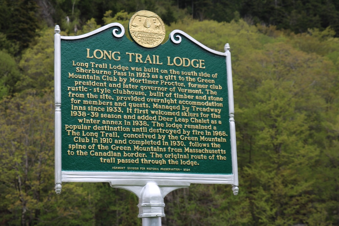
The Killington Section is hosting an unveiling ceremony for the new historical marker for the Long Trail Lodge on Saturday, September 27 at 4 p.m. Section President Herb Ogden, Historian David Wright, and Executive Director Mike DeBonis will all speak about the significance of this historical site. Free and open to the public.
The Green Mountain Club had many homes before today’s headquarters on Route 100 in Waterbury Center. We got our first home in 1924, a magical rustic structure enclosing giant boulders and other natural elements high on Sherburne Pass. The Green Mountain Club House was a gathering place for club members, hikers and visitors to the Killington area.
Renamed the Long Trail Lodge in 1925, it generated income as a guest house from 1924 to 1953. GMC leased it to Treadway Inns, an experienced hotelier, in 1933, then sold it (to Treadway) in 1953 to help pay down debt and start a trust fund, the seed for today’s endowment. It continued operations until it burned down in 1968, and some ruins are still visible, though screened from the highway by dense woods.
GMC’s Killington Section has been working to preserve the history and remains of the unique building. They reached a milestone this spring: A Vermont State roadside historical marker is ready for installation on Route 4 near the site.
Lodge History
The Club House was a generous donation by Mortimer Proctor, an early club supporter who became GMC’s President and later Vermont’s Governor. With vision and location in mind he hired Paul Thayer, an architect specializing in rustic style. Use of the surrounding landscape was the most notable characteristic of the lodge.
“The huge boulders deposited on its site in pre-historic time by some glacier or fallen from the cliff opposite…are a unique feature, being enclosed in the house in several places, forming parts of the wall, with ferns moss, and lichens growing on them as vigorously as outside,” the April 1924 Long Trail Newscommented.
Perhaps its most remarkable inclusion of the outdoors was the Long Trail itself, which ran right through the lodge, marked by indoor white blazes. According to historian David Wright, whose uncle was lodge manager for many years, “It came in through the south on the second level of the building, out the door, down through the porch, and out the main entrance of the building.”
The Long Trail and Appalachian Trail continued through the ruins of the lodge until 1999, when 4.2 miles of the LT/AT were relocated about a mile west to accommodate ski area expansion. The original route is now an official blue-blazed side trail, the Sherburne Pass Trail, though it bypasses the ruins.
The interior décor of twisted roots, bark on logs, and stuffed animals fully immersed the visitor in the spirit of the outdoors. It was intended as a home base for hikers, since Killington, Pico, and Carmel Mountains and Deer Leap provided numerous hiking opportunities. Like trailside hostels today, it offered comfortable beds, hot meals, and a chance to clean up and rest for end-to-end Long Trail hikers.
The Club House opened in 1924, shortly after the Long Trail News warned, “Too much should not be expected of the results of the first season, which will be experimental.”
At first, only club members and their recommended guests were served, but service quickly expanded to the public. It hosted the Green Mountain Club annual meeting every year until its demise. The facility was significantly enlarged in its first few years, with administrative and facilities outbuildings and cabins.
Deer’s Leap Annex was built across the road in 1939 for winter use. That building is now the Inn at Long Trail, still popular with Long Trail hikers.
Preserving Long Trail History
The Killington Section has been interested in preserving and restoring the lodge site for almost ten years. Installation of the new roadside historic marker is a major step in their plan to commemorate the GMC’s first home. “It means more people will learn about GMC’s first headquarters and the original location of the Long Trail,” says Killington Section President Herb Ogden, who visited the lodge as a teen,
The Long Trail Lodge roadside historical marker is the third one commemorating the impact of hiking in Vermont. The Long Trail historical marker, created in 1949, is now at the Long Trail parking lot at Route 2 in Bolton, and is visible from Interstate 89.
In 2022 the Burlington Section completed an application, and a Green Mountain Club historical marker was subsequently installed at the former site of the Van Ness Hotel, where Long Trail visionary James P. Taylor first met with 11 contemporaries to found the club in 1910. It is on the corner of Pine and Saint Paul Streets in Burlington.
Hike It!
To see the new marker, stop at the roomy parking lot at the Sherburne Pass Trailhead, south of Route 4 and across from the Inn at Long Trail. The former site of the Lodge is just west of the parking lot.
To explore the surrounding area, hike the Deer Leap Trail on the north side of the pass, which leads to an impressive rock outcrop overlooking Sherburne Pass. From the small lower parking lot at the Inn at Long Trail, enter the woods and wind uphill for 0.5 mile on the Sherburne Pass Trail. Reach the junction with the AT, and turn left for 220 feet. Then, hike the Deer Leap Trail 0.4 mile to the Deer Leap Overlook Spur. The 0.2-mile spur leads you to dramatic views of the Coolidge Range. Return the way you came, or make a loop: continue north on the Deer Leap Trail for 0.9 mile, summiting Deer Leap Mountain, and return eastward (trail north) on the AT (0.9 mile) and Sherburne Pass Trail (0.5 mile).
“One of my favorite early memories about Long Trail Lodge is climbing Deer Leap with my brothers, following the old Cave Trail through the rockfall below the cliffs,” David Wright recalls.
GMC wants to help you make the most of your summer with Summer Hiking Bingo! These challenges are designed to help you get outside, learn new hiking skills, and connect with the hiking community. Download and print your own or stop in at GMC’s Visitor Center to pick up your bingo board. More information and instructions for each bingo square are listed below.
Download Summer Hiking Bingo Here
Safety First
Review your safety plan before a hike: Before every outdoor excursion, review how you are going to stay safe and what could go wrong. Consider: how long is the hike, and how long do you think it will take your group? What is the weather forecast, and what time does it get dark? what time will you turn around to ensure you get back before dark? Who — and how —will you call in case of emergency? What safety gear are you taking with you? Review the HikeSafe pledge and Ready for Rescue.
Use a map and compass to check your direction: Cell phones and GPSs are incredible tools, but not infallible. Using a map and compass is an excellent skill. You can buy a Long Trail Map from GMC, and review how it works here.
Pack the Ten Essentials for a Hike: Even for a short hike, you need to be prepared for the unexpected. The Ten Essentials can go a long way to keeping you and your hiking buddies safe. The actual items you bring are open to a little interpretation. What do you already have in your house that would fit each of these categories? Navigation (map and compass); hydration; nutrition; sun protection; insulation; illumination; first-aid supplies; fire starter; emergency shelter; tools and repair kit. Read more here.
Eat a good snack on a hike: Food is fuel…and also delicious! You need good snacks on any hike (See Essential #3 above, nutrition). Find a beautiful or comfortable spot along the way to take a break and refeul your body. Good hike snacks include sandwiches, granola bars, dried fruit, pretzels, trail mix, and so much more.
Find a blue trail blaze: Blazes are 2″ by 6″ rectangles that help mark the trail. The Long Trail uses white blazes, while its side trails use blue. Blazes are painted on trees or rocks at regular intervals.
Leave No Trace
Caretakers are sure to walk along rocks to protect alpine flora on Mt. Mansfield.Do the “rock walk”: The rock walk is a fun reminder to stay on the designated trail, especially in the fragile alpine zones on top of Camel’s Hump, Mount Mansfield, and Mt. Abraham. Stepping only on bare rock, and not on plants, grasses, or lichen, means you are protecting the fragile and endangered plants that grow there. If you leave the trail to take a break or eat a snack, find a place to sit and set your pack that’s rocks-only. Dogs should do the rock walk, too!
Pack out trash: You know you should remove your own wrappers, orange peels, and tissues, but take it up a step by packing out any litter you see on the trails! That includes organic litter like orange peels or sunflower seeds. See who in your hiking group can find the most trash on the trail. Pack a ziploc bag and consider gloves to avoid contamination.
Find the white string: GMC caretakers and volunteers tie up white string to mark the trail in open environments, like the bald summit of Camel’s Hump, where the forest doesn’t provide a natural trail border. Staying within the stringed zone helps follow the principle Travel and Camp on Durable Surfaces and concentrates impact to one designated trail. It also protects the alpine vegetation.
Hike directly through a mud puddle: Did you pack your extra socks? Vermont trails are known for being pretty muddy, thanks to our soil composition, steep, old trails, and consistent rain. You can protect the trails by hiking directly thought the mud, not around it. Hiking around the mud widens the trail, tramples vegetation, and makes the mud puddle worse! Consider wearing waterproof shoes and gaiters, and use trekking poles or a walking stick to gauge how deep the mud is before you start. If it’s too deep to walk through, consider turning around and finding another place to hike. More about Mud Season, though mud season conditions can be present any time.
Exploring
Barnes Camp Boardwalk. Photo courtesy: Amy Potter
Vermont has hundreds of trails to offer! Here are some ideas to get you started.
Your favorite hike: You choose this one! Maybe it’s the one closest to your house or one you have special memories doing. Bonus points if you bring a friend who’s never been there.
A hike you’ve never done: Is this the year you make it to the summit of Camel’s Hump? Or, if you’ve hiked Burrows Trail a million times, try the Long Trail South for a challenging way to the summit. GMC has hundreds of day hike recommendations, so start browsing and find one that looks good to you! You can also use TrailFinder.
Hike, walk, or bike on an accessible trail: Outdoor recreation is for everybody! Explore some accessible ways to get outside, like the Thundering Falls boardwalk, Island Line Trail or Lamoille Valley Rail Trail, and more.
Hike to a river or swim spot: Always check water levels and only swim when it is safe. Consider the River Trail at Green Mountain Audubon Center; spots around Honey Hollow in Duxbury, or Bingham Falls via the Mill trail in Stowe.
Go camping: Spend the night outside — and yes, your backyard counts! Backyard camping is a great way to test out your gear, practice setting up a tent, and seeing how younger kids do with a new sleep routine. When you’re ready to level it up, try a drive-in state park campground or get a taste of the Long Trail experience with a night in an LT lean-to or shelter.
Hike to a firetower or observation deck: For the best views around! Here are several currently open fire towers:
Stratton Mountain
Ludlow Mountain (Okemo)
Mount Elmore
Belvidere Mountain
Mount Ascutney, Windsor
Gile Mountain, Norwich
Spruce Mountain, Plainfield
Burke Mountain and Bald Mountain in the Northeast Kingdom
Observation platform on Bolton Mountain
Observation platform on Mount Ellen
Ethan Allen Tower in Ethan Allen Park, Burlington
Visit a state park or town forest: We love the Long Trail and its 88 side trails, but there are so may places to explore in Vermont. Many town have amazing town forest trails, like Preston Pond in Bolton or Hinesburg Town Forest. For state parks outside the LT System, try Little River State Park in Waterbury, Mt. Philo in Charlotte, or Emerald Lake State Park in Rutland.
Hiking Community
Say hi to a GMC caretaker: Caretakers are professional staff of the Green Mountain Club. They are stationed at busy summits and ponds and their job is to protect the fragile environments around them. You’ll find them stewarding the alpine zones on Camel’s Hump, Mount Mansfield, and Mt. Abraham; roving through the Killington area, and at Sterling Pond, Little Rock Pond, and Stratton Pond. Caretakers can answer questions about the trails, the flora and fauna around you, and Vermont’s natural history. Say hello and ask them their favorite part of their job!
Meet a thru-hiker: Thru-hikers, also called End-to-Enders, are people who hike the entire Long Trail, or any long-distance hiking trail. About 300 people hike the Long Trail each year. Can you cross paths with one while you are out hiking on the Long Trail? They might be identified by a huge backpack, muddy shoes, and a tired yet accomplished look. Learn more about hiking the Long Trail End to End.
Carpool with friends to a hike: Parking is limited at almost all trailheads, and parking lots fill up, especially on sunny summer days. You can follow good stewardship principles and connect with fellow hiking buddies by arranging a carpool to a hike! Please make sure to always park in designated spots only, and not on the side of a road. If parking lots are full, plan an alternate hike nearby. This is especially important to respect the neighbors who live on roads to popular trailheads, like Camel’s Hump Road in Huntington. It’s also critical to ensure emergency vehicles have room to access a trailhead if something goes wrong.
Share your hiking pics with GMC! Did you snap some evidence of your great hike? We’d love to see your photos! Send your photos to us via email at or tag us on Instagram or Facebook, @greenmountainclub. Use the Hashtag #SummerHikingBingo! We will repost our favorite photos.
Visit GMC’s Rothberg-Birdwhistell Visitor Center in Waterbury Center: Stop in to learn more about what the Green Mountain Club does and how you can get outside. We offer weekly guided hikes on the Short Trail, an easy interpretive trail on our campus, and Hiking 101 workshops. Open Monday – Saturday, 10 a.m. – 4 p.m. Map it.
The World Around You
Spot a red eft (newt): These little guys are frequently spotted on trail, thanks to their bright orange color. “Eft” refers to the juvenile stage of an eastern newt, which turns green, brown, and yellow as it matures. Red efts live on land for two to three years before migrating to a pond as they reach adult stage.
Bigelow’s Sedge. Photo by: Angela HilsmanIdentify an alpine plant like Bigelow’s Sedge: Vermont is very lucky to have three alpine zones, where biologically diverse and rare plant species grow. These ecological zones are characterized by harsh winds and colder temperatures. The plants that grow here are vulnerable to impacts from human and pet footsteps — that’s why doing the rock walk and staying on trail is so important. Ask a caretaker to point out some alpine plants to you. Bigelow’s Sedge is a common one. It looks a lot like ordinary grass at first glance, but the blades have sharp edges. More about Vermont’s Alpine Zones and Alpine Plant Identification.
Write a hiking haiku: Art can help us connect to the nature around us. You can draw, paint, write a story, or write a poem about your hike. A haiku is a short poem, often nature related. It has three lines and the syllables in each line follow the pattern 5-7-5. Explore more poems from the trai (page 10)l.
FOR IMMEDIATE RELEASE: May 22, 2025
CONTACT: Chloe Miller, Communications Manager, , 802-241-8324
Make the Most of Hiking Season with a Visit to the Green Mountain Club Visitor Center
Waterbury Center, Vermont – Though the weather may not feel like it, this Friday of Memorial Day Weekend officially kicks off Vermont’s hiking season. The Green Mountain Club, which manages and maintains 500 miles of trails in the state, including the Long Trail, wants to help hikers get outside and enjoy our wonderful natural spaces this season.
This year, the club has opened the new Rothberg-Birdwhistell Hiker Visitor Center on Route 100 in Waterbury Center to help visitors plan their hikes. Information Specialists can offer advice regarding current trail conditions, recommendations based on needs, and insight into Long Trail history and our natural surroundings.
“The Visitor Center is the perfect place to orient users to the Green Mountains and plan your perfect hike, whether it be a quick nature walk, a challenging summit, or an overnight camping trip on the Long Trail System,” said Emily Mosher, Visitor Services Manager. “Talk to one of our specialists about what you are looking for, peruse trip-planning resources like maps and guidebooks from our Hiker Center, or join an informal Learn to Hike program.”
The Visitor Center will be open seven days a week from 10 a.m. to 4 p.m. Programming, including guided hikes on the “Short Trail” and backpacking workshops, will be offered on a regular basis.
This weekend will start out cold and rainy, with snow possible at high elevations, so those hitting the trails should be prepared with plenty of layers, supplies, and a commitment to turn back if weather takes a turn for the worse. Hiker safety is GMC’s top priority, and hikers can refresh their skills at a recorded or upcoming GMC workshop or take advantage of hiking guides on our website and social media.
Out on the trails, hikers can expect to see GMC trail crews, caretakers, and volunteers working and helping visitors statewide. Crews will begin flood recovery work in southern Vermont and continue employing sustainable trail building strategies to further protect recreational assets from extreme weather. Caretakers and volunteers are stationed at busy summits and ponds to help visitors make the most of their hikes and do their part to protect the fragile environments.
Connect with the club for critical hiking information and inspiration all season long. Our trained professionals are available via email (), phone (802-244-7037), and social media message (Instagram and Facebook). The Long Trail Hiking — GMC Community Facebook group is a great way to connect with fellow hikers.
###
About the Green Mountain Club: The Green Mountain Club was founded in 1910 with one goal: to build a long-distance hiking trail that spans the length of Vermont’s mountains. The Long Trail, the oldest long-distance hiking trail in the United States, was completed in 1930. Today, Green Mountain Club staff and volunteers care for roughly 500 miles of trail in Vermont, and take a sustainable approach to trail building and maintenance in the face of climate change impacts and increased year-round use of the trails. We support the hiking community with education and access to enjoy Vermont’s beloved trails.
FOR IMMEDIATE RELEASE: April 10, 2025CONTACT: Chloe Miller, Communications Manager at Green Mountain Club, , 907-632-7405
The 29th Edition of the Long Trail Guide reflects all trail changes and updates since 2017.
All-new Long Trail Guide is released to help hikers make the most of Vermont’s trails
The Green Mountain Club’s comprehensive guidebook is your companion for enjoying nearly 500 miles of hiking trails
Waterbury Center, VT — The 29th edition of the Long Trail Guide, the most comprehensive and up-to-date reference for hiking in Vermont, is now available for purchase from the Green Mountain Club. With new, easier-to-read maps and information charts, updated hike planning resources and stewardship guidelines, and reliable, detailed trail descriptions, the guide is ready to help you plan your summer adventures!
The guidebook, first published in 1917, was last released in 2017. The 2025 edition reflects major shifts in the outdoor recreation world and a boom of backcountry construction, resulting in numerous new and/or improved shelters and campsites.
“In an age where hikers have numerous digital resources available at their fingertips, the newly printed edition of the Long Trail Guide provides an easy-to-use, one stop shop for planning a hike on the Long Trail – whether it’s a quick jaunt in the woods or an entire end-to-end trek,” said Chloe Miller, editor of the 29th edition. “Hikers can also be assured that when purchasing a Long Trail Guide, they are supporting the work of the Green Mountain Club to maintain and protect our trails and public lands in Vermont.”
The 272-mile Long Trail extends along the spine of the Green Mountains from the Massachusetts border to Canada, summiting all of Vermont’s 4,000-foot peaks and offering countless memorable excursions for hikers of all ages and backgrounds. It was built between 1910 and 1930, and is the oldest long-distance hiking trail in the United States.
The Long Trail Guide is available for purchase at the Green Mountain Club’s visitor center in Waterbury Center, from local outdoor retailers, and online at store.greenmountainclub.org. It retails for $19.95 for paperback, $9.95 for an eBook. Wholesalers receive 40% off the listing price. Bookstores, outdoor gear stores, and other wholesalers interested in carrying the book can inquire at .
Current GMC members receive 20% off their purchase. For more information: store.greenmountainclub.org/long-trail-guide
Join us for a Guidebook Release and Hike Planning Event:
When: May 10, 2025, from 10am-12pm
Where: Green Mountain Club Rothberg-Birdwhistell Visitor Center
4711 Waterbury-Stowe Road (Route 100 between Waterbury and Stowe)
Waterbury Center, VT 05677
The guidebook editor will present useful features of the book and be available for question and answer and to purchase books. End-to-Enders (hikers who have completed the entire Long Trail) will be available for small-group hike planning workshops. Get inspired for hiking season! Register here.
###
About the Green Mountain Club: The Green Mountain Club was founded in 1910 with one goal: to build a long-distance hiking trail that spans the length of Vermont’s mountains. The Long Trail, the oldest long-distance hiking trail in the United States, was completed in 1930. Today, Green Mountain Club staff and volunteers care for roughly 500 miles of trail in Vermont, and take a sustainable approach to trail building and maintenance in the face of climate change impacts and increased year-round use of the trails. We support the hiking community with education and access to enjoy Vermont’s beloved trails.