Category: From the Field

  • Field Season on Film

    Field Season on Film

    Field season on film

    This article was written by assistant trail crew lead Jivana Esposito and appeared first in the Fall 2025 Long Trail News.

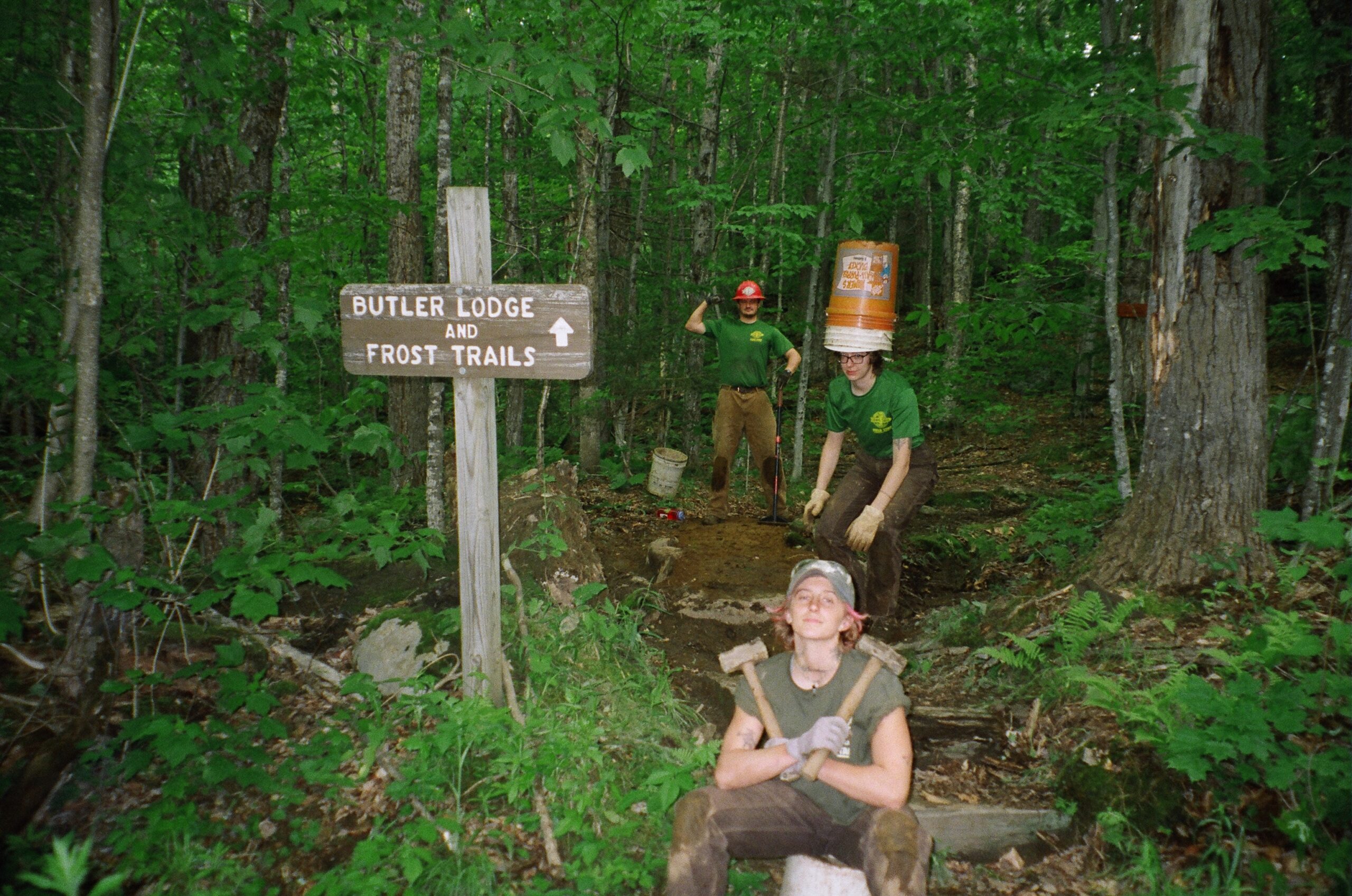
    As I dive deeper into the trail world, I find myself extremely inspired by archival pictures of trail crews in the early 20th century, when film photography was just evolving. Photos of crews cutting trail bench into sheer hillsides, using historic power carriers and pneumatic jackhammers, and creating camp communities, which inspired how we live in the field now.

    Trail work is not a very well-known profession. Many people have a very limited understanding of what our job entails or do not take it very seriously. But what most fail to realize is that trail work is one of the oldest trades in history. That’s why documentation is so important in this field of work.

    Long before there was standardized and recreational trail building, indigenous people built trail networks to establish their communities and for ceremonial purposes. The first recreational trails aimed at tourists developed in the 1850s in California and the Northeast. Being a part of the evolution of trail design means being part of a rich and long history of good craftsmanship that can endure generations. It feels important to document my trail crew’s experience to be able to show our families, friends, and others that we did historic work while building community and strengthening our will.

    But the documentation is also an effort to show trail work as a legitimate profession that requires physically demanding labor in rustic, often-isolating settings, and in inescapable weather conditions. We are a part of something special that has gone on long before us and will continue long after us. I think capturing the season on film is just a small way we can hold onto the memories we’ve created together.

    Field season on film
    Trail crew members use rockbars, pick mattocks, and other hand tools while working on a project near the Long Trail’s southern terminus.

    Field season on film
    Trail crew member Rio Hammond rests against a large boulder near one of the crew’s project sites on the southern Long Trail.

    Field season on film
    Font to back: GMC professional trail crew leads Jivana Esposito, Molly Belvo, and Owen Maille pose during a pre-season project, where they honed some of their trail skills before meeting their crews.

    “Early in the season when we experienced days of torrential downpour, we named our camp Sun Dome, based off a short dystopian story where people living on Mars experience rain all day, every day, and have to walk thousands and thousands of miles to reach a “Sun Dome” to experience sunlight.”

    Trail crew member Rio Hammond holds up slices of watermelon during a mid-day break, delivered to the crew by a GMC section volunteer.

    “Trail crew member Lily Nylund naps in a borrow pit at our project site. Borrow pits are a trail construction technique where inorganic mineral soil is sourced from the surrounding area to use as fill for the trail, providing better structural support than organic soil.”

    “Our crew takes turns cooking for each other, with designated days to cook or clean dishes. Our kitchen experience always feels like a collaborative effort and we make sure we meet everyone’s dietary needs and restrictions.”

    Trail crew lead Owen Maille puts finishing touches on the crew’s large relocation project in southern Vermont. “He was the visionary behind this project and taught our crew a lot of tips and tricks on quality trail building.”

    “We are really proud of the work we’ve done. Within one big project, we all had our individual projects and honed our trail building skills over the course of many long, hard days.”

    Jivana Esposito was the assistant trail crew lead for GMC’s southern Long Trail Patrol crew during the 2025 field season. She previously completed the AmeriCorps Backcountry Trails Program in California and was a wildland firefighter in Oregon.

    The crew spent 10 weeks on the Long Trail/Appalachian Trail south of Risky Ranch Road, installing trail hardening structures and reroutes to alleviate the perpetual muddiness of the trail there.

  • Restoring Taft Lodge: A Labor of Love for Historical Preservation

    Historic Taft Lodge, built in 1020. This article appears in the 2025 Spring Long Trail News and was written by GMC Project Coordinator Justin Towers. One of the larger field projects this summer will be structural repairs to Taft Lodge, the oldest, largest, and second-highest shelter on the Long Trail. After a rebuild in 1996 and successful log replacements in 2016, the 105-year-old shelter once again needs attention. Notoriously snowy winters have taken their toll, with snow piled against the shelter encouraging rot in the lowest logs that had not appeared before the 2016 restoration. So we will again restore the historic cabin’s appearance, function, and structural integrity, while adhering to historic preservation standards. Serving on the Long Trail Patrol crew that replaced rotten sill logs in 2016 was the highlight of my six years on the seasonal staff. Now, as a project coordinator, I am pleased to plan and oversee the project.

    105 Years of History

    Taft Lodge was built in 1920 and is the oldest structure on the Long Trail. Photo from GMC’s archives.
    Taft Lodge sits at 3,650 feet, 0.8 trail miles from the summit of Mount Mansfield, at 4,395 feet the highest point in Vermont. Judge Clarence Cowles, a charter member of the Green Mountain Club and builder of the Long Trail between Camel’s Hump and Mount Mansfield, spearheaded the effort to build the lodge in 1920. Cowles hired local lumbermen and builders Willis Barnes and Clyde Brink to construct the shelter in the summer of 1920. Its namesake, however, was Judge Elihu Taft, a colleague of Cowles who donated the construction costs. Taft’s stated capacity is 32 campers, but a glance inside the truly cavernous lodge makes this figure seem conservative. It is a historical icon of Mount Mansfield and the Long Trail.

    Beginning the Restoration Process

    Justin Towers, pictured, worked on the 2016 Taft Lodge restoration and will lead the 2025 project.
    Replacing the lower logs of any large log cabin is daunting enough. Doing so most of the way up the tallest mountain in Vermont is another order of challenge. In 1920 horses hauled logs up the mountain, a testament to the determination needed for major tasks before modern machinery. Today however, using horses would be impossible: the route they took no longer exists, and improving the Long Trail for horses is not in line with modern environmental standards and management goals for the trail. So, we’ll do as we did in 2016, and use a helicopter. Five logs of varying lengths from 8 ½ to 13 inches in diameter will be required. Some will replace entire logs. Others will replace rotten sections, “scarfed,” or fitted, into the rest of an existing log. We expect to cut more than one log from a single tree. In the past, we’ve replaced Taft Lodge logs with spruce trees harvested from Will Monroe’s old tree farm at the end of Camel’s Hump Road in Duxbury. Monroe was a contemporary and friend of Cowles who was responsible for extending Cowles’s original trail from Camel’s Hump southward to Middlebury Gap. So it seems fitting to source logs from his farm, now part of Mount Mansfield State Forest. With permission from the Vermont Department of Forests, Parks and Recreation, we’ll do it again. After felling the trees, we’ll cut each just a little longer than we need, and debark them before the airlift. This may seem less impressive to people nowadays than transport by horses. However, I believe Cowles, Barnes, and Brink would think otherwise.

    Finishing the Job

    In 2026, after the logs have had a chance to dry a bit, we’ll return to finish the job. Stay tuned for a full report, but in broad strokes, we will use six-by-six-inch timbers and heavy duty screw jacks to support the wall above each log we will replace. We’ll cut the rotten log free, chopping it out until there is room for a fresh one, with the wall suspended in the air. Then, we’ll prepare the new logs. After a year’s seasoning they will be lighter and easier to move. Sills must be milled or hewed flat on one side and free of protruding knots or imperfections on the other. Each log for the second course will get similar treatment on top, while the bottom will be “Swedish scribed” to conform to any irregularities in the log below. Every log will require joinery on each end: saddle notches for full replacements, and scarf joints for partial replacements to fit into corresponding scarf joints on the sound existing logs in the same course. Now for the hard part: The newly prepared replacement logs must be slipped into place. Speaking from experience, this will require one part rigging, one part sweat, and one part Yankee ingenuity. Logs are irregular, both old and new, so each one will probably require an approach a different than the log before it.
    2016 Taft Restoration—crew member Daley whacks a replacement log.
    As expected with a large-scale project on a historic shelter, there is a significant cost associated. The Green Mountain Club is looking to raise $100,000 over the next two years to fund the necessary project design, materials, air lift, and skilled backcountry construction crew. I’m eager to be back at Taft over the next two summers, and I’m honored to have a role in preserving Mount Mansfield’s highest and largest backcountry shelter. I hope Cowles, Barnes, Brink, and Taft would be proud of the club’s continued commitment to keeping the cabin they worked so hard to build.
  • Trail Talk: Waterbars and Drainage

    This article appears in the 2024 Fall Long Trail News and was written jointly by GMC’s Communications Manager Chloe Miller and Education and Volunteer Coordinator Lorne Currier. When Keegan Tierney, GMC’s Director of Field Programs, interviewed for his job in 2017, he said “You’ll never see me build a waterbar.” A few years later, Keegan admits that the legacy (read: steep) trails of the Long Trail System need thousands of these stone or log drainage channels, and installing, repairing, and clearing them is essential to managing the Long Trail System. So, what’s a waterbar, how does it work, what happens when one fails, and why are waterbars imperfect but necessary structures on Vermont’s steep and rugged trails? If you read the previous installment of “Trail Talk,” exploring the purpose and design of common trail features, you know trail builders try to keep people on trails, and water off them. In Vermont, those goals go hand in hand. A waterbar is a simple channel cutting diagonally across a trail, diverting surface water that would otherwise run down the trail (removing surface soil as it goes), and instead dispersing it into the woods. Like brush-ins, effective waterbars must be well-designed, built, and maintained to do their job of handling water and holding up to hiker traffic.

    In a Perfect World

    Waterbars work well when built and maintained properly, but they fail easily. If we were to start over and build the nearly 500-mile Long Trail System today, we would follow sustainable grades and use modern trail building techniques to avoid the need for so many waterbars. But our century-old trails often take the steepest route up a mountain. That’s, coincidentally, the same route water wants to flow down. Years of deferred maintenance means a good chunk of these waterbars are clogged or otherwise failing. And we must continually invest in better drainage for today’s and tomorrow’s extreme rainstorms.

    Building and Repairing Waterbars

    waterbars graphic A waterbar has a few components: The rock or log bar itself; the catchment area above it, where water is intercepted; the ditch conveying water off the trail; the apron, or drainage area where water spreads across the forest floor; and the dirt berm above and below the bar. On the Long Trail, most waterbars are built with rock, which is more durable than wood.  An effective waterbar extends well beyond each side of a trail, at least three feet into the surrounding forest, so a) water will not find its way back on to the trail and b) hikers are not tempted to step around the large stones of the bar in the middle of the tread. The ideal waterbar is set at a 45-to-60-degree angle across the trail, with stones arranged in a shingled manner so the upper ones overlap the lower ones. Rocks must be set securely into the tread and reinforced with crushed stone and mineral soil to keep them in place. The berm above the bar separates rocks from water, so that the base around the rocks doesn’t erode away. Waterbars can fail for a few reasons:
    1. The waterbar is too narrow, insufficiently hardened, and annoying enough that hikers go around it instead of over. This compacts the soil at either end of the waterbar, and allows water to find its way back to the trail. It can be prevented by extending the waterbar beyond the edge of the treadway and hardening its ends to make walking over the waterbar the easiest route.
    2. A rock in the bar is either too small or improperly set and becomes loose, creating a weak point for water to sneak past and travel down trail. In this case the waterbar will probably need to be rebuilt.
    3. Organic debris (leaves, sticks, trail sediment) fills the ditch and catchment area to the point that water overtops the bar and continues down trail. This is prevented by regular and thorough maintenance.
    Unfortunately, the large storms we now see so often can sometimes overtop the best waterbar.

    Critical Routine Maintenance

    Every fall, and after heavy rain, waterbars fill with fallen leaves and trail sediment. Then water can overtop the drain and rush down the trail, removing the trail surface as it goes. Overflowing waterbars have compounding effects, because they increase the volume of water the next downhill waterbar must handle. A big storm can wash out an entire trail from just one or two poor drains at its top. Caretakers and volunteer trail adopters perform the critical maintenance of cleaning waterbars, using trail tools like hazel hoes, mattocks, or even their boots or hands to move all organic material and accumulated sediment to the downhill side of the trail. They clear the drain down to mineral soil — the dense, durable, light-brown material beneath the easily eroded topsoil. Maintainers must ensure a smooth gravitational path for water; any upgrade or flat spot will cause water to pool and the waterbar to fail. If there are gaps in the stones of the bar, maintainers block them by a berm of mineral soil. They may alert GMC headquarters if reconstruction is needed. As rainfall becomes more intense, waterbars become more important, and good training of volunteers is vital.

    Noticing Waterbars As a Hiker

    Now that you understand waterbars, watch for them on your next hike. If it’s raining, watch them in action – diverting water from the trail – or failing, with water overtopping them and continuing down the trail. You can also help us reduce future maintenance needs by stepping up and over a waterbar, not around.
  • Alpine ID: 15 Plants to Find above Treeline

    This post was first written on August 5, 2021 by Angie Hilsman and was updated with additional information on June 27, 2023 by Lily LaRegina.

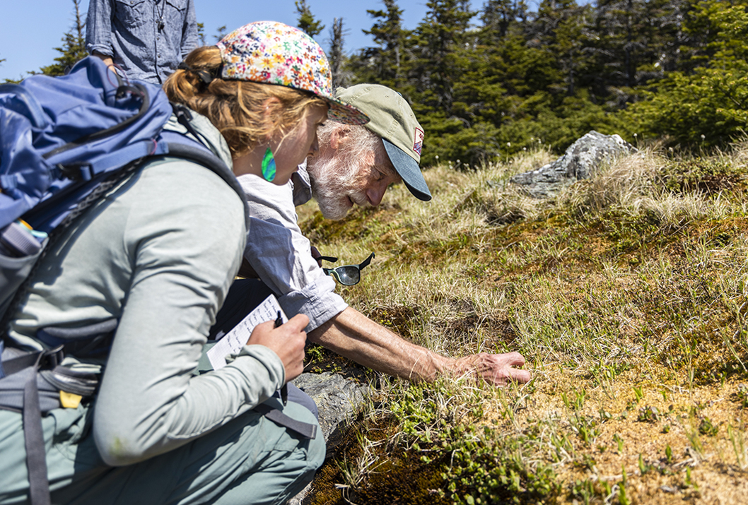
    Bob Popp, retired Vermont State Biologist, points out different alpine plants to caretakers during the 2023 alpine ecology training walk on Mt. Mansfield.
    Bob Popp, retired Vermont State Biologist, points out different alpine plants to caretakers during the 2023 alpine ecology training walk on Mt. Mansfield. Photo by Lily LaRegina

    State botanist Bob Popp kneels beside a flat rock, just in front of the Mt. Mansfield Visitor Center. He points out mountain cranberry and bluets to a dozen GMC staff — 11 of whom are recently hired seasonal caretakers.

    The mountain cranberry and bluets are alpine plants, rare and fragile species that grow above treeline. These plants can take a long time to grow in such an exposed environment, with wind, cold, and ultraviolet rays deterring growth and other vegetation. But they’re especially important; their roots will hold down soil and otherwise curb erosion at these altitudes.

    “There are only 13 square miles of alpine zone across New York, New Hampshire, Vermont, and Maine,” Bob explains to the caretakers. In Vermont, about 125 acres (0.2 square miles) of alpine zone remain; eight alpine species are classified as either endangered (4) or threatened (4) in Vermont, Bob says.

    The caretakers need to know this. Throughout the summer, they live and work along the Long Trail system. Caretakers’ workdays include maintaining campsites and trails, but a lot of their work will focus on protecting fauna and flora, like these alpine plants. They’ll do this with hiker education, or one-on-one conversations meant to involve hikers in trail stewardship.

    This can make a world of difference for alpine plants. Much of this vegetation is hardly noticeable, mimicking lawn grass and tucked around rocks. The plants are easily trampled by foot traffic or hindered when soil is compacted by hikers and pets. Caretakers will urge hikers to walk on the rocks to protect these precious plants.

    Bob and U.S. Fish & Wildlife Ranger Ken Sturm lead the staff across Mansfield’s ridgeline to learn more about alpine plants. While the orientation is a yearly part of caretaker training, it’s not insider knowledge. Here’s what caretakers learned about alpine plants. Brush up on your ID to become an informed hiker and effective trail steward.

    Azure Bluets

    Alpine bluets
    Azure bluets. Photo by: Angela Hilsman

    These small blue flowers are plentiful in the alpine. They’re not rare at all, says Bob. In fact, bluets can be found in every New England state; they grow in alpine zones and on any open ledges, meadows, or fields.

    Alpine Sandwort

    Alpine Sandwort
    Bob Popp points to a green plant called alpine sandwort. The brown plants are a moss species. Photo by: Angela Hilsman

    Alpine sandwort is what’s known as a disturbance colonizer. That means that this alpine plant grows where there is a lot of disturbance, such as foot traffic. You can usually find it tucked underneath rocks along the trail.

    You’ll find that identifying plants by their common names can be tricky. This is because such labels can vary by region. The alpine sandwort also goes by the names mountain sandplant and Greenland stitchwort. Scientific names — which include the genus and species — are more accurate because they are used universally. The scientific name for alpine sandwort is Minuartia groenlandica.

    Bearberry Willow (Endangered)

    Bearberry Willow
    Bearberry willow is an endangered species in Vermont. Photos by: Angela Hilsman

    Bearberry willow is an endangered species in Vermont, although it is more commonly found in Maine and Canada. This particular bearberry willow plant (pictured) is more than 100 years old, Bob says. “It appears in photos from the early 1900s.”

    Bigelow’s Sedge

    Bigelow's Sedge
    Hailey Lynch points out the Bigelow’s sedge, an alpine plant that looks a lot like lawn grass. Photo by: Angela Hilsman

    Bigelow’s sedge is pretty common around the alpine zone. These plants spread by underground stems to form meadows. It also looks a lot like grass. Due to the similarity, this sedge is often unappreciated by trail users; hikers are one if its biggest threats.

    Black Crowberry (Rare)

    Black crowberry grows on the alpine terrain of the ridgeline of Mt. Mansfield. Photo by Lily LaRegina

    Black crowberry gets its name from the dark berries it grows. While the fruits are edible — and enjoyed by dozens of bird species and black bears — they’re not super flavorful. This alpine plant is rare in Vermont, but is not on the threatened species list.

    Blueberries

    Bob Zaino, Vermont State Ecologist, points out flowering blueberries during an alpine plant ID walk with the 2023 caretakers on the ridgeline of Mt. Mansfield.
    Bob Zaino, Vermont State Ecologist, points out flowering blueberries during an alpine plant ID walk with the 2023 caretakers on the ridgeline of Mt. Mansfield. Photo by Lily LaRegina

    You may recognize some of your favorite summer fruits up in the alpine, but don’t go picking them all, says Bob. Try a bite, but leave the alpine blueberries, which will ripen by late summer, for all visitors.

    Conifers

    Bob Popp, retired Vermont State Biologist, uses a hand scope to examine a sprig of black spruce during the 2023 alpine ecology training walk on Mt. Mansfield. Photo by Lily LaRegina
    Bob Popp, retired Vermont State Biologist, uses a hand scope to examine a sprig of black spruce during the 2023 alpine ecology training walk on Mt. Mansfield. Photo by Lily LaRegina

    There are a few conifer species, or evergreens, that grow in the alpine zone. However, you’ll notice they don’t get as tall as they do below treeline. You may even notice that trees are stunted the higher up the mountain you climb. That’s because they too are fighting against wind exposure, and it takes a lot more energy to grow. Some trees you’ll find in the alpine include:

    You may first notice the balsam fir by its scent, but another telltale is the way its flat needles grow straight out of the branch instead of growing out in clusters (like pine needles do). If you were to hold the branch horizontally in front of you, you’d also notice that the branch is flat; needles grow only on the sides of the branch, not all around it.

    Spruce generally have sharp needles, but you’ll also notice that needles grow on every side of a black spruce branch (unlike on the balsam fir). Differentiating it from a red spruce can be tricky at these summits; under a hand lens, you may notice small, gland-tipped hairs that are indicative of the black spruce. The needles are also shorter and are a whitish-green color compared to the longer, more yellow-green needles of the red spruce, says Bob.

    Diapensia (Endangered)

    Diapensia
    Diapensia. Photos by: Angela Hilsman

    Diapensia is another endangered Vermont plant. It’s leathery leaves help it to prevent water loss, an adaptation to living at high altitudes. It also is a classic example of a “cushion” growth form, in which the plant grows in small, low clusters for protection from the wind and cold.

    Labrador Tea

    Labrador Tea
    Labrador tea. Photo by: Angela Hilsman

    While Labrador tea grows in the alpine zone, it also prefers bogs. Few plants can thrive in the acidic bogs, which means the Labrador tea has less competition for more space and other resources. If you flip its leaves, you’ll find hairs; this adaptation helps the Labrador plant lock in moisture.

    alpine bog on Mt. Mansfield.
    This bog is located in the alpine zone on Mt. Mansfield. Photo by: Angela Hilsman

    Fun fact: there are bogs located in the alpine zone, but do you know what makes a bog? The answer, says Bob, is that the only source of water feeding a bog is rain. There are no streams or underground springs to bring in nutrients. Nearby mosses release hydrogen ions into the water, which is why this bog is so acidic.

    Leatherleaf

    Leatherleaf
    Leatherleaf. Photo by: Angela Hilsman

    Leatherleaf most certainly gets its name from its leathery, narrow leaves. This shrub also thrives in bogs, and it can stabilize this wet habitat so that other bog-loving plants thrive as well.

    Mountain Cranberry

    Mountain Cranberry
    Mountain cranberry. Photo by: Angela Hilsman

    Mountain cranberry are categorized as cushion plants. They grow in cushion formation to lock in moisture and for protection against the elements. Their waxy leaves also help lock in moisture.

    Three-Leaved Goldthread

    Three-leaf Goldthread
    Three-leaved goldthread. Photo courtesy: Wild Adirondacks

    This delicate plant is known for its strong medicinal properties. Its rhizomes, or underground stems, are traditionally used for treating stomach cramps. The goldthread can be found all over New England in many different habitats.

    Three-Toothed Cinquefoil

    Three-toothed Cinquefoil
    Three-toothed cinquefoil. Photo by: Angela Hilsman

    The three-toothed cinquefoil gets its name from its distinctive leaf pattern. Its leaves are also evergreen, which means that when the snow starts to melt, these plants can jumpstart photosynthesis. Photosynthesis is the process in which plants turn sunlight into energy.


    Love the plant life? Talk to a GMC caretaker about the plants you see. You can also improve your plant id with apps like Go Botany and iNaturalist

    Bob Popp, retired Vermont State Biologist, points out different alpine plants to caretakers during the 2023 alpine ecology training walk on Mt. Mansfield.
    Bob Popp, retired Vermont State Biologist, points out different alpine plants to caretakers during the 2023 alpine ecology training walk on Mt. Mansfield. Photo by Lily LaRegina
    Alpine zone signage requests folks respect plants by walking on rocks, leashing dogs
    Entering the alpine zone on Mt. Mansfield. Photo by: Angela Hilsman
    Caretakers walk the ridgeline of Mt. Mansfield during the 2023 alpine ecology training walk, led by retired Vermont State Biologist, Bob Popp, and State Ecologist, Bob Zaino. The trees along the ridgeline grow shorter because they have been stunted by wind exposure and other harsh elements.
    Caretakers walk the ridgeline of Mt. Mansfield during the 2023 alpine ecology training walk, led by retired Vermont State Biologist, Bob Popp, and State Ecologist, Bob Zaino. The trees along the ridgeline grow shorter because they have been stunted by wind exposure and other harsh elements. Photo by Lily LaRegina
    Bob Zaino, Vermont State Ecologist, refers to the Appalachain Trail Club's "Field Guide to the New England Alpine Summits" during the 2023 alpine ecology training walk with caretakers on Mt. Mansfield.
    Bob Zaino, Vermont State Ecologist, refers to the Appalachain Trail Club’s “Field Guide to the New England Alpine Summits” during the 2023 alpine ecology training walk with caretakers on Mt. Mansfield. Photo by Lily LaRegina
    Hikers on Mt. Mansfield ridgeline.
    Notice the stringing along the trail? Caretakers set that up to encourage hikers to walk on rocks and to stay off alpine plants. Photo by: Angela Hilsman
    GMC 2021 seasonal caretakers on Mt. Mansfield
    GMC 2021 seasonal caretakers on Mt. Mansfield. Photo by: Angela Hilsman
    View from Mt. Mansfield ridgeline
    View from Mt. Mansfield ridgeline. Photo by: Angela Hilsman
  • Alpine ID: 15 Plants to Find above Treeline

    Alpine ID: 15 Plants to Find above Treeline

    This post was first written on August 5, 2021 by Angie Hilsman and was updated with additional information on June 27, 2023 by Lily LaRegina.

    Bob Popp, retired Vermont State Biologist, points out different alpine plants to caretakers during the 2023 alpine ecology training walk on Mt. Mansfield.
    Bob Popp, retired Vermont State Biologist, points out different alpine plants to caretakers during the 2023 alpine ecology training walk on Mt. Mansfield. Photo by Lily LaRegina

    State botanist Bob Popp kneels beside a flat rock, just in front of the Mt. Mansfield Visitor Center. He points out mountain cranberry and bluets to a dozen GMC staff — 11 of whom are recently hired seasonal caretakers.

    The mountain cranberry and bluets are alpine plants, rare and fragile species that grow above treeline. These plants can take a long time to grow in such an exposed environment, with wind, cold, and ultraviolet rays deterring growth and other vegetation. But they’re especially important; their roots will hold down soil and otherwise curb erosion at these altitudes.

    “There are only 13 square miles of alpine zone across New York, New Hampshire, Vermont, and Maine,” Bob explains to the caretakers. In Vermont, about 125 acres (0.2 square miles) of alpine zone remain; eight alpine species are classified as either endangered (4) or threatened (4) in Vermont, Bob says.

    The caretakers need to know this. Throughout the summer, they live and work along the Long Trail system. Caretakers’ workdays include maintaining campsites and trails, but a lot of their work will focus on protecting fauna and flora, like these alpine plants. They’ll do this with hiker education, or one-on-one conversations meant to involve hikers in trail stewardship.

    This can make a world of difference for alpine plants. Much of this vegetation is hardly noticeable, mimicking lawn grass and tucked around rocks. The plants are easily trampled by foot traffic or hindered when soil is compacted by hikers and pets. Caretakers will urge hikers to walk on the rocks to protect these precious plants.

    Bob and U.S. Fish & Wildlife Ranger Ken Sturm lead the staff across Mansfield’s ridgeline to learn more about alpine plants. While the orientation is a yearly part of caretaker training, it’s not insider knowledge. Here’s what caretakers learned about alpine plants. Brush up on your ID to become an informed hiker and effective trail steward.

    View this post on Instagram

    A post shared by Green Mountain Club (@greenmountainclub)

    Azure Bluets

    Alpine bluets
    Azure bluets. Photo by: Angela Hilsman

    These small blue flowers are plentiful in the alpine. They’re not rare at all, says Bob. In fact, bluets can be found in every New England state; they grow in alpine zones and on any open ledges, meadows, or fields.

    Alpine Sandwort

    Alpine Sandwort
    Bob Popp points to a green plant called alpine sandwort. The brown plants are a moss species. Photo by: Angela Hilsman

    Alpine sandwort is what’s known as a disturbance colonizer. That means that this alpine plant grows where there is a lot of disturbance, such as foot traffic. You can usually find it tucked underneath rocks along the trail.

    You’ll find that identifying plants by their common names can be tricky. This is because such labels can vary by region. The alpine sandwort also goes by the names mountain sandplant and Greenland stitchwort. Scientific names — which include the genus and species — are more accurate because they are used universally. The scientific name for alpine sandwort is Minuartia groenlandica.

    Bearberry Willow (Endangered)

    Bearberry Willow
    Bearberry willow is an endangered species in Vermont. Photos by: Angela Hilsman

    Bearberry willow is an endangered species in Vermont, although it is more commonly found in Maine and Canada. This particular bearberry willow plant (pictured) is more than 100 years old, Bob says. “It appears in photos from the early 1900s.”

    Bigelow’s Sedge

    Bigelow's Sedge
    Hailey Lynch points out the Bigelow’s sedge, an alpine plant that looks a lot like lawn grass. Photo by: Angela Hilsman

    Bigelow’s sedge is pretty common around the alpine zone. These plants spread by underground stems to form meadows. It also looks a lot like grass. Due to the similarity, this sedge is often unappreciated by trail users; hikers are one if its biggest threats.

    Black Crowberry (Rare)

    Black crowberry grows on the alpine terrain of the ridgeline of Mt. Mansfield. Photo by Lily LaRegina

    Black crowberry gets its name from the dark berries it grows. While the fruits are edible — and enjoyed by dozens of bird species and black bears — they’re not super flavorful. This alpine plant is rare in Vermont, but is not on the threatened species list.

    Blueberries

    Bob Zaino, Vermont State Ecologist, points out flowering blueberries during an alpine plant ID walk with the 2023 caretakers on the ridgeline of Mt. Mansfield.
    Bob Zaino, Vermont State Ecologist, points out flowering blueberries during an alpine plant ID walk with the 2023 caretakers on the ridgeline of Mt. Mansfield. Photo by Lily LaRegina

    You may recognize some of your favorite summer fruits up in the alpine, but don’t go picking them all, says Bob. Try a bite, but leave the alpine blueberries, which will ripen by late summer, for all visitors.

    Conifers

    Bob Popp, retired Vermont State Biologist, uses a hand scope to examine a sprig of black spruce during the 2023 alpine ecology training walk on Mt. Mansfield. Photo by Lily LaRegina
    Bob Popp, retired Vermont State Biologist, uses a hand scope to examine a sprig of black spruce during the 2023 alpine ecology training walk on Mt. Mansfield. Photo by Lily LaRegina

    There are a few conifer species, or evergreens, that grow in the alpine zone. However, you’ll notice they don’t get as tall as they do below treeline. You may even notice that trees are stunted the higher up the mountain you climb. That’s because they too are fighting against wind exposure, and it takes a lot more energy to grow. Some trees you’ll find in the alpine include:

    You may first notice the balsam fir by its scent, but another telltale is the way its flat needles grow straight out of the branch instead of growing out in clusters (like pine needles do). If you were to hold the branch horizontally in front of you, you’d also notice that the branch is flat; needles grow only on the sides of the branch, not all around it.

    Spruce generally have sharp needles, but you’ll also notice that needles grow on every side of a black spruce branch (unlike on the balsam fir). Differentiating it from a red spruce can be tricky at these summits; under a hand lens, you may notice small, gland-tipped hairs that are indicative of the black spruce. The needles are also shorter and are a whitish-green color compared to the longer, more yellow-green needles of the red spruce, says Bob.

    Diapensia (Endangered)

    Diapensia
    Diapensia. Photos by: Angela Hilsman

    Diapensia is another endangered Vermont plant. It’s leathery leaves help it to prevent water loss, an adaptation to living at high altitudes. It also is a classic example of a “cushion” growth form, in which the plant grows in small, low clusters for protection from the wind and cold.

    Labrador Tea

    Labrador Tea
    Labrador tea. Photo by: Angela Hilsman

    While Labrador tea grows in the alpine zone, it also prefers bogs. Few plants can thrive in the acidic bogs, which means the Labrador tea has less competition for more space and other resources. If you flip its leaves, you’ll find hairs; this adaptation helps the Labrador plant lock in moisture.

    alpine bog on Mt. Mansfield.
    This bog is located in the alpine zone on Mt. Mansfield. Photo by: Angela Hilsman

    Fun fact: there are bogs located in the alpine zone, but do you know what makes a bog? The answer, says Bob, is that the only source of water feeding a bog is rain. There are no streams or underground springs to bring in nutrients. Nearby mosses release hydrogen ions into the water, which is why this bog is so acidic.

    Leatherleaf

    Leatherleaf
    Leatherleaf. Photo by: Angela Hilsman

    Leatherleaf most certainly gets its name from its leathery, narrow leaves. This shrub also thrives in bogs, and it can stabilize this wet habitat so that other bog-loving plants thrive as well.

    Mountain Cranberry

    Mountain Cranberry
    Mountain cranberry. Photo by: Angela Hilsman

    Mountain cranberry are categorized as cushion plants. They grow in cushion formation to lock in moisture and for protection against the elements. Their waxy leaves also help lock in moisture.

    Three-Leaved Goldthread

    Three-leaf Goldthread
    Three-leaved goldthread. Photo courtesy: Wild Adirondacks

    This delicate plant is known for its strong medicinal properties. Its rhizomes, or underground stems, are traditionally used for treating stomach cramps. The goldthread can be found all over New England in many different habitats.

    Three-Toothed Cinquefoil

    Three-toothed Cinquefoil
    Three-toothed cinquefoil. Photo by: Angela Hilsman

    The three-toothed cinquefoil gets its name from its distinctive leaf pattern. Its leaves are also evergreen, which means that when the snow starts to melt, these plants can jumpstart photosynthesis. Photosynthesis is the process in which plants turn sunlight into energy.


    Love the plant life? Talk to a GMC caretaker about the plants you see. You can also improve your plant id with apps like Go Botany and iNaturalist

    Bob Popp, retired Vermont State Biologist, points out different alpine plants to caretakers during the 2023 alpine ecology training walk on Mt. Mansfield.
    Bob Popp, retired Vermont State Biologist, points out different alpine plants to caretakers during the 2023 alpine ecology training walk on Mt. Mansfield. Photo by Lily LaRegina
    Alpine zone signage requests folks respect plants by walking on rocks, leashing dogs
    Entering the alpine zone on Mt. Mansfield. Photo by: Angela Hilsman
    Caretakers walk the ridgeline of Mt. Mansfield during the 2023 alpine ecology training walk, led by retired Vermont State Biologist, Bob Popp, and State Ecologist, Bob Zaino. The trees along the ridgeline grow shorter because they have been stunted by wind exposure and other harsh elements.
    Caretakers walk the ridgeline of Mt. Mansfield during the 2023 alpine ecology training walk, led by retired Vermont State Biologist, Bob Popp, and State Ecologist, Bob Zaino. The trees along the ridgeline grow shorter because they have been stunted by wind exposure and other harsh elements. Photo by Lily LaRegina
    Bob Zaino, Vermont State Ecologist, refers to the Appalachain Trail Club's "Field Guide to the New England Alpine Summits" during the 2023 alpine ecology training walk with caretakers on Mt. Mansfield.
    Bob Zaino, Vermont State Ecologist, refers to the Appalachain Trail Club’s “Field Guide to the New England Alpine Summits” during the 2023 alpine ecology training walk with caretakers on Mt. Mansfield. Photo by Lily LaRegina
    Hikers on Mt. Mansfield ridgeline.
    Notice the stringing along the trail? Caretakers set that up to encourage hikers to walk on rocks and to stay off alpine plants. Photo by: Angela Hilsman
    GMC 2021 seasonal caretakers on Mt. Mansfield
    GMC 2021 seasonal caretakers on Mt. Mansfield. Photo by: Angela Hilsman
    View from Mt. Mansfield ridgeline
    View from Mt. Mansfield ridgeline. Photo by: Angela Hilsman
  • How Trail Crews Fight Erosion

    Stone stairs at Sterling Pond help curb erosion on a fall line trail.
    Stone stairs on the Sterling Pond Trail help curb erosion. Photo courtesy: Angela Hilsman
    “Erosion is what causes all the problems on trail,” says Kevin Hart, GMC field supervisor of the Long Trail Patrol. “The main goal of trail crew is to stop erosion.” Kevin’s not talking about bear encounters or overflowing privies or litter in firepits when he says “problems.” He’s talking about trail degradation. You know what that looks like: those deep gullies in the middle of the trail; widened, vegetation-less areas; and exposed roots and rocks. So what is erosion and how does it cause trail degradation? Kevin explained to his trail crew before the hiking season began with a quick demo. Follow along, as Kevin does a second demonstration to explain why erosion is a problem, why it’ll never go away, and how trail crews like the Long Trail Patrol upkeep and create sustainable trails.

    What is erosion?

    Erosion is the process of earthen materials (like soil and rock) being worn down and transported by natural forces such as wind, flowing water, or glacial ice. National Geographic has a great explainer here. “Erosion is always happening, but it’s happening so slowly that you can’t usually see it,” says Kevin.The exceptions are big storms and flash flooding, where a lot of water moves materials very quickly. As climate change increases the frequency and intensity of rain events, these will further expedite trail erosion. Looking into the next decade, climate change related storms are one of GMC’s biggest challenges.

    If erosion is normal, why is it a problem?

    Erosion can be particularly problematic around Vermont’s trail system because the Long Trail was built over a hundred years ago, long before sustainability was a consideration, says Kevin. “So many of our trails follow what’s called the fall line.” A fall line is the path that follows a mountain most directly downhill, he explains. And because it offers the least resistance, it’s also where water gathers. (Compare it to a switchback, or a trail that zigzags up the steep terrain instead of mimicking the slope.) “As the water channels along the fall line, it picks up speed, has more power, and causes more erosion,” explains Kevin. This exacerbates the wear-and-tear along Vermont’s Long Trail. Comparatively, when there is a switchback trail, the runoff water moves downhill in “sheets,” says Kevin. (Imagine flat and evenly dispersed.) Some of the water is absorbed into the relatively horizontal switchback trails, compared to funneling down the more vertical fall-line trails.

    How do trail crews stop this?

    Stone stairs and waterbars prevent erosion.
    Stone stairs and waterbars prevent soil erosion.
    “You can’t reverse erosion, but you can stop erosion on existing trails or build sustainable trails,” says Kevin. To stop water erosion, trail crews mainly use two methods: waterbars and stone stairs.

    #1. The Waterbar

    You’ve stepped over waterbars on trail: they’re the narrow drainage channels — usually fortified with rocks — that divert water off trail and into the forest. “[The water] ends up dispersing into the woods. It’s no longer stuck in a gullied path,” says Kevin. Trail crews and volunteers regularly clear waterbars of leaves and other debris to keep them working efficiently. Waterbars prevent water from following the fall line and lead the runoff to be absorbed by surrounding vegetation.

    #2. The Stone Stairs

    Rock stairs, which take the form of checksteps and stone staircases, create a durable surface. “Stone stairs are more resistant to erosion than dirt,” explains Kevin. “Water flows over the rock and essentially protects the trail surface. It keeps the gully [that exists] from deepening.” Stone steps have another benefit, says Kevin. Because they confine traffic to a durable surface, they prevent plants from getting trampled and encourage vegetation to return around the trail. Roots help anchor the soil in place, slowing erosion. These types of structures exist all over the Long Trail System; spot them on Stratton Mountain, the Sunset Ridge Trail up Mansfield, and the Monroe Trail to Camel’s Hump, says Kevin.

    Why can’t we reroute the trail to a more sustainable location?

    “A reroute is ideal, but it’s not as practical as it could be,” says Kevin. Sometimes barriers, such as private land or a ledge, prevent crews from moving the trail, he explains. More commonly, there’s not enough resources to reroute a trail.

    How can trail users help curb erosion?

    The best thing you can do as a trail user is to stick to the trail. Hiking around steep staircases, tree roots, mud puddles, and other trail features widens the path and increases trail erosion. The problem with a widened trail is twofold:
    1. Hikers disturb and kill off vegetation. Plant roots help anchor the soil in place, and without them, the soil becomes loose and easily picked up by runoff.
    2. Increased foot traffic compacts the soil, removing air pockets that water would normally seep into. When the rain and snowmelt cannot seep into the ground, it continues along the surface, picking up sediments as it goes.
    You’ll notice some of these issues on popular trails, like the Burrows Trail to the Camel’s Hump summit (which is currently getting a revamp). This steep, challenging trail tempts hikers to create their own routes; in doing so, trail users have widened the trail in areas. In doing so, water now has multiple paths to travel downhill, instead of the intended, durable path that trail crews designed.
  • Citizen Science Projects on the Long Trail and Beyond

    Spring is an excellent time to explore the natural world around us and celebrate plants and animals emerging again. But did you know your casual observations can contribute to scientific research projects all over the world? Citizen science refers to the public’s collaboration and participation in professional science projects, especially in the natural world. The most successful projects include data collection or analysis that require minimal training, and can be replicated on a large scale with lots of citizen participants.  
    person gestures to plants on rocky summit
    State Botanist Bob Popp Observes Diapensia on Mt. Mansfield, by Angie Hilsman
    Check out the below citizen science observation projects, both global and local, and consider how your next outdoor adventure might contribute to scientific research!  Spring is also the time of mud season in Vermont, which means we avoid high-elevation trails in Vermont in favor of drier, more durable surfaces. Please keep mud season guidance in mind and start your citizen science journey in your own backyard!

    Global Citizen Science Projects 

    INaturalist inaturalist.org and iNaturalist app  This global observation database welcomes your sightings of mammals, birds, fish, insects, plants, fungi, anything living you can think of. The site connects you, the citizen scientist, to millions of naturalists and identifiers to help name and catalog your findings. There’s even a computer-based tool that will automatically identify your photo, though it’s not 100% accurate.   eBird eBird.org and eBird app 
    woodpecker
    Nigel Bates spotted this Pileated Woodpecker at GMC Headquarters in Waterbury Center.
    eBird is an effort from the Cornell Center for Ornithology that helps birders collaborate on sightings to help inform conservation and education. Birders create or use checklists and record when, where, and how they saw or heard birds, then share those observations with the world. It allows scientists to track bird’s migration patterns on a global scale, in real time. Rare species sightings require photographic documentation and are checked by a group of experts. If you’re ever at the GMC headquarters in Waterbury Center, you can join and contribute to the GMC Headquarters HotSpot!   EButterfly ebutterfly.org only 
    yellow butterfly
    Swallowtail butterfly by Michelle Tatum
    Sponsored by the Vermont Center for EcoStudies, this international data-driven project requires photos and another community member to confirm your butterfly identifications. It’s a much smaller community than eBird or iNaturalist, but the observations help achieve the same goals of tracking butterfly biodiversity and changes over time.  Community Snow Observations and Mountain Rain or Snow, via NASA Mountain Hub app; rainorsnow.org  There may be a few more weeks this spring to contribute observations of snow depth and precipitation. The Community Snow Observations uses the Mountain Hub app and asks citizen scientists to measure snowpack using an avalanche probe. Mountain Rain or Snow asks observers to record the type of precipitation that falls and at what temperature to help gather data about mountain weather patterns.  

    Localized Citizen Science Projects 

    You can get involved in citizen science right in the Green Mountains, alongside Green Mountain Club caretakers, volunteers, and partners.   Loonwatch from the Vermont Center for Ecostudies
    loon on stratton pond
    Loon on Stratton Pond by John Plummer
    On the third Saturday in July (July 17, 2022) Vermonters fan out across the state to document and track breeding loons. GMC’s caretakers at Little Rock Pond and Stratton Pond keep an eye out for the majestic birds throughout the field season, and you can sign up for the Adopt a Lake program to track loon activity in the summer.   Peregrine Falcon Monitoring and Management Project from Audubon Vermont
    Peregrine Falcon, chick, nest on ledge
    Peregrine falcon and nest. Photo by: Paul Cormier
    Starting in very early spring, peregrine falcons return to their cliffside nests to lay eggs and raise fledglings. The peregrine falcon was labeled endangered in the 80s and 90s, but conservation efforts have allowed the population to recover. However, their continued success depends on careful monitoring and protection of their nests. Falcons will abandon their nests if disturbed, so GMC joins other outdoor organizations in Vermont to close trails near nesting sites and educate the public about protecting this bird population. Contact Margaret Fowle to adopt a nesting site and start monitoring.  Northeast Alpine Flower Watch, via iNaturalist 
    GMC caretakers walk up Mansfield ridgeline, stay on rocks
    GMC caretakers continue their alpine ID training along the Mansfield ridgeline. Photo by: Angela Hilsman
    This initiative is a partnership with GMC, the Adirondack Mountain Club, Appalachian Mountain Club, and Baxter State Park in Maine. It invites citizen scientists to photograph and record the phenology (timing of biological events such as flowers blooming) of fragile and delicate alpine plants. You can take part in the flower watch on your next hike to the top of Mt. Mansfield, Camel’s Hump, or Mt. Abe — just remember to observe from a distance and stay on the rocks!  Amphibian Road Crossing Program with the North Branch Nature Center 
    Spring Peeper calls are a telltale of spring because they're looking for mates.
    Spring Peeper. Photo courtesy: Vermont Reptile & Amphibian Atlas
    Amphibians, such as frogs, toads, newts, and salamanders, migrate from upland winter habitats to lowland wetlands each spring. They typically emerge on warm, wet nights and cross busy roads to access their breeding grounds. Citizen scientists can observe and report amphibian crossings near them, or even stand guard to ensure the creatures’ safety as they cross the road. North Branch Nature Center hosts other community-driven science projects throughout the year.  Readers, what other citizen scientist projects are you involved in that we missed? Comment below or send an email to telling us about your favorite citizen science projects. This article first appeared in the Spring 2022 Long Trail News and was written by Nigel Bates.
  • Dupuis Hill: A Case Study in Maintaining Appalachian Trail Open Areas Views

    dupuis hill map What makes a National Scenic Trail scenic? What is the significance of one scenic vista? How much time and money should be put into maintaining one view? These were some of the questions debated by US Forest Service (USFS), Appalachian Trail Conservancy (ATC) and Green Mountain Club (GMC) staff as we stood on the Appalachian Trail, atop Dupuis Hill in Pomfret in June 2021. Dupuis Hill is one of two dozen “open areas” along the Appalachian Trail (AT) in Vermont that are remnants of the rich agricultural history of the region. When the AT was first routed through the Upper Valley, the trail threaded through stretches of active agricultural fields, affording hikers sweeping views and a connection with the local community. As land use patterns changed in the 20th century, many hill top agricultural fields were abandoned and the ever-eager northern hardwood forests began to retake the hilltops. As a result, the character of the trail, especially between Killington and Norwich, changed. The hiking community realized what was being lost, and land managers at GMC, ATC, USFS and stalwart volunteers worked off and on to keep a handful of fields open. Today, these land managers work together to keep 19 fields open with the goals of providing views for hikers, maintaining the agricultural character of the region, suppressing invasive species, and providing meadow environments for wildlife. Some fields are still hayed by local farmers who have Special Use Permits with the National Park Service, while others are mowed by GMC and USFS. Dupuis Hill was used for sheep and cattle grazing into the mid-1900s. By 1980 the pasture had been abandoned but a 360-degree view was still visible from its summit. In the subsequent decades, however, trees began overtaking the area and obstructing the views. Today only a view to the southwest remains.

    Reclaiming the Open View

    Dupuis Hill mowing work 2016
    Open Areas Work on Dupuis Hill October 2016
    In 2016, GMC’s five-person Long Trail Patrol worked for five days with brush cutters and brush hog mower to ‘reclaim’ a 3 acre area at the top of Dupuis Hill. Only after clearing did we determine the full range of challenges to manage the site. Those challenges include:
    • Its remote location, ¾ of a mile from the nearest road access.
    • Its ledgy terrain, with numerous boulders and rocks poking above the ground that create hazards for mowers.
    • Its vigorous vegetation cover, especially a dense stand of cherry saplings that grow 3-4 feet a year and quickly obscure the main view to the southwest from the top of the hill.
    • Its significant invasive plant populations, mainly honeysuckle, that threaten to degrade wildlife habitat in the field.
    GMC and the Forest Service tried doing follow up mowings of the field in 2018 and 2019 respectively, but both determined that the site was too challenging for this time-consuming model of maintenance.
    Dupuis Hill after reclamation 2016
    Dupuis Hill after five days of mowing and brush cutting in 2016
    With that management history, we stood on the hill in June, considering a new approach to managing the field. Challenges aside, no one was prepared to give up on the site. It provides a unique view of Killington Peak and the Green Mountains, the last view of the range for northbound AT hikers in Vermont. It is also a popular day hike destination.

    All Hands on Deck to Address Open Areas Management Challenge

    We ended up landing on an all-hands-on-deck approach. One massive workday where each organization would bring their resources together to tackle the task. Together we would have the range of tools, know-how, and person-power to get the job done, which none of us could muster on our own. Our goal was to get 10-15 people together to knock out the task in one day with brush cutters, chainsaws, and walk-behind mowers. To prep for that day, we would also do a summer herbicide treatment of the invasive plants which would suppress their population and prep the site for mowing in the fall. We didn’t know if it would be successful, but thought it was worth a try. On August 25th two staff members from ATC and two from GMC hauled twelve gallons of herbicide the ¾ of a mile up to the field and treated all the invasive plants that could be found within the main portion of the open area. On October 13th two GMC staff members, three ATC staffers, and six USFS staff members tackled Dupuis Hill for one massive workday. With five brush cutters, three chainsaws, two walk behind mowers and an ATV, there were more pieces of power equipment than people. A constant mechanical drone echoed off the hill all day, but by 3 p.m., we had cleared the open area of all woody growth, mowed the main field, and girdled the white pine trees that had been growing up into the view. 88 person hours, approximately 10 gallons of gas (not including transportation to the site) and the job was done — at least for the next couple of years. Was this new approach a success? Should we do it all over again in two years as our management approach for Dupuis Hill going forward? How much time and money should be put into maintaining one view? GMC, ATC, and the Forest Service will keep considering these questions as we constantly reevaluate Dupuis Hill and the other fields in our Open Areas Initiative. In the meantime, please hike up Dupuis Hill to enjoy the view and consider these questions for yourself!

    Before

    dupuis hill southwest view before mowing 2021
    Dupuis Hill Before Mowing in 2021, photo by Mollie Klepack Flanigan

    After

    Dupuis hill southwest view after mowing
    Dupuis Hill’s southwestern view after GMC, ATC, and USFS mowed the overgrown field.
    This post was written by Mollie Klepack Flanigan, GMC Conservation Manager. For more information on the AT Open Areas initiative, contact Mollie at
  • A Day in the Life of a Long Trail Patrol Crew

    long trail patrol crew at workWhat is it like to work on a trail crew? For more than 90 years the Green Mountain Club has hired seasonal crews to live and work on our trails. The Long Trail Patrol, GMC’s professional crew, augments the efforts of the club’s hundreds of volunteers to undo the effects of erosion by water and of wear and tear by hikers. The goal: keep water off the trail, and hikers on it. The crew prioritizes skilled and demanding rock work because stone stands up to the pounding of boots and the harsh Northeastern climate.

    This year the northern crew concentrated on the Long Trail from Bruce Peak to Jay Peak, the first installment of a five-year plan to improve the Long Trail north of Route 15, the most rugged and historically underfunded stretch of the trail. GMC will field a dedicated crew to rebuild the northern trail to match the quality of the rest of the LT, which has benefitted from state and federal funding for many years. This investment will be funded by the Long Trail Legacy Campaign.

    The crew started at “Site F,” a long, steep and badly eroded piece of trail just north of Route 242 near Jay Camp. Crew Lead Clara Kuhn and Field Supervisor Rosalie Sharp scouted the piece in the spring to plan at least 150 feet of restructuring and rock work. Two and a half weeks of work resulted in a new waterbar, about 15 feet of turnpike, seven check steps, and a 20-step stone staircase on the steepest section.

    The story that follows, gained by observing the crew on two days separated by a week, describes just a sample of the work required for such a thorough reconstruction.

    7 a.m. The crew wakes up at their “spike site,” home-away-from-home at the Jay Camp Overflow Tenting Area

    The crew — Lead, Clara Kuhn; Sam “Kenney” Kenney; Sam “B.B.” (short for Big Beard) Sylvester; Andrew Rosenthal-Baxter; and Sarah Pillard — dress in long pants, boots and a Long Trail Patrol T-shirt; and grab gloves, safety glasses and hard hats. They make their own breakfasts, lunches and snacks, and rotate turns cooking a communal dinner.

    For breakfast the crew heads to the tarp-sheltered kitchen area to boil water on a two-burner Coleman stove, provided by GMC along with other kitchen gear. They carried a steel bear box to the site when they arrived, and now they hang extra cooking items high in trees. Most crew members enjoy a typical backcountry breakfast: oatmeal, peanut butter, energy bars and coffee, though Sam Kenney usually opts for ramen.

    8 a.m. The crew hikes to the work site about 15 minutes from camp and preps for the day’s work.

    They drop their day packs in the brush off trail, and fetch tools from a cache behind a large boulder about 50 yards off trail. For construction materials they will use rocks, soil and brush from the surrounding forest, taking care to leave little or no visible disturbance.

    The crew considers the day’s plan, and splits up to tackle its components. Earlier they rebuilt a failed waterbar, and now they will create a passable and obvious route so hikers will stay on a narrow and firm footpath, allowing the formerly widened trail to revegetate and avoid further erosion.

    9 a.m. The day’s first big project is placing a check step mid-way through the work site.

    Andrew and B.B. wrangle a particularly challenging step into place with rockbars.

    Andrew and B.B. set to work on the third check step, a massive rock with a fairly flat top set into the trail, forming a step resistant to flowing water. Check steps, quarried from the surrounding area, are typically placed three to five feet apart on gentle grades.

    Using pick mattocks they carve a bed for the step, a couple feet deep and just wide enough to fit the rock. But it’s more complicated than that. A check step must be set so the supporting earth won’t settle or erode, displacing it before its time. The best steps sit sturdily on other rocks below ground rather than on impermanent earth. Crews must sometimes clip tree roots to make room for check steps, but avoid it if they can.

    Next they use heavy steel rock bars and strategy—not brute force—to lever a 200-plus-pound rock into position.

    10 a.m. B.B. and Andrew still struggle with their mammoth rock. It often takes hours to set a rock right, and this one is proving finicky. Each places a rock bar beneath an edge of the rock, trying to nudge it into a stable set. One slides his bar under an edge seeking a “bite,” or hold, and little by little they raise one side and shift the rock. They test the set by standing on each corner and axis of the step, sensing the slightest rocking or movement.

    11 a.m. Lunch Time

    long trail patrol eats lunch on the trail
    The crew eats lunch from their bear canisters just off trail.

    “Hey Clara, what time is it?” B.B. asks.

    “It’s eleven o’clock on the dot,” says Clara — the crew’s typical lunch break.

    “Well, that means this rock is going to set itself, and we can go to lunch,” quips B.B. with lighthearted sarcasm, and just a hint of frustration. A full morning of work, and nothing to show for it…yet.

    Lunch is a quiet affair. Each crew member carries a bear-proof canister as a lunchbox. Calories are important; space and weight are too, though less so than on an overnight hike. Tortillas stuffed with hummus, cheese, tuna, or peanut butter are common (not all together, usually). And plenty of water.

    I ask what they usually eat. Kenney says Sarah eats “stuff that requires my knife.” Sarah says she usually eats “B.B.’s apple cores” — the Leave No Trace ethic runs deep. Andrew reads an e-book on his phone, while Kenney tosses thought provoking conversation starters, like takes on the classic “trolley experiment” conundrum of the study of ethics.

    11:30 a.m. Clara, in her fifth season with GMC and her first as LTP Lead, keeps a close eye on the clock. Lunch break is 30 minutes, and they break for 30 minutes at midafternoon.

    11:35 a.m. Checking in on Kenney and Sarah, who are finalizing a stretch of turnpike.

    long trail patrol making crush
    Sarah creates “crush” with a single jack hammer.

    While B.B. and Andrew continue wrestling with what must be the most difficult check step in GMC history, Kenney and Sarah finalize the 15-foot section of turnpike just above the new waterbar.

    Turnpikes are deceptively complex. They often raise and harden a boggy piece of trail, but this turnpike is designed to funnel hikers to a narrow path to the staircase. A turnpike is built in layers to drain water: large rocks, smaller rocks, golf-ball-size “crush,” topped with firm mineral soil. A well-constructed turnpike looks like an ordinary packed section of dirt, but there’s a lot hidden beneath the surface. Sarah makes crush, slamming mid-size rocks with a sledgehammer until they shatter, while Kenney gathers mineral soil from the pit he dug several yards off trail.

    12:30 p.m. Meanwhile, B.B. and Andrew successfully set the check step into place.

    testing the set of a check step

    They jump heavily on it to test its security before filling in the surrounding earth with scree, crush and mineral soil. This helps create drainage as well as raises the level of the trail, so that each subsequent step is a reasonable grade up from the one that precedes it.

    1 p.m. Getting down to business with the Griphoist

    long trail patrol moves a rock with a griphoist long trail patrol moves a rock with a griphoist

    Left: Andrew operates the Griphoist by cranking a long metal handle. The wire rope extends from the Griphoist to the rock pictured at right, where Clara guides the rock over obstacles with her rockbar.

    After the challenging rock is finally set, the crew decides it’s time to bring in the big gun: the Griphoist, a manually operated hoist that pulls wire rope with metal jaws to haul rocks uphill, through long distances, or over obstacles. This piece of trail is particularly steep, making it hard even to get a foothold, let alone a solid grip on a massive rock.

    Clara reviews methods of wrapping rocks with slings made of webbing, sized for varying loads. Granite or schist, typical Vermont types of stone, weigh 150 to 175 pounds per cubic foot. Some not-so-scientific eyeballing puts these future steps at 600 to 800 pounds each.

    Andrew stands at the Griphoist, which is anchored to a large tree about 20 feet uphill. Clara clips the cable to the webbing, adjusting it for the desired direction of movement. “Ten-SION!” announces Andrew as he starts to crank the metal arm of the hoist back and forth.

    Slowly but steadily the slings tighten, and the rock begins to move inch by inch uphill, over the previously placed check steps, as Clara guides it over obstacles with a rock bar. This gargoyle rock is destined to form a border along the check steps to confine hikers to the staircase. Using the Griphoist is slow, but sometimes it’s the only way to shift really large rocks or maneuver them along tricky upgrades.

    2 p.m. As the afternoon wears on, the crew tackles three more portions of the never-ending staircase.

    LTP griphoist LTP adjusts rock on trail

    Kenney and B.B. anchor the hoist to different trees chosen in line with each rock’s intended destination. Repeatedly moving the heavy tackle from tree to tree is time consuming, but it’s better than a faulty position, which risks a rock slipping from its slings and skittering 20 feet downhill, where the crew takes care never to be.

    2:30 p.m. The crew takes its second break, snacking, reading, or discussing weekend plans.

    Reading is popular – B.B. describes his current place in Dracula, which others have recently read. Sarah is reading A Brief History of Seven Killings, while Kenney laments that he’s read everything on his Kindle, and needs to download some new options.

    3:00 p.m. Kenney and B.B. are once again nudging and fudging a rock for that perfect set, this time on the upper staircase that will replace the steepest, most badly eroded section of this trail. Clara looks on with her discerning eye. The crew thinks they have a set, but Clara shakes her head and points out a subtle rocking on one axis of the step. “There are a lot of bad rock staircases out there,” she says. “This is not going to be one of them.” When the step is finally set, they quickly grab bucketfuls of mineral soil and small crush to secure and level the edges and surfaces of the step.

    3:30 p.m. Hikers admire the progress and ask the crew questions as they pass.

    hikers on new LTP staircase
    Andrew observes hikers as they test out the new staircase.

    On the lower half of the staircase Andrew and Sarah pause to let some day hikers pass. Carefully watching where they go, Andrew guides them down the staircase rather than along the drainage swale, which will later be brushed in to better define the footway.

    Observing hiker behavior is a valuable tool in trail maintenance as well as construction. If what hikers consider the clearest or easiest path is off the desired trail line, maintainers can install scree or other materials to delineate the proper course.

    Hikers thank the crew as they descend the challenging trail. “It will be easier soon!” the crew responds.

    4:15 p.m. — Winding Down on the Trail

    view from the top of jay
    View from the top of Jay Peak, a wonderful place for the crew to wind down after a hard day of work.

    The workday is winding down, but finishing is not as simple as punching a clock. The crew can’t leave hazardous boulders half-set. They strategically finish the last big move or set, and refrain from starting what they can’t finish. They account for all tools, and re-cache them before enjoying downtime before group dinner.

    The hike back to camp is quick today, and a few hours of daylight remain for a hike up Jay Peak. Andrew heads up to relax, while Kenney summits to reload his Kindle via the strong wireless signal there.

    6:30 p.m. Tonight is Sarah’s turn to make dinner: burritos with black beans, rice, peppers, onion, cheese and salsa.

    Communal dinner under the cooking tarp.

    Andrew helps prep, and the whole crew makes sure there are no leftovers. After cleanup they play a round of “Midnight,” a favorite camp game involving dice. Betting coveted Fig Newtons keeps things interesting.

    8 p.m. As the sun dips behind the trees, the crew retires to their tents, eager for rest before another long day of rock work.

    Each increment of trail work may seem small, but at the end of each week the crew can look back with satisfaction on a vastly transformed stretch of trail, both more durable and easier to hike than the washed-out mess it was before. Well-built stone structures can easily last many decades, though the Green Mountain environment is tough, and there are no guarantees. As hiker traffic and extreme weather intensify, the club must continually adapt its trail maintenance strategies and plans.

    Through funding by the Long Trail Legacy Campaign, GMC will run an additional Long Trail Patrol crew dedicated solely to the Northern Long Trail for the next five years, to help manage increased year-round use and the impacts of a changing climate, including more frequent and more intense weather events. Thanks to everyone who has supported this work.


  • What a Day Looks Like for GMC Caretakers

    Caretakers live onsite during their work weeks.
    Caretakers fold up a tent at Stratton Mt.

    This article previously appeared in the Spring 2021 Long Trail News under the title “Day in the Life of a GMC Caretaker.”

    As many more people than usual took up hiking last summer, the Green Mountain Club had to manage their impacts while making them feel welcome. Fortunately our caretakers can tap more than 50 years of experience educating and connecting with hikers while maintaining trails and overnight sites. Dozens of paid GMC caretakers live in the backcountry each season, helping hikers learn how to care for the special places they enjoy. This work, supported by your donations, keeps the Long Trail a world class hiking experience.

    Below, Nigel Bates takes us through a typical day in the life of a caretaker.

    A Caretaker’s Morning

    7:15 a.m.: I wake up on the caretaker bunk in Taft Lodge[1]. Most caretakers tent outside their shelters, but tenting is prohibited at Taft to protect the fragile subalpine ecosystem there. I sleep at Taft during my workweek, Thursday through Monday. On days off I leave the mountain and recharge at GMC headquarters in Waterbury Center.

    [1]In 2020 GMC did not station caretakers at Taft and Butler Lodges, to avoid the risk of COVID-19. We plan to resume staffing them this year, with appropriate precautions.

    7:30: After a few minutes to gather myself for the day, I climb down and make breakfast. I have to backpack my food to the lodge, so when I shop I choose lightweight but calorie- and nutrient-dense items. Today I opt for a big bowl of oatmeal with dried bananas, and plenty of maple syrup.

    As I dig in, I chat with a few thru-hikers about their plans. They’re headed south over Mount Mansfield to Puffer Shelter. I tell them about water availability, stress the ruggedness of the trail, and suggest Taylor Lodge as a fallback if they find themselves behind schedule.

    I learned the basics of trail maintenance, privy management and informal hiker education in a two-week preseason training, but like other caretakers, I learned the details of my range on my own.

    Lead caretakers pose for a photo.
    2019 Lead Caretakers: Taylor Radigan, Nigel Bates, McV LaPointe

    8:15: Once the hikers are off, I gather what I need for a morning on Mansfield’s summit. Some of the supplies are obvious: food, water, a Long Trail map, a first aid kit, and lots of extra layers. Others might surprise you! I never expected to carry a ball of cotton twine (to delineate the trail above treeline), a tally counter (to record the number of visitors to the summit), or an extra dog leash (in case someone arrives at the summit without one), yet all of these are essential components of my summit pack.

    8:30: I start up the Long Trail toward the summit. My commute, while only 0.6 miles, is some of the most difficult terrain of the trail. Fortunately I’m now intimately familiar with it!

    I arrive to find this morning’s thru-hiker friends basking in the sun and taking in the marvelous view from Vermont’s highest point. They’re in luck — more than half the time, the summit is enshrouded in clouds. I point out some of the main features: Mount Washington and Franconia Ridge to the east, Lake Champlain and the Adirondacks to the west, and the spine of the Green Mountains stretching south to Killington.

    White flowers of mountain sandwort, an alpine plant, on Mt. Mansfield
    White flowers of mountain sandwort, an alpine plant, on Mt. Mansfield. Photo by: Sheri Larsen

    Then I draw their attention downward to the alpine vegetation. These remarkable plants — diapensia, mountain sandwort, Bigelow’s sedge and others — survive on only a few of Vermont’s highest peaks, where harsh weather precludes trees. I remind them to step only on rocks above treeline to avoid trampling this fragile vegetation, a refrain I repeat countless times per day. Promising to do so, they continue their journey.

    9:15: A family of day hikers arrives. It’s a beautiful Saturday, so they are bound to be the first of many. I click my counter[2] four times as I say hello, and ask which trail they took. They hiked the Laura Cowles Trail, one of the more strenuous routes, and would like an easier way down. I recommend the Sunset Ridge Trail for stunning views as well as gentler terrain. I snap a family photo and remind them of the fragility of the alpine vegetation. They, too, promise to stay on rocks.

    [2]Caretakers count hikers so the club can chart trends from year to year, and devise trail management strategies accordingly.

    Caretakers engage hikers, especially on busy days like this one on Mt Mansfield.
    Busy summit on Mt. Mansfield. Photo courtesy: Michael Dillon

    10:30: The summit is getting busy, so it’s time for a trash sweep. Caretakers lead by example, whether on duty or off, so we try to clean up while hikers are watching. As I crisscross the summit with my trash bag (staying on the rocks, of course), I talk with visitors about how we can all help keep the mountain clean. There are always many new hikers, and we strive to introduce them to the principles of trail stewardship in a welcoming and inclusive way. We hope to inspire all visitors, new or experienced, to pack out their trash, and maybe even some left by others!

    11:00: A man arrives and begins to set up a drone. I walk over, say a friendly hello, and ask him to refrain from flying the drone on the summit.

    “Why not?” he asks, a bit irritated. I explain that drones have a negative impact, not only on other hikers but also on birds. On cue, a peregrine falcon appears overhead and dives into Smuggler’s Notch. We’re both awestruck. As he puts the drone away, I thank him for respecting the wildlife that call Mansfield home. This was an example of soft stewardship: taking an opportunity to make hikers aware of the impacts of their actions and empower them to make good decisions.

    A Caretaker’s Afternoon

    12:30 p.m.: My summit shift is almost finished, and another caretaker arrives for the afternoon. Since it’s so busy we work together for a while to make sure everyone stays on the rocks while they eat lunch. When the rush subsides, I leave for some trail maintenance lower down the mountain.

    1:30: With more than 10 miles of trails in my range, there are always plenty of tasks. Today I decide to clip the corridor on the Hellbrook Trail. Corridor maintenance is a delicate balance: too narrow, and hikers are hit in the face with annoying branches. Too wide, and hikers tend to trample vegetation on the edges of the trail. I clip conservatively here to preserve delicate mosses and bunchberries along the path.

    Compost run on Glen Ellen
    Nigel stirs compost at Glen Ellen.

    3:30: I rush back to stir the composting run at the privy at Taft. Once a week I spend an hour digging into the pile with a spading fork to break up clumps and redistribute the mixture of waste and bark mulch for another cycle of heating. I explain to a curious group of teenagers that because Taft is such a popular site, it generates a lot of human waste, so we use high-temperature composting to speed the process. We all agree that the process is kind of gross, but also kind of cool.

    A Caretaker’s Evening

    5:00: After dousing myself in hand sanitizer, I hike out to the Adam’s Apple for a few minutes of solitude before overnight hikers start arriving. Caretaking is a full time job, and while I love interacting with people, it’s important to find time to recharge and remember why I’m out here in the first place. The dramatic views of Lake of the Clouds and Smuggler’s Notch never fail to blow me away.

    Nigel takes a breather on Camel's Hump.
    Nigel takes a breather on Camel’s Hump.

    6:00: As it enters its second century, Taft Lodge welcomes a new generation of hikers. This evening while backpackers stream in I orient them to the privy, water source and washpit, gently reminding them of Leave No Trace principles as needed. As stewards of the backcountry, caretakers and hikers new and old should pass along our principles with kindness and respect.

    Soon enough the sun goes down, chatter subsides, and hikers retire to sleeping bags. I climb to my bunk and join them in slumber. I’m tired, but it’s a good fatigue, the kind you feel after a long day making a difference. Tomorrow I’ll wake and do it all again. But every day on Mansfield is a little different, and I look forward to seeing what tomorrow will bring.


    From May through October Green Mountain Club backcountry caretakers from Stratton Mountain to Sterling Pond spend their days protecting ponds, summits and trails while helping the hiking public get more from their time in the Green Mountains. This rewarding and vital program is possible only through your support through memberships and donations. You enable each caretaker to protect the backcountry, and to welcome and inform the hiking public.


    Nigel Bates started with the GMC as Mansfield Lead Caretaker in 2019 and is now entering his second season supervising the caretaker program.