Category: History

  • Battell Shelter: A Look Back and Plans for the Future

    Battell Shelter: A Look Back and Plans for the Future

    The first Battell Shelter, built 1938 in the classic Adirondack lean-to style.

    At 3,300 feet on the south side of Mount Abraham, just under a mile from the summit, the Long Trail hiker comes upon Battell Shelter. The three-sided Adirondack-style lean-to, built in 1967 by work parties from Farm and Wilderness Camp in Plymouth, sleeps eight.

    Battell Shelter is one of the highest three-sided shelters on the Long Trail System. Popular among Long Trail end-to-end hikers, and only about two miles from the nearest trailhead parking, it is also popular among novice hikers seeking a Long Trail overnight and to climb of one of Vermont’s 4000-foot summits.

    In the early 1980s I was one such hiker. It was January, and my Scout troop planned an overnight at Battell. It was my first overnight camping trip, and a memorable one. After dinner, we lay outside to look at the stars and a lunar eclipse. Tucked into the warmth of our sleeping bags, we read Jack London’s short story “To Build a Fire”, and I felt thankful I didn’t have to build a fire to survive that night.

    Early the next morning we hiked to the summit to enjoy crisp mountain air and the 360-degree view of the surrounding countryside. Climbing Mount Abraham and staying overnight at Battell in winter made a profound impact on me. It sparked a lifelong interest in astronomy, winter hiking and climbing, and led me to a career in natural resource management.

    Today’s Battell Shelter is almost 60 years old, but it is actually the fourth shelter on the mountain. The first was built in 1899 by Col. Joseph Battell for use by friends, family and guests staying at his inn in Ripton at what is now the Breadloaf Campus of Middlebury College.

    Col. Battell was a publisher, philanthropist, and early conservationist. When he died in 1915 he was Vermont’s largest landowner, having accumulated properties totaling 30,000 acres, which he bequeathed to Middlebury College and the State of Vermont to be preserved as “wild lands.” They include today’s Joseph Battell Wilderness, Breadloaf Wilderness, and Camel’s Hump State Forest.

    Unfortunately, the original Battell Lodge didn’t last as long as Battell’s land holdings. Not long after his death, Battell Lodge fell into disrepair.

    The 1924 Long Trail Guide read: “This Log cabin in bad repair: affords shelter, is apt to be dirty for picnickers. Stove inside fair. No bunks. Simple cooking utensils. Fine water 1/8 mile south on trail. This Lodge built by Col. Joseph Battell in 1899 for use of his guests, fitted complete with everything needed by campers and kept open for their use. Looted and wrecked by hunters.”

    In 1926, a new shelter built by the Forestry Department of Middlebury College replaced the original Battell Lodge. More modest than the original, it was nevertheless was popular among hikers, with bunks for 10 to 12, a wood stove, and a large fireplace against a giant rock. It burned mysteriously in 1937.

    Battell Lodge, rebuilt in 1927, pictured here in the late 1930s.

    The Long Trail Patrol, led by Roy Buchanan, built a third shelter, Battell Shelter, on the site of the current shelter. This was a classic Adirondack-style open-front lean-to built of logs harvested onsite. It is reported that the privy was also made of logs to match the shelter. This shelter was replaced by the current shelter in 1967 by the U.S. Forest Service, which defines it as a Mid-Century Modern iteration of the classic Adirondack open camp style.

    In the 1950s and ’60s the Forest Service began to modernize existing overnight facilities and build new ones to handle increasing participation in outdoor recreation. Shelter plans reflected post-war modern touches, like milled sheathing and dimensional framing instead of logs, three-tab asphalt roofing shingles, and poured concrete piers. The minimalist design emphasized function over aesthetics, and could be prefabricated offsite and airlifted to a site.

    Battell Shelter in 2025 shows the need for repairs and expanded capacity. Photo by Keegan Tierney.

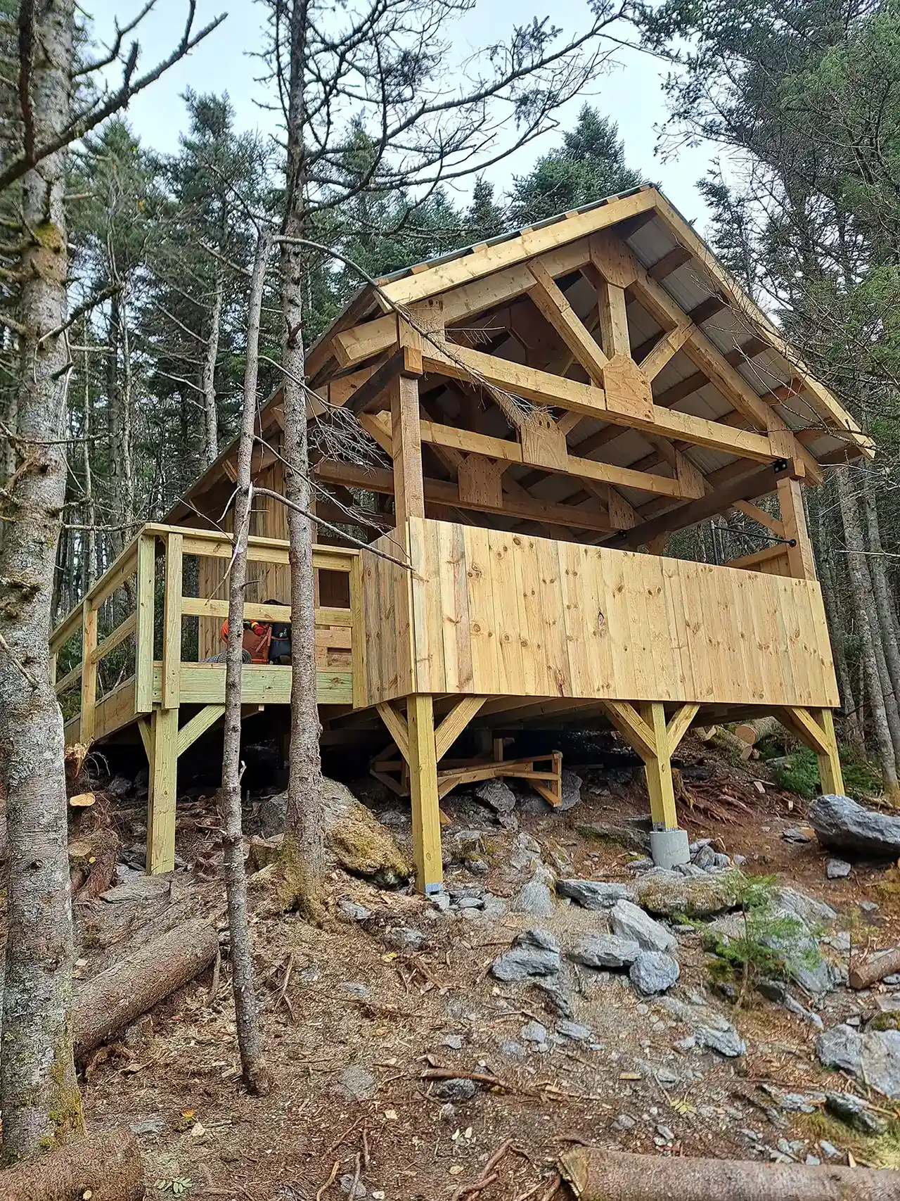
    As GMC begins our 2025 field season, we are working with the Forest Service to plan the next iteration of the Battell overnight site. We need to increase capacity and improve the hiker experience while protecting vulnerable high-elevation vegetation from impacts of overuse. Because of the current shelter’s historical and architectural significance, we will likely build a new shelter next to it rather than replace it. The club will continue to station a backcountry caretaker at the site in the hiking season to help manage it. We will share details of the final plans later this year.

    As the Battell Shelter site continues to evolve, it will undoubtedly remain important and popular for generations of hikers traveling Vermont’s footpath in the wilderness. Thanks to the ongoing support of members and donors like you, we can preserve both the historic shelter site and the fragile alpine vegetation surrounding this beloved overnight site.

  • A Visual History of the Long Trail News Design, GMC’s 100-Year-Old Membership Magazine

    The Long Trail News is GMC’s membership magazine. In 2022 the magazine celebrated its Centennial with a special edition examining the past, present, and future of the magazine. Here, we take a look at the Long Trail News design, layout, and contents of the magazine. With our increased focus on digital communications and a general decline of print news, we are once again examining the purpose and role of the magazine as a part of the club’s suite of communications.

    Green Mountain News 1922December 1922. Founded by Edward Sprague Marsh, “The Green Mountain News” is “designed to impart to members and others interested in the Green Mountain Club the latest news of the Club and the Trail, and to constitute a record of the activities of the Club down to date of publication.” The first issue had five pages, but the page count settled at an even four until 1940.


    1925 LTN CoverDecember 1925. The paper’s name changed. “The name ‘The Green Mountain Clubhouse’ having been officially changed to ‘Long Trail Lodge,’ it has seems best to follow suit and adopt a corresponding title for this paper. The reason is the same in both cases: the new name is more distinctive.” In April 1928, the trustees voted to publish bi-monthly, and made a plea to the sections to provide enough updates, news, and material to support such a publishing schedule.

    October 1939. J.A. Allis reported the death of Marsh in June 1939. For years it has been believed that the August 1939 issue was missing. Upon further review of club records, it seems likely the issue was skipped because of Mr. Marsh’s death.

    LTN Cover 1944November 1940. A new editor was named, and the magazine got a flashy new look. The new series featured a cover image and was a pocket-sized 16-page booklet with a single column of text and illustrations and photos throughout.

    Wartime threw the club, and its publication, into disarray. The April 1944 book covered three issues, and acting editor L.B. Puffer explained the schedule change and the new budget. “First, of course, an apology is due to all the members of the club for the delay in the appearance of the News. There is really no good excuse, but there are reasons…. However, here is an issue, and, since it takes the place of two or three regular numbers, we can afford to make it a little more voluminous and include more illustrations without exceeding the limited appropriation of the last annual meeting.”

    LTN Cover 1944By August 1944, the publication returned to a simple, four-page, two-column newspaper-type layout, the result of both a limited budget and limited submissions. GMC Corresponding Secretary Lula Tye wrote, “Time goes by very quickly, and if you send in everything you can, then it will not be difficult to get the material together for the printing. Come on, let’s all get busy and send in lots and lots of good material for the News.”
    The magazine saw few changes in the next decades. It was the primary member communication, so it included detailed reporting of trustee meetings, annual meetings, intersectionals (club-wide camping and hiking gatherings), and reports from sections. “Lighter fare” included poetry, trip reports, letters from hikers, and a few photographs. Its length increased with time.

    LTN Cover 1985In May 1985, editor Jeffrey Silman revealed an updated format, cover design, and paid advertisements. The Board approved these changes warily: “Concern was expressed, however, that the News not be changed drastically or become a slick magazine.”


    LTN COver 1992 Sylvia Plumb oversaw two thoughtful redesigns during her editorship. In Fall 1992, she writes, “We introduce this new look with the hope that we have developed a cleaner, easier to read, more modern publication, while maintaining a sense of the Club’s history and tradition.”


    LTN Cover 1998Just six years later, Sylvia did it again. “Why the change? We needed to communicate better with you. Articles about the goings on at the club left no room for features and photographs about GMC volunteers, history, or sections and little room for discussion of trail issues. To remedy this problem, we have added eight pages and redesigned the format.” — Winter 1998. Sylvia introduced departments such as “Trail Mix” and “Mountain Views.”


    LTN Cover 2021Sound familiar? The magazine kept this 32-page, full-color, feature-and-department format for 20-plus years. In Winter 2020, we scaled back to 24 pages considering pandemic pressures, staff capacity, and the increased focus on digital communications.

  • 8 Tips for Avoiding Search and Rescue Services

    Stowe Mountain Rescue members package the patient on Sunset Ridge.
    In this Search and Rescue mission, Stowe Mountain Rescue members prep the patient for evacuation. Photo courtesy: Underhill Jericho Fire Department

    There can be no denying that 2021 was been an active year for search and rescue (SAR) in Vermont. While no database provides exact numbers, there have been an estimated 25 percent more incidents than usual. A backcountry rescue can require more time and resources, so it’s important to know how to get yourself out of the forest when possible to avoid straining rescue personnel and supplies. This is all the more true in winter. Search and Rescue Coordinator Neil Van Dyke talks us through safety tips for avoiding emergency calls.

    This article appeared in the Winter 2021 edition of the Long Trail News under the headline “Search & Rescue Report.” See the full article (pages 14-15) for specific incident reports and insights.

    Tip #1: Carry enough equipment, food, and water

    Pack enough to be self sufficient for 12 to 24 hours. This includes extra layers of clothes, extra food and water, a headlamp, extra batteries (or an extra headlamp), and a map and the skill to use it. Make sure your phone is fully charged, and keep it on airplane mode to conserve its battery life unless you absolutely need it.

    [Related: 5 Tips for Avoiding Backcountry Emergencies]

    Tip #2: Tell someone where you are going

    Communicate where you are going and when you expect to be back with someone you trust. Keep your contact updated if your plans change, and let them know when your hike is complete.

    A search and rescue mission took nearly 20 people and six hours to complete.
    A search and rescue mission on the Sunset Ridge Trail, Mt. Mansfield, took nearly 20 people and six hours to complete. Photo courtesy: Underhill Jericho Fire Department

    Tip #3: Research your trip

    Research ahead of your trip and make sure it is within your ability level. Allow plenty of time to finish before it gets dark. Don’t be afraid to turn back if conditions are not what you expect.

    GMC’s Long Trail Guide and Long Trail Map are excellent resources. Browse online for guidebooks and maps.

    Tip #4: Plan your hikes well before dark

    The sun sets early in winter, so a headlamp and extra clothes are a must on any hike. If you need a rescue, or even if your descent just takes longer than planned, you do not want to be stuck without light or warmth.

    Tip #5: Invest in a satellite communication device…

    It is very common for SAR to receive calls from loved ones who have not heard from a hiker who promised to call and check in. While SAR understands that this can be worrisome, a missed phone call alone is usually not enough to elicit an emergency response unless there are other risk factors. Remember that cell service is often poor in the backcountry.

    If checking in is truly important, hikers should consider buying a satellite communication device, which is generally more reliable than cell phone coverage.

    Tip #6: And know how to use your satellite device

    Users of satellite communication devices should be very familiar with their function to avoid inadvertent activation. Some models allow messages about the nature of an emergency. That can be very useful when used properly, and also can provide peace of mind for users and their loved ones.

    Tip #7: Consider your pet’s needs too

    Waterbury Backcountry Rescue Team members carry pups Lily and Luna down from Hunger Mountain. Photo courtesy: Waterbury Backcountry Rescue Team

    Hiking with dogs is enjoyable, but they are not immune to risk or injury. Not all SAR teams have the resources or knowledge for animal rescues.

    • Keep your dogs close and under voice command if very well-trained, or leashed if not.
    • Use extra caution after sunset, when porcupines and other wildlife are more
      active.
    • If your pets do have a run-in with a porcupine, seek veterinary care as soon as possible. Trying to remove quills yourself can cause further injury.
    • If you have to call for help, listen carefully to questions and provide as much information as you can. Be aware of your surroundings so SAR will know where to find you.

    [Related: Hiking the Long Trail with Your Dog]

    Tip #8: If lost, stay calm and stay put

    Take a break, consider your options, and make a plan, including calling SAR if service allows. Sometimes telephone coaching is enough to get hikers out of a tricky situation, and self-extricating by following directions saves valuable time and resources. Be prepared with emergency supplies like a headlamp and extra food, water, and clothing.


    Neil Van Dyke is the Search and Rescue Coordinator for the Vermont Department of Public Safety, and he has participated in and coordinated countless backcountry searches and hiker rescues. An avid hiker and longtime GMC member, he provides search and rescue training each spring to the club’s field staff.

    This article appeared in the Winter 2021 edition of the Long Trail News under the headline “Search & Rescue Report.” See the full article (pages 14-15) for more insight on avoiding a rescue.

  • 88 Side Trails in Less Than a Week

    88 Side Trails in Less Than a Week

    A side-to-side trail, the Lye Brook Trail waterway and shoreline
    Lye Brook Trail. Photos courtesy: Nigel Bates
    This article was written by Nigel Bates. It previously appeared in the Winter 2020 Long Trail News under the title “Side-to-Side in Less Than a Week.” In July I set the fastest known time for hiking the 88 trails on the Green Mountain Club’s list of Long Trail side trails in six days, 10 hours, 47 minutes and 43 seconds. It was a mighty endurance challenge, a daunting logistical puzzle, and a scenic tour of some lesser-hiked corners of the Green Mountains. While the side-to-side trails total 166.1 miles, hiking all of them requires more than 200 miles, including round trips and sections of the Long Trail that connect side trails. My route totaled 226.66 miles—plus 56,947 feet of elevation gain, almost double the height of Mt. Everest above sea level. Route planning and coordinating my support crew were perhaps as much fun as the hike itself, and I likely spent more time at it than hiking. It was an incredible amount of work, but I enjoyed the logistical puzzle. I had already done about 75 percent of the side trails, most of them while working on the GMC field staff. In a way, I had been scouting the trip for years! My crew and I made sure our plans and backup plans were solid, because trailheads often don’t have cell service.

    How I planned my route:

    First and foremost, I determined the optimal route. Some choices were obvious—going out and back on the Journey’s End Trail was the only move, for example—while others presented interesting tradeoffs among mileage, elevation and terrain. I had started sketching a path through the Mount Mansfield network of 27 intertwined looping side trails in the fall of 2019 when I was a backcountry caretaker there. This proved invaluable, both for planning my route and for negotiating the more technical trails in the rain. Route planning continued this spring and summer. Then I lined up a support crew. I enlisted fellow GMC staff members Lorne Currier, John Plummer and McV LaPointe, who planned to meet me for breaks, carry my food and water, and, most importantly, keep my spirits up. We pulled of at least 30 meet-ups without an error. They shuttled the car (and sometimes me) between trailheads working in shifts, with only one person helping me at a time. I carried only water, snacks, a phone to record progress, and a small first aid kit. A typical outing was between 12 to 18 miles. For longer sections (the longest was 24 miles), I added water purification tablets, an extra clothing layer and a headlamp. In the support car were more substantial food, big water and Gatorade coolers, caffeine, changes of clothing, a foam muscle roller, and lots and lots of tape to fight the battle against chafing.
    overlook from Old Long Trail toward Green Mountains and Nigel near trail signage on side-to-side trails
    Left, view from Old Long Trail, near Duck Brook Shelter; right, Nigel Bates at Broad Brook Trail.

    Staying motivated wasn’t always easy:

    I am very grateful to my crew for taking care of other needs as they popped up. John made a hotel reservation when I decided I really needed a shower. McV got me onion rings when I craved them more than anything. And Lorne set up my favorite moment of the whole trip: at the end of a long fourth day, I was dreading the last hike of the day up the New Boston Trail. He saved the day by joining me with an imaginative scheme: casting me as the “ATV” (all-terrain vehicle) and himself as the “trailer” being pulled by the ATV. Together we pretended we were hauling lumber up to the David Logan privy for the impending replacement project. I could go as fast as I wanted because I was an ATV, even if only in my mind. Lorne’s imagination and experience motivating people outdoors helped me get through a section of trail that proved mentally challenging. As with most long-distance challenges, my trek was full of highs and lows, even on a single day. The morning of day two was a miserable slog completing all of the side trails on Mount Mansfield in pouring rain, but that afternoon the clouds parted to reveal a phenomenal view of Camel’s Hump from the Duck Brook Trail. In the Lye Brook Wilderness I suffered through a day of 90-degree heat and intense blisters, but was rewarded later with a gorgeous sunset over Stratton Pond. I enjoyed the hike more than I anticipated, and the despair of each nadir made the next zenith even sweeter.
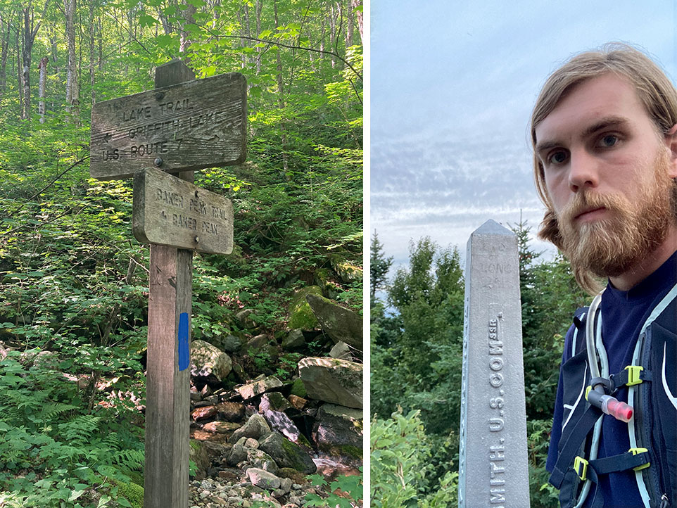
    Signage along the side-to-side trails
    Left, trail intersection near Baker Peak; right, Nigel at the Northern Terminus of the Long Trail.
    Though my job as field assistant takes me all over the Long Trail System, I still visit regularly only a handful of sites that see the most visitation. The side-to-side was a good reminder there are wilder pieces of the Green Mountains, often requiring no more effort to reach than places like Camel’s Hump or Sterling Pond.

    A few of my favorite side trails:

    • Amherst Trail: This parallels the Long Trail for 0.4 miles along the Mansfield ridgeline. It’s a great option for a loop hike from the Mansfield Visitor Center; you can escape crowds and see Vermont’s highest mountain from a different perspective.
    • Skylight Pond Trail: The trail reaches the top of the Breadloaf Wilderness ridgeline without any particularly rugged climbing (a rarity in Vermont). It switchbacks gradually for 2.5 miles to the Long Trail, and then descends another 0.1 mile to Skyline Lodge on the shore of Skylight Pond.
    • Shrewsbury Peak Trail: Though less than 20 minutes from the Killington ski slopes, it feels worlds away. A rugged climb through wild boreal forest leads 1.9 miles to a fine view at the summit of Shrewsbury Peak. Looping back on the Black Swamp Trail and the lightly travelled CCC road provides a gentler descent.
    • Homer Stone Brook Trail: This trail follows old woods roads along a lovely stream to Little Rock Pond. The moderate 2.3-mile climb showcases a forest gradually reclaiming an area once dominated by logging and farming.
    Overall, my side-to-side adventure showcased a beautiful and unique cross-section of Vermont. I hope it inspires others to explore these often underappreciated trails, whether in a week or in a lifetime. Nigel used his hike of the Long Trail side trails to raise funds for Outdoor Afro, a national not-for-profit organization that celebrates and inspires Black connections and leadership in nature. With nearly 90 leaders in 30 states, it connects thousands of people to outdoor experiences, and they are changing the face of conservation.
  • Codding Hollow Conservation: Celebrating Success after Thirty-Four Years

    The Fall 2020 Codding Hollow property conservation agreement protects one-third of a mile of Long Trail in Johnson and Waterville. You can read more about the protection in this press release.

    This article was written by GMC Conservation Manager Mollie Flanigan and appears in the Winter 2020 Long Trail News.

    codding hollow property
    Photo by Matt Larson

    In September the Green Mountain Club (GMC) joined its partners, The Trust for Public Land and the Vermont Department of Forests, Parks and Recreation, in celebrating the conservation of the Codding Hollow property in Waterville and Johnson. The acquisition protects 160.7 acres of forested landscape and one-third of a mile of the Long Trail, a critical stretch for the long-distance hiking trail where any gap could sever its continuity.

    Thirty-four years in the making, the accomplishment depended on the efforts of countless individuals and organizations who maintained relationships with the landowners, brainstormed creative trail protection scenarios, raised funds to support three decades of GMC’s land protection program, and finally signed the deeds.

    Why did it take so long to protect this modest but crucial parcel in northern Vermont? GMC’s three-inch thick land protection file for the property tells the complex story of Vermont land use philosophies, trail management priorities, public relations, tax law, and real estate deals that made Codding Hollow a thirty-four-year project.

    The Path to Conservation for the Codding Hollow Property

    1986 – GMC launches the Long Trail Protection Campaign. GMC has never mounted a capital campaign before. More than 60 miles of Long Trail in northern Vermont are located on private properties, protected only by the generosity of landowners and handshake agreements. Large tracts of timberland in northern Vermont are on the market, and GMC estimates that more than 30 miles of trail could be affected by their sale.

    1990 – GMC establishes a relationship with the Codding Hollow property owner, a Vermont-based timber company with multiple landholdings. The landowner is willing to discuss options for permanently protecting the Long Trail route but is not interested in anything that would prohibit timber harvesting along the trail or restrict sale of the land later. GMC and the landowner consider a possible land sale or donation, conservation easement, or trail right-of-way.

    1991 – GMC and the landowner continue to discuss trail protection options and example trail rights-of-way are shared and discussed.

    1992– The Green Mountain Club Board considers National Scenic Trail (NST) designation for the Long Trail, primarily motivated by the time and money it could take for the GMC to protect the Long Trail without federal support. (GMC had considered NST designation in 1975, 1986, and 1990, but had rejected the idea for fear that national designation would increase use of the already stressed trail system. GMC hoped that its land protection effort could succeed without federal involvement.) GMC’s Land Protection Committee estimates that under the current protection program, it would take more than $5 million and at least eight more years to protect the entire Long Trail.

    Photo by Matt Larson

    The Codding Hollow landowner lets GMC know that he’s “very gun-shy of having to deal with the federal government.” He is interested in working with GMC on an easement under development but fears the federal government would disregard the terms of an easement and restrict his property rights if the trail received NST designation.

    1993 – Governor Howard Dean asks GMC to pursue National Scenic Trail (NST) designation. A motion passes at GMC’s Annual Meeting “that in cooperation with appropriate interested parties, the GMC proceed to draft federal legislation for federal protection for the Long Trail subject to later Board approval of wording before introduction in Congress.

    The Codding Hollow landowner learns of the vote, again expresses his concerns with federal involvement, and says that if GMC proceeds with legislation, he would want the trail routed away from his property. GMC tries to reassure him that if NST designation were granted, an easement would be grandfathered and recognized as trail protection, and the property would not be subject to eminent domain. The landowner’s concerns are not assuaged, and he expresses concerns about pursuing an easement with GMC.

    1994 – GMC’s Land Protection Committee has been working since the summer of 1993 to draft NST legislation. Public meetings held around the state gather opinion from the public, GMC members and landowners in an attempt to build support for the controversial designation. The primary question is how eminent domain authority would be handled by the legislation and how that could affect landowners along the Long Trail.

    In September GMC’s board votes by a large majority to seek legislation to add the Long Trail System to the National Scenic Trail System. Proposed legislation stipulates that “eminent domain authority will be limited to the main route of the Long Trail and will not apply to side trails. Landowners who have agreed to protect the Trail corridor, both prior to and following the passage of legislation, will not be subject to eminent domain. Eminent domain can be used only as a last resort when no other means will protect the Trail and is limited to a maximum corridor of 1000 feet.” – GMC Long Trail News, Winter 1994

    In November the owner of the Codding Hollow property writes GMC a strongly worded letter stating that NST designation is “incompatible with the goals” of the timber company and that “it is particularly disturbing to us that our fifty years of good-will and volunteer trail protection will now be ‘rewarded’ with a taking.” The letter demands that “upon receipt of this letter you should actively proceed with relocating the trail off of the property.”

    GMC responds, asking the landowner to reconsider the relocation demand until they have reviewed the legislation wording, and the landowner agrees to suspend the relocation demand.

    1995 – Conversations with the landowner continue, discussing purchasing all or part of the property. The landowner is inclined to wait to see how GMC moves forward with NST designation before committing to any action. The Nature Conservancy discusses possibly helping to facilitate a land swap to conserve the Codding Hollow property with some recently donated land to the Conservancy. As a result of the 1994 mid-term election and continued public feedback, GMC decides to not pursue legislation designating the Long Trail as a National Scenic Trail.

    1996 – The land swap with The Nature Conservancy doesn’t work out, but GMC offers to look for land to exchange for the Codding Hollow property. The landowner is open to the offer.

    1997 – A land exchange is still being discussed, but a suitable property has not been identified.

    A neighboring property is opened for logging, and the Codding Hollow landowner is interested in conducting the harvest. Access to the neighboring land is through a GMC conservation easement. GMC tries to leverage the required permission to get protection for the trail on the Codding Hollow property, but the landowner is not interested.

    1998 – GMC purchases a neighboring property and offers to allow the Codding Hollow landowner to harvest the timber in exchange for Long Trail protection. The two parties discuss a long-term management agreement in exchange for a 25-acre protection zone for the Long Trail on the Codding Hollow property, but problems with the terms of the agreement emerge.

    2002 – GMC learns that the landowner is interested in selling their timber lands in Vermont, including the Codding Hollow property. GMC asks to buy the property or secure a trail right-of-way before the sale. An appraisal is conducted but the landowner asks for a purchase price that is deemed “outrageous” by GMC and GMC decides a purchase isn’t worth pursuing with the current owners.

    The landowner works with LandVest, a New England timberland management and real estate firm, to bundle their Vermont holdings—a total of 7,000 acres in 15 parcels—and offer them for sale for $6.5 million.

    GMC talks with The Nature Conservancy and the Vermont Land Trust to see if a collaboration to purchase the bundle is possible.

    Photo by Matt Larson

    2003 – The 7,000 acres are sold to an investment firm, and LandVest continues to manage the properties. GMC establishes a relationship with the new landowner.

    2004 – GMC discusses its interest in the Codding Hollow property with the new landowner, and the owner expresses a willingness to do a land exchange, proposing a 3:1 acreage ratio because they want to increase their holdings. Both parties look into potential properties for a land exchange.

    2007 – The landowner tells GMC they are interested in selling a bundle of their Vermont holdings called the Green Mountain Portfolio. GMC makes an offer to buy just the Codding Hollow property. The landowner considers the offer, but decides to sell the bundle of properties together instead.

    2008 – The Green Mountain Portfolio is on the market. GMC continues to express an interest in purchasing the Codding Hollow property. GMC discusses the Green Mountain Portfolio with The Trust for Public Land to see whether the bundle could be purchased and protected as a larger conservation project.

    2009 – A timber harvest is conducted on the Codding Hollow property. The forester gives GMC reassurance of a light-cut buffer along the Long Trail and promises to “make an effort to keep skid trail crossings to a minimum, ideally just one crossing, and will post signs on the trail warning of logging activity.”

    2011 – The timber harvest on the Codding Hollow property wraps up. GMC gets the property appraised and makes an offer to the landowner, but the offer is rejected as too low. The landowner moves forward with selling the Green Mountain Portfolio.

    2013 – The Green Mountain Portfolio properties are purchased by a privately held limited liability corporation. LandVest continues to manage the Codding Hollow property.

    GMC and The Trust for Public Land launch the Partnership for the Green Mountains, a collaboration to strategically conserve priority lands surrounding the Long Trail.

    2015 – LandVest lets GMC know that the landowner understands GMC’s interest in the Codding Hollow property and is willing to sell GMC the tract. The sale can happen once the landowner finds a comparable property to buy so as to not decrease the acreage of his holdings. GMC works with The Trust for Public Land to monitor the land deal, since GMC’s internal land protection capacity has decreased in recent years.

    2019 – LandVest tells The Trust for Public Land that the landowner has found a comparable property and is ready to sell the Codding Hollow tract. The Trust for Public Land gets the property under contract, and the State of Vermont invests $130,000 in the project through a legislative appropriation so the land can become part of the Long Trail State Forest. The towns of Johnson and Waterville support adding the land to the state forest system. The Trust for Public Land, GMC, and the Vermont Department of Forests, Parks, and Recreation work to conserve the property.

    2020 – The Codding Hollow property is purchased by the State of Vermont and incorporated in the Long Trail State Forest.  GMC purchases a conservation easement for the Long Trail on the property.

    Photo by Matt Larson

    When immersed in the continuing work of managing and stewarding a 110-year old resource like the Long Trail, it is easy to forget the hard work, generous support and bold vision that has gone into making the resource a reality. The conservation of Codding Hollow is a chance to celebrate the vision, vigilance and effort that it takes to steward the Long Trail. Its conservation is a critical addition to the quilt of conserved lands the Long Trail traverses. It fits perfectly into the design composed of more than a hundred other trail protection projects that GMC has worked on, and it joins the countless other conserved lands in Vermont open for public recreation today.

    Thank you and congratulations to all the members, donors, supporters, landowners and partners who have brought the Codding Hollow project to fruition! We especially want to thank Bari & Peter Dreissigacker for supporting this project.

  • 100 Years of Taft Lodge on Mount Mansfield

    This article was written by John Page and previously appeared in the Summer 2020 Long Trail News. Before 1910 the Summit House hotel at the top of the toll road from Stowe was the center of hiking activity on Mount Mansfield. Guests driven to the hotel spent their days exploring the top of the mountain, and many of today’s side trails around the main ridgeline date from that period. Burlington area mountain enthusiasts could also stay in a smaller hostelry on the Underhill side called the Half Way House, which maintained a bridle path to the ridge near the Summit House (now the Half Way House Trail). No trails reached the Chin directly from the base of the mountain. The only way to the summit was to ascend to the Summit House from either side, and then walk the ridge. Burlington attorney Clarence Cowles was one of the mountain enthusiasts from Burlington who enjoyed exploring Mansfield from these hotels. When James P. Taylor convened the first meeting of the Green Mountain Club in 1910, Cowles attended and signed up as a charter member. In the next seven years, Cowles personally cut the original Long Trail from Mount Mansfield to Camel’s Hump and then, as a key colleague of Will Monroe, helped extend the trail all the way to Middlebury Gap. For this alone, Clarence Cowles deserves a place in the GMC hall of fame. Cowles’ work as a trailbuilder wasn’t finished, however. In 1920 he supervised the building of Taft Lodge on a secluded shelf at 3,650 feet, in the shadow of Mount Mansfield’s Chin.  On a scouting trip the previous winter he had “slashed a tree with a blaze and there marked what he believed to be the finest location for a shelter.” He hired Stowe lumberman Willis Barnes and foreman Clyde Brink to construct a large log cabin from huge spruce logs drawn up the mountain with teams of horses. Cowles climbed Mount Mansfield thirty-one times that summer to personally supervise the project and, on one occasion, to carry the new lodge’s wood stove up the mountain. By now Cowles was a probate judge. He persuaded Elihu Taft, his fellow judge and mountain lover, to donate the construction costs for Taft Lodge, even though, as Cowles’ son put it, “old Judge Taft was then unable to climb mountains, he couldn’t have gone to Taft Lodge if we’d hauled him up.” Taft Lodge was immediately popular with hikers, particularly those from around Burlington. It had an overnight capacity of thirty-two (divided into men’s and women’s ends), and one report says up to seventy slept in and around the shelter one night.  For the next seven to eight summers, Cowles and his sons served as caretakers at Taft Lodge, providing blankets, wood, and water to hikers, while using their days to build the trails still used by hikers to ascend Mount Mansfield. While Taft was being built, Cowles blazed the current Long Trail from Smugglers’ Notch to the summit, thus finally routing the Long Trail over the Chin.  (It had previously bypassed the ridge, requiring a 2-mile side trail to the summit.) Cowles needed a more direct route to Taft from his home in Burlington, however, so the next summer he built his masterpiece, the Sunset Ridge Trail, which many today consider the premier hiking trail in Vermont. The part of this new trail that extended from the ridge down to Taft became the Profanity Trail. A few years later, Cowles built the Cowles Cut-Off from the site of the Half Way House to provide an even more direct route from Underhill to Taft Lodge. The Green Mountain Club later renamed this trail after Judge Cowles’ wife, Laura, who was an accomplished hiker in her own right and the first president of the Burlington Section. During his years of activity at Taft Lodge, Cowles and his sons also improved and blazed an old path up the Hell Brook drainage, providing yet another direct (albeit steep) route to the Chin from Smugglers’ Notch. Thus in a few short years, Clarence Cowles created a network of trails that shifted hikers’ focus from the Summit House to the Chin. Quoting Cowles’ son again: “Father’s trails always aimed up toward the chin of the mountain and Taft Lodge.” World War II ended the use of caretakers at Taft Lodge until 1969, when the modern caretaker program began. The lodge was substantially rebuilt in 1951 and again in 1996. Although it appears today much the same as the original structure, it’s unclear how much of the original fabric remains. The biggest mystery about the construction of Taft Lodge?  Why is the door so low that it dents hundreds of heads every summer?
    Taft Lodge, 1920s
    Taft Lodge, 1940s
    Taft Lodge, 1996
    Taft Lodge, 2016. Photo by Gus Billard.

    Fred Gilbert, 1996
    Fred Gilbert “Paul Bunyan” of the 1996 Taft Lodge Restoration In 1996 Taft Lodge had not been renovated for 35 years and was badly in need of repair. The Green Mountain Club hired Alfred “Fred” Carlton Gilbert III to completely restore the lodge that summer and fall. A long-time GMC volunteer, Fred was a club director and served on the trails and shelters committee for years. He died at age 73 on June 1, 2019, leaving an indelible mark on the Green Mountain Club. GMC’s archives house Fred’s detailed journal on the Lodge reconstruction. A couple of loose pages dated 1995 tucked into the journal express Fred’s fervent hope of landing the job: “…I may be attaining my life-long dream next year… I’ll be supervising the replacement of Taft Lodge on Mt. Mansfield. To be a Paul Bunyan in 1996! To be a revered personality in the veritable Green Mountains. Me, lowly, loving, me. I really hope all things work out.” In January, fifty 20-foot spruce logs were delivered to Barnes Camp at Smugglers’ Notch. Teams of horses did not pull the logs up the mountain as in 1920. On May 8 and 9 the Vermont Army Air National Guard made 60 helicopter trips to carry those logs, plus 60 ten-foot spruce logs, 100 hemlock boards, metal roofing, mortar mix, tools, and other supplies, to a landing site about 700 feet above the lodge. Fred and his assistant, John Bennett, moved to the mountain on May 14 bringing with them twelve gallons of gas and other supplies. “Beautiful stars and Milky Way at 3AM,” Fred wrote on May 15, after two trips to the outhouse. It was a welcoming first night of several months to come of living out his dream and working on the mountain. Throughout his journal, Fred recorded good progress in the rebuilding of the lodge with the help of many volunteers. There are humorous, personal thoughts too: “Great book this ‘Men are from Mars, Women are from Venus.’ Lots of interesting input!” In October, fifty people hiked to Taft Lodge to celebrate its completion and rededicate the shelter. In 2016 Taft underwent substantial renovation again, this time led by Kurt Melin. Today, 100 years after its first logs were cut and peeled, the lodge still stands steadfast on the western slope of Mount Mansfield. Thanks to Fred and others like him, it will be there to shelter hikers for decades to come.
  • Mountain Names: Remembering their Aboriginal Origins

    This article was written by Rich Holschuh and previously appeared in the Fall 2019 Long Trail News.

    Photo by: Jocelyn Hebert

    As Europeans settled on the continent and early pioneers explored, they often gave places new names commemorating the Founding Fathers and other important Americans… [Indigenous people] have viewed such commemorative names as inappropriate: humans are too small, too fleeting and insignificant to have places named for them. The land is eternal; it owns us, we do not own it.

    Doug Herman, Denali and America’s Long History of Using (or Not Using) Indian Names

    It feels fitting that the oldest long-distance hiking trail in the United States traverses the Green Mountains, which, at one billion years of age, are among the oldest mountains in North America. Of course, age is relative. We think of the Long Trail as old: it was finished in 1930. We think of Vermont as an old state: it had been settled for about 150 years when the trail was completed.

    But the time since the settling of Vermont, and the time since completion of the Long Trail, are short compared with the tenure of the native Algonquian-speaking people—primarily Abenaki—who were forced aside when settlers, primarily British, flooded in after the last so-called French and Indian War. The newcomers colonized the landscape in a startlingly rapid wave. During the preceding wars the Abenaki had aligned with New France to the north, so when the British won, they fancied the territory that eventually became Vermont a clean slate, ready for new names.

    The settlers applied their values with a broad, deliberate brush in a sociopolitical process known as displacement and assertion. These new Vermonters, as they came to call themselves, followed the geographic naming conventions of their forebears. They chose Old or New English localities, notable individuals, and wealthy patrons to supply labels for landmarks in this unfamiliar territory. The new names were abstractions that had nothing to do with the features themselves, but became referents simply by association.

    While hiking the Long Trail, few of us ponder the ideological motives for these relatively recent monikers, but the ancient skyline of the Green Mountains has been known intimately for millennia. We still recall some original names, but we have forgotten many others.

    A guiding principle in Wabanaki understanding is that the stories themselves, being alive, remember. While we may not recall the original names, we can reconnect to the knowledge of our mountain relatives when we nurture the proper relationships. The original names derive from those relationships and from the features themselves, a direct connection between the People and the Land—for they are the same.

    In that light, let’s take a look at some of these mountain names and their layered stories, walking sowanaki li pebonki—from south to north.

    Just south of the border looms the tallest peak in Massachusetts, once referred to as Grand Hoosuc or Saddleback, and since the early 1800s as Greylock. Although the origin of the current name is debated, majority opinion asserts that it is in remembrance of Wawanolewat, an honored war chief of the Abenaki who was known as Gray Lock. He oversaw a running war with the colonists in western New England for decades, never surrendering, and living to a great age.

    Gray Lock operated from his base at the village of Mazipskoik at Missisquoi Bay, although he originally hailed from Woronoco (near Westfield, Mass.). Wawanolewat (which means “he habitually fools the others”) was born with a shock of grey hair, and this trait also suggests the clouds that often wreath the top of the mountain. Naming a mountain after an individual is a Western convention, but in a surprising cultural twist of memorializing a foe, Greylock has persisted.

    Traveling north into Vermont, the trail leads to Glastenbury Mountain in the unincorporated town of the same name. Glastenbury seems to have been named by grantor Gov. Benning Wentworth of New Hampshire in 1761 for Glastonbury, Somerset, in England, in a series of transposed colonial references. In corroboration, the next township east (also unincorporated) was named Somerset.

    Vermont folklore authority Joe Citro has said that Glastenbury was known by the native people as “the place where four winds meet.” This claim seems unsubstantiated, a part of the accretion of legend around an area that has long sustained stories of mysterious phenomena and unexplained disappearances. There is no surviving name from the original language, which in this case is likely to have been Mahican, an Algonquian dialect closely related to Abenaki.

    Moving on to better-documented territory, the highest peak in southern Vermont looms ahead at Stratton Mountain, whose inaccessibility inspired James P. Taylor to conceive of the Long Trail in 1910. It is unknown where Gov. Wentworth borrowed the name Stratton when he chartered the town of Stratton. But the mountain was known early on as Manicknung, said to translate from the Mahican language as the “place where the mountain heaps up” and, alternatively, “home of the bear.”

    The latter is pure marketing spin, part of the not uncommon practice of romanticizing (and inventing) native heritage. It is not difficult to consult a dictionary or native speaker to avoid such absurdities. It is also worth noting the strong homophony of Manicknung with New Hampshire’s Monadnock to the east—”the mountain that stands alone” or “the separate mountain,” which could easily be another way of saying “where the mountain heaps up.”

    The next height with claims to an indigenous name is Pico, next to Killington. Conventional wisdom states that it may be derived from the Abenaki word for pass or opening, since it faces Sherburne Pass just to the north. While there is some similarity to the Abenaki roots for “open” and “cross,” this seems like a stretch. However, there is a specific Abenaki term for a mountain pass and it is “Pasadena,” which shows up in California, freely appropriated for its euphonious sound. Go figure. In a bizarre twist of geo-linguistic justice, it is more likely the name Pico is a direct application of the Spanish term for “peak.”

    Skipping Mounts Abraham and Ellen (with their original toponyms unrecorded), we ascend Camel’s Hump, whose striking profile has made a strong impression on observers for millennia. Samuel de Champlain’s “Le Lion Couchant” (the resting lion) became Ira Allen’s “Camel’s Rump,” which evolved into the more mellifluous Camel’s Hump, still a rather exotic appellation.

    The Abenaki knew this place as Tawapodiiwajo, meaning “place to sit in mountain,” or “saddle mountain,” or “mountain seat.” This makes perfect sense on a titanic scale when it is understood that the giant culture hero Gluskabe used the mountain as his personal seat in some traditional stories. Another Abenaki cognate for the peak, akin to the later Camel’s Hump moniker, is “Moziozagan” for “moose’s shoulder,” or “moose’s hump.”

    Continuing north, the Green Mountain’s loftiest peak of Mount Mansfield rises to 4,393 feet. Though some claim it memorializes a previous home in Connecticut, the now-dissolved namesake town appears simply to have been another tribute by New Hampshire Gov. Wentworth to a buddy back home in England, Lord Mansfield. Today’s fancied human profile was envisioned quite differently through its original referent as Mozdebiwajo, or Moosehead Mountain, the result of the mighty Gluskabe’s pursuit of an equally great beast, now turned to stone.

    Finally, at the border with Quebec rises Jay Peak, granted to and named for the first Chief Justice of the United States for his help making Vermont the 14th state. Jay Peak is in the Missisquoi River watershed, which flows west to Lake Champlain and embraces that same village—Mazipskoik—where Wawanolewat, Chief Gray Lock, sheltered during his long and storied career. On a clear day one can see the lake from the mountaintop. One old Quebecois source has stated that they knew it as Gwenaden—Long Mountain, a fitting end to the Long Trail.

    And so the stories continue.

    Rich Holschuh is deeply invested in Wantastegok—known to most today as Brattleboro in southern Vermont—the place where he has set roots. He serves on the Vermont Commission for Native American Affairs and as a public liaison for the Elnu Abenaki Tribe, representing with governmental agencies and other entities. Working with the contemporary Abenaki community, Rich partners with others to further their interests, increase awareness, and rebuild connections. His work as an independent historic and cultural researcher—expressed through writing and photography—draws upon indigenous history, linguistics, geography, and cultural practice to explore and share other ways of seeing and being in relationship with place.

  • Looking Back 50 Years: How the Caretaker Program Began

    This article was written by Vic Henningsen and previously appeared in the Spring 2019 Long Trail News.

    Ranger-Naturalists on Mansfield Summit. Photo by Lou Borie.

    Green Mountain Club caretakers are a familiar sight to those visiting the busiest parts of the Long Trail, but few hikers know we owe their presence to the hard work of visionaries more than a half century ago.

    In the mid-1960s University of Vermont botany professor Hubert “Hub” Vogelmann oversaw research on Camel’s Hump that would bring national attention to the degradation of fragile ridgelines and mountaintops. Vogelmann and his students focused on acid rain, ultimately influencing state and federal environmental policy, but they also noted damage to delicate ecological communities caused by rapidly increasing number of visitors. Similar studies in the Adirondacks and White Mountains confirmed that popular peaks were in danger of being “loved to death” by enthusiastic but uninformed visitors.

    In the summer of 1968, some 20 Long Trail miles to the north, Burlington Section member and passionate environmentalist Ken Boyd volunteered part-time as caretaker at Bolton Lodge. Beginning in the 1920s the GMC had stationed caretakers at Stratton Pond, Killington, Camel’s Hump, and Mount Mansfield, maintaining shelters, supplying firewood, and providing blankets and occasional meals to weary hikers. The early club caretaker program lapsed in the quiet years after World War II.

    Ranger painting blaze on summit. Photo by Lou Borie.

    When Boyd arrived at Bolton, his aims were quite different. Like Vogelmann, he knew the Green Mountains were besieged by human activity that threatened to overwhelm what visitors sought to enjoy. While Vogelmann and his students collected data on rainfall, soil erosion, and plant damage, Boyd began to study backcountry users. He made a point of talking with everyone who passed through, kept meticulous usage records, and amassed data on trail and shelter conditions along much of the Long Trail. Hiker reports confirmed his suspicion that the trail system needed more thoughtful management.

    Boyd developed a strategy of changing hiker behavior through low key, face to face education. Rather than harassing visitors about littering, he packed out the Bolton dump, explained the basic principles of what became the pack-it-in, pack-it-out philosophy, and enlisted hikers as partners to respect the trail, shelters, and mountain environment.

    Visitors didn’t intend to damage the resource, he believed; damage came from lack of knowledge, not malice. So, he concluded, don’t treat them like criminals, and don’t make them feel like idiots. In a friendly conversational approach, he explained what he was doing and why, and why they might want to join in. If it worked, they might influence others. It might be slow, but it promised to be effective.

    As the visitor tide rose in that decade, Vogelmann and Boyd pushed for action. Concerned also about Camel’s Hump’s even more heavily traveled northern neighbor, Mount Mansfield, Vogelmann pressed UVM (which owned most of Mansfield’s alpine area) and the Vermont Department of Forests and Parks, as it was then known, (which managed it) to mitigate the damage. Meanwhile, using statistics he had compiled at Bolton, Boyd lobbied the Burlington Section to reestablish shelter caretakers on Mount Mansfield.

    In 1969, Vogelmann found an ally in Vermont State Parks Director Rodney Barber, a master diplomat and administrator. He brokered a complicated agreement by UVM, the Mount Mansfield Company, and the Department of Forests and Parks to support a ranger on the Mansfield ridge. The same year, Boyd’s data-driven campaign convinced the Burlington Section to station the first caretaker at Taft Lodge since 1946.

    Starting in June 1969, state ranger-naturalists on the ridge and GMC caretakers at Taft did what they could to cope with hordes of visitors, whose numbers continued to increase because of a nationwide backpacking boom further swelled by widely disseminated articles in local and national news media publicizing the Long Trail and Mount Mansfield. It was slow and often deeply frustrating work.

    But things were beginning to change. In October 1969, prominent activists and stakeholders organized the Green Mountain Profile Committee to marshal a coordinated, ecologically driven approach to resource preservation. Vogelmann chaired this group, but always credited its development and influence to GMC president Shirley Strong, whom he later described to historians Laura and Guy Waterman as “the driving force” in pulling the State of Vermont, the GMC, UVM, and others into effective partnership.

    Ken Boyd and sons John and Jasen in Octogon

    By 1971, this began to pay off. Now the GMC’s volunteer caretaker coordinator, Ken Boyd persuaded the club to expand coverage beyond Taft Lodge to Butler, Taylor, Bolton, Gorham, and Montclair Glen Lodges, and Stratton Pond. Perhaps most importantly, Rodney Barber appointed Ken Chief Ranger-Naturalist on Mount Mansfield. Ken and his wife, Alice, who acted as a full member of the ranger-caretaker team, moved into the Mount Mansfield Company’s Octagon building with their two young sons, John and the newborn Jasen.

    Their arrival marked a crucial moment. The state ranger-naturalists and GMC caretakers could easily have descended into rivalry, but they united under the leadership of the Boyds. Alice’s managerial and logistical skills complemented Ken’s energy and drive as they showed enthusiastic young rangers and caretakers how to implement on a much larger scale the low key educational approach that Ken had developed at Bolton Lodge.

    Alice and the boys

    By Labor Day weekend 1971, the pattern that defines Vermont’s approach to backcountry management was set. The club caretaker system absorbed the state’s ranger-naturalist program in 1975. Since then, Long Trail hikers have continued to receive a consistent message from all backcountry personnel via friendly explanation and persuasion rather than enforcement.

    This “Green Mountain model” was widely adopted elsewhere. Today Appalachian Trail thru-hikers and visitors to major summits in the White Mountains and the Adirondacks regularly encounter trail stewards whose approach mirrors that originated by GMC caretakers a half century ago.

    Hub Vogelmann, Shirley Strong, and Rod Barber laid the groundwork for a united effort to preserve the fragile ecosystem of Vermont’s mountain ridgelines. But Ken and Alice Boyd and the rangers and caretakers they inspired and led invented and implemented the strategy that made that effort successful. Two generations later the ripple effect of the caretakers’ low key “each-one-teach-one” outreach to mountain visitors continues to spread.


    Historian and Vermont Public Radio commentator Vic Henningsen was a caretaker and ranger-naturalist on Mount Mansfield during the 1970s. He would like to thank Alice and Ken Boyd, Howard Van Benthuysen, and Larry Van Meter for their help with this article.