Category: Education

  • Rare Plant Discovery, A Win for Alpine Stewardship

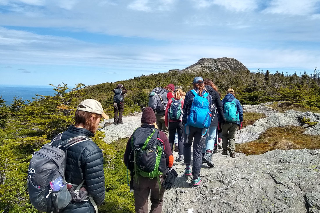
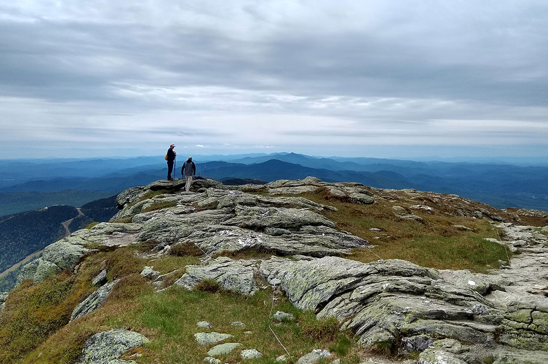
    GMC caretakers walk up Mansfield ridgeline, stay on rocks
    GMC caretakers continue their alpine ID training along the Mansfield ridgeline. Photo by: Angela Hilsman
    This article previously appeared in the Spring 2023 Long Trail News under the headline “Alpine Steward Discovers Rare Plant on Mount Mansfield’s Summit.”  It was written by Liam Ebner. Alpine zones, the living remnants of the last ice age, make their home on the higher summits in New England and New York, where they serve as the refuge to endangered plants that have adapted to thrive in the harsh conditions there. In Vermont, less than 275 acres of this special tundra biome remain. Because the rare patches of alpine zone lie in beautiful and popular recreational areas, their plants face multiple dangers: climate change, development, invasive species, and the most immediate danger, human recreational impacts. In such austere conditions, survival is never guaranteed. However in 2022, the alpine zone welcomed back to the community a plant long considered extinct in Vermont.

    A Steward of the Alpine Zone

    My first experience in the alpine zone was hiking Algonquin Peak with friends in September 2020. New York has 173 acres of alpine zone, fewer than neighboring states, all concentrated in the Adirondack High Peaks like Marcy, Haystack and Algonquin. I knew these mountaintops were special, and I wanted to help protect them. I was fortunate to work as a summit steward for the Adirondack Mountain Club in 2021 between my junior and senior years of college at Rensselaer Polytechnic Institute in Troy, New York. After graduation, I returned to ADK for the 2022 season, educating hikers about the alpine zone, assisting in botany research, and maintaining trails above tree line in the High Peaks. In February this year, I became the Summit Steward Coordinator for the Adirondack Mountain Club, and am thrilled to continue working to protect this fragile ecosystem.
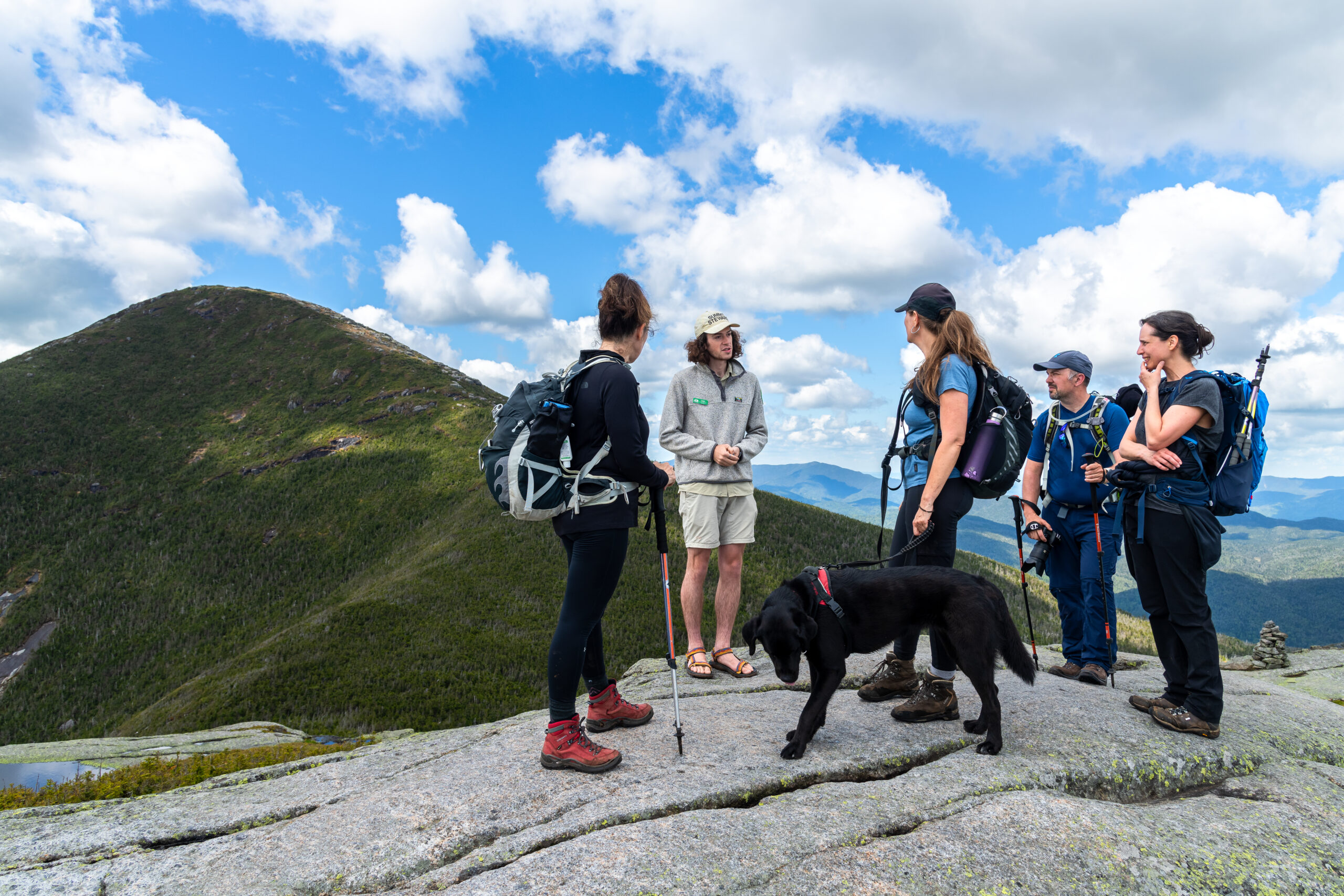
    Liam Ebner, Summit Steward for the Adirondack Club, talks with hikers on an alpine summit.
    Liam Ebner, Summit Steward for the Adirondack Club, talks with hikers on an alpine summit in the Adirondack Mountains.
    In October 2022, I attended the biennial Northeastern Alpine Stewardship Gathering co-hosted in Vermont by the Waterman Fund and the Green Mountain Club. The conference features professional presentations of alpine research and stewardship, and is a chance to engage with counterparts from New England, New York, and Canada to discuss challenges, trends, and successes. After two days of presentations, conference participants went on field trips to places with significant natural histories in Vermont. I joined a trip up Mount Mansfield led by Kevin Tolan, Staff Biologist at the Vermont Center for Ecostudies, to learn about the Bicknell’s Thrush (Catharus bicknelli), a rare migratory songbird that breeds in high elevation coniferous forests before migrating south to the Greater Antilles for the winter. Like alpine plants, the alpine and subalpine breeding habitats of the Bicknell’s Thrush are threatened by climate change. In October the chance of seeing this bird was slim, so I was also checking out some plants while on the summit ridge.

    Moment of Rediscovery

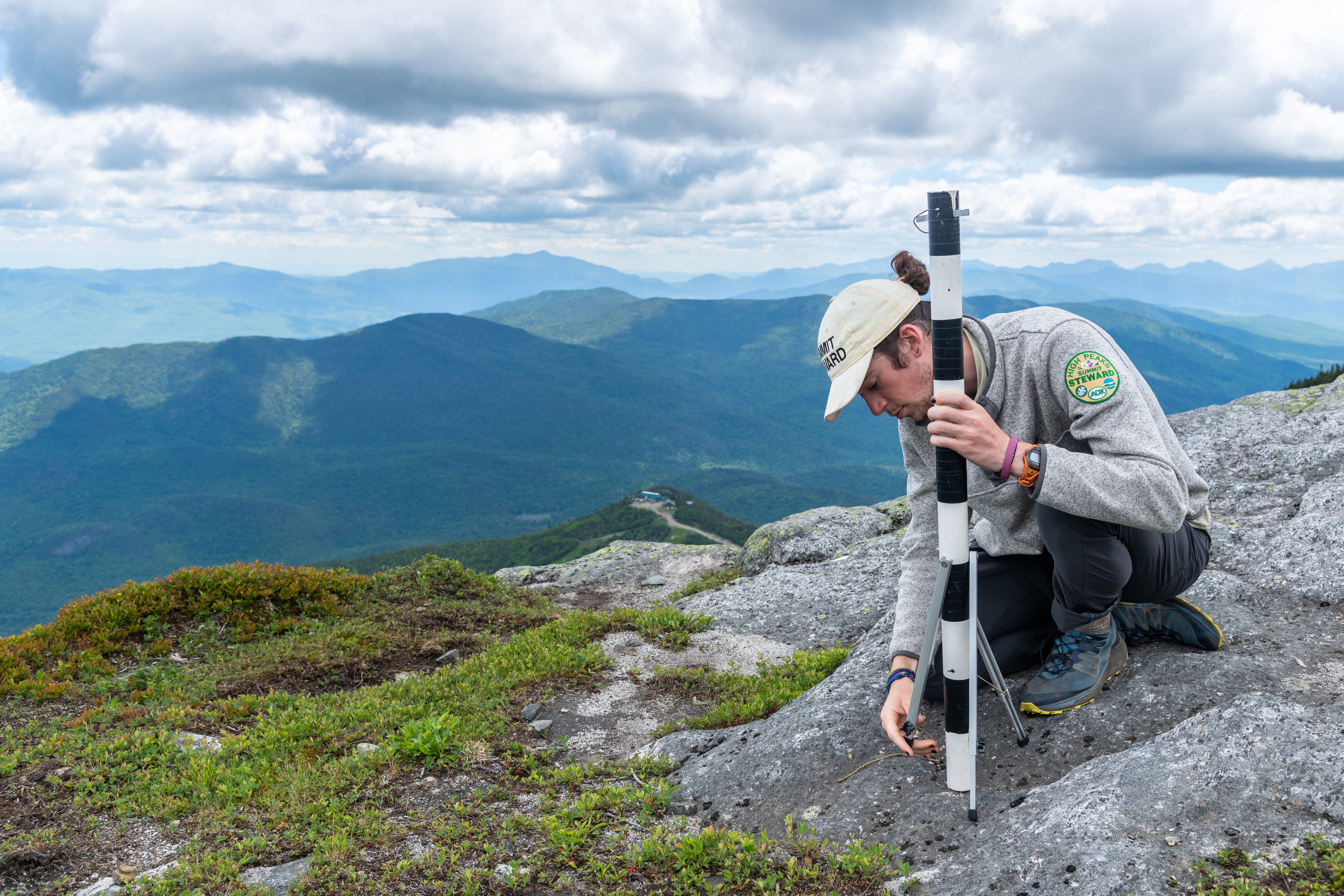
    Liam Ebner, Summit Steward for the Adirondack Club, on an alpine summit. At our turn-around point we chatted and took a snack break. Like any curious steward, I carefully explored, making sure to stick to bare rock while off trail. Plants in the alpine zone are extremely vulnerable to human impact: only a few footsteps can permanently damage or kill them. That’s why you’ll see white string delineating trail corridors on summits in Vermont and New Hampshire. It helps clearly guide people and dogs to stay on durable surfaces and concentrate their impact away from the most delicate plants. I noticed a small cluster of crowberry plants clinging to the soil and sprawling across the rock. In New York, two species of crowberry plants live in the alpine zone. The more common species, black crowberry, Empetrum nigrum, is abundant on most summits, and even grows on lower summits that would not normally be considered alpine (less than 3,500 feet in elevation). It’s common in Vermont as well.
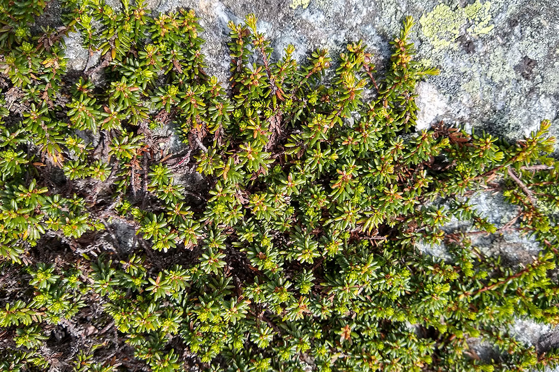
    Black crowberry
    Black crowberry. Photo by: Angela Hilsman
    Purple crowberry, Empetrum atropurpureum, is much rarer in New York. It had not been seen in Vermont since 1908, causing biologists to list it as extinct in the state. While working in New York I picked up the habit of checking every crowberry plant, hoping to find more populations of the purple crowberry. Two major characteristics differentiate the two plants. Berry color is the most obvious. Purple crowberry sports purple fruit, while black crowberry bears black fruit. This enables easy identification, but only when there are berries. The plant on Mansfield had no berries, so I turned to the next trait. Black crowberry leaves grow from a bare red-orange stem, while the purple crowberry stem has the same color, but fine white hairs too. The Mansfield plant had white hairs, confirming it to be purple crowberry!
    Purple Crowberry. Photos courtesy of Glen Mittenhauser/Native Plant Trust

    What Does Purple Crowberry’s Reappearance Mean?

    Discovering a plant thought to be extinct in Vermont is extremely exciting. Not only is it great news for the biological community, it helps show that stewardship practices, such as GMC’s summit caretaker program, continue to help protect the alpine zone. The greatest danger for these plants remains hikers’ footsteps, but the greatest protectors are hikers themselves. You need not be an outdoor professional to help ensure plant survival. Just stick to marked trails, stay on bare rock, and practice Leave No Trace principles.
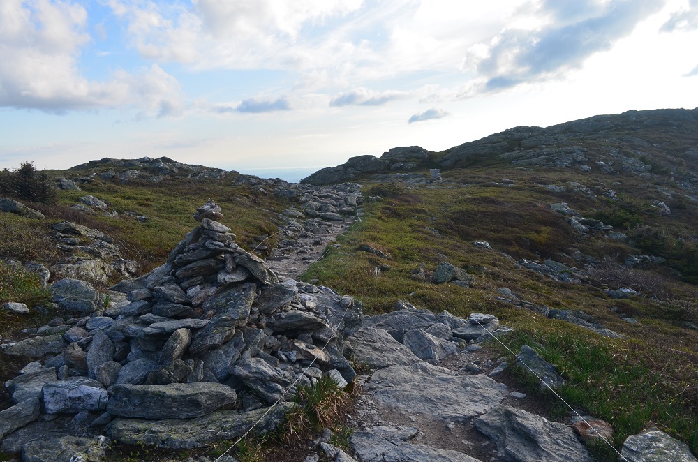
    Hikers on Mt. Mansfield ridgeline.
    Notice the stringing along the trail? Caretakers set that up to promote walking on rocks and off vegetation. Photo by: Angela Hilsman
    Vermont’s Fish and Wildlife department will monitor the health and growth of the purple crowberry and consider whether to include it on the state’s threatened and endangered species list. Next time you are on a high summit in Vermont or New York, ask a summit steward to show you some plants, and remember to do the rock walk! Liam Ebner is the Summit Steward Coordinator for the Adirondack Mountain Club. In his free time, he enjoys birding, paddling, and nature photography.
  • Winter Hiking FAQs

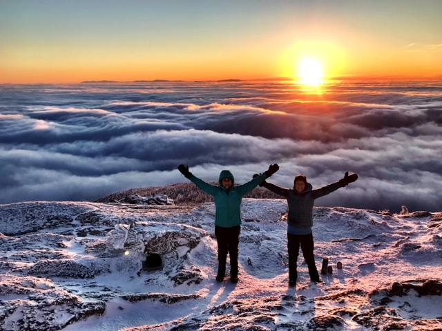
    Two hikers pose for a photo at sunrise from Camels Hump. Winter hiking can be glorious, but intimidating to get started. Below, we answer your frequently asked questions about winter hiking.
    What’s so great about hiking in the winter anyway?
    Hikers choose to hike in winter for many reasons, whether it’s fewer people on the trails, the different views and experiences from summer and fall, no bugs, the mental health benefits of getting outside and connecting with nature, or the extra challenges that winter hiking poses.
    What issues are the most important to consider in order to safely hike in the winter?
    Factors including experience level, trail difficulty, weather conditions, elevation, and gear are all important to consider to have a fun and safe hike. Think about who you are hiking with and the overall experience level and preparedness of the group. Taking on a difficult hike alone as an inexperienced winter hiker can raise the risks of winter hiking exponentially. Keep in mind that you will move more slowly in the winter than in summer. Snow and ice are harder to walk on, and navigation can be more difficult. So, a hike that takes you three hours in the summer may take up to twice as long in the winter. Keep that in mind when planning.
    What should I know about navigating trails in winter? Is it harder to navigate trails in winter?
    With snowfall, white or faded blazes can be more difficult to follow. Keep an eye out for cut branches on trees, the shape of the trail corridor, and blazes to distinguish the trail. Have a paper map and compass and knowledge of how to use both. Phones are not a reliable source of navigation because battery life doesn’t last as long in cold weather and cell service is spotty in the mountains.
    What should I wear?
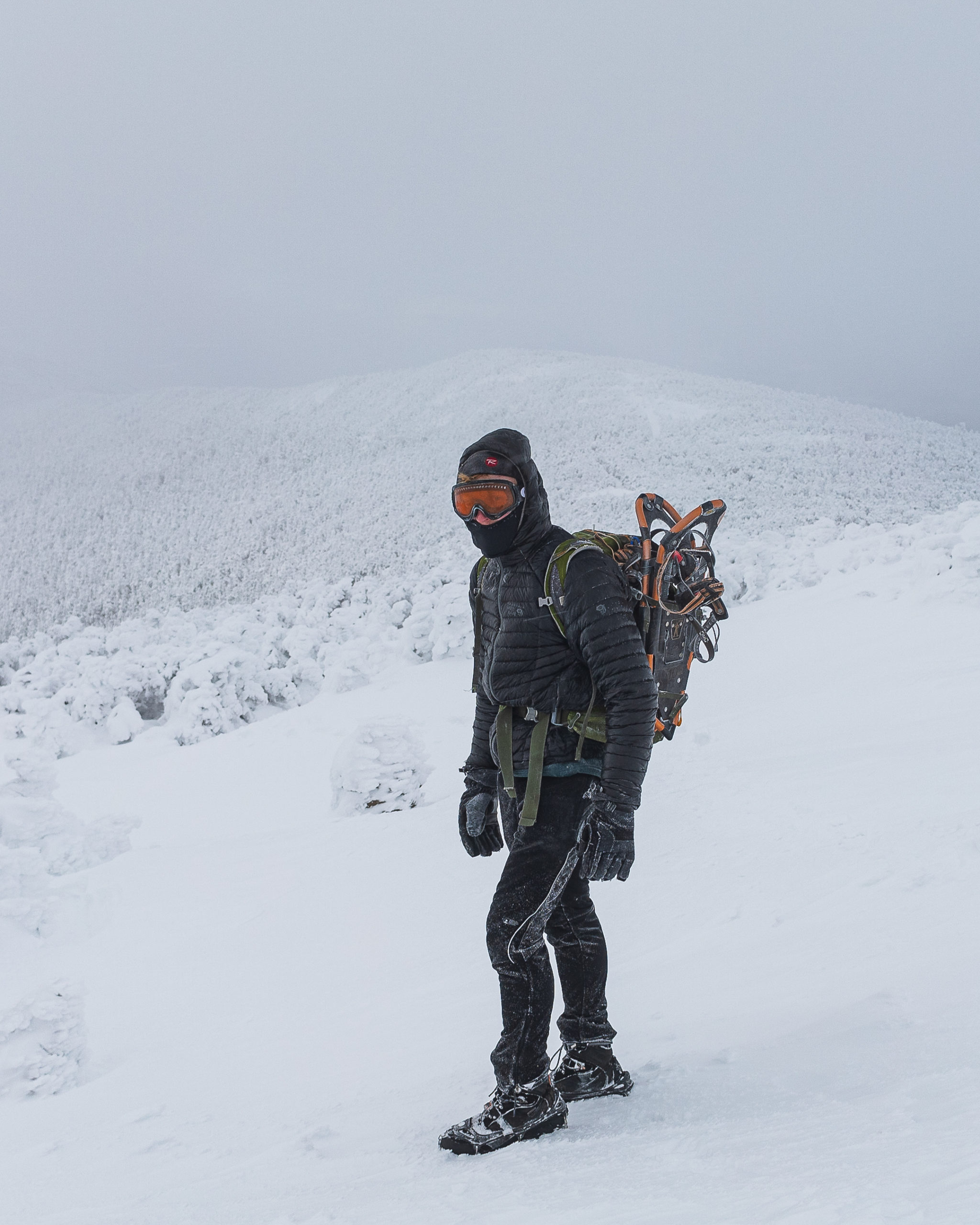
    Hiker Matt Heller dresses in layers and packs appropriate traction footwear while hiking in winter.Dress in layers to stay dry and regulate your body temperature while hiking. It’s important to be able to shed layers to minimize sweat, which leads to cold, and to be able to add sufficient layers back on to stay warm. Opt for wool or synthetic fabrics that dry quickly and wick away sweat and avoid moisture-retaining fabrics like cotton. Layers should include a base layer, mid layer, insulating outer layer, and a wind or rain-proof shell. Cover exposed skin with items like a neck warmer or buff, hat or headband, gloves or mittens. Pack an extra base layer, outer layer, and extra socks. For footwear, wear waterproof hiking boots with appropriate traction footwear: MICROspikes, crampons, and/or snowshoes. Trekking poles can help provide traction and balance as well.
    What should I pack and carry on me?
    Bring a daypack with room for the following:
    • Extra wool socks, an extra insulating layer like a squishable puffy jacket
    • At least two liters of water. Use an insulated bottle or store your bottle in a sock to keep it from freezing! Don’t use reservoirs with a hose, which are more likely to freeze quickly
    • Plenty of snacks that won’t freeze! Use a thermos for soup, or hot cocoa
    • The ten essentials in case of emergency
    What are the differences between types of traction/snowshoes? When should I use which option?
    • MICROspikes
      • Attach to boots with rubber straps, metal chains with small spikes run underfoot
      • Good for packed snow and ice
      • Easy to pack and put on
      • Midrange cost at ~$60
    • Crampons
      • Attach to boots using a step-in, strap, or hybrid design and made of metal with long sharp spikes
      • Excellent traction on packed snow, ice, and steep climbing
      • Higher price than MICROspikes, heavier and more complicate to put on, bulkier to store and carry
    • Snowshoes
      • Attach to boots with straps
      • Creates larger surface area to pack down and stay on top of snow
      • Avoid postholing
      • Good for hiking through fresh deep snow
    What are affordable gear rental options if I don’t have my own?
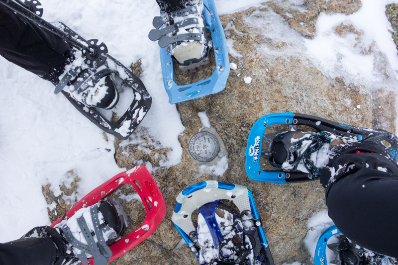
    Call the outdoor retailer nearest you to see if they offer traction rentals or used goods. Here are some we have confirmed recently in Vermont: Nearby snowshoe rentals: Hikers wear snowshoes for winter hiking.
    Can I use my cell phone when winter hiking?
    You can! Just be aware: cold weather drastically depletes battery life, and your phone can freeze or die quickly. Carry your phone close to your body in an inner pocket to keep it from freezing. You shouldn’t rely solely on your phone as a map and should conserve battery to be used to call for help in case of an emergency. Even then, cell service isn’t a given on trail.
    How do you keep your water from freezing during a hike?
    Lots of strategies here! Store your water bottle upside down, so that the water near the mouth is last to freeze. Store it inside a warm sock or insulated case. Fill it with hot or warm water to delay the time it takes to freeze. Store it in the interior of your backpack away from the edges. Avoid using a CamelBak or similar water bladder as the hose freezes easily. Also, take tea, hot chocolate, soup, or similar warm liquids in a thermos for unfrozen fuel and hydration.
    How can I find out the trail conditions before I go?
    Call the GMC visitor center for information about trail conditions. Hikers and club members frequently send in recent weather reports. Other sources of information include online local hiking forums (like GMC’s Long Trail hiking Facebook group) where often someone who has recently been to the area you’re interested in hiking and will know about the conditions. You can search each group for recent posts in your area of interest or post a call for information.
    Other safety precautions?
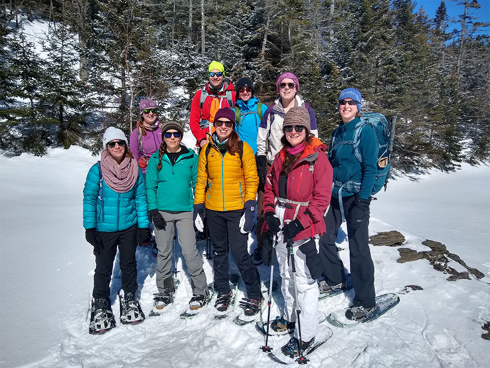
    Hike with an experienced partner if new to winter hiking. Give your entire hiking plan to 2 people, including departure time and expected return, route, gear carried, and any alternative routes and plans. Colorfully dressed hikers pose in snowshoes..
    How can I find other people to hike with or gain experience from?
    Join a GMC Section organized group hike, which are open to anyone but require pre-registration. On these hikes, you can meet other GMC members and experienced hikers and ask questions. You can also look at the Facebook groups for events and like-minded hikers, explore Meetup groups, and use local calendars like Seven Days and Front Porch Forum.
    What resources are there to find hikes?
    Visit GMC’s Winter Hiking or HikeVT pages for hike suggestions and information on trail difficulty levels and descriptions. If you prefer paper, pick up a copy of the Winter Hiking Guide from GMC’s store.
    How can I plan for winter hiking with kids?
    Looking to include kids in your winter adventures? Check out GMC’s recommended family-friendly and accessible trails. Try different learning activities and identification apps to make hikes even more engaging and fun. If winter hiking with babies or toddlers, make sure they’re warm and dressed in layers – a general rule of thumb is to dress them in one more layer than you feel comfortable in. Other pieces of advice are to start small, be flexible, and pack plenty of water and snacks! Other related blog posts about winter hiking and hiking FAQs: What other questions do you have? Leave a comment below or email the visitor center.

  • Hiking During Hunting Season in Vermont

    Hiking During Hunting Season in Vermont

    September 1st marks the start of Early Black Bear Season in Vermont, followed by many other hunting seasons throughout the fall. Hunting is allowed on all GMC owned and managed lands, including along the Long Trail and Appalachian Trail corridors in Vermont.  Please be safe when you are hiking and be respectful of all trail users.  The Green Mountain Club strongly encourages hikers to:

    • Wear blaze orange clothing, visible from both the front and back.
    • Avoid wearing brown or white, the colors of a deer.
    • Be especially careful while hiking in valleys and near roads and trailheads.
    • Avoid hiking during dawn and dusk due to low visibility.
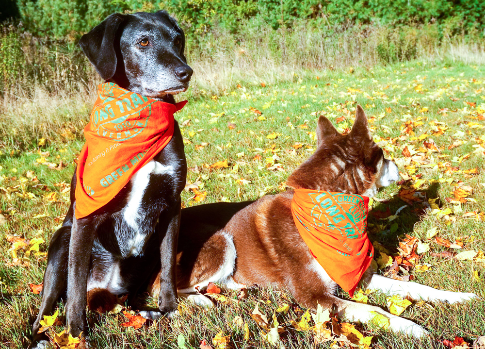
    • Please leave dogs at home. If you do bring a furry friend, dress your dog with bright bandanas or a blaze orange vest.
    • Wave and talk to make your presence known to hunters.
    • Stick to well-populated trails where hunters are likely to avoid.

    This is a wonderful time of year to go hiking in Vermont.  It’s also a good time to refresh your safety awareness with regard to hunting season and general preparedness.  A prepared hiker is a happy hiker!  Have fun out there!

    Check out Vermont Fish and Wildlife for more information about where, when, and how hunting is permitted in Vermont.

    Where should I hike during hunting season?

    Stick to the guidelines above. For some general recommendations, try:

    Prospect Rock via the Long Trail, Johnson – MODERATE
    Wiessner Woods, Stowe – EASY (hunting is prohibited)
    Camel’s Hump Summit via Burrows Trail LoopHuntington – MODERATELY DIFFICULT
    Thundering Falls, Killington — ACCESSIBLE
    Bromley MountainWinhall — MODERATE

    Please note that with the exception of Wiessner Woods, hunting is permitted on these lands.

    Share the trail and be safe out there, hikers!

  • What’s that String in the Alpine Zones?

    Mansfield Ridge stringing
    Stringing along Mansfield Ridge, 2017. Photo: GMC archives

    What’s that String?

    If you’ve hiked Camel’s Hump, Mount Mansfield or Mount Abraham, you’ve seen low-lying white string delineating trails above treeline. Yes, it helps hikers find their way on exposed bedrock. But more importantly, it protects the fragile plants that grow only on the approximately 200 acres of Vermont’s alpine zones. These plants survive difficult conditions on the thin soil of the cold, wind-blown summits of Vermont’s 4,000-footers, and even thrive there. But they can’t take trampling by hikers and dogs. Of course, it’s convenient to step off trail to snap a picture or have a snack. And you may think you’re settling down in a soft patch of grass. But that’s actually Bigelow’s sedge, extremely rare in Vermont, and heedless hikers are one of its biggest threats. Other rare and beautiful alpine flora include diapensia, alpine sandwort, and bearberry willow, and that’s just the beginning of a long list. So before hiking season officially started on Memorial Day Weekend, GMC staff members set out to “string the trail” on popular hiking routes in the alpine zone. On May 13 this year, we closed our laptops for a day, met the new lead caretakers, and spent an 80-degree day stringing the Sunset Ridge Trail. We pulled weathered and misplaced string from years past, and delineated a five- to ten-foot corridor for the mile from treeline to the Long Trail. We tried to provide hikers a variety of options on steep sections and for breaks, while still protecting patches of alpine vegetation.
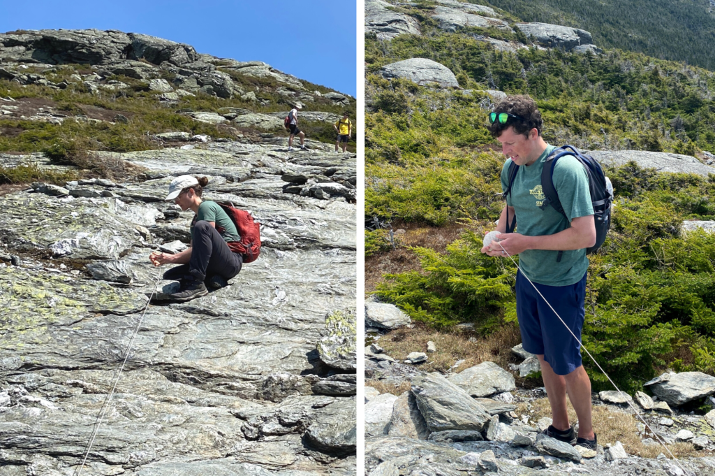
    GMC staff secure string along Sunset Ridge to mark the trail.
    GMC staff Mollie Flanigan (left) and Rick Dugan (right) secure string along Sunset Ridge to mark the trail to the top of Mt. Mansfield (2022). Photos by: Chloe Miller
    Stringing is a great pre-season tradition for our staff, especially since many of us are still working from home. We get to hang out with coworkers, learn about alpine ecology from GMC Field Supervisor Nigel Bates and Lead Caretaker Kate Songer, and prepare the trail for hiking season.

    How to Protect Alpine Plants

    Next time you’re in the alpine zone, note the string, and ensure you’re doing your part to remain on the trail and off the plants. Please remember these tips:
    • Do the “rock walk.” Remain on durable surfaces within the marked boundaries. If you do encounter vegetation on the trail, try to step over or around it.
    • Leash your dogs. Well-behaved dogs are welcome on the Long Trail System. However, they can’t recognize fragile vegetation, so they must remain leashed and close to your side in the alpine zone.
    • Please do not move rocks to build “cairns” or other structures. Rocks help secure the limited soil of the alpine zone, which plants need to take root.
    • Do not camp or build campfires in the alpine zone.

    This article originally appeared in the Summer 2022 edition of the Long Trail News under the title, “What’s that String?” 
  • How Trail Crews Fight Erosion

    Stone stairs at Sterling Pond help curb erosion on a fall line trail.
    Stone stairs on the Sterling Pond Trail help curb erosion. Photo courtesy: Angela Hilsman
    “Erosion is what causes all the problems on trail,” says Kevin Hart, GMC field supervisor of the Long Trail Patrol. “The main goal of trail crew is to stop erosion.” Kevin’s not talking about bear encounters or overflowing privies or litter in firepits when he says “problems.” He’s talking about trail degradation. You know what that looks like: those deep gullies in the middle of the trail; widened, vegetation-less areas; and exposed roots and rocks. So what is erosion and how does it cause trail degradation? Kevin explained to his trail crew before the hiking season began with a quick demo. Follow along, as Kevin does a second demonstration to explain why erosion is a problem, why it’ll never go away, and how trail crews like the Long Trail Patrol upkeep and create sustainable trails.

    What is erosion?

    Erosion is the process of earthen materials (like soil and rock) being worn down and transported by natural forces such as wind, flowing water, or glacial ice. National Geographic has a great explainer here. “Erosion is always happening, but it’s happening so slowly that you can’t usually see it,” says Kevin.The exceptions are big storms and flash flooding, where a lot of water moves materials very quickly. As climate change increases the frequency and intensity of rain events, these will further expedite trail erosion. Looking into the next decade, climate change related storms are one of GMC’s biggest challenges.

    If erosion is normal, why is it a problem?

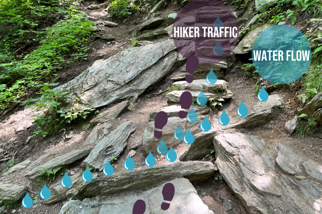
    Erosion can be particularly problematic around Vermont’s trail system because the Long Trail was built over a hundred years ago, long before sustainability was a consideration, says Kevin. “So many of our trails follow what’s called the fall line.” A fall line is the path that follows a mountain most directly downhill, he explains. And because it offers the least resistance, it’s also where water gathers. (Compare it to a switchback, or a trail that zigzags up the steep terrain instead of mimicking the slope.) “As the water channels along the fall line, it picks up speed, has more power, and causes more erosion,” explains Kevin. This exacerbates the wear-and-tear along Vermont’s Long Trail. Comparatively, when there is a switchback trail, the runoff water moves downhill in “sheets,” says Kevin. (Imagine flat and evenly dispersed.) Some of the water is absorbed into the relatively horizontal switchback trails, compared to funneling down the more vertical fall-line trails.

    How do trail crews stop this?

    Stone stairs and waterbars prevent erosion.
    Stone stairs and waterbars prevent soil erosion.
    “You can’t reverse erosion, but you can stop erosion on existing trails or build sustainable trails,” says Kevin. To stop water erosion, trail crews mainly use two methods: waterbars and stone stairs.

    #1. The Waterbar

    You’ve stepped over waterbars on trail: they’re the narrow drainage channels — usually fortified with rocks — that divert water off trail and into the forest. “[The water] ends up dispersing into the woods. It’s no longer stuck in a gullied path,” says Kevin. Trail crews and volunteers regularly clear waterbars of leaves and other debris to keep them working efficiently. Waterbars prevent water from following the fall line and lead the runoff to be absorbed by surrounding vegetation.

    #2. The Stone Stairs

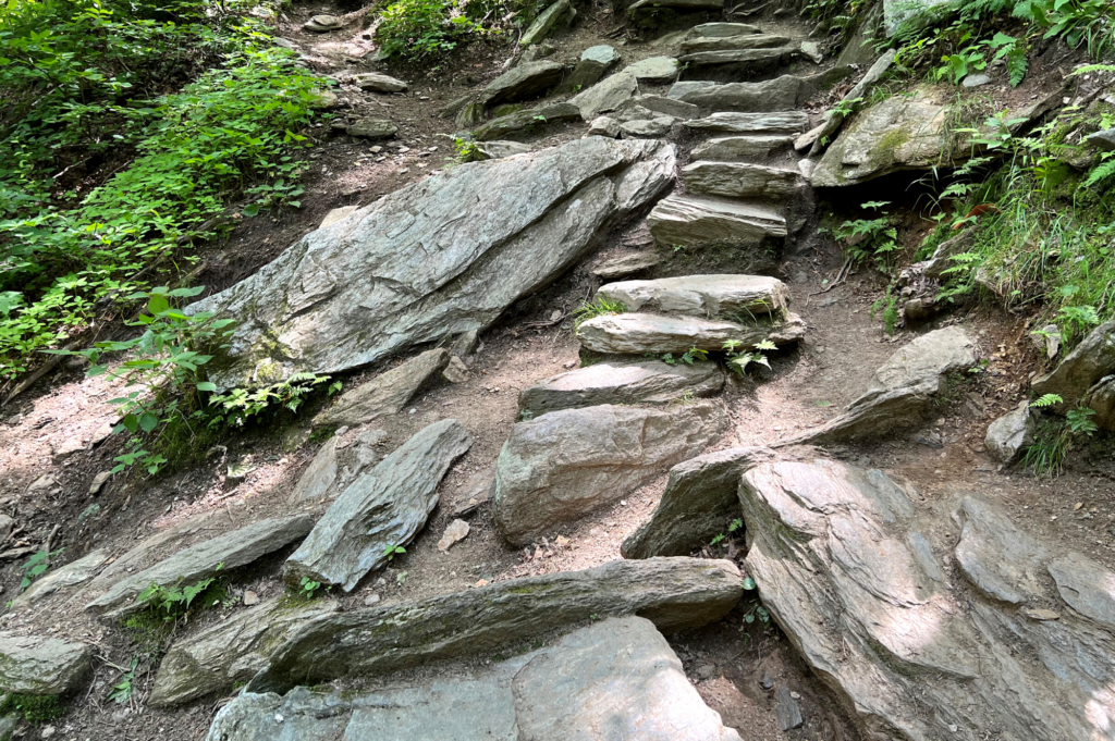
    Rock stairs, which take the form of checksteps and stone staircases, create a durable surface. “Stone stairs are more resistant to erosion than dirt,” explains Kevin. “Water flows over the rock and essentially protects the trail surface. It keeps the gully [that exists] from deepening.” Stone steps have another benefit, says Kevin. Because they confine traffic to a durable surface, they prevent plants from getting trampled and encourage vegetation to return around the trail. Roots help anchor the soil in place, slowing erosion. These types of structures exist all over the Long Trail System; spot them on Stratton Mountain, the Sunset Ridge Trail up Mansfield, and the Monroe Trail to Camel’s Hump, says Kevin.

    Why can’t we reroute the trail to a more sustainable location?

    “A reroute is ideal, but it’s not as practical as it could be,” says Kevin. Sometimes barriers, such as private land or a ledge, prevent crews from moving the trail, he explains. More commonly, there’s not enough resources to reroute a trail.

    How can trail users help curb erosion?

    The best thing you can do as a trail user is to stick to the trail. Hiking around steep staircases, tree roots, mud puddles, and other trail features widens the path and increases trail erosion. The problem with a widened trail is twofold:
    1. Hikers disturb and kill off vegetation. Plant roots help anchor the soil in place, and without them, the soil becomes loose and easily picked up by runoff.
    2. Increased foot traffic compacts the soil, removing air pockets that water would normally seep into. When the rain and snowmelt cannot seep into the ground, it continues along the surface, picking up sediments as it goes.
    You’ll notice some of these issues on popular trails, like the Burrows Trail to the Camel’s Hump summit (which is currently getting a revamp). This steep, challenging trail tempts hikers to create their own routes; in doing so, trail users have widened the trail in areas. In doing so, water now has multiple paths to travel downhill, instead of the intended, durable path that trail crews designed.
  • How to Get Started Backpacking

    Backpacking 101 by end-to-ender Ben Benson
    Get inspired to try backpacking by end-to-enders like Ben Bensen. Photo courtesy: Ben Bensen
    Interested in backpacking (or inspired by this year’s 481 End-to-Enders)? Getting started can be intimidating but once you get going, it’ll quickly become second nature. Here’s what you need to know about backpacking as you get started. Have questions? Email our experts  or stop by the Marvin B. Gameroff Hiker Information Center in Waterbury.

    Clothes & Gear

    You don’t have to spend a ton of money, but quality gear that fits well will make a big difference in your comfort. Your pack should fit your body (try on several at an outdoor retailer) and hold all your gear (45-65 liter capacity). Pack strategically so the weight in your pack is distributed evenly and isn’t pulling on your shoulders or back. Weight should sit on your hips. As for clothing, avoid cotton on all but the sunniest and driest of day-hikes. Beyond that, follow the WISE synonym, carrying at minimum:
    • Wicking (quick-dry base layer)
    • Insulating (warm mid-layer)
    • Shell (water- and wind-proof outer layer)
    • Extra (down jacket, hat, gloves, socks)
    Wear sturdy hiking boots or shoes and feel confident in their fit before setting out on a full trip. Dry, wool socks are your best friend. Keep tabs on tender hotspots, which turn into blisters and can quickly ruin a hiking trip.

    Backpacking 101: Get Started Outside

    • Get comfortable day hiking with a backpack
    • Build core strength to improve balance and handle a heavy pack
    • Increase distance, pack weight, and challenge
    • Do a one-night overnight in the backyard or a short hike distance to test gear and skills. Try one of these overnight hikes.
    • Stay injury free with stretching, yoga, and strength training

    Sleeping on Trail

    There are lean-tos, shelters, and tent sites throughout the Long Trail System and New England. Use a guidebook and map to plan your overnight stopovers, and consider having a backup if you don’t hike as far as you expect. During peak summer and fall months, you’ll likely be sharing shelter space with others; tents provide privacy and are a good backup in case shelters are full. You’ll also want a warm sleeping bag and a sleeping pad for both comfort and warmth. Don’t be surprised if it takes some practice to get used to the new environment and sleep soundly. Ear plugs can help. Designated overnight sites also have a water source and privy. Specifics vary, so plan ahead using the guidebook and follow signage or caretaker direction at the site.

    Wildlife & Food Storage

    We’re guests in the woods, and animals like our food. If we don’t properly store it, we risk exposing them to our food which is harmful for both wildlife and humans. Store food and all other smellables in a bear canister (the most foolproof method) or Ursack; use a GMC-provided bear box (at some shelters but not all), or throw a properly hung bear bag (nigh impossible at some LT overnight sites). You can borrow a bear canister from the GMC for free.

    Backpacking Foods

    As for what to eat, you can go as simple or as fancy with it as you want. Dehydrated or freeze-dried meals such as Backpackers Pantry or Good To-Go are quick and nutritious and require only boiling water. Find them at any outdoor retailer. With a little research and frontcountry preparation, you can also enjoy simple yet delicious made from scratch meals. Depending on the length of your trip, additions like preserved meat and cheese will up the satiety level and will last unrefrigerated for a few days. Carry plenty of calorie-dense snacks like protein bars, candy, jerky, and trail mix. Repackage food from original containers into Ziploc bags, which are lightweight, durable and packable.

    Water Safety

    You need a lot of water on a backpacking trip, both for drinking and cooking. You will find places to refill your water on the trail, but it needs to be treated to avoid infection and illness before using it for drinking or cooking. Use a Sawyer Squeeze or similar filter, iodine tablets, or boil water before drinking. It’s a good idea to always have a chemical backup in case your filter breaks or falls in a river. Look for clear, running water and fill up whenever you have the opportunity, as you don’t always know what the water source quality will be up ahead.

    Backcountry Emergencies

    You are responsible for being prepared for emergency situations. Some simple precautions can help empower you to address your situation when plans go awry. Attend a Wilderness First Aid Class, carry appropriate equipment and gear, and leave your itinerary with at least two reliable contacts. The most common potential emergency situations are minor-to-moderate injuries, weather conditions, and finding yourself hiking in the dark unexpectedly. In the event of an emergency, stay calm, make a plan, and keep yourself safe. Cell phones or satellite beacons are good to have, but you should always have a backup in case your technology fails.
    This article originally appeared in the Summer 2022 edition of the Long Trail News under the title “Backpacking 101.”
  • Everything to Know About Hiking with Kids

    hiking with kids - two toddlers on trail
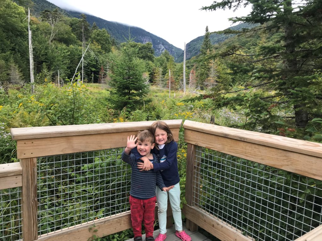
    The Barnes Camp boardwalk and other accessible trails are perfect starters to hiking with kids. Photo courtesy: Alicia DiCocco
    Hiking with kids is intimidating. There are more needs to anticipate and plan for. You will carry more. There’s new gear to navigate. We get it. Keep reading to get the whole family outside and hiking.

    How to Start Hiking

    How to hike with kiddos depends greatly on their age and abilities. Infants can generally be carried, but they go through so many developmental changes during the first year that you’re constantly transitioning gear, attire, and your routine. Plus, there’s a lot of diapers to pack out of the backcountry. With toddlers, the challenge is keeping them engaged. (Pro tip: snacks are always the right answer.) There are additional safety concerns, and you want terrain that is fun and encourages them to keep going. Older kids still have to be engaged, but there’s more wiggle room with their growing stamina. For tips on how to prep for any age group, read How to Hike with Infants, Toddlers, & Kids. Ready for the next steps? Try:

    Where to Hike

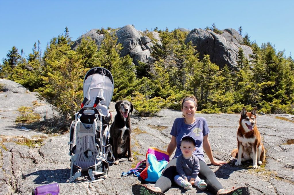
    mom, toddler, dogs, and backpacks sit on the rocks at the top of a hike
    GMC staffer Amy Potter, her son Quinn, and her two dogs. Photo courtesy: Amy Potter
    Knowing your child’s ability level is the first step to choosing an appropriate trail. These kid-friendly trails are easy enough for even the smallest of hikers and have interesting features like a gnome home:
    1. Wiessner Woods, Stowe: 1.84 miles; 135′ elevation gain; and a gnome home.
    2. Short Trail, Waterbury Center: .7 miles roundtrip; 54′ elevation gain.
    3. Beane Trail, Huntington: 2.8 miles roundtrip; ~600′ elevation gain.
    4. Appalachian Trail to Kent Pond, Killington: 1.2 miles roundtrip; < 20′ elevation gain.
    5. Long Trail to Little Rock Pond, Mount Tabor: 4 miles roundtrip; 324′ elevation gain.
    Also check out these five short walks with big views and family foliage hikes (by age group). This list of accessible trails includes smoother, gently graded trails around the state. These Vermont farm walks can bring a new perspective to the outdoors, or find a state park for fishing, boating, swimming, camping and more.

    How to Keep Kids Engaged in the Outdoors

    This is the real trick: engaging kiddos with the outdoors in a way that’s meaningful to them. That will help them learn about outdoor settings, appropriately challenge themselves, and keep coming back. Here are some activities to try:

    Family Hiking Inspiration

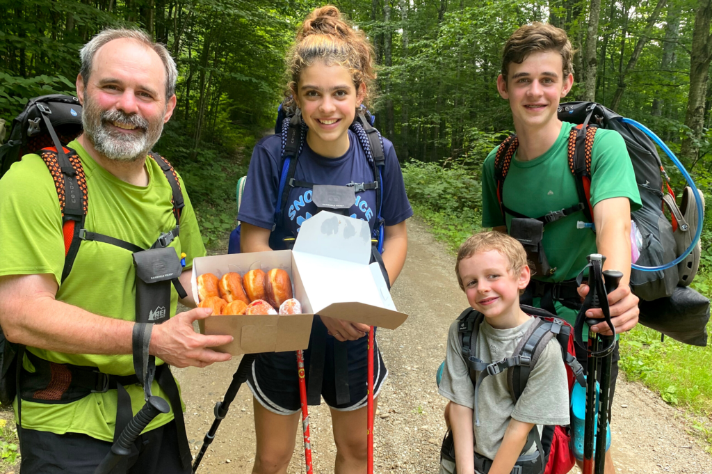
    Matt, Ruth, Joe, and Charlie Krebs with donuts on Long Trail.
    Left-right: Matt, Ruth, Joe, and Charlie Krebs with donuts on Long Trail. Photo courtesy: Matt Krebs
    Like we said, hiking with kiddos can be intimidating. The best you can do is to get started and learn along the way. Follow these grown-ups and read their stories for encouragement:
  • Citizen Science Projects on the Long Trail and Beyond

    Spring is an excellent time to explore the natural world around us and celebrate plants and animals emerging again. But did you know your casual observations can contribute to scientific research projects all over the world? Citizen science refers to the public’s collaboration and participation in professional science projects, especially in the natural world. The most successful projects include data collection or analysis that require minimal training, and can be replicated on a large scale with lots of citizen participants.  
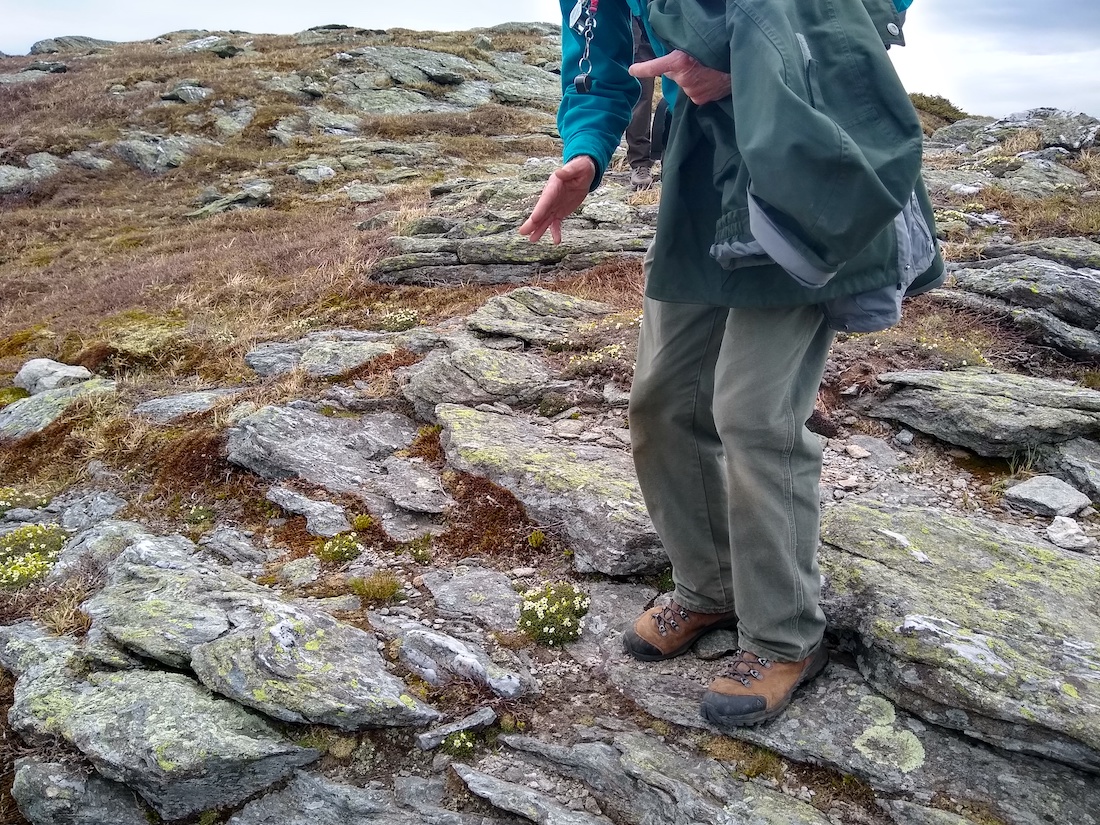
    person gestures to plants on rocky summit
    State Botanist Bob Popp Observes Diapensia on Mt. Mansfield, by Angie Hilsman
    Check out the below citizen science observation projects, both global and local, and consider how your next outdoor adventure might contribute to scientific research!  Spring is also the time of mud season in Vermont, which means we avoid high-elevation trails in Vermont in favor of drier, more durable surfaces. Please keep mud season guidance in mind and start your citizen science journey in your own backyard!

    Global Citizen Science Projects 

    INaturalist inaturalist.org and iNaturalist app  This global observation database welcomes your sightings of mammals, birds, fish, insects, plants, fungi, anything living you can think of. The site connects you, the citizen scientist, to millions of naturalists and identifiers to help name and catalog your findings. There’s even a computer-based tool that will automatically identify your photo, though it’s not 100% accurate.   eBird eBird.org and eBird app 
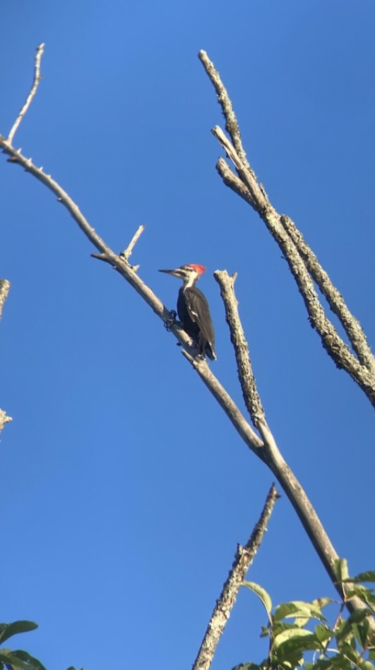
    woodpecker
    Nigel Bates spotted this Pileated Woodpecker at GMC Headquarters in Waterbury Center.
    eBird is an effort from the Cornell Center for Ornithology that helps birders collaborate on sightings to help inform conservation and education. Birders create or use checklists and record when, where, and how they saw or heard birds, then share those observations with the world. It allows scientists to track bird’s migration patterns on a global scale, in real time. Rare species sightings require photographic documentation and are checked by a group of experts. If you’re ever at the GMC headquarters in Waterbury Center, you can join and contribute to the GMC Headquarters HotSpot!   EButterfly ebutterfly.org only 
    yellow butterfly
    Swallowtail butterfly by Michelle Tatum
    Sponsored by the Vermont Center for EcoStudies, this international data-driven project requires photos and another community member to confirm your butterfly identifications. It’s a much smaller community than eBird or iNaturalist, but the observations help achieve the same goals of tracking butterfly biodiversity and changes over time.  Community Snow Observations and Mountain Rain or Snow, via NASA Mountain Hub app; rainorsnow.org  There may be a few more weeks this spring to contribute observations of snow depth and precipitation. The Community Snow Observations uses the Mountain Hub app and asks citizen scientists to measure snowpack using an avalanche probe. Mountain Rain or Snow asks observers to record the type of precipitation that falls and at what temperature to help gather data about mountain weather patterns.  
    Localized Citizen Science Projects 

    You can get involved in citizen science right in the Green Mountains, alongside Green Mountain Club caretakers, volunteers, and partners.   Loonwatch from the Vermont Center for Ecostudies
    loon on stratton pond
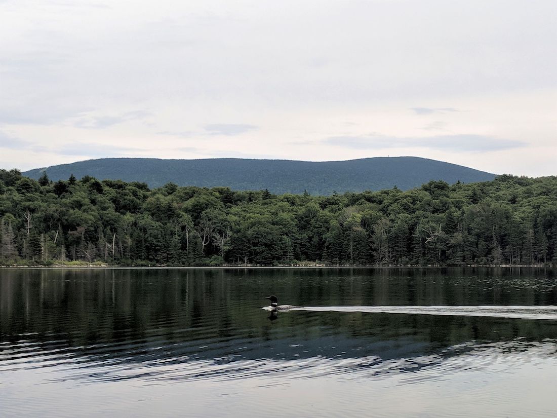
    Loon on Stratton Pond by John Plummer
    On the third Saturday in July (July 17, 2022) Vermonters fan out across the state to document and track breeding loons. GMC’s caretakers at Little Rock Pond and Stratton Pond keep an eye out for the majestic birds throughout the field season, and you can sign up for the Adopt a Lake program to track loon activity in the summer.   Peregrine Falcon Monitoring and Management Project from Audubon Vermont
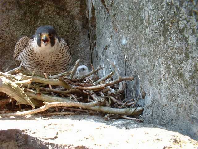
    Peregrine Falcon, chick, nest on ledge
    Peregrine falcon and nest. Photo by: Paul Cormier
    Starting in very early spring, peregrine falcons return to their cliffside nests to lay eggs and raise fledglings. The peregrine falcon was labeled endangered in the 80s and 90s, but conservation efforts have allowed the population to recover. However, their continued success depends on careful monitoring and protection of their nests. Falcons will abandon their nests if disturbed, so GMC joins other outdoor organizations in Vermont to close trails near nesting sites and educate the public about protecting this bird population. Contact Margaret Fowle to adopt a nesting site and start monitoring.  Northeast Alpine Flower Watch, via iNaturalist 
    GMC caretakers walk up Mansfield ridgeline, stay on rocks
    GMC caretakers continue their alpine ID training along the Mansfield ridgeline. Photo by: Angela Hilsman
    This initiative is a partnership with GMC, the Adirondack Mountain Club, Appalachian Mountain Club, and Baxter State Park in Maine. It invites citizen scientists to photograph and record the phenology (timing of biological events such as flowers blooming) of fragile and delicate alpine plants. You can take part in the flower watch on your next hike to the top of Mt. Mansfield, Camel’s Hump, or Mt. Abe — just remember to observe from a distance and stay on the rocks!  Amphibian Road Crossing Program with the North Branch Nature Center 
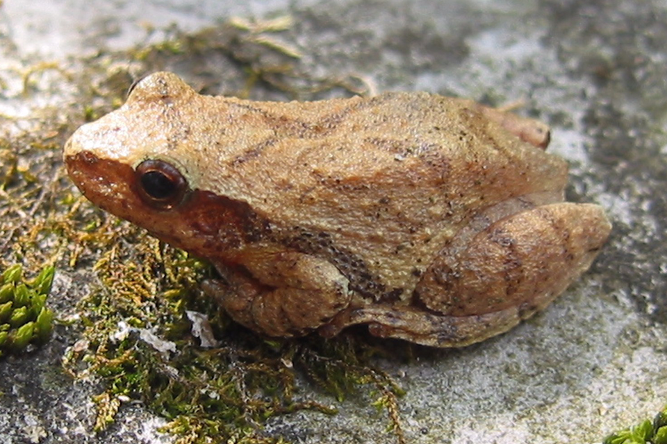
    Spring Peeper calls are a telltale of spring because they're looking for mates.
    Spring Peeper. Photo courtesy: Vermont Reptile & Amphibian Atlas
    Amphibians, such as frogs, toads, newts, and salamanders, migrate from upland winter habitats to lowland wetlands each spring. They typically emerge on warm, wet nights and cross busy roads to access their breeding grounds. Citizen scientists can observe and report amphibian crossings near them, or even stand guard to ensure the creatures’ safety as they cross the road. North Branch Nature Center hosts other community-driven science projects throughout the year.  Readers, what other citizen scientist projects are you involved in that we missed? Comment below or send an email to telling us about your favorite citizen science projects. This article first appeared in the Spring 2022 Long Trail News and was written by Nigel Bates.
  • 8 Tips for Avoiding Search and Rescue Services

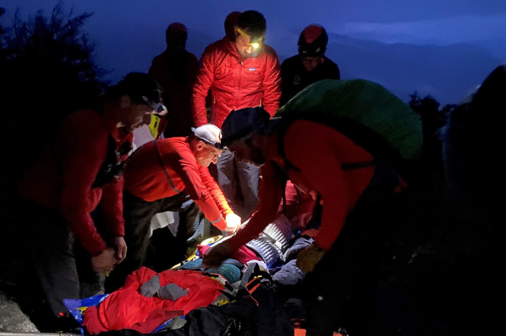
    Stowe Mountain Rescue members package the patient on Sunset Ridge.
    In this Search and Rescue mission, Stowe Mountain Rescue members prep the patient for evacuation. Photo courtesy: Underhill Jericho Fire Department

    There can be no denying that 2021 was been an active year for search and rescue (SAR) in Vermont. While no database provides exact numbers, there have been an estimated 25 percent more incidents than usual. A backcountry rescue can require more time and resources, so it’s important to know how to get yourself out of the forest when possible to avoid straining rescue personnel and supplies. This is all the more true in winter. Search and Rescue Coordinator Neil Van Dyke talks us through safety tips for avoiding emergency calls.

    This article appeared in the Winter 2021 edition of the Long Trail News under the headline “Search & Rescue Report.” See the full article (pages 14-15) for specific incident reports and insights.

    Tip #1: Carry enough equipment, food, and water

    Pack enough to be self sufficient for 12 to 24 hours. This includes extra layers of clothes, extra food and water, a headlamp, extra batteries (or an extra headlamp), and a map and the skill to use it. Make sure your phone is fully charged, and keep it on airplane mode to conserve its battery life unless you absolutely need it.

    [Related: 5 Tips for Avoiding Backcountry Emergencies]

    Tip #2: Tell someone where you are going

    Communicate where you are going and when you expect to be back with someone you trust. Keep your contact updated if your plans change, and let them know when your hike is complete.

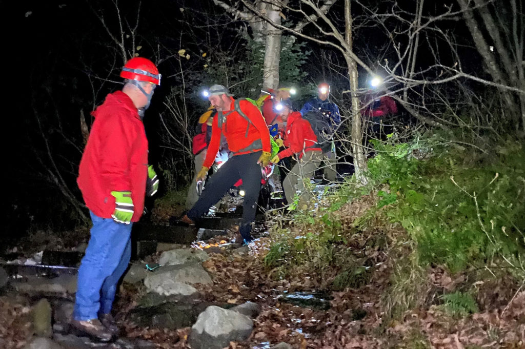
    A search and rescue mission took nearly 20 people and six hours to complete.
    A search and rescue mission on the Sunset Ridge Trail, Mt. Mansfield, took nearly 20 people and six hours to complete. Photo courtesy: Underhill Jericho Fire Department

    Tip #3: Research your trip

    Research ahead of your trip and make sure it is within your ability level. Allow plenty of time to finish before it gets dark. Don’t be afraid to turn back if conditions are not what you expect.

    GMC’s Long Trail Guide and Long Trail Map are excellent resources. Browse online for guidebooks and maps.

    Tip #4: Plan your hikes well before dark

    The sun sets early in winter, so a headlamp and extra clothes are a must on any hike. If you need a rescue, or even if your descent just takes longer than planned, you do not want to be stuck without light or warmth.

    Tip #5: Invest in a satellite communication device…

    It is very common for SAR to receive calls from loved ones who have not heard from a hiker who promised to call and check in. While SAR understands that this can be worrisome, a missed phone call alone is usually not enough to elicit an emergency response unless there are other risk factors. Remember that cell service is often poor in the backcountry.

    If checking in is truly important, hikers should consider buying a satellite communication device, which is generally more reliable than cell phone coverage.

    Tip #6: And know how to use your satellite device

    Users of satellite communication devices should be very familiar with their function to avoid inadvertent activation. Some models allow messages about the nature of an emergency. That can be very useful when used properly, and also can provide peace of mind for users and their loved ones.

    Tip #7: Consider your pet’s needs too

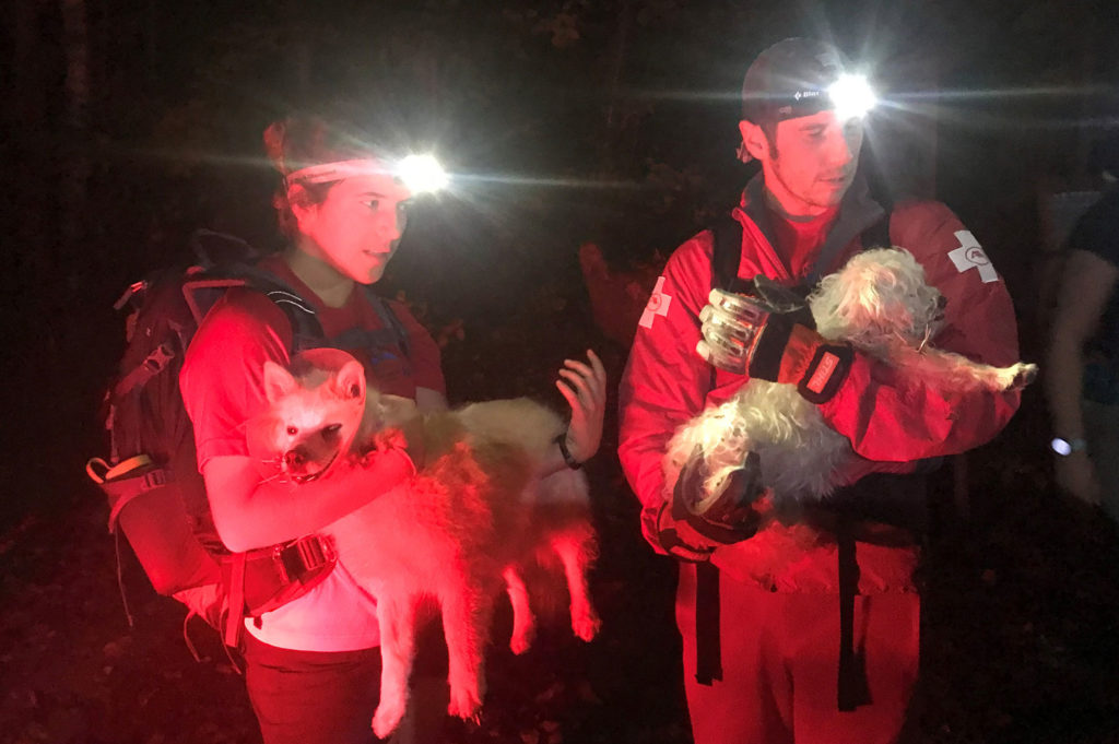
    Waterbury Backcountry Rescue Team members carry pups Lily and Luna down from Hunger Mountain. Photo courtesy: Waterbury Backcountry Rescue Team

    Hiking with dogs is enjoyable, but they are not immune to risk or injury. Not all SAR teams have the resources or knowledge for animal rescues.

    • Keep your dogs close and under voice command if very well-trained, or leashed if not.
    • Use extra caution after sunset, when porcupines and other wildlife are more
      active.
    • If your pets do have a run-in with a porcupine, seek veterinary care as soon as possible. Trying to remove quills yourself can cause further injury.
    • If you have to call for help, listen carefully to questions and provide as much information as you can. Be aware of your surroundings so SAR will know where to find you.

    [Related: Hiking the Long Trail with Your Dog]

    Tip #8: If lost, stay calm and stay put

    Take a break, consider your options, and make a plan, including calling SAR if service allows. Sometimes telephone coaching is enough to get hikers out of a tricky situation, and self-extricating by following directions saves valuable time and resources. Be prepared with emergency supplies like a headlamp and extra food, water, and clothing.


    Neil Van Dyke is the Search and Rescue Coordinator for the Vermont Department of Public Safety, and he has participated in and coordinated countless backcountry searches and hiker rescues. An avid hiker and longtime GMC member, he provides search and rescue training each spring to the club’s field staff.

    This article appeared in the Winter 2021 edition of the Long Trail News under the headline “Search & Rescue Report.” See the full article (pages 14-15) for more insight on avoiding a rescue.

  • 18 Recipes & Snacks to Try on Trail

    Organizing trail recipes and snacks for a thru-hike.
    Organizing trail recipes and snacks for a thru-hike. Photo courtesy: Royer family
    Arguably, food occupies the most brain space when it comes to backpacking trip planning. What will you eat on a multiday hike? How much should you pack? Fresh or dried? Hot food or stoveless? There’s so much to consider to appropriately fuel you while keeping pack weight low. And if you’ve ever planned a long-distance hike, you know food recommendations are sort of the same-old, same-old: tortillas, bagels, peanut butter, tuna packets, honey buns, ramen. Ugh, ramen. We revisited trail recipes to refresh and inspire the tent-side palate. (There’s so many great resources available! More below.) Check out these must-try menu items and comment with your own favorites.

    Ramen, Reimagined

    GMC Field Supervisor Kati Christoffel recommends mixing these ingredients for a one-pot dinner: ramen noodle soup, spicy tuna (from the packet), a handful of nuts and dried fruits, and peanut butter. “It sounds gross, but tastes so good in the backcountry,” she says. “When thru-hiking, I ate a lot of ‘ramen bombs,’ which are some combination of ramen, instant mashed potatoes, a tuna packet, and Knorr’s rice side,” says GMC Outreach & Field Coordinator John Plummer Committed to ramen? Try these four ramen revamps for a bit more spice.

    Stoveless Meals

    Facebook community member Margaret Daly recommends peanut butter and cheddar cheese sandwiches, while Kat Ellis suggests peanut butter and thick cut beef jerky on naan for “salty sweet deliciousness.” Tracy Sherbrook, another Facebook community member, loves a hummus wrap. “We used a dried hummus mix reconstituted, [which is] nice because you can make it thicker and more substantial. Add some of the sundried tomato oil, too. I even found some little packets of lemon juice to add. You can, of course, add other good stuff to your taste.” “Overnight oats are an effortless breakfast,” says GMC Communications Coordinator Angie Hilsman. Add oats, filtered water, and chia seeds to a sealed container at night. The chia and oats soak up the water without having to cook them. In the morning, stir in honey, raisins, and cinnamon –or whatever other flavors you enjoy.

    Worth the Extra Weight

    “A frying pan,” says GMC Executive Director Mike Debonis. “Modern camping pans don’t weigh very much and can greatly expand your backcountry cooking options.” Mike recommends this JetBoil Summit Skillet. Try Mike’s veggie burger bagel melt!
    • Use the frying pan to toast a halved bagel and to cook the burger. Assemble a single or double stack held together with cheddar cheese.
    • Add a little water to the pan to create steam and cover with a lid or plate. Cook the whole thing together until it’s warm and the cheese is melted.
    • Add generous amounts of Cholula hot sauce to season.

    Trail Snacks

    “My favorite after work snacks on crew [included] a big spoon of peanut butter hollowed out to support a puddle of syrup,” says now Field Supervisor Rosalie Sharp. She also enjoyed a slice of cheddar cheese with a raw garlic clove and hot sauce… cracker optional, she says. Looking for something a little less risky? Mike recommends moon cheese. “Crunchy cheese in a bag that never goes bad. What’s not to like?” he asks. Check out the 2021 field staff’s favorite trail snacks in last week’s blog. 

    Trail Beverages

    “I splurge on fancy hot cocoa when camping,” says Mike. “Spicy Aztec from Lake Champlain Chocolates is a favorite.” “I also always need a coffee in the morning,” says Visitor Center Manager Amy Potter. Her go-to? Starbucks instant coffee packets. We’re also really curious to try this Sherpa butter tea, made with black tea and ghee. Give it a try!

    Desserts

    While honey buns and chocolate bars could never get boring, it’s fun to mix up the routine with a hard-earned sweet. Show off your trail savvy: prep this rice pudding at home and enjoy it during a sunset view, or treat yourself to these chocolate mangoes after a hard climb.

    Accommodating a Dietary Need or Allergy

    The best thing about this lentil curry recipe is not that it’s vegan, but it’s a protein-packed, one-pot meal that’s perfect for backpacking. If you’re seeking a breakfast bar with a shelf life, try making your own! This vegan Barista bar recipe includes ¼ cup ground coffee, so you’ll be wired for the morning. Linda Hagstrom, a Facebook community member, adds an egg to the mix before baking. Try it out and let us know what you think! Prepping for an alternative diet or allergy can be tricky. Get recipes, ideas, and info on vegan backpacking here.

    With Maple

    Homemade gorp is a regular feature on trails, but style it like a Vermonter with this maple glazed trail mix recipe.

    More Resources