Winter hiking can be glorious, but intimidating to get started. Below, we answer your frequently asked questions about winter hiking.
What’s so great about hiking in the winter anyway?
Hikers choose to hike in winter for many reasons, whether it’s fewer people on the trails, the different views and experiences from summer and fall, no bugs, the mental health benefits of getting outside and connecting with nature, or the extra challenges that winter hiking poses.
What issues are the most important to consider in order to safely hike in the winter?
Factors including experience level, trail difficulty, weather conditions, elevation, and gear are all important to consider to have a fun and safe hike. Think about who you are hiking with and the overall experience level and preparedness of the group. Taking on a difficult hike alone as an inexperienced winter hiker can raise the risks of winter hiking exponentially.
Keep in mind that you will move more slowly in the winter than in summer. Snow and ice are harder to walk on, and navigation can be more difficult. So, a hike that takes you three hours in the summer may take up to twice as long in the winter. Keep that in mind when planning.
What should I know about navigating trails in winter? Is it harder to navigate trails in winter?
With snowfall, white or faded blazes can be more difficult to follow. Keep an eye out for cut branches on trees, the shape of the trail corridor, and blazes to distinguish the trail. Have a paper map and compass and knowledge of how to use both. Phones are not a reliable source of navigation because battery life doesn’t last as long in cold weather and cell service is spotty in the mountains.
What should I wear?
Dress in layers to stay dry and regulate your body temperature while hiking. It’s important to be able to shed layers to minimize sweat, which leads to cold, and to be able to add sufficient layers back on to stay warm. Opt for wool or synthetic fabrics that dry quickly and wick away sweat and avoid moisture-retaining fabrics like cotton.
Layers should include a base layer, mid layer, insulating outer layer, and a wind or rain-proof shell. Cover exposed skin with items like a neck warmer or buff, hat or headband, gloves or mittens. Pack an extra base layer, outer layer, and extra socks.
For footwear, wear waterproof hiking boots with appropriate traction footwear: MICROspikes, crampons, and/or snowshoes. Trekking poles can help provide traction and balance as well.
What should I pack and carry on me?
Bring a daypack with room for the following:
Extra wool socks, an extra insulating layer like a squishable puffy jacket
At least two liters of water. Use an insulated bottle or store your bottle in a sock to keep it from freezing! Don’t use reservoirs with a hose, which are more likely to freeze quickly
Plenty of snacks that won’t freeze! Use a thermos for soup, or hot cocoa
You can! Just be aware: cold weather drastically depletes battery life, and your phone can freeze or die quickly. Carry your phone close to your body in an inner pocket to keep it from freezing. You shouldn’t rely solely on your phone as a map and should conserve battery to be used to call for help in case of an emergency. Even then, cell service isn’t a given on trail.
How do you keep your water from freezing during a hike?
Lots of strategies here! Store your water bottle upside down, so that the water near the mouth is last to freeze. Store it inside a warm sock or insulated case. Fill it with hot or warm water to delay the time it takes to freeze. Store it in the interior of your backpack away from the edges. Avoid using a CamelBak or similar water bladder as the hose freezes easily. Also, take tea, hot chocolate, soup, or similar warm liquids in a thermos for unfrozen fuel and hydration.
How can I find out the trail conditions before I go?
Call the GMC visitor center for information about trail conditions. Hikers and club members frequently send in recent weather reports. Other sources of information include online local hiking forums (like GMC’s Long Trail hiking Facebook group) where often someone who has recently been to the area you’re interested in hiking and will know about the conditions. You can search each group for recent posts in your area of interest or post a call for information.
Other safety precautions?
Hike with an experienced partner if new to winter hiking. Give your entire hiking plan to 2 people, including departure time and expected return, route, gear carried, and any alternative routes and plans.
How can I find other people to hike with or gain experience from?
Join a GMC Section organized group hike, which are open to anyone but require pre-registration. On these hikes, you can meet other GMC members and experienced hikers and ask questions. You can also look at the Facebook groups for events and like-minded hikers, explore Meetup groups, and use local calendars like Seven Days and Front Porch Forum.
What resources are there to find hikes?
Visit GMC’s Winter Hiking or HikeVT pages for hike suggestions and information on trail difficulty levels and descriptions. If you prefer paper, pick up a copy of the Winter Hiking Guide from GMC’s store.
How can I plan for winter hiking with kids?
Looking to include kids in your winter adventures? Check out GMC’s recommended family-friendly and accessible trails. Try different learning activities and identification apps to make hikes even more engaging and fun. If winter hiking with babies or toddlers, make sure they’re warm and dressed in layers – a general rule of thumb is to dress them in one more layer than you feel comfortable in. Other pieces of advice are to start small, be flexible, and pack plenty of water and snacks!
Other related blog posts about winter hiking and hiking FAQs:
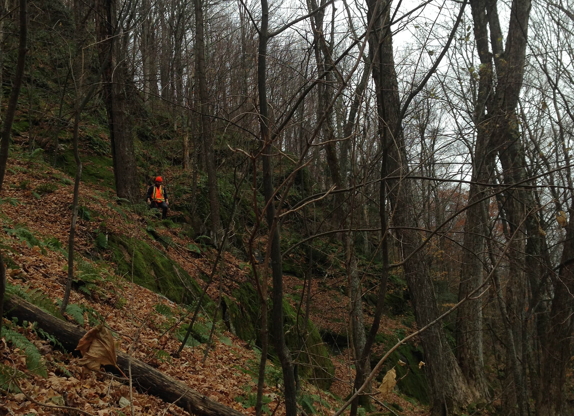
September 1st marks the start of Early Black Bear Season in Vermont, followed by many other hunting seasons throughout the fall. Hunting is allowed on all GMC owned and managed lands, including along the Long Trail and Appalachian Trail corridors in Vermont. Please be safe when you are hiking and be respectful of all trail users. The Green Mountain Club strongly encourages hikers to:
Wear blaze orange clothing, visible from both the front and back.
Avoid wearing brown or white, the colors of a deer.
Be especially careful while hiking in valleys and near roads and trailheads.
Avoid hiking during dawn and dusk due to low visibility.
Please leave dogs at home. If you do bring a furry friend, dress your dog with bright bandanas or a blaze orange vest.
Wave and talk to make your presence known to hunters.
Stick to well-populated trails where hunters are likely to avoid.
This is a wonderful time of year to go hiking in Vermont. It’s also a good time to refresh your safety awareness with regard to hunting season and general preparedness. A prepared hiker is a happy hiker! Have fun out there!
Check out Vermont Fish and Wildlife for more information about where, when, and how hunting is permitted in Vermont.
Where should I hike during hunting season?
Stick to the guidelines above. For some general recommendations, try:
Prospect Rock via the Long Trail, Johnson – MODERATE Wiessner Woods, Stowe – EASY (hunting is prohibited) Camel’s Hump Summit via Burrows Trail Loop, Huntington – MODERATELY DIFFICULT Thundering Falls, Killington — ACCESSIBLE Bromley Mountain, Winhall — MODERATE
Please note that with the exception of Wiessner Woods, hunting is permitted on these lands.
The Barnes Camp boardwalk and other accessible trails are perfect starters to hiking with kids. Photo courtesy: Alicia DiCocco
Hiking with kids is intimidating. There are more needs to anticipate and plan for. You will carry more. There’s new gear to navigate. We get it. Keep reading to get the whole family outside and hiking.
How to Start Hiking
How to hike with kiddos depends greatly on their age and abilities. Infants can generally be carried, but they go through so many developmental changes during the first year that you’re constantly transitioning gear, attire, and your routine. Plus, there’s a lot of diapers to pack out of the backcountry.
With toddlers, the challenge is keeping them engaged. (Pro tip: snacks are always the right answer.) There are additional safety concerns, and you want terrain that is fun and encourages them to keep going.
Older kids still have to be engaged, but there’s more wiggle room with their growing stamina. For tips on how to prep for any age group, read How to Hike with Infants, Toddlers, & Kids.
Ready for the next steps? Try:
GMC staffer Amy Potter, her son Quinn, and her two dogs. Photo courtesy: Amy Potter
Knowing your child’s ability level is the first step to choosing an appropriate trail. These kid-friendly trails are easy enough for even the smallest of hikers and have interesting features like a gnome home:
Wiessner Woods, Stowe: 1.84 miles; 135′ elevation gain; and a gnome home.
Short Trail, Waterbury Center: .7 miles roundtrip; 54′ elevation gain.
Beane Trail, Huntington: 2.8 miles roundtrip; ~600′ elevation gain.
Appalachian Trail to Kent Pond, Killington: 1.2 miles roundtrip; < 20′ elevation gain.
Long Trail to Little Rock Pond, Mount Tabor: 4 miles roundtrip; 324′ elevation gain.
This is the real trick: engaging kiddos with the outdoors in a way that’s meaningful to them. That will help them learn about outdoor settings, appropriately challenge themselves, and keep coming back. Here are some activities to try:
Use apps to learn about the world around you. PeakVisor identifies the surrounding mountains; SkyGuide identifies constellations; and Seek by iNaturalist identifies wildlife, plants, and fungi.
Left-right: Matt, Ruth, Joe, and Charlie Krebs with donuts on Long Trail. Photo courtesy: Matt Krebs
Like we said, hiking with kiddos can be intimidating. The best you can do is to get started and learn along the way. Follow these grown-ups and read their stories for encouragement:
Try the Vermont Fire Tower Challenge or the NEK 20 list. Pictured: view from Bald Mt. Photo courtesy: Cindy Griffith
Cindy Griffith and Ira Sollace are list people. They tackle lists of peaks and trails to reach places they’ve never even heard of, like Cow Mountain. Cindy recently found that one on the NorthWoods Stewardship Center’s list of mountains in the Northeast Kingdom region of Vermont. The couple completed the NEK 20 in October of 2021.
Are you a list person?
Feeling inspired by Cindy and Ira’s accomplishment? Whether you’re looking to explore the peaks of the Northeast Kingdom or you’re wondering what else is around, check out the following lists and more at 4000footers.com to start planning your summer adventures.
Please note: trails above 2,500′ should be avoided until after mud season in late May. If you encounter muddy trails, please turn around and choose a dryer trail; if you cannot turn around, walk through the mud instead of around it.Vermont
Mikaela Osler, 2021 Fastest Known Time (FKT) record holder. Photos courtesy: Mikaela Osler
Inside the Mind of Mikaela Osler, FKT Record Holder
When I finally removed my socks, at the end of a 20-hour hiking day, my feet were a waxy grey-white. My skin was grotesquely wrinkled and loose at the heels. When I ran my thumb across my sole I felt a jolting, ticklish sensation I later learned meant I had nerve damage.
It was 12:30 in the morning. I was at the Rolston Rest shelter in the middle of an attempt at an FKT, or Fastest Known Time, on the Long Trail, and I had trench foot.
It’s easy to describe the proximate causes of the trench foot: by then, it had been raining for nearly 24 hours. I’d been hiking since 3 am the day before, when I awoke from a three-hour nap, packed by headlamp in the rain, and started walking. Obsessing over miles, I hadn’t allowed myself breaks to dry out.
But as I sat in the shelter, fog swirling outside, I wasn’t thinking about proximate causes. I was thinking of quitting, and wondering why I was hiking in the middle of the night in the rain in the first place. Why was I trying to hike the Long Trail in six days? What on earth had possessed me to try for a speed record?
What are the FKT Basics?
FKTs are verified through GPS recordings and trip reports and are published on fastestknowntime.com, which grew out of a humble internet forum started in the early 2000s.
There are three types of FKT: unsupported, self-supported, and supported. On an unsupported FKT, the athlete carries from start to finish all the food and supplies they’ll need for the attempt. Self-supported FKTs are similar to other thru-hikes: athletes may cache, mail, or buy supplies; and may accept trail magic or favors from strangers, but they don’t pre-arrange aid and they never get into vehicles, even to hitchhike. Supported athletes can have any help they can imagine, short of somebody carrying them down the trail.
These guidelines are inflexible. Last year, Joe “Stringbean” McConnaughy completed the LT unsupported in under five days, breaking the previous record by over 24 hours. However, in a sleep-deprived, dehydrated delirium he accepted a sip of water when another hiker offered. So, his hike is recorded as self-supported.
The sport has recently exploded in popularity; 2020 saw a 350% increase in FKT submissions on the site over 2019. The Long Trail is no exception. At least 12 attempts, including mine, have been made on the LT FKT in 2021. Although I haven’t found anybody who has a definitive count of attempts in previous years, most people I’ve asked have estimated it to be in the low single digits—three, four, maybe five.
Turning the LT into a race track?
“Can we please stop celebrating these things?” reads a comment under the GMC’s Instagram post about my Long Trail FKT. “It’s not in the spirit of the Long Trail to turn in (sic) into a race track or an ego filled competition. It sickens and saddens me.”
In other words, not everybody is happy about the growing popularity of FKTs. I’ve gotten similar criticism before, and usually my reaction is righteous anger: hike your own hike, dude! But if I’m being honest, the criticism bothers me because it’s a little bit true. Publicly attempting to be one of the fastest people in the world absolutely involves ego. I’d love to say that I was on the trail purely for personal challenge, but as I sat at Rolston Rest Shelter considering my wrecked feet, I was thinking a lot about how other people perceived my hike. I had wanted to quit before, but didn’t have a good reason. Now, I could post the nasty photos and nobody would blame me for bailing. I could go home and rest with my vanity intact.
But the next morning I awoke urgently needing to use the privy. I leapt from the shelter. I was halfway there before I realized I was able to walk.
Oh no, I thought. I still had the option to quit without shame, but I couldn’t leave the trail knowing I hadn’t given it my full effort.
Something other than ego was driving me, but I’m still puzzled by what. Luckily, I know a lot of people who’ve attempted Long Trail FKTs, and I reached out to them to help me work it out. Why do we do this? Is it really all about vanity?
Ben Feinson, who recently broke the supported record, rephrased my question: “Is it possible to connect to the rhythms of nature and the flow of the trail while simultaneously struggling physically and pushing yourself to the limit?” The answer seems to be yes. Most people I talked to spontaneously told stories of transcendent experiences in nature. Ben remembers sobbing as he ran across Mount Mansfield. RJ Thompson, who made unsupported attempts in 2021 and 2011, talked about hiking the Monroe Skyline at sunset, the shadows playing tricks on his eyes. Joe McCounaghy recalled being on Camel’s Hump at midnight in 40-mile-per-hour winds. Nika Meyers, whose unsupported record I was attempting to break, remembers connecting to the tiniest details of the trail: “I think less about huge views and vistas than tiny trickles across the trail, these micro-landscapes…I feel so small on an FKT. I’m part of this big picture and I can relate to so many things. I can see the connection between this root and this rock.”
FKT attempts also offer the opportunity to connect to your body and mind. It’s human nature to forget pain, and when I asked people about it they often struggled to articulate the appeal of such a physically intense experience. Instead, they spoke of the mental state their FKTs unlocked. An FKT requires immense focus and awareness. It can feel strangely freeing to subsume yourself to such an extreme goal. And sleep deprivation, hunger, and prolonged solitude can produce bizarre mental experiences. Jeremy Howard, who attempted the unsupported record this year, told me about an hours-long out-of-body that he describes as “the most tranquil and peaceful I’ve ever been in my entire life.” On the last night of my FKT, Nika texted me the story of a conversation she had with a newt on the last night of hers.
A Sacred Trail
Everyone I talked to felt a profound connection to the Long Trail. Many of us consider Vermont our home, or one of our homes. Nika worked for the GMC for years before her FKT and talked about how her hike allowed her to connect with people and places that had been “incredibly transformative” in her life, including some who had passed away. Joe, who got married in Vermont, did his FKT attempt shortly before moving from Boston to the West Coast in the middle of the pandemic. Many called the LT “perfect.”
I know of a few people who’ve attempted Long Trail FKTs without setting foot on the trail in advance, and most failed. The athletes I talked to had spent countless days and weeks hiking, running, camping, and working on the LT, and see a speed attempt as one among many equally valid ways of experiencing the trail. Ben said, “Everyone is allowed to have the experience that is meaningful to them, in life, and especially on a trail as sacred as the Long Trail.”
Like my fellow speed demons, my connections to the trail go much deeper than an FKT attempt. I grew up in Vermont. My first hikes in preschool and kindergarten were to Butler and Taylor Lodges. My home looks out on the Bolton Mountain ridgeline; the Long Trail traverses the horizon of my childhood world. I chose to attempt an FKT to challenge myself, and yes, I even chose to do it a little bit out of vanity, but mostly I wanted to deepen the connection I already felt to the Green Mountains. I wanted to access that ineffable mental state that comes with extreme exertion while immersed in a landscape that has always nurtured me. For me, the Long Trail could never just be a race track.
The morning before I got trench foot, I reached an outcropping at a pause in the showers and looked out across the Green Mountains. Wisps of fog were rising from the valleys. The sky was a flat mass of clouds except for one perfect, tiny circle of sun. The glacier-carved ridges, the lush green forest, the schist under my feet worn smooth by generations of hikers: the view elicited something deep within me, a profound recognition and comfort. I was home.
At Rolston Rest, sleep deprived and starving, my feet a mess, I thought of that view, of how special it was to be there when everybody else was still asleep. I thought of how much I had left to learn about my body and mind, how much the Long Trail still had to teach me. Like any other Long Trail user, I made the choice that was meaningful to me at the time. I kept hiking.
Mikaela finished the LT in 6 days, 11 hours, and 33 minutes, setting a new women’s unsupported record. She is originally from Jericho, and now lives in Albuquerque, New Mexico where she is working on a memoir.This post was written by Mikaela Osler. It appeared in the Winter 2021 edition of the Long Trail News under the headline “The Long Trail in Less Than a Week: Inside the Mindset of a Fastest Known Time Record Holder.”
Sue Johnston at the Long Trail’s Southern Terminus in winter. Photo courtesy: Sue Johnston
Sue Johnston and her husband, Chris Scott, park at the Route 9 trailhead in Bennington. No hikers greet them, nor do they expect any to at 3 a.m. on a March morning. Chris says his goodbyes as Sue slips into socks, boots, and Microspikes. She heads northbound up the Long Trail carrying enough gear for an emergency overnight, two liters of water, snacks, a GPS tracker on her phone, a charger, a map and compass, and snowshoes. After all, a 22.6-mile hike awaits her if she is to complete the last section of her winter end-to-end hike along the Long Trail. Chris will meet her at the finish line.
That day — March 8, 2021 — marks Sue’s 25th nonconsecutive day and third season working toward the goal of completing all 272 miles in winter. It’s also her fourth attempt; in December 2013, she set off from Journey’s End Road but retreated due to deep snow and an indiscernible trail. In 2014, she made two more attempts with the same results.
“I wasn’t accustomed to ‘failing’ that much,’” says Sue, already an accomplished hiker and mountaineer with nearly 30 years of winter hiking experience. “I could’ve bushwhacked, but I wanted to be on the LT proper as much as possible. It was a wake-up call to get my act together and get a GPS tracker.”
Long Trail’s northern terminus at Journey’s End. Photo courtesy: Sue Johnston
So, in summer 2017, Sue tracked the length of the Long Trail herself via her fifth LT thru-hike. And on her 53rd birthday — December 23, 2018 — she again started southbound from Journey’s End. “I finally made it from North Jay Pass to Jay Pass, convinced that maybe, just maybe, this was doable after all,” she wrote on her blog, RunSueRun.
Now 55 and sensing the finish line, Sue climbs the dark, steep 1.6 miles to Melville Nauheim Shelter before switching into snowshoes. She eyes the handwarmers in her pack, which she carries to ease the pain of her Raynaud’s disease — a condition that causes your blood vessels to overreact and limit blood supply in your hands and feet when exposed to cold or stress. Deciding against it, she continues; she has 21 more miles to go before reaching Kelley Stand Road in Stratton.
“It was the most intimidating day for sure because of the mileage, and it’s not very well traveled in winter,” recalls Sue.
* * * * * * * *
Sue first considered a winter Long Trail hike after reading about it in Forest and Crag: A History of Hiking, Trail Blazing, and Adventure in the Northeast Mountains. The book profiles Tom and Diane Sawyer, a couple who completed the section hike in the 1980s. Although impressed that the feat happened with ‘80s-era gear, Sue decided to take up the challenge with more modern technology.
“The Whites’ popular peaks get super crowded, even in winter, which was my reason to do the Long Trail. I love the Long Trail, and in winter, you don’t have to deal with the mud, bugs, heat, and overcrowding,” she says.
Finding the LT’s white blazes in a snowy, winter landscape is no easy feat. Photo courtesy: Sue Johnston
That doesn’t mean winter hiking comes without challenges; the biggest obstacle is finding the trail. With more than a foot of snow, there’s no discernible indentation where the trail should be, explains Sue. Snow camouflages the white blazes, and the cold and darkness are real dangers.
“Your margin of error is so thin,” says Sue. “It’s really hard to follow the trail in a normal snow year. In a lighter snow year, it would be easier. The snow adds this huge extra challenge.” Having tracked the footpath over the summer boosts Sue’s confidence, although she’s also handy with a map and compass.
“I don’t know how some people before me did it without GPS,” she wonders aloud. “I never 100 percent relied on my phone, but thankfully, it never let me down, so I never had to use my compass.” [The GPS tracker can work without regular cell service, which is unreliable on the LT. Cold weather can drain cell phone batteries more quickly as well.]
Left, bunny tracks; right, following animal tracks. Photos courtesy: Sue Johnston
The snow presented some fun surprises too, Sue admits. To prep for the steep, scrambly sections and ladders, Sue packed crampons, a rope, and an ice ax. “I was really nervous about the section going south off Mansfield,” she says. Upon arriving though, she found many of the ladders completely buried.
“It made it much easier because I could just slide down. It wasn’t hard or scary at all. Going up [Mansfield’s] Chin is scarier than going down all those ladders,” she laughs.
Moose poop in the snow on Mt. Mayo. Photo courtesy: Sue Johnston
Another perk? Animal tracks are clearer in the snow. “Between Lincoln Gap and Middlebury Gap, I saw animal tracks for almost every mammal in Vermont,” says Sue. “The animals like the trail and walk along it.”
This benefited Sue, who says she followed a coyote for miles. When she became disoriented, she’d check the GPS and it matched with the canine’s prints. “I started trusting this coyote. He stuck to the trail!”
* * * * * * * *
Sue skis and is an avid summer hiker; winter hiking was a natural extension of that. She began winter hiking as a young adult in the early ‘90s, so she has plenty of experience to call upon.
“Back then, it was harder to find people who winter hike, but I got snowshoes and fell in with a group of people who did it,” she explains. Breaking trail in the snow cover is difficult, which is why most of the LT — apart from icons like Mt. Abe, Mansfield, and Camel’s Hump — remains relatively untouched through winter, even today, she says. “It’s difficult to do it solo.”
Left, Long Trail signage; right, sunlit view between Middlebury and Brandon Gaps. Photos courtesy: Sue Johnston
Considering that, her attitude toward planning this trek is relatively nonchalant, apart from thru-hiking for GPS purposes. “I already had everything. This was just day hiking,” she says.
And while Sue dislikes winter camping — which she credits to an expedition up Denali — she still prepared for emergency overnights. She carried a bivy and foam pad, along with her usual gear: a down jacket designed for mountaineering, insulated pants, a small stove and pot, “monster Black Diamond mittens,” and a thermos of Campbell’s tomato soup. She estimates her daypack weighed 20-25 pounds.
She kept up her energy levels with “whatever looked good that day,” with little consideration for calories. “In the winter, you have to worry about things freezing. You don’t bring a banana because it will turn black, and you don’t bring something that’ll break your teeth when you bite into it,” she says. She consumed CLIF Nut Butter Bars, Snickers, Cabot cheese, bagels, and occasionally, salami.
“I didn’t have to learn all this because I’ve been doing this for so long. It’s second nature to me,” Sue says. “I know how to read my body. I know how to manage moisture with layering. I know how to eat and drink. I know navigation,” she says.
* * * * * * * *
Past Maple Hill, Sue struggles to stay on the trail among the open hardwood forests, especially around Little Pond Mountain, Glastenbury Mountain, and Kid Gore Shelter. She compares it to a spruce forest where the trees grow denser, and the trail gap is more discernible. “But oh, what beautiful hardwoods,” she wrote in her blog.
Left, Stratton Mountain; right, bridge at north end of Lye Brook Wilderness. Photos courtesy: Sue Johnston
Sue checks her GPS often and sticks to the trail as adamantly as she can. At Glastenbury, she unfastens her snowshoes to climb the fire tower and take in the view. She spots snowmobile trails, which she’ll cross as she continues northbound.
She’d followed the trail southbound for most of her hike, but for logistical reasons, she had switched the last few hikes around. From Glastenbury Mountain, she has 12.2 miles to go. That’s nothing compared to the 150 miles she had left at the start of the season. Between 2018 and 2020, Sue had hiked 120 miles of the LT.
“The first winter, I was dabbling and wasn’t fully sure I could do it,” she says, adding that her mom was also battling Stage 4 cancer and passed away. “The second winter, I got to Lincoln Gap and thought, ‘I can do this. I got the hardest part done.’” By the third season, Sue was eager to finish.
After passing Story Spring Shelter, Sue notices more foot traffic. She doesn’t mind hiking alongside others but says that being an introvert enhanced her trek.
“I don’t mind being alone. I get completely lost in my thoughts and I’m so interested in my surroundings,” she says. “I wasn’t going to let the lack of a partner keep me from doing this. In the end, it was very satisfying to do it alone.”
Sue Johnston finishes the Long Trail at Kelley Stand Road. Photo courtesy: Sue Johnston
When Sue reaches Kelley Stand Road around 4:20 p.m., she becomes the 11th known winter end-to-ender. Chris waits for her at the trail head, and the two scramble into the car and head back to their Lyndon home. “Whenever I finish something like this, it’s bittersweet,” she says. “I’m happy I did it, but sad it’s over.”
* * * * * * * *
Sue’s husband, Christ Scott, stands near an iced fall on the south side of Laraway Mountain. Photo courtesy: Sue Johnston
Overall, Sue hiked approximately 304 miles, which includes approach trails and unplowed roads; of the LT miles, 247 (more than 90 percent) were solo, she writes. It took 25 day hikes over three winters to complete.
Looking forward, Sue has many more adventures planned. “I’m a peak bagger, so I’m always working on these obscure lists,” she says.
This past summer, she finished Vermont’s 110, 3,000-footers. She and Chris are currently working on the Northeast Kingdom’s 100 highest peaks, which require a lot of bushwhacking, she explains. But she knows she can do it.
“I remember when I first started hiking; if I lost the trail, I immediately freaked out,” she says, reflecting on her growth. “I’m not like that anymore.”
* * * * * * * *
This post was written by Angela Hilsman, GMC communications coordinator. It appeared in the Winter 2021 edition of the Long Trail News under the headline “Hiking End-to-End in Winter.” Ice forms between Brandon Gap and Sherburne Pass. Photo courtesy: Sue JohnstonTaft Lodge buried in winter snow, March 2019. Photo courtesy: Sue JohnstonThe sunrise highlights bear tracks on Hazen’s Notch Road, Dec. 2019. Photo courtesy: Sue JohnstonView between Appalachian Gap and Lincoln Gap. Photo courtesy: Sue JohnstonWinhall River Bridge covered in snow. Photo courtesy: Sue JohnstonFirst light south of Lincoln Gap. Photo courtesy: Sue Johnston
Organizing trail recipes and snacks for a thru-hike. Photo courtesy: Royer family
Arguably, food occupies the most brain space when it comes to backpacking trip planning. What will you eat on a multiday hike? How much should you pack? Fresh or dried? Hot food or stoveless? There’s so much to consider to appropriately fuel you while keeping pack weight low.
And if you’ve ever planned a long-distance hike, you know food recommendations are sort of the same-old, same-old: tortillas, bagels, peanut butter, tuna packets, honey buns, ramen. Ugh, ramen.
We revisited trail recipes to refresh and inspire the tent-side palate. (There’s so many great resources available! More below.) Check out these must-try menu items and comment with your own favorites.
Ramen, Reimagined
GMC Field Supervisor Kati Christoffel recommends mixing these ingredients for a one-pot dinner: ramen noodle soup, spicy tuna (from the packet), a handful of nuts and dried fruits, and peanut butter. “It sounds gross, but tastes so good in the backcountry,” she says.
“When thru-hiking, I ate a lot of ‘ramen bombs,’ which are some combination of ramen, instant mashed potatoes, a tuna packet, and Knorr’s rice side,” says GMC Outreach & Field Coordinator John Plummer
Committed to ramen? Try these four ramen revamps for a bit more spice.
Stoveless Meals
Facebook community member Margaret Daly recommends peanut butter and cheddar cheese sandwiches, while Kat Ellis suggests peanut butter and thick cut beef jerky on naan for “salty sweet deliciousness.”
Tracy Sherbrook, another Facebook community member, loves a hummus wrap. “We used a dried hummus mix reconstituted, [which is] nice because you can make it thicker and more substantial. Add some of the sundried tomato oil, too. I even found some little packets of lemon juice to add. You can, of course, add other good stuff to your taste.”
“Overnight oats are an effortless breakfast,” says GMC Communications Coordinator Angie Hilsman. Add oats, filtered water, and chia seeds to a sealed container at night. The chia and oats soak up the water without having to cook them. In the morning, stir in honey, raisins, and cinnamon –or whatever other flavors you enjoy.
Worth the Extra Weight
“A frying pan,” says GMC Executive Director Mike Debonis. “Modern camping pans don’t weigh very much and can greatly expand your backcountry cooking options.” Mike recommends this JetBoil Summit Skillet.
Try Mike’s veggie burger bagel melt!
Use the frying pan to toast a halved bagel and to cook the burger. Assemble a single or double stack held together with cheddar cheese.
Add a little water to the pan to create steam and cover with a lid or plate. Cook the whole thing together until it’s warm and the cheese is melted.
Add generous amounts of Cholula hot sauce to season.
Trail Snacks
“My favorite after work snacks on crew [included] a big spoon of peanut butter hollowed out to support a puddle of syrup,” says now Field Supervisor Rosalie Sharp. She also enjoyed a slice of cheddar cheese with a raw garlic clove and hot sauce… cracker optional, she says.
Looking for something a little less risky? Mike recommends moon cheese. “Crunchy cheese in a bag that never goes bad. What’s not to like?” he asks.
Check out the 2021 field staff’s favorite trail snacks in last week’s blog.
Trail Beverages
“I splurge on fancy hot cocoa when camping,” says Mike. “Spicy Aztec from Lake Champlain Chocolates is a favorite.”
“I also always need a coffee in the morning,” says Visitor Center Manager Amy Potter. Her go-to? Starbucks instant coffee packets.
We’re also really curious to try this Sherpa butter tea, made with black tea and ghee. Give it a try!
Desserts
While honey buns and chocolate bars could never get boring, it’s fun to mix up the routine with a hard-earned sweet. Show off your trail savvy: prep this rice pudding at home and enjoy it during a sunset view, or treat yourself to these chocolate mangoes after a hard climb.
Accommodating a Dietary Need or Allergy
The best thing about this lentil curry recipe is not that it’s vegan, but it’s a protein-packed, one-pot meal that’s perfect for backpacking.
If you’re seeking a breakfast bar with a shelf life, try making your own! This vegan Barista bar recipe includes ¼ cup ground coffee, so you’ll be wired for the morning. Linda Hagstrom, a Facebook community member, adds an egg to the mix before baking. Try it out and let us know what you think!
Prepping for an alternative diet or allergy can be tricky. Get recipes, ideas, and info on vegan backpacking here.
With Maple
Homemade gorp is a regular feature on trails, but style it like a Vermonter with this maple glazed trail mix recipe.
If you’re curious about the Long Trail or planning a thru-hike, learn from folks who have completed an end-to-end hike on the Long Trail. Panelists shared advice with the hiking community based on their recent experiences on the Long Trail. Check out attendees’ questions below — about technology, training, pacing, transportation needs, solo hiking, and weather and trail conditions — answered by panelists and GMC staff.
Panelist: George Ma completed his first thru-hike last summer on the Long Trail, NOBO, at age 18.
Be sure to also:
Check out the Q&A Part 1 for questions on gear, footwear, food, shelter, wildlife safety, and hiking with dogs.
Training
What is the earliest the trail is open? It depends on snow conditions of the winter, the weather of spring, whether the trail faces north/south, and the elevation of the trail. Right now, southern Vermont, low elevation is near hiking season. Northern Vermont is still very snowy with over two feet of snow or full mud conditions. Green Mountain Club advises to wait until Memorial Day Weekend for any high-elevation training hikes. Hiking recommendations that are appropriate for mud season here.How much did each of you train or prepare fitness wise before the hike? Depends on how you want to tackle your hike. If you want to go into the hike and start with medium – small miles and then pick it up while you get your trail legs, then just a bit of running and a bit of hiking with a pack. No serious training. If you want to go hard immediately, then I would walk every or every other day for at least 2-3 hours with a pack for the weeks leading up to the trail. I did the former option.
Pace & Timing
Did you take 0 days? Is it realistic to hike the trail in ~3 weeks? It is possible, but definitely a bit on the faster side. I took two zero days. I have averaged about 14-15 a day on all the non-zero days, and I finished in just barely over 3 weeks (counting the zero days). So it’s possible! Bit tough.
How many days did it take each of the panelists? I think it took most of us 20-23 ish days.
I’m planning a September thru-hike – probably SOBO – and I wondered if I should have any concerns about hunting season. You shouldn’t be super concerned. I hiked during hunting season and didn’t see anything. Have blaze orange visible from front and back — big banana or blaze hat. Here are tips for hunting season.
Transport
Panelist: Emily Hunt (she/her) hiked in fall 2020, SOBO. She used public transit and shuttles to move to-and-from the trail.Can you avoid hitching into town to pick up mail drops? You can. There are shuttles and shuttle services who you can use. Green Mountain Club can help get you the list of shuttle services.
How far do you have to hike off trail in general to get to resupply in towns? I didn’t do this, but from what I heard from other hikers it’s about maybe 5 miles max? Not entirely sure but around there. Sometimes 3 miles, sometimes 5 depending on the town.
Is there somewhere we could park our car for 3 weeks near the southern terminus? Yes! The Greylock Community Center. Or you can find a place in Bennington and take the Green Mountain Express down to Williamstown.
Technology & Other Resources
People are referencing phones and apps. Did you carry solar chargers or…? Invest in a really great portable charger. The one I used had five full charges which can last me a bit more than a full week if my phone is on airplane mode and I use the apps a lot. Charge up when you go into town!
What brand portable charger did you have? I have used multiple. 26800mAB is the amount I have in my chargers usually though. That’s totally enough. You can just search up 26800 on Amazon and you can find that.
I’m interested in lightening my pack, so very interested in more feedback on heavy items that you thought you’d absolutely need, but didn’t (already nixed reading books). Honestly, I nixed my battery pack after the first section. I didn’t need it after 5 days and it seemed to weigh almost as much as my sleep set-up. Airplane mode and off kept my phone alive most of the time.
What cell phone service tends to be the best? All depends, the trail is up and down the state.
Do you think that Guthook (or similar app) is the best way to access water sources?Guthook Guides is great for finding water supplies. Highly recommend that app!
What’s the best weather app? I used my default iPhone one. Worked pretty well!
Terrain & Elements
Panelists: Jennifer Royer and daughters Cassandra, and Jessica hiked last July. The three shared their mother-daughter experience as local Vermonters who were supported by friends and family along the way.Are there any major water crossings to be aware of? Nope!
What was the worst weather you experienced during your hike? IT POURED HARD some days. I was hiking during a tropical storm. That’s the worst it will get though. Only hard rain. I hate the rain, so sometimes I woke up 3am to hike. I would just check the weather and try so hard to hike anytime it was not raining. Not too difficult.
Are there are any sections you think would be better to avoid in the rain if possible (from a safety standpoint)? Certain sections of Mansfield and Camel’s Hump can get slippery. And above treeline navigating in rain and wind can be challenging, let alone unpleasant.
Solo Hiking
I’m very interested to hear tips for solo thru hiking! Conversations with yourself keep you going. Try and meet people on trail that go about the same pace as you, and meeting them at shelters and talking with them are always pick me ups! Also, when you get the chance to talk to day hikers, do it!
Any tips for solo female hikers? Trust your gut! Most people are nice and friendly, and happy to chat. And make sure someone knows generally where you will be (let family back home know where you expect to be and check in when you get to town).
Documentation
Panelist: Joan Butterton is an infectious disease doctor who took some time off from treating Covid to solo hike NOBO last August, her first solo backpacking trip.Do you need to register to do the LT? Or can you just go to a terminus and then start in? Just start! Although, as. a safety measure, always good to write your name in the trailhead registries as you go.
What’s the best way to log my hike so my thru-hike gets certified? The certification process is pretty simple. I did not log too much. I actually only found out about the certification after I was on trail. Just keep a trail journal honestly and fill out the application when you finish the trail. Application is pretty basic stuff like start date end date and pictures.
Last week, seven end-to-enders took questions from the hiking community about their experiences hiking the Long Trail. Whether you’re simply curious about the Long Trail, or you’re actively planning an end-to-end hike over its 272 miles, browse the attendees’ questions and the answers from panelists and GMC staff.
[Part One of this Q&A covers gear, footwear, food, shelter, wildlife safety, and hiking with dogs. Part two will cover aspects of planning, including technology, training, pacing, transportation needs, solo hiking, and conditions.]End-to-Ender & 2021 panelist, Joan Butterton
Meet the panelists:
Joan Butterton (she/her) is an infectious disease doctor who took some time off from treating Covid to solo hike NOBO last August, her first solo backpacking trip.
George Ma (he/him) completed the Long Trail NOBO last summer at age 18, before his freshman year of college. It was his first thru hike.
Emily Hunt (she/her) hiked in fall 2020, SOBO. Emily has lots of insight into using public transit and shuttles to plan your hike.
High schoolers Cassandra (she/her) and Jessica Royer (she/her) hiked last July with mom JenniferRoyer (she/her) and another friend. Cassandra, Jessica, and Jennifer shared their mother-daughter experience as local Vermonters who were supported by friends and family along the way.
Kat Ruegger (she/they) hiked the Long Trail last year prior to starting the Fall semester of college. The Indianapolis native finished the LT in just over two weeks alongside her partner and their dog, Lego. Learn how they prepared on local trails and shuttled themselves around the trail system.
Of course, these panelists shared recommendations that worked for them, and should serve as a starting point. Training, testing gear, and doing your own research will help you find the best options for you. Happy hiking!
Food & Water
How much water do you recommend carrying at a time? Two liters. There are times where you should have more, which is where a collapsible water bottle can be helpful.
What containers did you bring for water?Smartwater bottles and bladders!
Favorite meals?Ramen Bomb. Make ramen, then drop a packet of mash potatoes in it. Oh my god my mouth is watering thinking about it.
Best ways to keep food cold, if at all possible? Food in the middle of the pack can be kept reasonably cool.
How do you cook the nettle? When I cooked it, I put my dinner (usually lentils, coconut milk powder, and some dehydrated veggies) in my cup and on my stove, then stirred the nettle in at the end. It’s similar to spinach, so it cooks very quickly.
Are there a lot of towns to re supply on the way? There are towns every couple of days, depending on your speed. It is fairly easy to fully resupply in towns!
How many days of food did you pack to play it safe between resupply? It’s a good rule to plan for an extra day. Even if it’s emergency food like bars or something else, always good to have a little extra. Your number of days will depend on how often you want to re-supply.
Gear
What type(s) of water purification do you recommend? I used to use gravity (like Platypus). It works well. In my opinion though, squeeze filters — like the Sawyer Squeeze — are the best. Not the mini Sawyer Squeeze though; get the one bigger then that. I highly recommend.
What capacity backpack would you recommend? Mine was 75L, but some people do 60. Some do a bit more. That’s about the range that works though.
Did you need a bug net on your hammock in September? Mine has a built in bug net so I always have it because the bugs love me! Most people would probably be ok with no net SOBO in September.
Did anyone bring rain pants? (And what month did you hike?) I did not have rain pants. I hiked in August. There was a lot of rain, including a tropical storm. However, I do not think rain pants are necessary, especially if you may want to go ultralight.
I used rain pants on the AT but didn’t bother this time. I have knee high gaiters to keep the rain out of my shoes. Otherwise, you get too hot with the pants, so you sweat more than you would get wet from the rain!
Would anyone recommend hiking poles, or does it not really matter? They all recommend hiking poles!
Hiking pole type/brand? Go to a store and try them out and see how they feel in your hand so you can find what you like!
Bathroom questions: did anyone bring a shovel? A bidet? Privy only? Bringing a trowel is a good idea. You never know when the urge is going to strike. With a good, sharp trowel for Vermont’s rooty and rocky soil you can dig a proper cathole, which is 6-8 inches deep and 2-4 inches in diameter. A proper cathole is important for minimizing impacts to water quality, wildlife and other hikers. Imagine the size of a Nalgene.
Curious what people used for stoves, and if anyone went without one? I used a Jetboil, which I used on the whole AT and LOVE it!
How much did your pack weigh? Mine was about 34 pounds to start, including 2L water and food for six days.
Feet & Footwear
Did anyone hike in sandals? Doesn’t sound like it! I wouldn’t suggest. There are a lot of rocks on the Long Trail.
Any issues with wet feet? Socks? Wet feet are always an issue. Socks can be a luxury item, and you’ll want shoes that drain well. Hang your socks on your bag during the day to dry.
You mentioned a liner sock and I’d love to hear it again! They are called Injinji.
Bears & Food Storage
What is the best method for bear proof food storage? The best is a hard-sided bear canister. They are very user-friendly with little opportunity for user error. They’re durable, can hold 5-7 days of food and can be easily cleaned. And you can use them to sit on, use as a footrest or whatever other clever use you can come up with.
If you have a bear canister, where do you put it overnight? Sleep with it 100 yards from your tent, privy, shelter, or water source. Make sure it’s closed, and stick it nested within a tree, under a log or in some branches. You don’t want it near a cliff, water source, or anywhere the bear could roll it around.
If you are using one of the provided bear boxes, does it need to be locked with a padlock? No, you don’t need to bring a padlock. The provided bear box design has a locking mechanism on it. (List of bear boxes on the Long Trail.)How hard is it to find a tree for a proper bear hang on the LT? It’s hard in my opinion! The high elevation tenting spots don’t have many solid branches. And after a long and tiring day of hiking searching for good trees is exhausting. That’s why we suggest a bear canister or an Ursack.
Please talk about how effective you found the bear bag, specifically where did you put it at night? Did you have any problems with animals chewing through the Ursacks? Hanging a bear bag is hard on the Long Trail. Many trees are at high elevation and too weak for a good bear hang. That is why we suggest a bear canister or Ursack.
Is it enough to secure an Ursack to a tree rather than doing a full bear hang? Yes.
Wildlife & Safety
Did you have any issues with ticks, and if so, what did you do in terms of tick prevention? Not too many honestly. Just check every night and spray bug spray if you really want to be cautious. I don’t think I had to deal with a single tick though. More tick safety tips here.Did folks spray their clothing with permethrin before heading on the trail to avoid ticks? Did not have too many problems at all with it. But if you used permethrin, you will totally be fine!
Shelters
Spruce Peak Shelter.Be honest, how are the spiders in the shelters? There are not many spiders in the shelters!
How much are the fees at shelters? Fees are $5 at the shelters which have caretakers. You can email to find out which shelters have caretakers.
Which shelter would you highly recommend, and why? I’m looking for the best views! Puffer is awesome. Spruce and Butler too! Also at the top of Abraham are some sweet campsites that are not on Guthook Guides.
Dogs
Are dogs allowed on the trail? Yes, dogs are allowed on the trail. There are sections of the trail which are very rugged, so your dog should be in good shape. Also, you should be prepared for your dog to be around wildlife and other people. And there are places where you should leash your dog. More info about hiking the LT with dogs here.How did Lego, Kat’s dog, get down “Ladder Ravine?” A mixture of her scrambling and us passing her down using the handle on her backpack — imagine holding a suitcase with legs.
Lye Brook Trail. Photos courtesy: Nigel BatesThis article was written by Nigel Bates. It previously appeared in the Winter 2020 Long Trail News under the title “Side-to-Side in Less Than a Week.”
In July I set the fastest known time for hiking the 88 trails on the Green Mountain Club’s list of Long Trail side trails in six days, 10 hours, 47 minutes and 43 seconds. It was a mighty endurance challenge, a daunting logistical puzzle, and a scenic tour of some lesser-hiked corners of the Green Mountains.
While the side-to-side trails total 166.1 miles, hiking all of them requires more than 200 miles, including round trips and sections of the Long Trail that connect side trails. My route totaled 226.66 miles—plus 56,947 feet of elevation gain, almost double the height of Mt. Everest above sea level.
Route planning and coordinating my support crew were perhaps as much fun as the hike itself, and I likely spent more time at it than hiking. It was an incredible amount of work, but I enjoyed the logistical puzzle. I had already done about 75 percent of the side trails, most of them while working on the GMC field staff. In a way, I had been scouting the trip for years! My crew and I made sure our plans and backup plans were solid, because trailheads often don’t have cell service.
How I planned my route:
First and foremost, I determined the optimal route. Some choices were obvious—going out and back on the Journey’s End Trail was the only move, for example—while others presented interesting tradeoffs among mileage, elevation and terrain. I had started sketching a path through the Mount Mansfield network of 27 intertwined looping side trails in the fall of 2019 when I was a backcountry caretaker there. This proved invaluable, both for planning my route and for negotiating the more technical trails in the rain. Route planning continued this spring and summer.
Then I lined up a support crew. I enlisted fellow GMC staff members Lorne Currier, John Plummer and McV LaPointe, who planned to meet me for breaks, carry my food and water, and, most importantly, keep my spirits up. We pulled of at least 30 meet-ups without an error. They shuttled the car (and sometimes me) between trailheads working in shifts, with only one person helping me at a time.
I carried only water, snacks, a phone to record progress, and a small first aid kit. A typical outing was between 12 to 18 miles. For longer sections (the longest was 24 miles), I added water purification tablets, an extra clothing layer and a headlamp. In the support car were more substantial food, big water and Gatorade coolers, caffeine, changes of clothing, a foam muscle roller, and lots and lots of tape to fight the battle against chafing.
Left, view from Old Long Trail, near Duck Brook Shelter; right, Nigel Bates at Broad Brook Trail.
Staying motivated wasn’t always easy:
I am very grateful to my crew for taking care of other needs as they popped up. John made a hotel reservation when I decided I really needed a shower. McV got me onion rings when I craved them more than anything. And Lorne set up my favorite moment of the whole trip: at the end of a long fourth day, I was dreading the last hike of the day up the New Boston Trail. He saved the day by joining me with an imaginative scheme: casting me as the “ATV” (all-terrain vehicle) and himself as the “trailer” being pulled by the ATV. Together we pretended we were hauling lumber up to the David Logan privy for the impending replacement project. I could go as fast as I wanted because I was an ATV, even if only in my mind. Lorne’s imagination and experience motivating people outdoors helped me get through a section of trail that proved mentally challenging.
As with most long-distance challenges, my trek was full of highs and lows, even on a single day. The morning of day two was a miserable slog completing all of the side trails on Mount Mansfield in pouring rain, but that afternoon the clouds parted to reveal a phenomenal view of Camel’s Hump from the Duck Brook Trail. In the Lye Brook Wilderness I suffered through a day of 90-degree heat and intense blisters, but was rewarded later with a gorgeous sunset over Stratton Pond. I enjoyed the hike more than I anticipated, and the despair of each nadir made the next zenith even sweeter.
Left, trail intersection near Baker Peak; right, Nigel at the Northern Terminus of the Long Trail.
Though my job as field assistant takes me all over the Long Trail System, I still visit regularly only a handful of sites that see the most visitation. The side-to-side was a good reminder there are wilder pieces of the Green Mountains, often requiring no more effort to reach than places like Camel’s Hump or Sterling Pond.
A few of my favorite side trails:
Amherst Trail: This parallels the Long Trail for 0.4 miles along the Mansfield ridgeline. It’s a great option for a loop hike from the Mansfield Visitor Center; you can escape crowds and see Vermont’s highest mountain from a different perspective.
Skylight Pond Trail: The trail reaches the top of the Breadloaf Wilderness ridgeline without any particularly rugged climbing (a rarity in Vermont). It switchbacks gradually for 2.5 miles to the Long Trail, and then descends another 0.1 mile to Skyline Lodge on the shore of Skylight Pond.
Shrewsbury Peak Trail: Though less than 20 minutes from the Killington ski slopes, it feels worlds away. A rugged climb through wild boreal forest leads 1.9 miles to a fine view at the summit of Shrewsbury Peak. Looping back on the Black Swamp Trail and the lightly travelled CCC road provides a gentler descent.
Homer Stone Brook Trail: This trail follows old woods roads along a lovely stream to Little Rock Pond. The moderate 2.3-mile climb showcases a forest gradually reclaiming an area once dominated by logging and farming.
Overall, my side-to-side adventure showcased a beautiful and unique cross-section of Vermont. I hope it inspires others to explore these often underappreciated trails, whether in a week or in a lifetime.
Nigel used his hike of the Long Trail side trails to raise funds for Outdoor Afro, a national not-for-profit organization that celebrates and inspires Black connections and leadership in nature. With nearly 90 leaders in 30 states, it connects thousands of people to outdoor experiences, and they are changing the face of conservation.