Page Type: Explore

  • Northeast Kingdom Trails

    Northeast Kingdom Trails

    Northeast Kingdom Trails

    Suggested Northeast Kingdom Hikes

    • Brousseau Mountain, Norton 
    • Bluff Mountain, Island Pond 
    • Haystack Mountain Loop, Westmore 
    • Wheeler Mountain, Barton 
    • Sentinel Rock Trail, Westmore  
    • Mt. Pisgah 
    • Mt Hor 
    • Silvio O. Conte Boardwalk 
    • CCC Road 
    • Burke Mountain 

    Just Outside the NEK, on the Long Trail

    • Jay Peak 
    • Belvidere Mountain 
    • Devilโ€™s Gulch

    Be Prepared with the Northeast Kingdom Hiking Map

    GMC’s Northeast Kingdom Hiking Map includes the Kingdom Heritage Trail on Middle Mountain and Bluff Ridge trails near Wheeler Mountain. It also includes trails around Lake Willoughby and Wheeler Pond, plus Burke, Gore, Bluff, Brousseau and Averill Mountains. The map includes directions to trailheads and trail difficulty ratings.

    GMC recommends always hiking with a paper map, as cell phones and digital assets can fail in the backcountry.

    NEK2019map_web_large
    wood grain texture

    Explore Other Hiking Areas

    • Camels Hump_2013_Mary Keenan

      Explore

      Camel’s Hump Area Trails

    • Killington Area Hikes_View from Killington w Hiker_Matt Heller

      Explore

      Killington Area Trails

    • Lye Brook Trail_10-14-2027_Peckar

      Explore

      Manchester Area Trails

    • Mansfield Ridgeline

      Explore

      Mount Mansfield Area Trails

    Mountain Weather

    Many of these hikes are strenuous and mountain weather can change quickly. Always check the near-term mountain weather forecast for your hike before you begin, and pack or alter plans accordingly. We recommend the National Weather Service’s Summit Forecasts and mountain-weather.com.

  • Hike

    Hike

    The Green Mountain Club is your go-to resource to help you explore Vermontโ€™s natural beauty by foot. We curate day hiking and backpacking recommendations across more than 500 miles of trail, including the world-famous Long Trail. Find hike preparation and safety guidelines online and in-person. Our goal is to help you find your next Vermont hiking adventure.

    Explore the Trails

    Vermont is home to countless world-class hiking trails. Discover the Green Mountains, home to the Long Trail, the oldest long-distance hiking trail in the United States, and its 88 side trails. The 2,000-mile Appalachian Trail also spans 150 miles of southern and eastern Vermont on its way to Maine. 

    Plan and Prepare

    Hiking and exploring the backcountry can come with some inherent risks. To have a successful hike, whether it is one mile or an entire 272-mile thru-hike, be sure you are prepared with the necessary knowledge, gear, and safety planning.

    GMC Rental Cabins

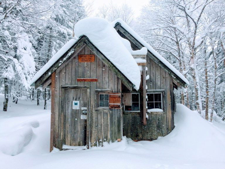
    GMC owns and rents four rustic cabins that serve as an excellent home base for all types of recreating. Two cabins are in the backcountry network at Bolton Valley and two sit adjacent to each other on Wheeler Pond in the Northeast Kingdom.

    dirt and rocks
    wood grain texture

    More Resources

    • Blaze and heart_Trail at Willard Gap 07-04-2021

      Explore

      The Long Trail

    • Hiker wearing head lamp_Camel's Hump hut clearing_10-28-2023_Joe Iadanza

      Stay Safe

      Staying Safe

    • Maps+guides_E2E resources_04-08-2025_Lily LaRegina

      Be Prepared

      Guidebooks, Maps & More

    • Hiker at Frenchman's Pile_Mount Mansfield_ 7_14_2018_Laura Knapp

      Explore

      Day Hiking

  • Accessible Trails

    Accessible Trails

    Nature for All โ€“ On and Off the Long Trail System 

    The Green Mountain Club is working to make the Long Trail welcoming and accessible to more people โ€“ across all abilities. This commitment is part of our Strategic Plan and guidesย how we plan projects. GMC partners with accessibility and adaptive recreation experts toย identify potentialย locations where the trail can becomeย accessibleย and we work with local nonprofits, and local, state, and federal land managers to bring those ideas to life.ย 

    Statewide, Vermont is home to several boardwalks, expanded rail trails, and smooth, gently graded interpretive trails. 

    Mud season spring trails_Mount Philo_04-14-2023_Lily LaRegina
    Accessible trail_Smugglers' Notch, Barnes Camp boardwalk_06-10-2023_Lily LaRegina

    What Are Accessible Trails?

    In the outdoor recreation world, there are a variety of terms and guidelines used to improve accessibility for certain trails and facilities, even in backcountry settings. GMCย adheres to the U.S. Forest Service Trail Accessibility Guidelines.ย Not all trails will be accessible to all users, soย reviewing trail descriptions and photosย is the best wayย for users toย determineย if a certain trail or destination will work for them.

    Find an Accessible Trail

    TrailFinder offers the most comprehensive information and directory of trails in Vermont and New Hampshire that meet various accessibility standards. Explore their information and search for accessible trails near you. You can also select the โ€œaccessibleโ€ feature in GMC HikeFinder tool.

    Consider mountain toll roads, like those at Okemo, Ascutney, Burke, Mansfield, and Mt. Equinox, and Mt. Philo, or scenic gondola and chairlift rides offered by ski resorts, which may be great options for scenic views and fresh air depending on your mobility and disability needs.  

    Select Accessible Trail Recommendations 

    Here are aย few favorite accessible experiences statewide.ย 

    Mollie Beattie Bog, Brighton. This 200-foot wheelchair-accessible boardwalk in the Silvio O. Conte Wildlife Refuge reaches a black spruce woodland bog thatโ€™s home to the rare bog sedge plant. Get there.

    Sentinel Rock State Park, Westmore. A 1-mile accessible trail off Hinton Hill Road overlooks Lake Willoughby and the Green Mountains and reaches the glacial erratic the park is named for. Get there.

    Ravenโ€™sย Ridge Natural Area, Monkton.ย Travelingย a 935-foot accessible boardwalk to a 0.3-mile-long accessible trail gives you a chance to spot bats, bobcats, and rare plants. Get there.

    Thundering Falls Boardwalk, Killington. Nine hundred feet of accessible boardwalk on the Appalachian Trail in Vermont, built andย maintainedย by the Green Mountain Club, crosses an extensive wetland and connects to a smooth gravel switchback path to a platform at a 140-foot waterfall. Get there.

    West River Trail, Jamaica State Park, Jamaica. The 16-mileย universally accessibleย trail is a converted railway with a packed gravel surface, including two miles in Jamaica State Park.ย  Get there.

    Waterbury Center State Park Trail, Waterbury. A 1,500-foot accessible trail, built in 2010, skirts the Waterbury Reservoir. Get there.

    Smugglersโ€™ Notch Boardwalk, Stowe. You can explore wetlands, see a beaver dam, and admire the notch from this 660-foot accessible boardwalk on the Long Trail. Get there.ย 

    Mount Mansfield Visitor Center, via Stowe Auto Toll Road. Visit the GMC caretaker- and volunteer-staffed Mansfield Visitor Center at the top of the Stowe Auto Toll Road, for information about the mountain and its alpine ecology.ย The Chin, the highest summit, is another 1-mile hike with occasional rough footing. Seasonal; fee applies to drive. The Toll Road isย operatedย by Stowe Mountainย Resortย and all fees go to the resort, not the Green Mountain Club.ย 

    Winooski River Footbridge, Bolton. The 224-foot Long Trail suspension bridge, built andย maintainedย by the Green Mountain Club, is accessible from the Duxbury Road (south) side of the Winooski River.ย There is no accessible parkingย atย the south side of the bridge, so users may need to be dropped off.ย ย Get there.

    Camelโ€™sย Hump View Trail, Duxbury. This lollipop-styleย .75 mileย loop trail features multiple gorgeous views of Camelโ€™s Hump. This is a universally accessible trail. It includes elevation changes, and theย trailย surface is dirt and gravel, so it may not be passable by wheelchairs designed for smooth surfaces. It starts from the โ€œwinterโ€ parking lot on Camelโ€™s Hump Road in Duxbury. Get there.

    wood grain texture

    Partner Spotlights 

    Vermont trails & Greenways Council
    Trailfinder
    Vermont Adaptive Ski and Sports
    Sunset view of Mount Mansfield_Puffer Shelter_July-2019_Andrew McNealus

    Get Connected to the Long Trail

     Get email updates from the Green Mountain Club. 

  • Day Hiking

    Day Hiking

    Day Hikes by Region

    Little Rock Pond_10-03-2022_Jocelyn Smith

    Manchester Area Hikes

    GMC-statemaptrails-Manchester Area

    The Manchester area in southern Vermont includes wonderful hikes like Stratton, Bromley, and Equinox Mountains, and Stratton and Little Rock Ponds. This section of the Long Trail overlaps with the Appalachian Trail and is situated in the Green Mountain National Forest. 

    Killington Area Hikes

    GMC-statemaptrails-Killington Area

    The Killington Area in central Vermont includes popular hikes like Killington, Pico, and Deer Leap. The Long Trail, Appalachian Trail, and North Country Trail all meet at Maine Junction, where the AT forks east, past scenic Kent Pond and the Thundering Falls accessible boardwalk.

    Killington_Matt Heller
    Hiker + Camel's Hump view_Bamforth Ridge_06-08-2025_Lily LaRegina.jpg

    Camelโ€™s Hump Area Hikes

    GMC-statemaptrails-Camel's Hump Area

    Camelโ€™s Hump is an iconic silhouette visible from many parts of north-central Vermont. Explore multiple ways to summit the 4,000-footer, or venture slightly south to the beautiful Monroe Skyline, home to the summits of Mt. Abraham and Ellen.

    Mansfield Area Hikes

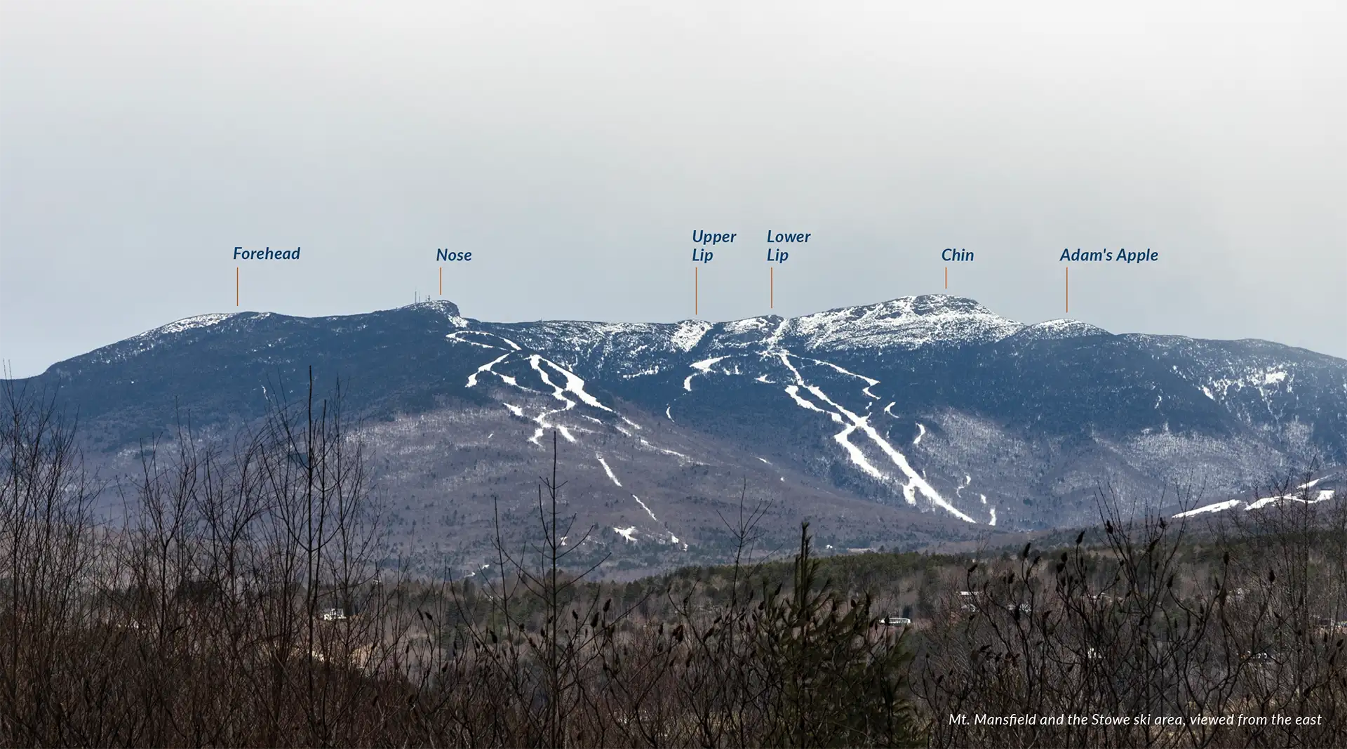
    Mount Mansfield is Vermontโ€™s highest peak, at 4,395 feet, and offers something for every hiker. There is a vehicle-accessible Toll Road (operated by Stowe Mountain Resort) that takes you to the alpine ridgeline, as well as a complex network of interesting and challenging side trails. Explore the east or west sides of the mountain, or venture across Smugglersโ€™ Notch to pleasant views at Sterling Pond or Elephantโ€™s Head Cliff.

    Amherst Trail_Mount Mansfield side trail_08-09-2021_Eduardo Donoso Estay
    Wheeler Pond from Moose Mnt_09-22-2023_Barb Mackay

    Northeast Kingdom Area Hikes

    GMC-statemaptrails-Northeast Kingdom

    Vermontโ€™s Northeast Kingdom is known for its natural beauty, outdoor recreation, and independent spirit, and feels like a Vermont all its own. Explore stunning hikes on the cliffsides of dramatic Lake Willoughby, the Kingdom Heritage Trail System, and hikes that start at the doorstep of GMCโ€™s Wheeler Pond rental cabins.

    Getting Started

    Be Prepared to Hike Safely

    Hiking can be one of the most accessible outdoor activities, but proper preparation and gear is a must. Conditions can change quickly and help is not readily available in the backcountry. Explore gear, weather, and other safety considerations here.

    VC visitors_11-06-2024_Lily LaRegina-2
    Hikers on the Short Trail 01_07-22-2025_Lily LaRegina

    Hiking With Confidence and Community

    Be prepared and hit the trail with confidence by attending a free GMC-hosted hiking workshop. Want to find others to hike with? Explore GMC volunteer sections or all upcoming events.

    Sunset view of Mount Mansfield_Puffer Shelter_July-2019_Andrew McNealus

    Get Hiking Recs Tailored to You

    GMCโ€™s knowledgeable visitor center staff can help you sift through the endless hiking opportunities to find one that works for you. Call, email, or stop in today. 

  • Camel’s Hump Area Trails

    Camel’s Hump Area Trails

    GMC-statemaptrails-Camel's Hump Area

    Camel’s Hump Area Trails

    Camelโ€™s Hump Hike Suggestions

    From Burrows (West) Parking Lot 

    From Monroe (East) Parking Lot 

    From Duxbury Window Parking Lot 

    Donโ€™t Forget Your Map

    The Green Mountain Clubโ€™s Camelโ€™s Hump Area Waterproof Hiking Map, 2nd Edition, is the best companion for these hikes. We recommend always carrying a paper map and compass, as technology can fail and cell phone batteries can die. The map is also available in digital version from Avenza.

    Mountain Weather

    Many of these hikes are strenuous and mountain weather can change quickly. Always check the near-term mountain weather forecast for your hike before you begin, and pack or alter plans accordingly. We recommend the National Weather Service’s Summit Forecasts and mountain-weather.com.

    wood grain texture

    Explore Other Hiking Areas

    • Hiker_Mount Pisgah overlooking Lake Willoughby_07-18-2020_Nathanael-Asaro

      Explore

      Northeast Kingdom Trails

    • Killington Area Hikes_View from Killington w Hiker_Matt Heller

      Explore

      Killington Area Trails

    • Lye Brook Trail_10-14-2027_Peckar

      Explore

      Manchester Area Trails

    • Mansfield Ridgeline

      Explore

      Mount Mansfield Area Trails

  • Killington Area Trails

    Killington Area Trails

    GMC-statemaptrails-Killington Area

    Killington Area Trails

    Killington Area Hike Suggestions

    Here are just a few we recommend (full descriptions coming soon).

    wood grain texture

    Explore Other Hiking Areas

    • Hiker_Mount Pisgah overlooking Lake Willoughby_07-18-2020_Nathanael-Asaro

      Explore

      Northeast Kingdom Trails

    • Camels Hump_2013_Mary Keenan

      Explore

      Camel’s Hump Area Trails

    • Lye Brook Trail_10-14-2027_Peckar

      Explore

      Manchester Area Trails

    • Mansfield Ridgeline

      Explore

      Mount Mansfield Area Trails

    Be Prepared with the Killington Area Hiking Map

    GMC’s Killington Area Hiking Trail Map, 2nd edition, 2022, highlights the spectacular hiking around Killington Peak, including Pico, Dear Leap and the Appalachian Trail to Thundering Falls accessible boardwalk. It also includes detailed maps of Mount Ascutney and Okemo State Forest on the reverse side.  The map has directions to trailheads with GPS coordinates, trail mileages, and trail difficulty ratings.

    GMC recommends always hiking with a paper map, as cell phones and digital assets can fail in the backcountry.

    Killington2022_Map_Cover_low-res_002_large

    Mountain Weather

    Many of these hikes are strenuous and mountain weather can change quickly. Always check the near-term mountain weather forecast for your hike before you begin, and pack or alter plans accordingly. We recommend the National Weather Service’s Summit Forecasts and mountain-weather.com.

  • Manchester Area Trails

    Manchester Area Trails

    GMC-statemaptrails-Manchester Area

    Manchester Area Trails

    Manchester Area Hike Suggestions

    Here are just a few we recommend (full descriptions coming soon).

    • Big Branch Picnic Area  
    • Little Rock Pond  
    • Green Mountain Trail Loop  
    • Griffith Lake  
    • Baker Peak via Griffith Lake Trail  
    • Baker Peak via Lake Trail  
    • Baker Peak > Griffith Lake Loop
    • Branch Pond  
    • Stratton Pond Trail  
    • Stratton Pond Loop (Long Trail > Stratton Mountain > Stratton Pond Trail)  
    • Bromley Mountain via Long Trail
    • Prospect Rock (Manchester) 
    • White Rocks via Long Trail South
    wood grain texture

    Explore Other Hiking Areas

    • Hiker_Mount Pisgah overlooking Lake Willoughby_07-18-2020_Nathanael-Asaro

      Explore

      Northeast Kingdom Trails

    • Camels Hump_2013_Mary Keenan

      Explore

      Camel’s Hump Area Trails

    • Killington Area Hikes_View from Killington w Hiker_Matt Heller

      Explore

      Killington Area Trails

    • Mansfield Ridgeline

      Explore

      Mount Mansfield Area Trails

    Be Prepared with the Long Trail Map

    The Manchester Area Map is currently out of stock and needs to be updated and reprinted. You can find all these trails on the Long Trail Map, though. We recommend always carrying a paper map and compass, as technology can fail and cell phone batteries can die. The map is also available in digital version from Avenza.

    Mountain Weather

    Many of these hikes are strenuous and mountain weather can change quickly. Always check the near-term mountain weather forecast for your hike before you begin, and pack or alter plans accordingly. We recommend the National Weather Service’s Summit Forecasts and mountain-weather.com.

  • Mount Mansfield Area Trails

    Mount Mansfield Area Trails

    GMC-statemaptrails-Camel's Hump Area

    Mount Mansfield Area Trails

    Mansfield Area Hike Suggestions

    Mansfield itself is home to 28 different trails โ€“ from the Long Trail, which hugs its highest ridgeline, to the short yet treacherous Profanity Trail to the aptly named Cliff Trail and to the more leisurely Lake Mansfield Trail on the mountainโ€™s southern slope.

    Here are just a few we recommend.

    wood grain texture

    Explore Other Hiking Areas

    • Hiker_Mount Pisgah overlooking Lake Willoughby_07-18-2020_Nathanael-Asaro

      Explore

      Northeast Kingdom Trails

    • Camels Hump_2013_Mary Keenan

      Explore

      Camel’s Hump Area Trails

    • Killington Area Hikes_View from Killington w Hiker_Matt Heller

      Explore

      Killington Area Trails

    • Lye Brook Trail_10-14-2027_Peckar

      Explore

      Manchester Area Trails

    Be Prepared with the Mansfield Area Hiking Map

    GMCโ€™s Mount Mansfield Area Map, 5th Edition, shows the numerous side trails along the Mansfield Ridgeline in great detail, including mileages and difficulty ratings. It also includes hikes in the Worcester Range, such as Stowe Pinnacle and Mount Hunger. The Worcester Range is outside of the Long Trail System and managed by the Vermont Department of Forests, Parks, and Recreation.

    GMC recommends always hiking with a paper map, as cell phones and digital assets can fail in the backcountry.

    Mansfield_Map_5th_Ed

    Mountain Weather

    Many of these hikes are strenuous and mountain weather can change quickly. Always check the near-term mountain weather forecast for your hike before you begin, and pack or alter plans accordingly. We recommend the National Weather Service’s Summit Forecasts and mountain-weather.com.

  • Find a Hike

    Find a Hike

    Find a Hike

    Search Results:

    • Bamforth Ridge Shelter

      Bamforth Ridge Shelter

      From the parking area, hike north on the Long Trail. Cross a bridge over Gleason Brook (0.6 mi), then on to Duxbury Window, a beautiful lookout over the Winooski Valley with a bench (1.6 mi). Note that most of the hike is a gradual incline, but the trail is fairly steep for a short stretch…

      Hike Details


    • Barnes Camp Loop

      Barnes Camp Loop

      The Barnes Camp Loop starts on the Long Trail South at the boardwalk on the northern end of the parking lot. Proceed along the boardwalk with wetland views then continue on single track Long Trail North, blazed in white. In 0.3 mi. at intersection with Long Trail South…

      Hike Details


    • Battell Trail to Battell Shelter

      Battell Trail to Battell Shelter

      From Elder Hill Rd. parking lot,ย climb steadily through a sugarbush forย almost aย mile. After crossing two small streams and an old woods road (1.0 mi.), and then another woods road (1.2 mi.), arrive at the LT (2.0 mi.) just south of Battell Shelter.ย Take a right ontoย Long Trailย Northย for 0.1 mi…

      Hike Details


    • Beaver Meadow Lodge Loop

      Beaver Meadow Lodge Loop

      The trail to Beaver Meadow Lodge follows an old road to a high basin surrounded by mountains on three sides and makes an excellent family hike. On a clear day, it is possible to see Whiteface Mountain to the north. Beaver Meadow Lodge is one of two shelters…

      Hike Details


    • Burrows Trail

      Burrows Trail

      See the results of a three-year restoration of the extremely popular Burrows Trail, completed by GMC and FPR in 2024. This trail is steep and difficult, but the work put in by crews over the last three years has made the footing a lot more manageable. There are a…

      Hike Details


    • Camel’s Hump Summit via Monroe and Alpine Trails

      Camel’s Hump Summit via Monroe and Alpine Trails

      From theย Monroe Parking lot,ย followย the blue-blazedย Monroe Trailย for 1.3 mi.ย At theย intersection withย Dean Trail,ย stay right onย Monroeย for 1.2 miย (2.5 mi).ย Atย intersection withย theย Alpine Trailย continueย rightย onย Alpine Trailย forย 1.2ย miย (3.7ย mi).ย Turnย left ontoย Long Trail Southย for 0.8 miย towards the summitย (4.5 mi).ย From theย Hut Clearingย continue onย Long Trailย Southย for 0.3ย miย (4.8ย mi).ย toย the summit.ย ย The summit ofย Camel’s Humpย is one of the five tallest in Vermontย at 4,083โ€™ย and offers 360-degree views toย the…

      Hike Details


    • Camel’s Hump Summit via Monroe and Dean Trails

      Camel’s Hump Summit via Monroe and Dean Trails

      From theย Monroe Parking lot,ย followย the blue-blazedย Monroe Trailย for 1.3 mi. At the first intersectionย take a left ontoย Dean Trail,ย continuing for 1.0 mi. toย Wind Gapย (2.3 mi). From Windย Gapย take a right ontoย Long Trail North.ย Follow for 1.5 mi. to the summit ofย Camelโ€™s Humpย (3.8 m.).ย The summit of Camelโ€™s Hump is one of the five tallest…

      Hike Details


    • Camel’s Hump View Trail

      Camel’s Hump View Trail

      This lollipop-style loop trail features multiple gorgeous views of Camelโ€™s Hump, which are especially good as the leaves begin to fall in autumn. The trail also features several benches, which offer nice rest spots.   From the sign at the parking lot, head out on the main path. Soon…

      Hike Details


    • Deer Leap Trail

      Deer Leap Trail

      Theย Deer Leap Trailย is aย relatively shortย but rugged hike to the top of a rock outcrop with impressive views of theย Coolidge Rangeย andย Sherburne Pass. The trail starts on the north side ofย Rt.ย 4, at the east end of theย Inn at Long Trailย parking lot.ย Note that it is suggested to park across Rt. 4ย as…

      Hike Details


    • Duxbury Window Trail

      Duxbury Window Trail

      A greatย optionย onย a clear day! From the parking area on Duxbury Road, hikeย south on theย Long Trail. Cross a bridge over Gleason Brook (0.6 mi), then on to a beautiful lookout over the Winooski Valley with a bench (1.6 mi).ย Note: Most of the hike is a gradual incline, but the…

      Hike Details


    • Elephantโ€™s Head Cliff (via Long Trail)ย 

      Elephantโ€™s Head Cliff (via Long Trail)ย 

      There are a few different ways to reach the Elephantโ€™s Head Cliff overlook, which offers spectacular views of Smugglerโ€™s Notch and Mount Mansfield. This description is for the Long Trail route. Start at the Barnes Camp visitor center and take the Long Trail North, which starts behind the…

      Hike Details


    • Forest City, Long Trail,ย andย Burrows Trail Loop

      Forest City, Long Trail,ย andย Burrows Trail Loop

      This challenging loop to the Camelโ€™s Hump summit is a fun alternative to the popular out-and-back Burrows route.  Starting at theย Lower/Forest City lot, takeย Forest City Trailย follow an old logging road and cross over Brush Brook, passing anย intersection with theย Forest Cityย Connectorย (0.8 mi).ย Continue onย Forest City Trail,ย climbing graduallyย for 1.4 mi. to the intersection withย Montclair Glen Lodgeย and…

      Hike Details


    • Frost Trail and Butler Lodge Loop

      Frost Trail and Butler Lodge Loop

      This is a good moderate day hike or beginning overnight trip. A beautiful but difficult 4.8-mile loop can be made by connecting the Frost, Maple Ridge, Rock Garden, and Butler Lodge Trails. The loop provides a variety of terrain with many amazing views, exciting rock scrambles and caves,…

      Hike Details


    • Gondola to Cliff Trail

      Gondola to Cliff Trail

      There are multiple ways up to the summit of Mt. Mansfield from multiple trailheads. This description involves a paid gondola ride, operated by Stowe Mountain Resort, followed by a short but difficult hike to the summit. Stowe Gondola SkyRide is owned and operated by Vail Resorts and Stowe…

      Hike Details


    • Halfway House and Sunset Ridge Loop

      Halfway House and Sunset Ridge Loop

      From Underhill State Park parking area, walk along the Park Road Trail for about one mile. Take a right onto CCC Road for 0.2 mi. (1.1 mi.).Turn left onto Halfway House Trail for 0.9 mi.(2.0 mi.). At intersection with Canyon Trail continue on Halfway House for 0.3 mi.…

      Hike Details


    • Hellbrook Trail

      Hellbrook Trail

      Hellbrook Trail is one of the most strenuous trails on the east side of Mount Mansfield. Descending this trail in wet weather is not recommended. This trail ascends 2,330โ€™ in 1.5 miles to the Long Trail (LT) junction. This trail climbs steeply to the ridge, frequently on precipitous…

      Hike Details


    • Jerusalemย Trailย to Orvis Lookout

      Jerusalemย Trailย to Orvis Lookout

      From theย Jerusalem trailhead, ascend theย Jerusalem Trailย 2.4 miles to the intersection with theย Long Trail.ย Note that this trail passes through an active sugarbush for the firstย portion, crossingย ATV trails and pastย mapleย tubes/lines.ย Be sure to stay on the blue-blazed trail.ย At intersection with theย Long Trailย take a left on the white-blazedย LT North. Follow it a…

      Hike Details


    • Killington Summit via Bucklin Trail

      Killington Summit via Bucklin Trail

      Killington (4235′) is the highest peak in the Coolidge Range. The Bucklin Trail is located on the western side and is the most direct approach to the summit.   At Brewerโ€™s Corners parking lot navigate to the Bucklin Trail. The trail gradually follows an old road for about…

      Hike Details


    • Killington Summit viaย Sherburne Passย Trail

      Killington Summit viaย Sherburne Passย Trail

      For a longer trip to the top of Vermontโ€™sย second-highest peak,ย takeย the Sherburne Pass Trailย south from the parking lot at Rt 4.ย Passย Pico Campย (2.7 mi) and continue another 0.4 mi to anย intersection with the Long Trail at Jungle Junctionย (3.1 mi). Follow the LT South as it graduallyย climbs forย 2.3ย miles to Cooper Lodge,…

      Hike Details


    • Lake Mansfield Trail to Taylor Lodgeย 

      Lake Mansfield Trail to Taylor Lodgeย 

      From the Trout Club parking lot, follow the trail alongside Lake Mansfield, nestled in the shadows of Mount Mansfield, and continue on Lake Mansfield Trail for 1.6 mi. to Taylor Lodge and a junction with the Long Trail. This route climbs up toward Nebraska Notch and offers great…

      Hike Details


    • Laura Cowles and Sunset Ridge Loop

      Laura Cowles and Sunset Ridge Loop

      From Underhill State Park follow Park Road Trail for 0.9 mi. until intersection with Sunset Ridge Trail and CCC Road Trail (0.9 mi.). Take a left at the intersection, following Sunset Ridge Trail for 0.1 mi (1.0 mi.). Turn right onto Laura Cowles Trail. Follow Laura Cowles for…

      Hike Details


    • Long Trail South and Haselton Loop

      Long Trail South and Haselton Loop

      From Barnes Camp, take the Long Trail South, across the boardwalk, to the road crossing at Route 108 (0.5 mi.) Cross the road to continue on the Long Trail South and begin a continuous climb up Mount Mansfieldโ€™s northern ridge. Come to the junction of the Taft Lodge…

      Hike Details


    • Maine Junction via AT/LT

      Maine Junction via AT/LT

      The Long Trail (LT) and Appalachian Trail (AT), two long distance hiking trails, overlap in Vermont from Massachusetts for roughly 100 miles. The AT splits off from the LT in Killington at what is known as the Maine Junction.   Starting at theย AT/LT VT Rt. 4ย parking lot, crossย US-4ย (please note that this isย a very busyย road). Followย Long Trailย Northย for 1.0 mi towardsย Willard…

      Hike Details


    • Maple Ridge and Sunset Ridge Loop

      Maple Ridge and Sunset Ridge Loop

      Starting at Underhill State Park follow Park Road Trail until its intersection with the Sunset Ridge Trail and CCC Road Trail (0.9 mi.). Take a right at the intersection to follow CCC Road for 1.1 mi. (2.0 mi.). At the intersection of Maple Ridge and Frost Trail, take…

      Hike Details


    • Molly Stark’s Balcony

      Molly Stark’s Balcony

      While short, the route to Molly Starkโ€™s Balcony is a rugged walk on rolling terrain.   From the Appalachian Gap parking lot, head north on the Long Trail for 0.4 mi past Mad River Lookout and reaching Baby Stark Mountain. Continue on the Long Trail North for 0.9 mi. over Molly Stark Mountain before a final short descent to the Balcony on the north slope of Molly…

      Hike Details


    • Monroe Skyline

      Monroe Skyline

      This classic section of the Long Trail, the Monroe Skyline day hike, requires two cars and a drop-off at one end of the hike. It can be hiked inย eitherย directionย but this description goes north to south. This hike summits two of Vermontโ€™s five 4,000-foot peaks (Mt. Abraham and Mt.…

      Hike Details


    • Mt. Abraham via the Long Trail

      Mt. Abraham via the Long Trail

      From theย Lincoln Gapย trailhead, hike north on theย Long Trailย for 1.7 miles to Battell Shelter. Continue 0.9 miles onย Long Trail Northย (2.6 mi). This section north of the shelter includes a few rocky scrambles beforeย emergingย above tree line and reaching theย Mount Abrahamย summit at 4,006โ€™.ย Mt. Abe isย one of theย five 4,000-foot peaksย inย Vermont, andย from the…

      Hike Details


    • Nebraska Notch to Taylor Lodge

      Nebraska Notch to Taylor Lodge

      This is a good moderate day hike or beginner-friendly overnight trip. From Stevensville Rd. Trailhead register, take a right onto Nebraska Notch Trail and follow it for1.5 mi. Nebraska Notch Trail is a gradual climb through the woods and near streams to reach Nebraska Notch. Where Nebraska Notch…

      Hike Details


    • Section Hike: Brandon Gap to Route 4

      Section Hike: Brandon Gap to Route 4

      This four-day, three-night, intermediate itinerary can be followed either north or south in Central Vermont, and could be modified to a 2-night trip for a more experienced backpacker. This is a great route for those who are looking to test their backcountry set up for multiple nights without…

      Hike Details


    • Section Hike: Camelโ€™s Hump to Routeย 108

      Section Hike: Camelโ€™s Hump to Routeย 108

      This challenging, 35-mile itinerary traverses some of the most iconic summits of the Long Trail, Camelโ€™s Hump and Mount Mansfield, and crosses the Winooski River Valley. With 10,000 feet of elevation gain, it offers amazing 360-degree views of the Long Trail, the White Mountains in New Hampshire, Lake…

      Hike Details


    • Section Hike: Jay Pass (Route 242) to Northern Terminus

      Section Hike: Jay Pass (Route 242) to Northern Terminus

      Complete the Northern Terminus with a two-day, one-night hike from Jay Pass. For extra miles, this hike could also be done from Route 118, Hazenโ€™s Notch.

      Hike Details


    • Section Hike: Southern Terminus to Routeย 9

      Section Hike: Southern Terminus to Routeย 9

      This two or three-day, one-to-two-night itinerary is a great way to get some southern Long Trail miles. Choose either the Pine Cobble Approach Trail or the Appalachian Trail to reach the Southern Terminus. Youโ€™ll have around 4,000 feet of elevation gain over 17-18 miles, along with a steep…

      Hike Details


    • Smugglersโ€™ Notch Boardwalk

      Smugglersโ€™ Notch Boardwalk

      The Smugglersโ€™ Notch Boardwalk, part of the Long Trail, built by GMC crews in 2010, is an accessible trail through wetlands, by a beaver dam, and with beautiful views of Smugglersโ€™ Notch. Park in the Barnes Camp parking lot or the Stowe Resort parking lot across the street.…

      Hike Details


    • Stark Mountain Trail

      Stark Mountain Trail

      Start at the Mad River Glen Single Chair loading station. The Stark Mountain Trail follows a wide service road for 1.5 mi. winding up the ski area. At  the intersection with Sunnyside Trail take a right to continue for 0.9 mi. (2.4 mi.). At the intersection with the Long Trail take a right onto Long Trail North for 0.1 mi until reaching the Starkโ€™s Nest overlook at 3,644โ€™ (2.5 mi). To return to…

      Hike Details


    • Sterling Pond

      Sterling Pond

      Sterling Pond Trail is short but steep two-mile round-trip hike on the eastern side of Smugglersโ€™ Notch. The excursion can be turned into a half-day or all-day hike by adding connecting trails, including stretches of Vermontโ€™s Long Trail. One of the Long Trail shelters, Sterling Pond Shelter, faces…

      Hike Details


    • Sunset Ledgeย from Lincoln Gap

      Sunset Ledgeย from Lincoln Gap

      This short, popular hike leads to open ledges with views west to Lake Champlain and the Adirondacks. From the parking lot, follow the white-blazed Long Trail South for 1.1 miles until reaching the lookout, Sunset Ledge. To return, follow the Long Trail back north to the parking area (2.2 mi). While this trail is short, be prepared…

      Hike Details


    • Sunset Ridge to Mansfield Summit (the Chin)

      Sunset Ridge to Mansfield Summit (the Chin)

      One of the busiest trails in the state, the Sunset Ridge Trail is a moderately difficult, very scenic pathway to the summit. This is the easiest route to the summit from the western side, and the recommended route down the mountain to complete a loop with Laura Cowles,…

      Hike Details


    • Toll Road

      Toll Road

      The Stowe Auto Toll Road ascends from the Toll House on Route 108. The 150-year-old Toll Road zigs and zags 4.5 miles on an unpaved road up to the Mount Mansfield Summit Station Visitor Center at 3,850โ€™. A drive up the toll road is paid, and all proceeds…

      Hike Details


    • Winooski Footbridge

      Winooski Footbridge

      This 224-foot Long Trail suspension bridge, built andย maintainedย by the Green Mountain Club, is accessible from Duxbury Road on the south side of the Winooski River. The bridge is wheelchair accessible from the south side, on Duxbury Road, but there is no parking permitted here. Park about 1.0 mi…

      Hike Details


    Search results come from a curated selection of all GMC-managed trails. GMC manages the Long Trail, its 88 side trails, the entire Appalachian Trail in VT, and 30+ miles of trail in the Northeast Kingdom. Additionally, there are hundreds more hiking trails in the state, in state parks, state forests, town forests, and on private land. Those can be found on TrailFinder, which works directly with land managers to ensure accurate information.  

    Donโ€™t Forget Your Map

    Paper maps make great hiking companions. Cell service is limited and batteries can die. Purchase a guidebook, Long Trail Map or area-specific hiking map produced by the Green Mountain Club, so you know you have the most accurate and up-to-date information in your pocket.

    Long Trail map_Skylight Lodge_07-23-2021_Kurt Wehde
    wood grain texture

    More Hiking Resources

    • Hikers on the Short Trail 01_07-22-2025_Lily LaRegina

      Be Prepared

      Get Started

    • Hiker at Frenchman's Pile_Mount Mansfield_ 7_14_2018_Laura Knapp

      Explore

      Day Hiking

    • E2E_2024_Leo He_hiker at sunset

      Explore

      Section Hiking the Longย Trail

    • Hiker_Camel's Hump in the distance_08-07-2021_

      Explore the Trails

    GMC Hike Experts at Your Fingertips

    Need more information? Call, email, or visit the GMC Visitor Center to get custom hike planning advice and trail recommendations. 

  • GMC Rental Cabins

    GMC Rental Cabins

    Rental Cabins 

    The Green Mountain Club manages four rustic cabins for rental by the public. There are two in the backcountry trails network at Bolton Mountain, and two on the shores of Wheeler Pond in the Northeast Kingdom. These cabins provide affordable lodging for families and small groups to enjoy Vermontโ€™s world-class outdoor recreation opportunities and all the best of rustic living. Cabin pricing ranges from $75-$100 per night and we reserve a few nights each year to donate to groups that are advancing diversity in the outdoors. Explore the cabins and booking information below.

    wood grain texture

    More Information

    • Cabins_Jean Haigh Cabin_Alicia DiCocco_2024

      Explore

      Rental Info

    • Jean Haigh Cabin_guests_Mollie Flanigan

      Explore

      Rental FAQs

    • Cabins_Bolton Lodge_2018_Mollie Flanigan

      Explore

      Rental Policies