Region: Mount Mansfield

  • Section Hike: Camel’s Hump to Route 108

    Section Hike: Camel’s Hump to Route 108

    This challenging, 35-mile itinerary traverses some of the most iconic summits of the Long Trail, Camel’s Hump and Mount Mansfield, and crosses the Winooski River Valley. With 10,000 feet of elevation gain, it offers amazing 360-degree views of the Long Trail, the White Mountains in New Hampshire, Lake Champlain, and the Adirondacks in New York. Below is one option.

    • Day 1: Forest City Trail to Montclair Glen Lodge, 1.4 miles. (Can combine with Day Two for a four-day trip)
    • Alternate Day 1: Monroe Trail to Hump Brook Tenting Area, 1.3 miles. (Can combine with Day Two for a four-day trip)
    • Day 2: Montclair Glen Lodge to Bamforth Ridge Shelter, 6 miles; summit Camel’s Hump
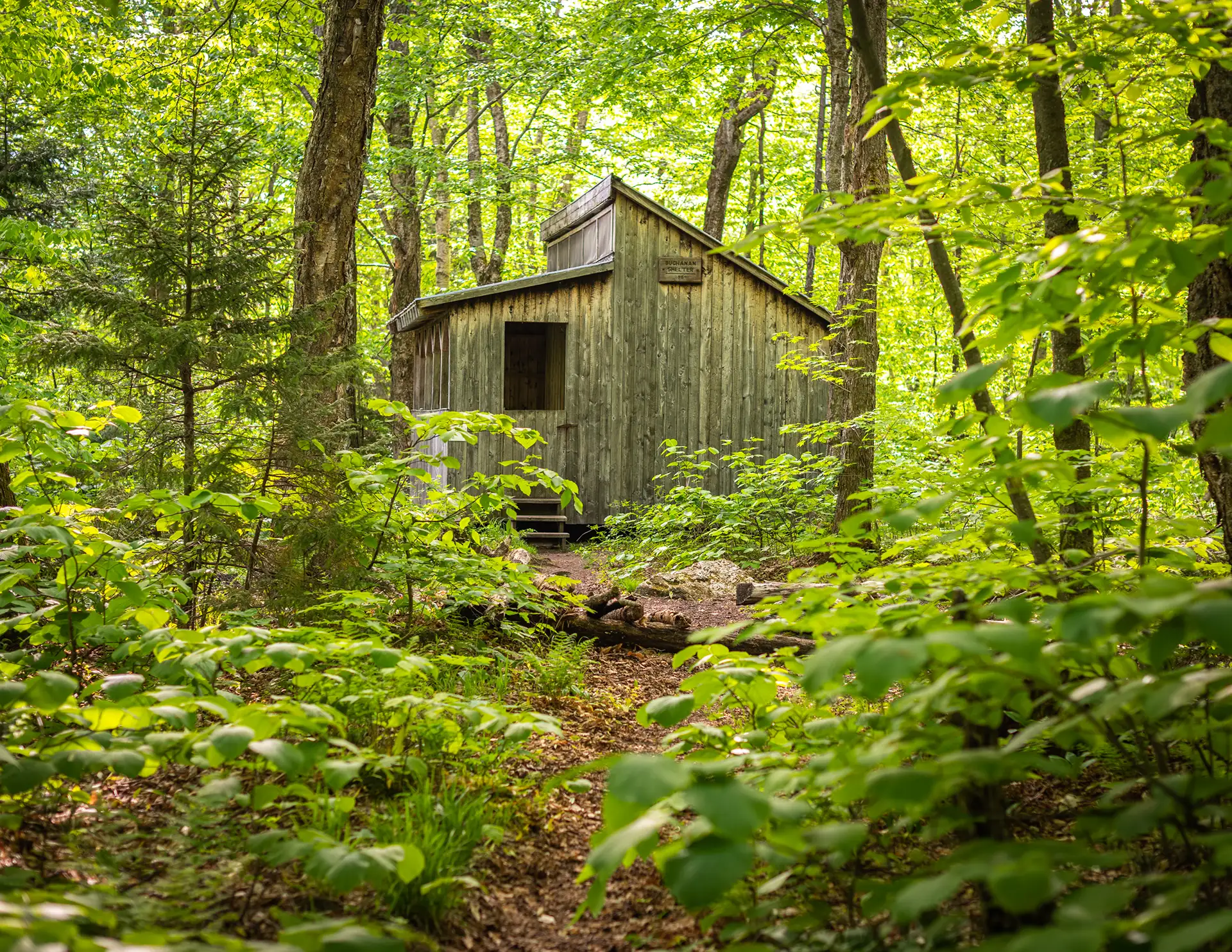
    • Day 3: Bamforth Ridge Shelter to Buchanan Shelter, 12 miles; cross Winooski River
    • Day 4: Buchanan Shelter to Butler Lodge, 11 miles
    • Day 5: Butler Lodge to Route 108, 6 miles; summit Mansfield
  • Sunset Ridge to Mansfield Summit (the Chin)

    Sunset Ridge to Mansfield Summit (the Chin)

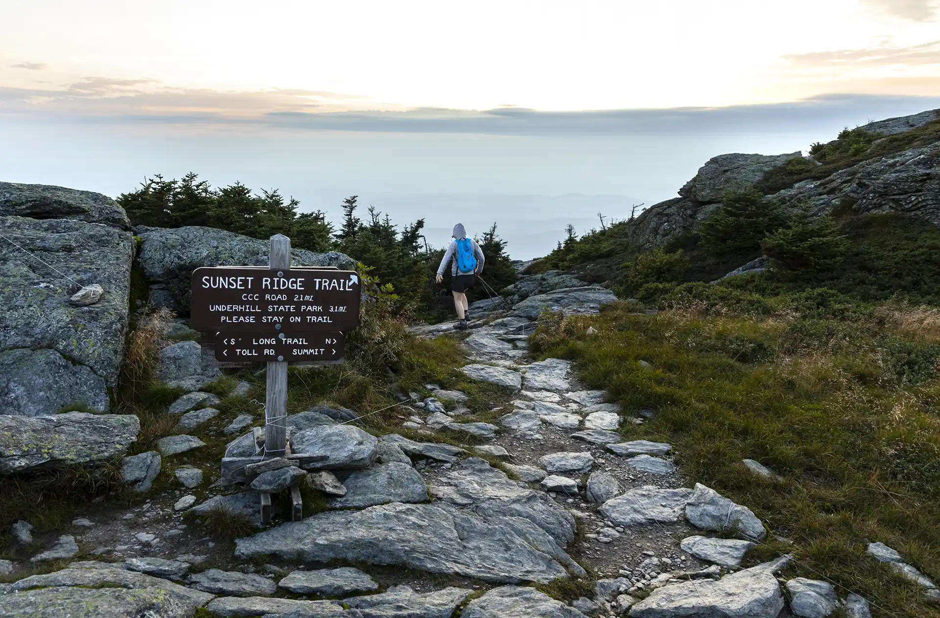
    One of the busiest trails in the state, the Sunset Ridge Trail is a moderately difficult, very scenic pathway to the summit. This is the easiest route to the summit from the western side, and the recommended route down the mountain to complete a loop with Laura Cowles, Halfway House, or Maple Ridge trails.

    From Underhill State Park parking area, walk along the CCC access road for about one mile. Take a left onto Sunset Ridge Trail (0.9 mi.). The trail crosses several streams, passes the beginning of the Laura Cowles Trail, and begins a steady ascent through a wooded area. Pass the side trail to Cantilever Rock on the left (1.5 mi.). Once the trail reaches the ridgeline, it continues to the summit over rocky, exposed ledges for 1.4 mi. (2.9 mi.). Use extreme caution in inclement weather. There are several short inclines that are steep, but foot and handholds are plentiful and these sections are passable by beginners.

    The trail turns southward below the base of a false summit, soon intersecting with the Laura Cowles Trail, and then the Long Trail (3.0 mi.). Turning left, continue north along Long Trail North to the summit of Mount Mansfield, the Chin. The Chin is the highest point in Vermont at 4,395 ft. To return, continue back down Long Trail South to Sunset Ridge Trail for 3.2 miles (6.2 mi.) to return to Underhill State Park.

    Mt. Mansfield, the tallest point in Vermont, features a long summit ridge with multiple highpoints. The ridge is said to look like the profile of a person, so its highpoints have names like the Forehead, the Nose, and the Chin (the highest point in Vermont, at 4,395’). It also has long side ridges, like Sunset Ridge. It is one of the most popular hiking destinations in Vermont and can become very crowded, drawing visitors from all over the Northeast and Quebec. In order to avoid crowds, plan to visit early in the morning or on weekdays.

    There are multiple ways up to the summit of Mt. Mansfield from multiple trailheads. Please note that the trails described here leave from Underhill State Park. There are a few loop options available from the Underhill Trailhead. If planning to start and end at different trailheads, make sure to drop a car and plan for the driving distance between trailheads, which can be as much as two hours.

  • Smugglers’ Notch Boardwalk

    Smugglers’ Notch Boardwalk

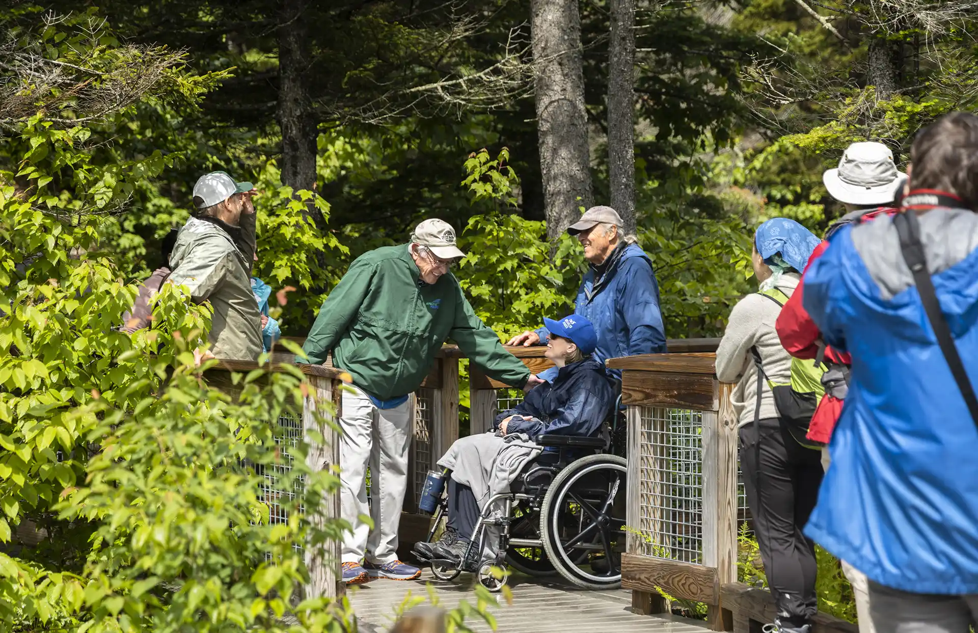
    The Smugglers’ Notch Boardwalk, part of the Long Trail, built by GMC crews in 2010, is an accessible trail through wetlands, by a beaver dam, and with beautiful views of Smugglers’ Notch. Park in the Barnes Camp parking lot or the Stowe Resort parking lot across the street. The boardwalk starts at the western end of the lot (opposite end of the parking lot from the building). The boardwalk is 5 feet wide with interpretive panels and viewpoints.

  • Nebraska Notch to Taylor Lodge

    Nebraska Notch to Taylor Lodge

    This is a good moderate day hike or beginner-friendly overnight trip.

    From Stevensville Rd. Trailhead register, take a right onto Nebraska Notch Trail and follow it for1.5 mi. Nebraska Notch Trail is a gradual climb through the woods and near streams to reach Nebraska Notch. Where Nebraska Notch and the Long Trail intersect, take a right and follow the Long Trail South for 0.3 mi (1.8 mi.). The Long Trail then intersects with Clara Bow Trail, an optional side trail climbing over and under enormous boulders through the notch, with a ladder to aide in negotiating a vertical drop. You can also continue on the Long Trail for 0.4 mi. instead of Clara Bow, both routes reach Taylor Lodge (2.2 mi.).

    Taylor Lodge features scenic views of a beaver pond and lovely streams. The lodge provides bunks for 6 to 12 people, along with comfortable bench tables outside. To return either take Clara Bow from the Lodge or Long Trail North (2.6 mi.) back to Nebraska Notch Trail then end at Stevensville Rd. (4.4 mi.).

  • Toll Road

    Toll Road

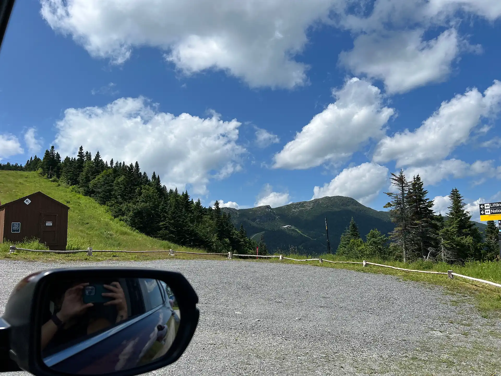
    The Stowe Auto Toll Road ascends from the Toll House on Route 108. The 150-year-old Toll Road zigs and zags 4.5 miles on an unpaved road up to the Mount Mansfield Summit Station Visitor Center at 3,850’. A drive up the toll road is paid, and all proceeds go to Stowe Mountain Resort. For prices and hours, click here.

    From the parking lot, you can explore the Visitor Center’s interpretive displays and hike along the Mansfield Ridgeline (Long Trail) to additional viewpoints, including the mountain’s highest point, the Chin. For mobility-impaired visitors, the drive to the top of the Toll Road and a visit to the visitor center is a wonderful way to experience Vermont’s tallest mountain.

    From the Summit Station, the Chin is an additional 1.4 mile hike north with an elevation gain of 546’. The footing can be difficult in places, and the hike is rated moderate overall.

    There are numerous side trails extending off the Long Trail on the ridge. These trails can range in difficulty from easy (Amherst Trail) to very strenuous (Cliff Trail, Canyon, and Canyon North Trails). The Green Mountain Club caretakers and volunteers at the Summit Station are a valuable resource in sharing appropriate hike recommendations. All trails on the Mansfield ridgeline require appropriate footwear.

    Overnight parking is not permitted at the top or along the toll road.

    *Note: During mud season, after Stowe Mountain Resort operations have closed for the season, hiking is permitted on the Toll Road. Check the Toll Road website or contact GMC for information.

  • Maple Ridge and Sunset Ridge Loop

    Maple Ridge and Sunset Ridge Loop

    Starting at Underhill State Park follow Park Road Trail until its intersection with the Sunset Ridge Trail and CCC Road Trail (0.9 mi.). Take a right at the intersection to follow CCC Road for 1.1 mi. (2.0 mi.). At the intersection of Maple Ridge and Frost Trail, take a left onto Maple Ridge Trail continuing past two other side trail intersections (Rock Garden and Wampahoofus) for 1.1 mi. until reaching the Forehead (3.1 mi.). The Forehead offers views of surrounding mountains and a unique perspective of the Mount Mansfield ridgeline. Follow Long Trail North for 1.8 mi. (past the Mount Mansfield Visitor Center 0.7 mi from Forehead) until reaching the summit also known as the Chin (4.9 mi.) at 4,395 ft. Note there are several trail intersections along the ridgeline. Continue “straight” on the Long Trail until reaching the highest point.

    From the Chin (4.9 mi.), turn back down Long Trail going south for 0.2 mi. until reaching Sunset Ridge and Laura Cowles Trail intersection. Take a right from the Long Trail onto a connector trail for 0.1 mi. (5.0mi.) until reaching the intersection. Turn right, going down Sunset Ridge Trail following an open ridgeline for 2.0 mi. (7.0 mi.). Continue past Laura Cowles Trail intersection for 0.1 mi. (7.1 mi.) until reaching Park Road Trail once again. Follow Park Road for 0.9 miles back to Underhill State Park (8.0 mi.).

    Mt. Mansfield, the tallest point in Vermont, features a long summit ridge with multiple high points. The ridge is said to look like the profile of a person, so its highpoints have names like the Forehead, the Nose, and the Chin (the highest point in Vermont, at 4,395’). It also has long side ridges, like Sunset Ridge. It is one of the most popular hiking destinations in Vermont and can become very crowded, drawing visitors from all over the Northeast and Quebec. In order to avoid crowds, plan to visit early in the morning or on weekdays.

    There are multiple ways up to the summit of Mt. Mansfield from multiple trailheads. Please note that the trails described here leave from Underhill State Park. There area few loop options available from the Underhill Trailhead. If planning to start and end at different trailheads, make sure to drop a car and plan for the driving distance between trailheads, which can be as much as two hours.

    Park Road Trail and CCC Road are not open to vehicles.

  • Sterling Pond

    Sterling Pond

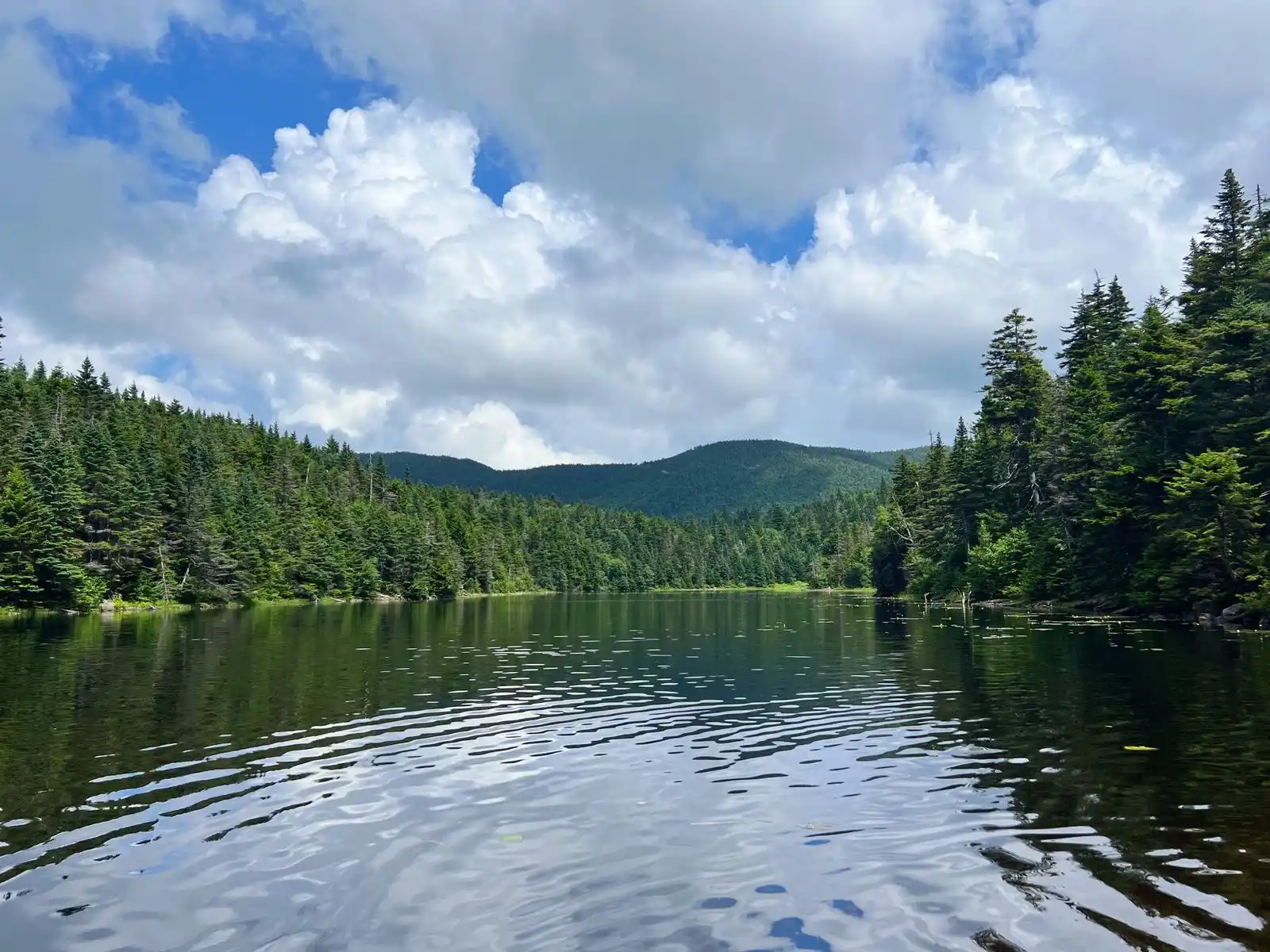
    Sterling Pond Trail is short but steep two-mile round-trip hike on the eastern side of Smugglers’ Notch. The excursion can be turned into a half-day or all-day hike by adding connecting trails, including stretches of Vermont’s Long Trail. One of the Long Trail shelters, Sterling Pond Shelter, faces away from the water and its usual prevailing winds. The trail gains 1,066’ just over one mile, making it a moderate trail, but a good day hike option in summer, fall, and winter (note additional road walk needed).

    From the Sterling Pond parking lot, carefully cross Rt. 108 to get to the trailhead. The Sterling Pond Trail is on the right and begins with a steep ascent on stone steps. Follow blue blazes for 1.1 mile to the intersection with the Long Trail. Turn left, heading north on the Long Trail (blazed in white) and continue to Sterling Pond, an additional .01 of a mile (1.1 mi). To get to Sterling Pond Shelter continue straight on the Long Trail around Sterling Pond for 0.3 mi (1.4 mi). To return to Rt. 108 as an out-and-back take the Long Trail back to Sterling Pond Trail for a trip total of 2.8 mi.

    For a loop option, continue past Sterling Pond shelter on the Long Trail to the intersection with Elephants Head Trail. This trail is 0.7 miles and follows the rocky shore of the pond. At the Elephants Head Trail and Long Trail intersection, turn right and follow Long Trail North for 0.3 mi. to the Sterling Pond Trail. At Sterling Pond Trail intersection take a left to return to the parking lot within another 1.1 mi. This loop is 3.5 mi. total.

    Note this is a busy trail system, especially on weekends. Consider visiting outside of peak periods.

  • Lake Mansfield Trail to Taylor Lodge 

    Lake Mansfield Trail to Taylor Lodge 

    From the Trout Club parking lot, follow the trail alongside Lake Mansfield, nestled in the shadows of Mount Mansfield, and continue on Lake Mansfield Trail for 1.6 mi. to Taylor Lodge and a junction with the Long Trail. This route climbs up toward Nebraska Notch and offers great views of the Notch. Return the way you came. (3.2 mi.)

  • Hellbrook Trail

    Hellbrook Trail

    Hellbrook Trail is one of the most strenuous trails on the east side of Mount Mansfield. Descending this trail in wet weather is not recommended. This trail ascends 2,330’ in 1.5 miles to the Long Trail (LT) junction. This trail climbs steeply to the ridge, frequently on precipitous ledges, using hand holds or metal rebar for gripping through the woods with occasional views of the ledges on the east side of the notch.

    From VT-108/Mountain Road take Hellbrook Trail 0.9mi. up the northeastern side of Mount Mansfield. At the Hellbrook Cutoff and Hellbrook Trail intersection, continue on Hellbrook Trail for 0.4 mi. until reaching Lake of the Clouds and Adam’s Apple intersection. Continue past the lake on Hellbrook Trail 0.2 mi. to the Long Trail. Take Long Trail North for 0.3 mi. until reaching the Chin, highest point of Mount Mansfield (3.6 mi). To return, either head back down the same way via Long Trail South to Hellbrook Trail or go over the Adam’s Apple to Hellbrook Trail, or continue descending on the Long Trail past the Hell Brook Trail intersection another 0.2 mi, reaching the Hell Brook Cutoff Trail. Take the Cutoff Trail 0.6 mi. to join back up with the Hellbrook Trail and descend the remaining 0.7 mi. back to the trailhead.

    Note that Hellbrook Trail can be hazardous in wet weather and descending this trail is very difficult.

    Mt. Mansfield, the tallest point in Vermont, features a long summit ridge with multiple highpoints. The ridge is said to look like the profile of a person, so its highpoints have names like the Forehead, the Nose, and the Chin (the highest point in Vermont, at 4,395’). It also has long side ridges, like Sunset Ridge. It is one of the most popular hiking destinations in Vermont and can become very crowded, drawing visitors from all over the Northeast and Quebec. In order to avoid crowds, plan to visit early in the morning or on weekdays.

    There are multiple ways up to the summit of Mt. Mansfield from multiple trailheads, so take care to review maps and return to the same trailhead you started from. If planning to start and end at different trailheads, make sure to drop a car and plan for the driving distance between trailheads, which can be as much as two hours.

  • Long Trail South and Haselton Loop

    Long Trail South and Haselton Loop

    From Barnes Camp, take the Long Trail South, across the boardwalk, to the road crossing at Route 108 (0.5 mi.) Cross the road to continue on the Long Trail South and begin a continuous climb up Mount Mansfield’s northern ridge. Come to the junction of the Taft Lodge spur trail, Profanity Trail, and Hellbrook Cutoff Trail (1.7 mi.) Taft Lodge is 300 feet away and makes a great break spot. Continue on the Long Trail South ascending another 0.6 mi to the Chin (2.3 mi.), the highest point in Vermont. This is very steep and exposed requiring some scrambling.

    From the Chin continue south along the exposed, rocky spine of Mount Mansfield another 1.4 miles to the Mount Mansfield Summit Station (3.7 mi.) This is also where the Mount Mansfield Toll Road ends with a large parking lot. Proceed down the Toll Road for 0.5 miles to an intersection with the Haselton Trail (4.2 mi) on your left, entering a ski trail. The trail descends steeply down the mountain side, with spectacular views, crossing and following a couple of ski trails, eventually entering the woods (watch for Haselton Trail sign on your left). The trail exits the woods by the Midway Base Lodge. Follow the Lodge Road to Route 108, turn left following the road 0.3mi. back to the Long Trail south parking lot.(5.8 mi.)

    Mt. Mansfield, the tallest point in Vermont, features a long summit ridge with multiple highpoints. The ridge is said to look like the profile of a person, so its highpoints have names like the Forehead, the Nose, and the Chin (the highest point in Vermont, at 4,395’). It also has long side ridges, like Sunset Ridge. It is one of the most popular hiking destinations in Vermont and can become very crowded, drawing visitors from all over the Northeast and Quebec. In order to avoid crowds, plan to visit early in the morning or on weekdays.

    There are multiple ways up to the summit of Mt. Mansfield from multiple trailheads, so take care to review maps and return to the same trailhead you started from. If planning to start and end at different trailheads, make sure to drop a car and plan for the driving distance between trailheads, which can be as much as two hours.